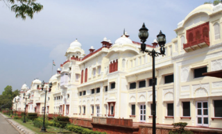
Patiala is a city in southeastern Punjab, northwestern India. It is the fourth largest city in the state and is the administrative capital of Patiala district. Patiala is located around the Qila Mubarak constructed by the Sidhu Jat Sikh chieftain Ala Singh, who founded the royal dynasty of Patiala State in 1763, and after whom the city is named.

Ludhiana(Punjabi pronunciation: [lʊdiˈɑːnə] ) is the most populous and the largest city in the Indian state of Punjab. The city has an estimated population of 1,618,879 as of the 2011 census and distributed over 310 km2 (120 sq mi), making Ludhiana the most densely populated urban centre in the state. It is a major industrial center of Northern India, referred to as "India's Manchester" by the BBC. It is also known as the Commercial capital of Punjab.
Mohali, officially known as Sahibzada Ajit Singh Nagar, is a planned city in the Mohali district in Punjab, India, which is an administrative and a commercial hub lying south-west of Chandigarh. It is the headquarters of the Mohali district. It is also one of the six Municipal Corporations of the State. It was officially named after Sahibzada Ajit Singh, the eldest son of Guru Gobind Singh.

Malerkotla is a city and district headquarters of Malerkotla district in the Indian state of Punjab. It was the seat of the eponymous princely state during the British Raj. The state acceded to the union of India in 1947 and was merged with other nearby princely states to create the Patiala and East Punjab States Union (PEPSU).

The Northern Railway (NR) is one of the 19 Railway zones of India and the northernmost zone of the Indian Railways. It is headquartered at Baroda House in New Delhi.

Ambala is a city and a municipal corporation in Ambala district in the state of Haryana, India, located on the border with the Indian state of Punjab and in proximity to both states capital Chandigarh. Politically, Ambala has two sub-areas: Ambala Cantonment and Ambala City, eight kilometres apart, therefore it is also known as "Twin City". It has a large Indian Army and Indian Air Force presence within its cantonment area. It is located 200 km (124 mi) to the north of New Delhi, India's capital, and has been identified as a counter-magnet city for the National Capital Region to develop as an alternative center of growth to Delhi.

British Punjab was a provincial colony of the British Raj, with its capital being Lahore. Most of the Punjab region was annexed by the British EIC in April 1849 following the Second Anglo-Sikh War, and declared a province of British Colonial Rule. It was one of the last areas of the subcontinent to fall under direct British control. In 1858, the Punjab, along with the rest of the Company-ruled regions, came under the direct rule of the British Crown. It had an area of 358,354.5 km2.
Phillaur is a city and a municipal council as well as a tehsil in Jalandhar district in the Indian state of Punjab.The city is situated 20 km from Ludhiana, 45 km from Jalandhar and 140 km from Amritsar. Situated on Doaba and Puadh regions Border. Phillaur is in Doaba region
Balachaur is a town in Balachaur Tehsil in the Shaheed Bhagat Singh Nagar District of Punjab, India.

Doraha is a city and a municipal council in Ludhiana district in the state of Punjab, India.
The town of Mullanpur Dakha, also known as Mandi Mullanpur, is located in the Ludhiana district in the Indian state of Punjab. It is a nagar panchayat, a settlement in transition from rural to urban. Due to the availability of transport routes to other villages, the town serves as a marketplace of grain and other goods to the surrounding area.
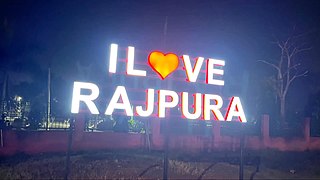
Rajpura is a city in Patiala district in the Indian state of Punjab, India, situated along the border of the Indian state of Haryana. It is located 26 KM Patiala city, towards East from District Head Quarter. It is Tehsil Head Quarter. Rajpura is the largest tehsil of the district.
Zirakpur is a satellite town, in Mohali District, Punjab, neighboring Mohali, Chandigarh in India. It is set on the foothills of Shivalik hills. It is part of the tehsil Dera Bassi. It is the gateway to Chandigarh from Delhi. It comprises mainly the following areas near Chandigarh Airport including VIP Road, Dhakoli, Lohgarh, Bhabat, Bishanpura, Kishanpura, Nabha, Gazipur, Baltana, Singhpura, Peer Muchalla and Dyalpura. This town is situated on the junction of national highways Himalayan Expressway, National Highway 5 (India) towards Shimla, Ambala Chandigarh Expressway towards Ambala and National Highway 7 (India) towards Patiala.
Ajiwal is a village, situated on the National Highway no. 95, in the tehsil and district of Moga in Eastern Punjab (India). It is 16 km away from Moga and 14 km away from Jagraon.

Puadh is a historic region in north India that comprises parts of present-day Punjab, Haryana, Uttar Pradesh, Himachal Pradesh and the U.T. of Chandigarh, India. It has the Sutlej river in its north and covers the regions immediately south of the Ghaggar river. The people of the area are known as Puadhi and speak the Puadhi dialect of Punjabi. The capital cities of Puadh region are Rupnagar, Fatehgarh Sahib, Mohali, Patiala, Chandigarh, Panchkula, Ambala, Yamunanagar

Punjab has a long history of education.

The Panjab Digital Library is a voluntary organization digitizing and preserving the cultural heritage of Panjab since 2003. With over 65 million digitized pages, it is the biggest resource of digital material on Panjab. There are many historically significant documents stored and made available online. Its scope covers Sikh and Punjabi culture. The library funded by The Nanakshahi Trust was launched online in August 2009. Its base office is located at Chandigarh, India.
Mohanpur is a village in Khanna Tehsil in Ludhiana district of Punjab State, India.

The Ambala–Attari line is a railway line connecting Ambala Cantonment in the Indian state of Haryana and Attari in Punjab. The line is under the administrative jurisdiction of Northern Railway.
Delhi–Amritsar–Katra Expressway is an approved 670 km (420 mi) long, 4-lane wide controlled-access expressway, which will connect Bahadurgarh border near Delhi with Katra in Jammu and Kashmir via Haryana and Punjab. It will have a spur section which will connect Nakodar with Sri Guru Ram Dass Jee International Airport located in Raja Sansi, Amritsar. The 397.7 km (247.1 mi) long Delhi–Nakodar–Katra section is National Expressway 5(NE-5) and 99 km (62 mi) long Amritsar–Nakodar section is National Expressway 5A(NE-5A). Once completed, it will reduce the current Delhi-Katra distance from 727 km (452 mi) to 588 km (365 mi) and the time travel will be reduced from 14 hours to 6 hours, and Delhi-Amritsar distance to 405 km (252 mi) and from the time travel will be reduced from 8 hours to only 4 hours.
 Madudass di smadhi
 Jain mandir, Khanna
 An old building in the city of Khanna
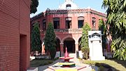 A.S Senior Secondary School, Khanna
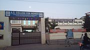 A.S. College for Women, Khanna
 Old building in Khanna city


