Kingston Springs, Tennessee

Last updated

Kingston Springs, Tennessee
Cheatham County Tennessee Incorporated and Unincorporated areas Kingston Springs Highlighted 4739660.svg
Location of Kingston Springs in Cheatham County, Tennessee.
USA Tennessee location map.svg
Red pog.svg
Kingston Springs
Location within Tennessee
Usa edcp location map.svg
Red pog.svg
Kingston Springs
Location within the United States
Coordinates: 36°06′07″N87°06′54″W / 36.1020038°N 87.1150054°W / 36.1020038; -87.1150054
Country United States
State Tennessee
County Cheatham
Area
[1]
  Total10.06 sq mi (26.04 km2)
  Land10.05 sq mi (26.04 km2)
  Water0.00 sq mi (0.01 km2)
Elevation
[2]
522 ft (159 m)
Population
 (2020) [3]
  Total2,824
  Density280.91/sq mi (108.46/km2)
Time zone UTC-6 (Central (CST))
  Summer (DST) UTC-5 (CDT)
ZIP code
37082
Area code 615
FIPS code 47-39660 [4]
GNIS feature ID1290262 [2]
Website kingstonsprings.net

Kingston Springs is a town in Cheatham County, Tennessee, United States. As of the 2020 census, the population was 2,824.

Contents

Geography

According to the United States Census Bureau, the town has a total area of 10.05 square miles (26.0 km2). [5]

Climate

Climate data for Kingston Springs, Tennessee (1991–2020 normals, extremes 1962–present)
MonthJanFebMarAprMayJunJulAugSepOctNovDecYear
Record high °F (°C)78
(26)
84
(29)
89
(32)
91
(33)
95
(35)
109
(43)
107
(42)
108
(42)
104
(40)
98
(37)
94
(34)
78
(26)
109
(43)
Mean daily maximum °F (°C)49.5
(9.7)
53.9
(12.2)
63.4
(17.4)
73.3
(22.9)
80.7
(27.1)
87.6
(30.9)
90.8
(32.7)
90.7
(32.6)
85.2
(29.6)
74.7
(23.7)
62.6
(17.0)
52.6
(11.4)
72.1
(22.3)
Daily mean °F (°C)38.1
(3.4)
41.4
(5.2)
49.6
(9.8)
58.8
(14.9)
67.4
(19.7)
75.3
(24.1)
79.0
(26.1)
78.0
(25.6)
71.5
(21.9)
59.9
(15.5)
48.7
(9.3)
40.9
(4.9)
59.0
(15.0)
Mean daily minimum °F (°C)26.7
(−2.9)
28.8
(−1.8)
35.8
(2.1)
44.2
(6.8)
54.2
(12.3)
63.0
(17.2)
67.2
(19.6)
65.4
(18.6)
57.8
(14.3)
45.0
(7.2)
34.8
(1.6)
29.3
(−1.5)
46.0
(7.8)
Record low °F (°C)−30
(−34)
−9
(−23)
2
(−17)
20
(−7)
29
(−2)
37
(3)
47
(8)
43
(6)
32
(0)
20
(−7)
5
(−15)
−18
(−28)
−30
(−34)
Average precipitation inches (mm)3.91
(99)
4.19
(106)
4.84
(123)
4.77
(121)
5.43
(138)
3.97
(101)
4.36
(111)
3.32
(84)
3.92
(100)
3.43
(87)
3.61
(92)
4.80
(122)
50.55
(1,284)
Average snowfall inches (cm)0.2
(0.51)
0.8
(2.0)
0.0
(0.0)
0.0
(0.0)
0.0
(0.0)
0.0
(0.0)
0.0
(0.0)
0.0
(0.0)
0.0
(0.0)
0.0
(0.0)
0.0
(0.0)
0.4
(1.0)
1.4
(3.6)
Average precipitation days (≥ 0.01 in)11.011.111.911.312.19.910.78.38.28.910.012.0125.4
Average snowy days (≥ 0.1 in)0.41.40.20.00.00.00.00.00.00.00.00.22.2
Source: NOAA [6] [7]

Demographics

Historical population
CensusPop.Note
1970 312
1980 1,017226.0%
1990 1,52950.3%
2000 2,77381.4%
2010 2,756−0.6%
2020 2,8242.5%
Sources: [8] [9] [10] [3]

2020 census

Kingston Springs racial composition [11]
RaceNumberPercentage
White (non-Hispanic)2,51489.02%
Black or African American (non-Hispanic)270.96%
Native American 50.18%
Asian 90.32%
Other/Mixed 1063.75%
Hispanic or Latino 1635.77%

As of the 2020 United States census, there were 2,824 people, 1,013 households, and 772 families residing in the town.

2000 census

In the 2000 United States Census, there were 2,773 people, 983 households, and 809 families in the town. The population density was 283.7 inhabitants per square mile (109.5/km2). There were 1,015 housing units, at an average density of 103.9 per square mile (40.1/km2). The racial composition of the town was 97.44% White, 0.87% African American, 0.36% Native American, 0.54% Asian, 0.40% from other races, and 0.40% from two or more races. Hispanic or Latino of any race were 0.54%

Of the 983 households, 43.0% had children under the age of 18 living with them, 69.1% were married couples living together, 8.9% had a female householder with no husband present, and 17.7% were non-families. 13.0% of households were one person and 3.2% were one person aged 65 or older. The average household size was 2.82 and the average family size was 3.10.

The age distribution was 28.5% under the age of 18, 6.9% from 18 to 24, 33.1% from 25 to 44, 25.5% from 45 to 64, and 6.0% 65 or older. The median age was 37 years. For every 100 females, there were 98.8 males. For every 100 females who were 18 and over, there were 94.5 males.

The median household income was $58,490, and the median family income was $60,125. Males had a median income of $41,543 and females had $30,650. The per capita income for the town was $24,519, and about 5.9% of families and 8.4% of the population were below the poverty line, including 12.0% of those under age 18 and 7.4% of those age 65 or over.

Government

Kingston Springs is governed by a city commission. The board of commissioners are elected and the commissioners pick amongst themselves for the seats of Mayor and Vice Mayor. Currently the non-mayoral city commissioners are Carolyn Clark, Mike Hargis, and Bob Stohler. Tony Gross serves as the mayor, and Glenn Remick is the vice-mayor. [12]

Notable people

Related Research Articles

<span class="mw-page-title-main">Robertson County, Tennessee</span> County in Tennessee, United States

Robertson County is a county located on the central northern border of Tennessee in the United States. As of the 2020 United States Census, the population was 72,803 people. Its county seat is Springfield. The county was named for James Robertson, an explorer, founder of Nashville, and a state senator, who was often called the "Father of Middle Tennessee." Robertson County is a component of the Nashville-Davidson–Murfreesboro–Franklin, TN Metropolitan Statistical Area.

<span class="mw-page-title-main">Roane County, Tennessee</span> County in Tennessee, United States

Roane County is a county of the U.S. state of Tennessee. As of the 2020 census, the population was 53,404. Its county seat is Kingston. Roane County is included in the Knoxville, TN Metropolitan Statistical Area.

<span class="mw-page-title-main">Cheatham County, Tennessee</span> County in Tennessee, United States

Cheatham County is a county located in the U.S. state of Tennessee. As of the 2020 census, the population was 41,072. Its county seat is Ashland City. Cheatham County is located in Middle Tennessee, and is part of the Nashville-Davidson–Murfreesboro–Franklin, TN Metropolitan Statistical Area.

<span class="mw-page-title-main">Ashland City, Tennessee</span> Town in Tennessee, United States

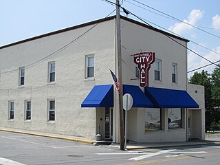
Ashland City is a town and the county seat of Cheatham County, Tennessee. Located in Middle Tennessee, it is part of the Nashville-Davidson–Murfreesboro–Franklin, TN Metropolitan Statistical Area. As of the 2020 census, the town's population was 5,193.

<span class="mw-page-title-main">Pegram, Tennessee</span> Town in Tennessee, United States

Pegram is a town completely in Cheatham County, Tennessee, United States. As of the 2020 census, the population was 2,072.

<span class="mw-page-title-main">Pleasant View, Tennessee</span> City in Tennessee, United States

Pleasant View is a city on the northern border of Cheatham County. Located in Middle Tennessee, it is part of the Nashville-Davidson–Murfreesboro–Franklin, TN Metropolitan Statistical Area. As of the 2020 census, the city's population was 4,807.

<span class="mw-page-title-main">New Tazewell, Tennessee</span> City in Tennessee, United States

New Tazewell is a city in Claiborne County, Tennessee, United States. The population was 3,037 at the 2010 census.The population was 2,769 at the 2020 census.

<span class="mw-page-title-main">Parrottsville, Tennessee</span> Town in Tennessee, United States

Parrottsville is a town in Cocke County, Tennessee, United States. The population was 263 at the 2010 census.

<span class="mw-page-title-main">Burns, Tennessee</span> Town in Tennessee, United States

Burns is a town in Dickson County, Tennessee, in the United States. It is part of the Nashville-Davidson–Murfreesboro–Franklin, TN Metropolitan Statistical Area. The population was 1,468 at the 2010 census.

<span class="mw-page-title-main">Savannah, Tennessee</span> City in Tennessee, United States

Savannah is a city in and the county seat of Hardin County, Tennessee, United States. The population was 7,213 at the 2020 census. Savannah is located along the east side of the Tennessee River.

<span class="mw-page-title-main">Mount Pleasant, Tennessee</span> City in Tennessee, United States

Mount Pleasant is a city in Maury County, Tennessee, United States. Mount Pleasant was the birthplace of 19th-century writer and humorist Samuel R. Watkins and formerly titled "The Phosphate Capital of the World." The population was 4,561 at the 2010 census, and 4,784 in 2020.

<span class="mw-page-title-main">Decatur, Tennessee</span> Town in Tennessee, United States

Decatur is a town in Meigs County, Tennessee, United States. The population was 1,563 at the 2020 census. It is the county seat of Meigs County.

<span class="mw-page-title-main">Livingston, Tennessee</span> Town in Tennessee, United States

Livingston is a town in Overton County, Tennessee, United States, and serves as the county seat. The population was 3,905 at the 2020 census and 4,058 at the 2010 census. The current mayor, Curtis Hayes, began serving his mayoral position in September 2006.

<span class="mw-page-title-main">Kingston, Tennessee</span> City in Tennessee, United States

Kingston is a city in and the county seat of Roane County, Tennessee, United States. This city is thirty-six miles southwest of Knoxville. It had a population of 5,934 at the 2010 United States census, and is included in the Harriman, Tennessee Micropolitan Statistical Area. Kingston is adjacent to Watts Bar Lake.

<span class="mw-page-title-main">Springfield, Tennessee</span> City in Tennessee, United States

Springfield is the county seat of Robertson County, Tennessee, United States. It is located in Middle Tennessee near the northern border of the state. As of the 2020 census, the city's population was 18,782.

<span class="mw-page-title-main">Smyrna, Tennessee</span> Town in Tennessee, United States

Smyrna is a town in Rutherford County, Tennessee. Smyrna's population was 53,070 at the 2020 census, making it the largest town in Tennessee by population in that census. In 2007, U.S. News & World Report listed Smyrna as one of the best places in the United States to retire. Smyrna is part of the Nashville metropolitan statistical area.

<span class="mw-page-title-main">Gordonsville, Tennessee</span> Town in Tennessee, United States

Gordonsville is a town in Smith County, Tennessee, United States. The population was 1,213 at the 2010 census.

<span class="mw-page-title-main">Thompson's Station, Tennessee</span> Town in Tennessee, United States

Thompson's Station is a town in Williamson County, Tennessee. The population has grown from 2,194 at the 2010 Census to 7,485 in the 2020 Census. Locations in Thompson's Station listed on the U.S. National Register of Historic Places include the Jacob Critz House and the Thomas L. Critz House, Thompson's Station Bank, John Neely House, James P. Johnson House, Homestead Manor and James Giddens House.

<span class="mw-page-title-main">Tennessee Ridge, Tennessee</span> Town in Tennessee, United States

Tennessee Ridge is a town in Houston and Stewart counties in the U.S. state of Tennessee. The population was 1,332 at the 2020 census and 1,368 at the 2010 census.

<span class="mw-page-title-main">Farragut, Tennessee</span> Town in Tennessee, United States

Farragut is a suburban town located in Knox and Loudon counties in the State of Tennessee, United States. The town's population was 23,506 at the 2020 census. It is included in the Knoxville Metropolitan Area. The town is named in honor of Union Admiral David Farragut, who was born just east of Farragut at Campbell's Station in 1801, and fought in the American Civil War.

References

  1. "ArcGIS REST Services Directory". United States Census Bureau. Retrieved October 15, 2022.
  2. 1 2 U.S. Geological Survey Geographic Names Information System: Kingston Springs, Tennessee
  3. 1 2 "Census Population API". United States Census Bureau. Retrieved October 15, 2022.
  4. "U.S. Census website". United States Census Bureau . Retrieved January 31, 2008.
  5. "2019 U.S. Gazetteer Files". United States Census Bureau. Retrieved July 30, 2020.
  6. "NowData - NOAA Online Weather Data". National Oceanic and Atmospheric Administration. Retrieved October 2, 2021.
  7. "Station: Kingston Springs, TN". U.S. Climate Normals 2020: U.S. Monthly Climate Normals (1991-2020). National Oceanic and Atmospheric Administration. Retrieved October 2, 2021.
  8. "Census of Population and Housing: Decennial Censuses". United States Census Bureau . Retrieved March 4, 2012.
  9. "Incorporated Places and Minor Civil Divisions Datasets: Subcounty Resident Population Estimates: April 1, 2010 to July 1, 2012". Population Estimates. U.S. Census Bureau. Archived from the original on June 11, 2013. Retrieved December 11, 2013.
  10. "Census of Population and Housing". Census.gov. Retrieved June 4, 2016.
  11. "Explore Census Data". data.census.gov. Retrieved December 26, 2021.
  12. "Town of Kingston Springs: Government - Elected Officials". kingstonsprings.net. Retrieved March 21, 2022.