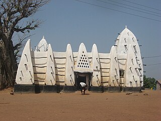
The Brong-Ahafo region was a region in central Ghana. Brong-Ahafo was bordered to the north by the Black Volta river and to the east by the Lake Volta, and to the south by the Ashanti, Eastern and Western regions. The capital of Brong-Ahafo is Sunyani. Brong-Ahafo was created on 14 April 1959 from the then Western Ashanti and named after the main ethnic groups, the Brong and Ahafo. In 2019, as a result of the 2018 Ghanaian new regions referendum, the region was divided into three, namely Bono, Bono East and Ahafo regions, and ceased to exist.

The Kintampo complex, also known as the Kintampo culture, Kintampo Neolithic, and Kintampo Tradition, was established by Saharan agropastoralists, who may have been Niger-Congo or Nilo-Saharan speakers and were distinct from the earlier residing Punpun foragers, between 2500 BCE and 1400 BCE. The Kintampo complex was a part of a transitory period in the prehistory of West Africa, from pastoralism to sedentism in West Africa, specifically in the Bono East region of Ghana, eastern Ivory Coast, and Togo. The Kintampo complex also featured art, personal adornment items, polished stone beads, bracelets, and figurines; additionally, stone tools and structures were found, which suggests that Kintampo people had both a complex society and were skilled with Later Stone Age technologies.

Kintampo District is a former district that was located in Brong-Ahafo Region, Ghana. Originally created as an ordinary district assembly on 10 March 1989. However on 12 November 2003, it was split off into two new districts: Kintampo North District and Kintampo South District. The district assembly was located in the southern part of Brong-Ahafo Region and had Kintampo as its capital town.
Articles related to Ghana include:

Wenchi is a town and is the capital of Wenchi Municipal of the Bono Region in middle-belt of Ghana. Wenchi is located at 7.73333 [latitude in decimal degrees], -2.1 [longitude in decimal degrees] at an average elevation/altitude of 304 meters. Wenchi is approximately 30 km north of Techiman and about 50 km east of the Ivory Coast border. Wenchi has a population of 39,187 people in 2013.
Jema is the administrative capital of Kintampo-South District in the Bono East Region of Ghana. It has an estimated population of about 7,868 while the total District population stands at 93,600. The town is known for the Jema High School. The school is the only second cycle institution in the district.
Zabzugu is a small town and is the capital of Zabzugu district, a district in the Northern Region of north Ghana. It has a nucleated settlement and less populated. Most of the people there are farmers and their main produce is Yam.

Kintampo waterfalls is one of Ghana' highest waterfalls located in Bono East. It was formerly known as Sanders Falls during the colonial days. It is located on the Pumpum river, a tributary of the Black Volta, about 4 kilometres (2.5 mi) north of the Kintampo municipality, on the Kumasi–Tamale road. It is just after the Falls Rest Stop when moving Northwards, on the right side of the road. This waterfall is hidden in the forest and formed by three main drops, with the longest measuring 25 metres (82 ft), followed by a number of steps and cascades, and the river, which falls about 70 metres (230 ft).

Banda Ahenkro is a town located in the west-northern of Bono region, Ghana, near the border of Ivory Coast. Its geography provided a home for numerous groups seeking shelter from across West Africa during the slave trade era. The original name of the settlement was Serminakuu meaning groups of 'grasses'. This name was changed to Banda, which is a corruption of 'Woanda' meaning 'they did not sleep'. Ancestors of Banda Ahenkro were allies of the Asante kingdom during wars and they provided a military force that virtually refused to sleep during at-war times. This is because they were predominantly Muslims and were found praying throughout the night. Later, 'woanda' was also corrupted by the Bono neighbours to become Banda. The settlement evolved to become the chief town or 'Ahenkro' within a collection of Nafana communities.
Japekrom is the Municipal Capital of Jaman South Municipality of the Bono Region of Ghana. It has been an important town since the colonial Gold Coast days in Ghana's History, then referred to as Pruano but spelled as Pulliano in colonial Gold Coast maps. The Japekromhene is part of Asanteman council. The township was built on a foundation of solid stone and as a result of resistance to any form of suppression or oppression. Traditional leaders of the Japekrom strongly uphold the principles of truth, fairness, hard work, a welcoming heart, inclusion and preservation of culture. The people of Japekrom are very welcoming of people from other tribes and cultures.

The Savannah Region is one of the newest regions of Ghana and yet the largest region in the country. The creation of the Region follows presentation of a petition by the Gonja Traditional Council, led by the Yagbonwura Tumtumba Boresa Jakpa I. Upon receiving favourable responses from all stakeholders in the Northern Region, the Brobbey Commission, a referendum was conducted on the 27th December 2018. The result was a resounding yes of 99.7%. The President of the Republic of Ghana signed and presented the Constitutional Instrument (CI) 115 to the Yagbonwura in the Jubilee House, Accra on 12 February 2019. The launch was well attended by sons and daughters of Gonjaland including all current and past Mps, MDCEs and all appointees with Gonjaland descent. Damongo was declared the capital of the new Savannah Region. It is located in the north of the country. The Savannah Region is divided into 7 districts; Bole, Central Gonja, North Gonja, East Gonja, Sawla/Tuna/Kalba, West Gonja, North East Gonja and 7 Constituencies; Bole/Bamboi, Damongo, Daboya/Mankarigu, Salaga North, Salaga South, Sawla/Tuna/Kalba and Yapei/Kusawgu. The capital of Bole district is Bole; East Gonja municipal is Salaga; West Gonja district is Damango; Sawla Tuna Kalba district is Salwa; Central Gonja is Buipe; North Gonja is Daboya; and North East Gonja is Kpalbe

Kwaku Agyenim-Boateng is a Ghanaian politician and member of the Seventh Parliament of the Fourth Republic of Ghana representing the Berekum West constituency in the Bono Region on the ticket of the New Patriotic Party.

Sanja Nanja is a Ghanaian politician and member of the Eight Parliament of the Fourth Republic of Ghana representing the Atebubu Amantin Constituency in the Bono East Region on the ticket of the National Democratic Congress.

The Bono East region of Ghana is a new region carved out of the Brong Ahafo region. The capital of the new region is Techiman. This creation of this new region was in fulfillment of a promise made by the New Patriotic Party prior to the 2016 Ghana general election. Upon winning the elections, the President, Nana Akuffo Addo created the Ministry of Regional Reorganization to oversee policy formulation and implementation. In all six new regions are to be created from the existing ten regions of Ghana. The other regions are Bono, Western North, Ahafo, Savannah, North East, and Oti regions.
Adabokrom is a town in Western North Region of Ghana. It is the capital of Bia East. Adabokrom was named the District capital after Bia East District split from Bia District in 2012. Adabokrom is about 250 km west of Kumasi. The town is noted for cocoa production.
Twedie is a town in the Ashanti Region of Ghana. It's located 16 km west of Kumasi, the Ashanti Regional capital. Twedie is the district capital of the Atwima Kwanwoma District.

Alexander Gyan is a Ghanaian politician and member of parliament for the Kintampo South constituency in the Bono East region of Ghana.
Masaaba Sariki Fanyinama III is the paramount chief of the Wangara Community of Ghana. He resides in a Zongo area popularly called Targona Line at Kintampo, a town in the Bono East Region. He plays host to the annual Benkadi Kurubi Festival of the Wangara Community of Ghana.


