Kulm, North Dakota

Last updated

Kulm, North Dakota
Kulm, North Dakota 6-12-2008.jpg
Business district in Kulm
Motto: 
"Small Town With A Big Heart"
ND LaMoure County Kulm.svg
Location of Kulm, North Dakota
Coordinates: 46°18′7″N98°56′53″W / 46.30194°N 98.94806°W / 46.30194; -98.94806
CountryUnited States
State North Dakota
County LaMoure
Founded1892
Area
[1]
  Total0.38 sq mi (0.99 km2)
  Land0.38 sq mi (0.99 km2)
  Water0.00 sq mi (0.00 km2)
Elevation
1,972 ft (601 m)
Population
 (2020) [2]
  Total368
  Estimate 
(2022) [3]
368
  Density963.35/sq mi (371.69/km2)
Time zone UTC-6 (Central (CST))
  Summer (DST) UTC-5 (CDT)
ZIP code
58456
Area code 701
FIPS code 38-43580
GNIS feature ID1033648 [4]
Website kulmnd.com

Kulm is a city in LaMoure County, North Dakota, United States. The population was 368 at the 2020 census. [2] Kulm was founded in 1892.

Contents

Geography

Kulm is located at 46°18′7″N98°56′53″W / 46.30194°N 98.94806°W / 46.30194; -98.94806 (46.301844, -98.948135). [5]

According to the United States Census Bureau, the city has a total area of 0.38 square miles (0.98 km2), all land. [6]

Transportation

Kulm Municipal Airport ( FAA LID : D03) is a public use airport located one nautical mile (1.85 km) northeast of the central business district of Kulm.

Demographics

Historical population
CensusPop.Note
1900 463
1910 64539.3%
1920 72512.4%
1930 7422.3%
1940 734−1.1%
1950 707−3.7%
1960 664−6.1%
1970 625−5.9%
1980 570−8.8%
1990 514−9.8%
2000 422−17.9%
2010 354−16.1%
2020 3684.0%
2022 (est.)368 [3] 0.0%
U.S. Decennial Census [7]
2020 Census [2]

2010 census

As of the census of 2010, there were 354 people, 179 households, and 91 families residing in the city. The population density was 931.6 inhabitants per square mile (359.7/km2). There were 248 housing units at an average density of 652.6 per square mile (252.0/km2). The racial makeup of the city was 97.7% White, 0.3% Native American, 1.4% from other races, and 0.6% from two or more races. Hispanic or Latino of any race were 4.5% of the population.

There were 179 households, of which 19.6% had children under the age of 18 living with them, 44.7% were married couples living together, 3.4% had a female householder with no husband present, 2.8% had a male householder with no wife present, and 49.2% were non-families. 45.3% of all households were made up of individuals, and 30.7% had someone living alone who was 65 years of age or older. The average household size was 1.98 and the average family size was 2.77.

The median age in the city was 51.3 years. 21.5% of residents were under the age of 18; 5% were between the ages of 18 and 24; 16.1% were from 25 to 44; 25.1% were from 45 to 64; and 32.2% were 65 years of age or older. The gender makeup of the city was 45.8% male and 54.2% female.

2000 census

As of the census of 2000, there were 422 people, 214 households, and 123 families residing in the city. The population density was 1,335.7 inhabitants per square mile (515.7/km2). There were 251 housing units at an average density of 794.5 per square mile (306.8/km2). The racial makeup of the city was 99.05% White, 0.24% Native American, 0.24% from other races, and 0.47% from two or more races. Hispanic or Latino of any race were 1.90% of the population.

There were 214 households, out of which 17.3% had children under the age of 18 living with them, 53.3% were married couples living together, 2.8% had a female householder with no husband present, and 42.1% were non-families. 40.7% of all households were made up of individuals, and 29.4% had someone living alone who was 65 years of age or older. The average household size was 1.97 and the average family size was 2.63.

In the city, the population was spread out, with 16.4% under the age of 18, 4.7% from 18 to 24, 16.6% from 25 to 44, 22.7% from 45 to 64, and 39.6% who were 65 years of age or older. The median age was 56 years. For every 100 females, there were 89.2 males. For every 100 females age 18 and over, there were 88.8 males.

The median income for a household in the city was $25,125, and the median income for a family was $29,643. Males had a median income of $29,583 versus $16,607 for females. The per capita income for the city was $19,904. About 7.7% of families and 10.4% of the population were below the poverty line, including 7.9% of those under age 18 and 14.6% of those age 65 or over.

Climate

This climatic region is typified by large seasonal temperature differences, with warm to hot (and often humid) summers and cold (sometimes severely cold) winters. According to the Köppen Climate Classification system, Kulm has a humid continental climate, abbreviated "Dfb" on climate maps. [8]

Notable people

Related Research Articles

<span class="mw-page-title-main">Cave City, Arkansas</span> City in Arkansas, United States

Cave City is a city in Independence and Sharp counties in the U.S. state of Arkansas. The population was 1,904 at the 2010 census. The city was named for a large cave underneath the Crystal River Tourist Camp, which is the oldest motor court in Arkansas. Cave City is known for its award-winning "world's sweetest" watermelons and holds an annual watermelon festival in July.

<span class="mw-page-title-main">Hudson, Iowa</span> City in Iowa, United States

Hudson is a city in Black Hawk County, Iowa, United States. The population was 2,546 at the time of the 2020 census. The rural community of Hudson has grown in recent years and is included as a part of the Waterloo-Cedar Falls Metropolitan Statistical Area.

<span class="mw-page-title-main">Fairbank, Iowa</span> City in Iowa, United States

Fairbank is a city in Buchanan and Fayette counties in the U.S. state of Iowa. The population was 1,111 at the time of the 2020 census.

<span class="mw-page-title-main">Walker, Iowa</span> City in Iowa, United States

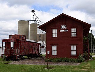
Walker is a city in Linn County, Iowa. The population was 688 at the 2020 census. It is part of the Cedar Rapids, Iowa metropolitan area.

<span class="mw-page-title-main">Dixon, Iowa</span> City in Iowa, United States

Dixon is a city in Scott County, Iowa, United States. The population was 202 at the time of the 2020 census.

<span class="mw-page-title-main">Maysville, Iowa</span> City in Iowa, United States

Maysville is a city in Scott County, Iowa, United States. The population was 156 at the time of the 2020 census.

<span class="mw-page-title-main">Gibson Township, Michigan</span> Civil township in Michigan, United States

Gibson Township is a civil township of Bay County in the U.S. state of Michigan. The township's population was 1,124 as of the 2020 census. It is included in the Bay City Metropolitan Statistical Area.

Montcalm Township is a civil township of Montcalm County in the U.S. state of Michigan. The population was 3,394 at the 2020 census, up from 3,350 in 2010.

<span class="mw-page-title-main">Lake Shore, Minnesota</span> City in Minnesota, United States

Lake Shore is a city in Cass County, Minnesota, United States. The population was 1,056 at the 2020 census. It is part of the Brainerd Micropolitan Statistical Area.

<span class="mw-page-title-main">Coleraine, Minnesota</span> City in Minnesota, United States

Coleraine is a city in Itasca County, Minnesota, United States. The population was 1,970 at the 2010 census. The community was named after Thomas F. Cole, President of the Oliver Iron Mining Company.

<span class="mw-page-title-main">Grasston, Minnesota</span> City in Minnesota, United States

Grasston is a city in Kanabec County, Minnesota, United States. The population was 158 at the 2010 census.

<span class="mw-page-title-main">Lancaster, Minnesota</span> City in Minnesota, United States

Lancaster is a city in Kittson County, Minnesota, United States. As of the 2020 census, the city population was 364.

<span class="mw-page-title-main">Linneus, Missouri</span> City in Missouri, United States

Linneus is a small city in Linn County, Missouri, United States. The population was 281 at the 2020 census. It is the county seat of Linn County.

<span class="mw-page-title-main">Hayti Heights, Missouri</span> City in Missouri, United States

Hayti Heights is a city in eastern Pemiscot County in the bootheel of southeast Missouri, United States. The population was 515 at the 2020 census.

<span class="mw-page-title-main">Clarkson Valley, Missouri</span> City in Missouri, United States

Clarkson Valley is a city in St. Louis County, Missouri, United States. The population was 2,609 at the 2020 census.

<span class="mw-page-title-main">Shelocta, Pennsylvania</span> Borough in Indiana County, Pennsylvania, USA

Shelocta is a borough in Indiana County, Pennsylvania, United States. The population was 102 at the 2020 census. The Keystone Generating Station is located to the west of the borough, in Plumcreek Township. The current Mayor is Tessa Rinehart, who is following in the footsteps of her late grandmother, Carol Rinehart. Carol Rinehart maintained the position for 20 years.

<span class="mw-page-title-main">Lennox, South Dakota</span> City in South Dakota, United States

Lennox is a city in Lincoln County, South Dakota, United States, located 20 miles (32 km) southwest of Sioux Falls. The population was 2,423 at the 2020 census.

<span class="mw-page-title-main">Carthage, South Dakota</span> City in South Dakota, United States

Carthage is a city in Miner County, South Dakota, United States. The population was 127 at the 2020 census.

<span class="mw-page-title-main">Crooks, South Dakota</span> City in South Dakota, United States

Crooks is a city in Minnehaha County, South Dakota, United States and is a suburb of Sioux Falls. The population was 1,362 at the 2020 census. Crooks was named New Hope until 1904. The town's present name honors W. A. Crooks, a local politician.

<span class="mw-page-title-main">New Holstein, Wisconsin</span> City in Wisconsin, United States

New Holstein is a city in Calumet County in the U.S. state of Wisconsin. The population was 2,891 as of 2024. The city is located within the Town of New Holstein.

References

  1. "ArcGIS REST Services Directory". United States Census Bureau. Retrieved September 20, 2022.
  2. 1 2 3 "Explore Census Data". United States Census Bureau . Retrieved October 17, 2023.
  3. 1 2 "City and Town Population Totals: 2020-2022". United States Census Bureau. October 17, 2023. Retrieved October 17, 2023.
  4. "US Board on Geographic Names". United States Geological Survey. October 25, 2007. Retrieved January 31, 2008.
  5. "US Gazetteer files: 2010, 2000, and 1990". United States Census Bureau. February 12, 2011. Retrieved April 23, 2011.
  6. "US Gazetteer files 2010". United States Census Bureau. Archived from the original on January 25, 2012. Retrieved June 14, 2012.
  7. United States Census Bureau. "Census of Population and Housing" . Retrieved January 23, 2014.
  8. Climate Summary for Kulm, North Dakota
  9. "Angie Dickinson". IMDb .
  10. "UNC Herbarium".[ permanent dead link ]