Related Research Articles

Mount Umunhum is a peak in the Santa Cruz Mountains, located in Santa Clara County, California. It is the fourth-highest peak in the Santa Cruz Mountains, after Loma Prieta, Crystal Peak, and Mt. Chual. Most of the mountain is located within the Sierra Azul Open Space Preserve.

State Route 35, generally known as Skyline Boulevard for most of its length, is a mostly two-lane state highway in the U.S. state of California. It runs along the ridge of the Santa Cruz Mountains from the high point of State Route 17 near Lexington Reservoir in Santa Clara County to State Route 1 just south of Daly City in San Mateo County, where it crosses SR 1 and loops around Lake Merced to become Sloat Boulevard in San Francisco. SR 35 then continues along Sloat Boulevard until it reaches its terminus when it meets SR 1 again at 19th Avenue.

Formed in 1972 by voter initiative, the Midpeninsula Regional Open Space District (MROSD) is a non-enterprise special district in the San Francisco Bay Area. It has acquired and preserved a regional green belt of open space land and provides opportunities for ecologically-sensitive public enjoyment and education.
Los Trancos Open Space Preserve is a 274-acre (1.11 km2) open space preserve, located in San Mateo and Santa Clara Counties, California, near Los Altos Hills, California. The preserve contains about 5 miles (8 km) of hiking trails, of which 2.1 miles (3.4 km) are open to equestrians, and none are open to bicycles.

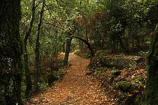
Saratoga Gap Open Space Preserve is a 1540-acre regional park located near Saratoga Gap in the Santa Cruz Mountains of Santa Clara County, California. The preserve is owned and operated by the Midpeninsula Regional Open Space District. The preserve contains about 2 miles (3 km) of hiking trails, which are open to equestrians and bicycles.

Black Mountain is a summit on Monte Bello Ridge in the Santa Cruz Mountains of west Santa Clara County, California, south of Los Altos and Los Altos Hills, and west of Cupertino; it is within the Palo Alto city limits though not near the developed part of the city. It is located on the border between Rancho San Antonio Open Space Preserve and Monte Bello Open Space Preserve, with the summit located in the former. Early Spanish explorers commonly named tree- or chaparral-covered summits which look black in the distance Loma Prieta, from the Spanish . The Spanish also called the middle portion of the Santa Cruz Mountains the Sierra Morena meaning, extending from Half Moon Bay Road south to a gap at Lexington Reservoir, and which includes a summit called Sierra Morena. There are over 100 "Black Mountains" in California.
Skeggs Point is a scenic turnout in San Mateo County along State Route 35 between Kings Mountain and State Route 84. The feature is marked with a guide sign along the road and is listed on the USGS 7.5 minute quadrangle, "Woodside, California" as well as in the National Geographic Names Database. The area is about three miles west and 2,000 feet above the town of Woodside.

The Purisima Creek Redwoods Open Space Preserve is located on the western slopes of historic Kings Mountain in Woodside, California. This 4,471-acre (1,809 ha) preserve was established with a $2 million gift from the Save the Redwoods League.

Rancho San Antonio County Park and Rancho San Antonio Open Space Preserve are a conjoined public recreational area in the Santa Cruz Mountains, in the northwest quadrant of Santa Clara County, California. The County Park is bordered by Los Altos with some parts of the eastern part of the County Park in western Cupertino. The Open Space Preserve is on the west side of the County Park, also bordered by Los Altos Hills, Monte Bello Open Space Preserve, and the Permanente Quarry.
Alpine Creek is a small river in San Mateo County, California. It flows about 5 miles (8 km), from its source near West Alpine Road about a mile southwest of Skyline Boulevard (CA 35), to its confluence with La Honda Creek to form San Gregorio Creek in La Honda at California State Route 84.

La Honda Creek is a 7 miles (11 km) long stream on the Pacific slope of the Santa Cruz Mountains and is a tributary of San Gregorio Creek. From its source near Bear Gulch Road and Skyline Boulevard (CA 35) in San Mateo County, California, La Honda Creek's water flow south to its confluence with Alpine Creek to form San Gregorio Creek in La Honda, and thence to the Pacific Ocean.
El Corte de Madera Creek is a small river in the Santa Cruz Mountains, San Mateo County, northern California. It is a tributary of San Gregorio Creek.
Pulgas Ridge Open Space Preserve is a public recreation area in the Santa Cruz Mountains, San Mateo County in northern California. It is managed by the Midpeninsula Regional Open Space District (MROSD).

Sierra Azul Open Space Preserve is managed by the Midpeninsula Regional Open Space District in Santa Clara County, California. It is approximately 19,300 acres (7,800 ha) in area. The preserve is named for the Sierra Azul or "Blue Mountains", the name the colonizing Spanish used for the half of the Santa Cruz Mountains south of today's California Highway 17.
Monte Bello Open Space Preserve is a 3,133-acre (12.68 km2) open space preserve, located near Palo Alto in the Santa Cruz Mountains, in San Mateo and Santa Clara Counties, California, United States. The preserve encompasses the upper Stevens Creek watershed in the valley between Monte Bello Ridge and Skyline Ridge. "Monte Bello" means "beautiful mountain" in Italian, and refers to Black Mountain which is the highest part of Montebello Ridge. The straight valley of upper Stevens Creek is also the rift valley of the San Andreas Fault.

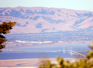
Thornewood Open Space Preserve is a small regional park located in the Santa Cruz Mountains in San Mateo County. The park lies in the San Francisco Bay Area and is operated by the Midpeninsula Regional Open Space District. It offers approximately 1.5 miles (2.4 km) of hiking and equestrian trails and is dog-friendly. The Schilling Lake Trail leads to Schilling Lake, a protected wildlife habitat. This trail offers brief views of the southern San Francisco Bay, Palo Alto and surrounding cities, and the Diablo Range. From Schilling Lake, the Bridle Trail leads to Old La Honda Road.

San Mateo County's Sam McDonald Park is located between La Honda and Loma Mar and is operated by the San Mateo County Department of Parks. The park is 867 acres (3.51 km2) of redwood forest, mixed woods and open meadows. Trails climb up to a ridgeline with views across the Pescadero Creek valley, Butano Ridge, and the Pacific Ocean. The park includes Heritage Grove and borders Pescadero Creek County Park through which it connects to Memorial County Park, Portola Redwoods State Park, and Big Basin Redwoods State Park. Horseback riding is popular here, and many use Jack Brook Horse Camp.

Long Ridge Open Space Preserve is a 2,035 acre open space preserve along Long Ridge in the Santa Cruz Mountains.
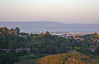
Foothills Open Space Preserve is a 212-acre open space preserve on Page Mill Road in Palo Alto, California. The land for the preserve was gifted to the Midpeninsula Regional Open Space District in 1974. The preserve's only trail is .4 miles and leads to a hilltop with views of the San Francisco Bay Area.
The Bear Creek Redwoods Open Space Preserve is a public open space preserve in the Santa Cruz Mountains. The preserve is located along both sides of Bear Creek Road, west of State Route 17 and Lexington Reservoir, and mostly north and east of the Skyline Boulevard and Summit Road sections of State Route 35. It surrounds the Presentation Center, a conference and retreat facility run by the Sisters of Presentation.
References
- ↑ "Huge new Bay Area open space preserve opens to public Friday". mercurynews.com. Retrieved 2017-11-30.
- ↑ "New Peninsula Open Space Preserve Readies For Public Opening « CBS San Francisco". sanfrancisco.cbslocal.com. Retrieved 2017-11-30.
- ↑ "La Honda Creek Master Plan | Midpeninsula Regional Open Space District". openspace.org. Retrieved 2017-11-30.
- ↑ "Sprawling nature preserve, a haven for Jesse James outlaws and threatened frogs, opens in Bay Area". SFGate. Retrieved 2017-11-30.