Ladson, South Carolina

Last updated

Ladson, South Carolina
SCMap-doton-Ladson.PNG
Location of Ladson, South Carolina
Coordinates: 33°0′34″N80°6′20″W / 33.00944°N 80.10556°W / 33.00944; -80.10556
CountryUnited States
State South Carolina
Counties Berkeley, Charleston, Dorchester
Founded1905 [1]
Named for Ladson family [1]
Area
[2]
  Total7.03 sq mi (18.21 km2)
  Land7.03 sq mi (18.21 km2)
  Water0.00 sq mi (0.00 km2)
Elevation
49 ft (15 m)
Population
 (2020) [3]
  Total15,550
  Density2,211.32/sq mi (853.85/km2)
Time zone UTC-5 (Eastern (EST))
  Summer (DST) UTC-4 (EDT)
ZIP code
29456
Area code 843 and 854
FIPS code 45-39220 [4]
GNIS feature ID1246274 [5]

Ladson is a census-designated place (CDP) in Berkeley, Charleston and Dorchester counties in the U.S. state of South Carolina. The population was 13,790 at the 2010 census. [6] It is named in honor of the Ladson family, one of the oldest planter and merchant families in the Charleston area; one of its members was lieutenant governor James Ladson.

Contents

Geography

Ladson is located in southwestern Berkeley County, northern Charleston County, and southeastern Dorchester County at 33°0′34″N80°6′20″W / 33.00944°N 80.10556°W / 33.00944; -80.10556 (33.009563, -80.105553). [7] It is bordered to the southwest by the town of Summerville, to the south by the city of North Charleston, to the east by the city of Goose Creek, and to the northwest by Sangaree, a census-designated place.

U.S. Route 78 and Interstate 26 run parallel through Ladson, with Exit 203 providing access from I-26. Downtown Charleston is 20 miles (32 km) to the southeast, and Columbia is 97 miles (156 km) to the northwest.

According to the United States Census Bureau, the CDP has a total area of 7.0 square miles (18.2 km2), all land. This is a decrease from 8.6 square miles (22.3 km2) at the 2000 census, due to annexations of portions of the area into Summerville and North Charleston.

Demographics

Historical population
CensusPop.Note
2000 13,264
2010 13,7904.0%
2020 15,55012.8%
U.S. Decennial Census [8]

2020 census

Ladson racial composition [9]
RaceNum.Perc.
White (non-Hispanic)7,63349.09%
Black or African American (non-Hispanic)4,04125.99%
Native American 910.59%
Asian 4072.62%
Pacific Islander 90.06%
Other/Mixed 9075.83%
Hispanic or Latino 2,46215.83%

As of the 2020 United States census, there were 15,550 people, 5,046 households, and 3,767 families residing in the CDP.

2010 census

Ladson racial composition (2010) [10]
RaceNum.Perc.
White (non-Hispanic)7,88557.18%
Black or African American (non-Hispanic)3,53225.61%
Native American 950.69%
Asian 2862.07%
Pacific Islander 70.05%
Other/Mixed 4313.13%
Hispanic or Latino 1,55411.27%

As of the 2010 United States census, there were 13,790 people, 4,709 households, and 3,625 families residing in the CDP.

2000 census

As of the census [4] of 2000, there were 13,264 people, 4,571 households, and 3,560 families residing in the CDP. The population density was 1,540.9 inhabitants per square mile (594.9/km2). There were 4,863 housing units at an average density of 564.9 per square mile (218.1/km2). The racial makeup of the CDP was 71.70% White, 22.06% African American, 0.97% Native American, 2.04% Asian, 0.07% Pacific Islander, 1.30% from other races, and 1.86% from two or more races. Hispanic or Latino of any race were 2.97% of the population.

There were 4,571 households, out of which 44.3% had children under the age of 18 living with them, 56.4% were married couples living together, 15.8% had a female householder with no husband present, and 22.1% were non-families. 15.9% of all households were made up of individuals, and 3.0% had someone living alone who was 65 years of age or older. The average household size was 2.90 and the average family size was 3.22.

In the CDP, the population was spread out, with 30% under the age of 18, 9.7% from 18 to 24, 33.7% from 25 to 44, 20.7% from 45 to 64, and 4.9% who were 65 years of age or older. The median age was 31 years. For every 100 females, there were 99.3 males. For every 100 females age 18 and over, there were 96.4 males.

The median income for a household in the CDP was $41,589, and the median income for a family was $44,726. Males had a median income of $31,290 versus $23,524 for females. The per capita income for the CDP was $16,482. About 7.1% of families and 9.8% of the population were below the poverty line, including 13.5% of those under age 18 and 9.3% of those age 65 or over.

Related Research Articles

<span class="mw-page-title-main">Dorchester County, South Carolina</span> County in South Carolina, United States

Dorchester County is a county located in the U.S. state of South Carolina. As of the 2020 census, the population was 161,540. Its county seat is St. George.

<span class="mw-page-title-main">Berkeley County, South Carolina</span> County in South Carolina, United States

Berkeley County is a county in the U.S. state of South Carolina. As of the 2020 census, its population was 229,861. Its county seat is Moncks Corner, and the largest community is Goose Creek. After two previous incarnations of Berkeley County, the current county was created in 1882. Berkeley County is included in the Charleston-North Charleston, SC Metropolitan Statistical Area.

<span class="mw-page-title-main">Charleston Park, Florida</span> Census-designated place in Florida, United States

Charleston Park is an unincorporated community and census-designated place (CDP) in Lee County, Florida, United States. The population was 235 at the 2020 census, up from 218 at the 2010 census. It is part of the Cape Coral-Fort Myers, Florida Metropolitan Statistical Area.

<span class="mw-page-title-main">Eden Roc, Hawaii</span> Census-designated place in Hawaii, United States

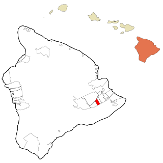
Eden Roc is a census-designated place (CDP) in Hawaiʻi County, Hawaiʻi, United States, located in the District of Puna. The population was 942 at the 2010 census, up from 451 at the 2000 census.

<span class="mw-page-title-main">Bonneau, South Carolina</span> Town in South Carolina, United States

Bonneau is a town in Berkeley County, South Carolina, United States. The population was 487 at the 2010 census. It is part of the Charleston–North Charleston–Summerville Metropolitan Statistical Area.

<span class="mw-page-title-main">Jamestown, South Carolina</span> Town in South Carolina, United States

Jamestown is a town in Berkeley County, South Carolina, United States. The population was 72 at the 2010 census.

<span class="mw-page-title-main">Moncks Corner, South Carolina</span> Town in South Carolina, United States

Moncks Corner is a town in and the county seat of Berkeley County, South Carolina, United States. The population was 7,885 at the 2010 census. As defined by the U.S. Census Bureau, Moncks Corner is included within the Charleston-North Charleston, SC Metropolitan Statistical Area.

<span class="mw-page-title-main">St. Stephen, South Carolina</span> Town in South Carolina, United States

St. Stephen is a town in Berkeley County, South Carolina, United States. The population was 1,697 at the 2010 census.

<span class="mw-page-title-main">Lincolnville, South Carolina</span> Town in South Carolina, United States

Lincolnville is a town in Charleston County, South Carolina, United States. A very small portion of the town extends into Dorchester County. The population was 1,139 at the 2010 census, up from 904 in 2000.

<span class="mw-page-title-main">Harleyville, South Carolina</span> Town in Dorchester County, South Carolina, United States

Harleyville is a town in Dorchester County, South Carolina, United States. The population was 677 at the 2010 census, up from 594 at the 2000 census. Harleyville is part of the Charleston-North Charleston-Summerville metropolitan area. As of 2018 the population is 696.

<span class="mw-page-title-main">Ridgeville, South Carolina</span> Town in South Carolina, United States

Ridgeville is a town in Dorchester County, South Carolina, United States. The population was 1,979 at the 2010 census, up from 1,690 at the 2000 census. Ridgeville is part of the Charleston-North Charleston-Summerville metropolitan area.

<span class="mw-page-title-main">St. George, South Carolina</span> Town in South Carolina, United States

Saint George is a town in Dorchester County, South Carolina, United States. The population was 2,084 at the 2010 census, eight fewer than in 2000 census. It has been the county seat of Dorchester County since the county was formed from Colleton County in 1897.

<span class="mw-page-title-main">Gantt, South Carolina</span> Census-designated place in South Carolina, United States

Gantt is a census-designated place (CDP) in Greenville County, South Carolina, United States. The population was 14,229 at the 2010 census. It is part of the Greenville–Mauldin–Easley Metropolitan Statistical Area and a suburb of the city of Greenville.

Parker is a census-designated place (CDP) in Greenville County, South Carolina, United States. The population was 11,431 at the 2010 census, up from 10,760 in 2000. It is part of the Greenville–Mauldin–Easley Metropolitan Statistical Area.

<span class="mw-page-title-main">Bucksport, South Carolina</span> Census-designated place in South Carolina, United States

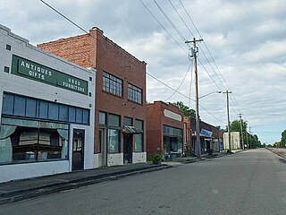
Bucksport is an unincorporated community and census-designated place (CDP) in Horry County, South Carolina, United States. The population was 876 at the 2010 census. It is a rural port on the Atlantic Intracoastal Waterway at the merger point with the Waccamaw River. The port has some services available for boaters and is also home to the Bucksport Restaurant.

<span class="mw-page-title-main">Socastee, South Carolina</span> CDP in South Carolina, United States

Socastee is a census-designated place (CDP) in Horry County, South Carolina, United States. The population was 19,952 at the 2010 census.

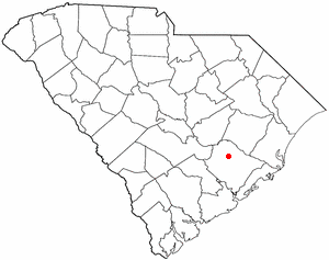
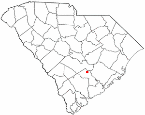
Cane Savannah is a census-designated place (CDP) in Sumter County, South Carolina, United States. The population was 1,452 at the 2000 census. It is included in the Sumter, South Carolina Metropolitan Statistical Area.

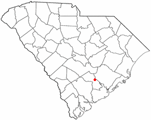
Stateburg is a census-designated place (CDP) in the High Hills of Santee in Sumter County, South Carolina, United States. The population was 1,380 at the 2010 census. It is included in the Sumter, South Carolina Metropolitan Statistical Area. Stateburg is located within the larger Stateburg Historic District.

<span class="mw-page-title-main">Summerville, South Carolina</span> Town in South Carolina, United States

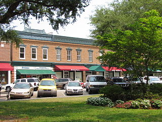
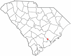
Summerville is a town in the U.S. state of South Carolina situated mostly in Dorchester County, with small portions in Berkeley and Charleston counties. It is part of the Charleston-North Charleston-Summerville, SC Metropolitan Statistical Area. Summerville's population at the 2020 census was 50,915.

<span class="mw-page-title-main">Morgan Farm, Texas</span> CDP in Texas, United States

Morgan Farm is a census-designated place (CDP) in San Patricio County, Texas, United States. The population was 463 at the 2010 census. Prior to the 2010 census, Morgan Farm CDP was known as Morgan Farm Area CDP.

References

  1. 1 2 Neuffer, Claude Henry; Neuffer, Irene (1966). Claude and Irene Neuffer's Names in South Carolina Vols. XIII-XVIII, 1966-1971. South Carolina: The Reprint Company. p. 41. ISBN   9780871523914 . Retrieved April 19, 2021.
  2. "ArcGIS REST Services Directory". United States Census Bureau. Retrieved October 15, 2022.
  3. "Census Population API". United States Census Bureau. Retrieved October 15, 2022.
  4. 1 2 "U.S. Census website". United States Census Bureau . Retrieved January 31, 2008.
  5. "US Board on Geographic Names". United States Geological Survey. October 25, 2007. Retrieved January 31, 2008.
  6. "Geographic Identifiers: 2010 Demographic Profile Data (G001): Ladson CDP, South Carolina". U.S. Census Bureau, American Factfinder. Archived from the original on February 12, 2020. Retrieved April 7, 2014.
  7. "US Gazetteer files: 2010, 2000, and 1990". United States Census Bureau. February 12, 2011. Retrieved April 23, 2011.
  8. "Census of Population and Housing". Census.gov. Retrieved June 4, 2016.
  9. "Explore Census Data". data.census.gov. Retrieved December 15, 2021.
  10. "Explore Census Data". data.census.gov. Retrieved May 8, 2024.