
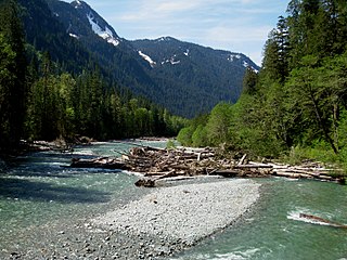
The Columbia River is the largest river in the Pacific Northwest region of North America. The river rises in the Rocky Mountains of British Columbia, Canada. It flows northwest and then south into the US state of Washington, then turns west to form most of the border between Washington and the state of Oregon before emptying into the Pacific Ocean. The river is 1,243 miles (2,000 km) long, and its largest tributary is the Snake River. Its drainage basin is roughly the size of France and extends into seven US states and a Canadian province. The fourth-largest river in the United States by volume, the Columbia has the greatest flow of any North American river entering the Pacific.

The Yakima River is a tributary of the Columbia River in south central and eastern Washington state, named for the indigenous Yakama people. The length of the river from headwaters to mouth is 214 miles (344 km), with an average drop of 9.85 feet per mile (1.866 m/km). It is the longest river entirely in Washington state.

The Lehigh River, a tributary of the Delaware River, is a 109-mile-long (175 km) river located in eastern Pennsylvania, in the United States. Part of the Lehigh, along with a number of its tributaries, is designated a Pennsylvania Scenic River by the state's Department of Conservation and Natural Resources. "Lehigh" is an Anglicization of the Lenape name for the river, Lechewuekink, meaning "where there are forks".

Lake Chelan is a narrow, 50.5-mile (81.3 km) long lake in Chelan County, north-central Washington state, U.S. Before 1927, it was the largest natural lake in the state by any measure. Upon the completion of Lake Chelan Dam in 1927, the elevation of the lake was increased by 21 feet (6.4 m) to its present maximum-capacity elevation of 1,100 feet (340 m). Two communities lie on the southern end of the lake, and a third sits at the far north end, providing a gateway to the North Cascades National Park.

Deep Creek Lake State Park is a public recreation area occupying more than 1,100 acres (450 ha) on the northeast side of Deep Creek Lake in Garrett County, Maryland, in the United States. The park features water activities, camping facilities, and recreational trails and is located about 18 miles (29 km) south of Interstate 68 on U.S. Route 219.

Lake Havasu is a large reservoir formed by Parker Dam on the Colorado River, on the border between San Bernardino County, California and La Paz County, Arizona. Lake Havasu City sits on the Arizona (eastern) side of the lake with its Californian counterpart of Havasu Lake directly across the lake. The reservoir has an available capacity of 619,400 acre feet (764,000,000 m3). The concrete arch dam was built by the United States Bureau of Reclamation between 1934 and 1938. The lake's primary purpose is to store water for pumping into two aqueducts. Prior to the dam construction, the area was home to the Mohave Indians. The lake was named after the Mojave word for blue. In the early 19th century, it was frequented by beaver trappers. Spaniards also began to mine the areas along the river.
Lake Mohave is a reservoir on the Colorado River between the Hoover Dam and Davis Dam in Cottonwood Valley defining the border between Nevada and Arizona in the United States. This 67 mile stretch of the Colorado River flows past Boulder City, Nelson, Searchlight, Cottonwood Cove, Cal-Nev-Ari, and Laughlin to the west in Nevada and Willow Beach and Bullhead City to the east in Arizona. A maximum width of 4 miles wide and an elevation of 647 feet (197 m), Lake Mohave encompasses 28,260 acres of water. As Lake Mead lies to the north of the Hoover Dam, Lake Mohave and adjacent lands forming its shoreline are part of the Lake Mead National Recreation Area administered by the U.S. National Park Service.

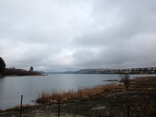
Wilson Lake is a reservoir in the U.S. state of Kansas, on the border of Russell County and Lincoln County. Built and managed by the U.S. Army Corps of Engineers for flood control, it is also used for wildlife management and recreation. Several parks are located along its shoreline, including Wilson State Park.
The Baker River is an approximately 30-mile (48 km), southward-flowing tributary of the Skagit River in northwestern Washington in the United States. It drains an area of the high North Cascades in the watershed of Puget Sound north of Seattle, and east of Mount Baker. With a watershed of approximately 270 square miles (700 km2) in a complex of deep valleys partially inside North Cascades National Park, it is the last major tributary of the Skagit before the larger river reaches its mouth on Skagit Bay. The river flows through Concrete, Washington, near its mouth and has two hydroelectric dams owned by Puget Sound Energy.

The Cimarron River, flowing entirely in New Mexico, was also known as La Flecha or Semarone. Its headwaters are Moreno, Sixmile, and Cieneguilla creeks in the Sangre de Cristo Mountains, which feed into Eagle Nest Dam. From the dam, it runs for 60 miles (97 km) to below the city of Springer, New Mexico in the Taylor Springs area, where it flows into the Canadian River, the southwestern-most major tributary flowing into the Mississippi River via the Arkansas River sub-basin.

Keechelus Lake is a lake and reservoir in the northwest United States, near Hyak in Kittitas County, Washington. Approximately fifty miles (80 km) southeast of Seattle and a few miles southeast of Snoqualmie Pass, it is the source of the Yakima River.
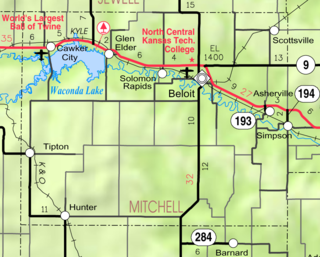
Waconda Lake, also known as Glen Elder Reservoir, is a reservoir in Mitchell County and Osborne County, Kansas, United States. Built and managed by the U.S. Bureau of Reclamation for flood control and irrigation, it is also used for recreation. Glen Elder State Park is located on its north shore.

Holter Dam is a hydroelectric straight gravity dam on the Missouri River about 45 miles (72 km) northeast of Helena, Montana, in the United States. The dam, which was built between 1908 and 1918, is 1,364 feet (416 m) long and 124 feet (38 m) high. The reservoir formed by the dam, Holter Lake is 25 miles (40 km) long and has a storage capacity of 243,000 acre feet (300,000,000 m3) of water when full. The dam is a "run-of-the-river" dam because it can generate electricity without needing to store additional water supplies behind the dam.

Kanopolis Lake is a reservoir in Ellsworth County in the Smoky Hills of central Kansas, about 31 miles southwest of Salina and a few miles southeast of the town of Kanopolis. The lake is formed by Kanopolis Dam. Completed in 1948 as a flood control and water conservation project of the United States Army Corps of Engineers, the dam impounds the Smoky Hill River.
Rock Lake is the deepest and largest of all scabland lakes left behind from the Missoula Floods, and holds that distinction for all of eastern Washington. At its deepest, it is more than 360 feet (110 m) deep, although the official measurement is uncertain. The lake is over 7 miles (11 km) long and averages 1 mile (1.6 km) in width, and is accessible via a solitary landing area located on the south end. The rest of the shoreline is inaccessible to vehicles, other than a few private properties.
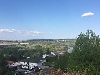
The Yakima River Delta is an area of land in Richland, Washington where the Yakima River enters the Columbia River at River Mile 335. It hosts several protected areas and is crossed by State Route 240. This area is mostly floodplain with riparian-type growth, including non-native species such as Russian olive. Amon Creek enters the Yakima River in this area.
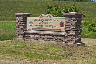
Lake Logan State Park is an Ohio state park in Hocking County, Ohio, United States. Lake Logan State Park is located in Falls Township, Hocking County, Ohio. Lake Logan Dam is directly accessible off State Route 664 just southwest of the county seat of Logan. Lake Logan State Park lies in the Hocking Valley, formed by the Hocking River. Lake Logan was created in 1955 with the construction of the Lake Logan Dam on Clear Fork Creek, a tributary of the Hocking River. Lake Logan is a 400-acre (160 ha) lake and is open to fishing, boating, ice fishing, ice boating and swimming.

Deep Lake is a 66-acre (27 ha) body of water lying eight miles (13 km) south of Olympia in Thurston County, Washington. It is 17 feet (5.2 m) deep at its deepest point and has a water volume of 771 acre feet (951,000 m3). The lake drains into Black River by way of Beaver Creek and Scott Lake. Deep Lake is located in Section 3, Township 16N, Range 2W, Willamette. The lake is bordered on two sides by Millersylvania State Park. An RV resort camp occupies the lake's eastern shore. The lake's fish population includes stocked rainbow trout and naturally reproducing largemouth bass, bluegill, yellow perch, and pumpkinseed.
Pearrygin Lake is a 212-acre (86 ha) reservoir lying 1.5 miles (2.4 km) east of Winthrop in Okanogan County, Washington. It has a maximum depth of 49 feet (15 m) and has a water volume of 6,260 acre feet (7,720,000 m3). The lake is fed by a diversion from the Chewuch River and several small inlets; it drains westerly into the Chewuch River. It lies within the watershed of the Lower Chewuch River.
