
The Andaman Sea is a marginal sea of the northeastern Indian Ocean bounded by the coastlines of Myanmar and Thailand along the Gulf of Martaban and the west side of the Malay Peninsula, and separated from the Bay of Bengal to its west by the Andaman Islands and the Nicobar Islands. Its southern end is at Breueh Island just north of Sumatra, with the Strait of Malacca further southeast.

Wisconsin has a long history with the Boy Scout and Girl Scout organizations from the 1910s to the present day, both programs have independently served thousands of youth in programs that suit the environment in which they live.

Scouting in Illinois has served youth since 1909. The state was the home of the Boy Scouts of America (BSA) founder, William D. Boyce.

An underwater environment is a environment of, and immersed in, liquid water in a natural or artificial feature, such as an ocean, sea, lake, pond, reservoir, river, canal, or aquifer. Some characteristics of the underwater environment are universal, but many depend on the local situation.
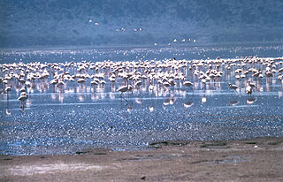
The Rift Valley lakes are a series of lakes in the East African Rift valley that runs through eastern Africa from Ethiopia in the north to Malawi in the south, and includes the African Great Lakes in the south. These include some of the world's oldest lakes, deepest lakes, largest lakes by area, and largest lakes by volume. Many are freshwater ecoregions of great biodiversity, while others are alkaline "soda lakes" supporting highly specialised organisms.
Northeast Illinois Council is a Boy Scouts of America local council that is headquartered in Vernon Hills, Illinois, United States.
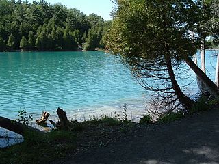
Green Lakes State Park is a New York State Park located east of Syracuse in the Town of Manlius. The park is strikingly scenic, and has a "masterpiece" golf course designed by Robert Trent Jones very early in his career. Green Lake itself is perhaps the most studied meromictic lake—one in which layers of water do not mix—in the world. The park preserves the largest stand of old growth forest in Central New York, and Round Lake has been designated as a National Natural Landmark by the U.S. Department of the Interior.

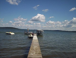
Flathead Lake is a large natural lake in northwest Montana, United States.

Lake Tazawa is a caldera lake in the city of Semboku, Akita Prefecture, northern Japan. It is the deepest lake in Japan at 423 metres (1,388 ft). The area is a popular vacation area and several hot spring resorts can be found in the hills above the lake. Akita Prefecture's largest ski area, Tazawako Ski Area [ja], overlooks the lake.
Botn is an inland fjord in the Rissa area of the municipality of Indre Fosen in Trøndelag county, Norway. It flows through a short, small river into the Sundsbukta, a small bay off the Trondheimsfjorden. The village of Årnset lies on the north shore of Botn.
Green Lake — also known as Big Green Lake — is a lake in Green Lake County, Wisconsin, United States. Green Lake has a maximum depth of 237 ft (72 m), making it the deepest natural inland lake in Wisconsin and the second largest by volume. The lake covers 29.72 km2 and has an average depth of 30.48 m (100.0 ft). Green Lake has 43.94 km (27.30 mi) of diverse shoreline, ranging from sandstone bluffs to marshes.
Bathurst Harbour is a shallow bay located in the south west region of Tasmania, Australia. Bathurst Harbour is contained within the Port Davey/Bathurst Harbour Marine Nature Reserve, and the Southwest National Park, part of the Tasmanian Wilderness World Heritage Area.
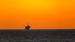
Offshore drilling is a mechanical process where a wellbore is drilled below the seabed. It is typically carried out in order to explore for and subsequently extract petroleum that lies in rock formations beneath the seabed. Most commonly, the term is used to describe drilling activities on the continental shelf, though the term can also be applied to drilling in lakes, inshore waters and inland seas.
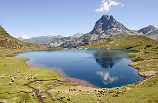
A lake is an often naturally occurring, relatively large and fixed body of water on or near the Earth's surface. It is localized in a basin or interconnected basins surrounded by dry land. Lakes lie completely on land and are separate from the ocean, although they may be connected with the ocean by rivers, such as Lake Ontario. Most lakes are freshwater and account for almost all the world's surface freshwater, but some are salt lakes with salinities even higher than that of seawater. Lakes vary significantly in surface area and volume of water.
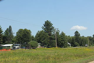
Pearson is an unincorporated community in the town of Ainsworth, Langlade County, Wisconsin, United States. Pearson is 5 miles (8 km) west of Pickerel and 17 miles (27 km) north-northeast of Antigo, the county seat of Langlade County. The community is situated on Pickerel Creek near its confluence with the Wolf River. County Highway T runs through Pearson; the closest state highway to the community is Wisconsin State Highway 55 in Pickerel.

Water and Woods Field Service Council was a field service council of the Michigan Crossroads Council that served youth in the central and northeastern Lower Peninsula of Michigan. The Council was headquartered in Flint, Michigan, with service centers located in Auburn, Lansing, and Port Huron. The Water and Woods Field Service Council was the result of a merger in 2012 of Lake Huron Area Council, Blue Water Council, Tall Pine Council and Chief Okemos Council.

The hydrology of Hungary, is mostly determined by Hungary's lying in the middle of the Carpathian Basin, half surrounded by the Carpathian Mountains. All parts of the country have some outflow. All surface water gravitates towards its southern center, and from there, is united in the Danube, which flows into the Black Sea. The whole of Hungary lies within the Danube drainage basin.

Lake James is a natural lake located in the northeast corner of the state of Indiana in the United States. It is popular as a place for boating and fishing and has a wide variety of wildlife. As the state's fourth-largest natural lake, it has over 1,200 acres (490 ha) of surface water, and consists of three basins. Its water quality is ranked among the best in Indiana lakes. The lake is the largest of a group of lakes known as the James Lake Chain. These lakes are located mostly in Steuben County, Indiana, but also extend into southern Michigan.
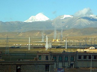
The Yangbajain Geothermal Field (羊八井地热田) is a geothermal field near the town of Yangbajain in Damxung County, Tibet Autonomous Region, China. The fluid is heated by magmatic activity not far below the surface. It is a tourist attraction and also supplies steam to a major power plant with 25 MW capacity.

Lake Manly was a pluvial lake in Death Valley, California. It forms occasionally in Badwater Basin after heavy rainfall, but at its maximum extent during the so-called "Blackwelder stand," ending approximately 120,000 years before present, the lake covered much of Death Valley with a surface area of 1,600 square kilometres (620 sq mi). Water levels varied through its history, and the chronology is further complicated by active tectonic processes that have modified the elevations of the various shorelines of Lake Manly; during the Blackwelder stage they reached 47–90 metres (154–295 ft) above sea level. The lake received water mainly from the Amargosa River and at various points from the Mojave River and Owens River. The lake and its substantial catchment favoured the spread of a number of aquatic species, including some lizards, pupfish and springsnails. The lake probably supported a substantial ecosystem, and a number of diatoms developed there.

