Leadington, Missouri

Last updated
Leadington, Missouri
St. Francois County Missouri Incorporated and Unincorporated areas Leadington Highlighted.svg
Location of Leadington, Missouri
Coordinates: 37°50′04″N90°28′50″W / 37.83444°N 90.48056°W / 37.83444; -90.48056 Coordinates: 37°50′04″N90°28′50″W / 37.83444°N 90.48056°W / 37.83444; -90.48056
Country United States
State Missouri
County St. Francois
Area
[1]
  Total0.91 sq mi (2.36 km2)
  Land0.91 sq mi (2.36 km2)
  Water0.00 sq mi (0.00 km2)
Elevation
[2]
896 ft (273 m)
Population
 (2020)
  Total764
  Density837.72/sq mi (323.37/km2)
Time zone UTC-6 (Central (CST))
  Summer (DST) UTC-5 (CDT)
FIPS code 29-41024 [3]
GNIS feature ID2395660 [2]

Leadington is a city in St. Francois County, Missouri, United States. The population was 422 at the 2010 census.

Contents

History

Leadington was platted in 1895, soon after lead mining began at the town site. [4] A post office called Leadington was established in 1894, and remained in operation until 1966. [5]

Geography

According to the United States Census Bureau, the city has a total area of 0.90 square miles (2.33 km2), all land. [6]

Demographics

Historical population
CensusPop.Note
1960 365
1970 299−18.1%
1980 238−20.4%
1990 201−15.5%
2000 2062.5%
2010 422104.9%
2020 76481.0%
U.S. Decennial Census [7]

2010 census

As of the census [8] of 2010, there were 422 people, 193 households, and 116 families living in the city. The population density was 468.9 inhabitants per square mile (181.0/km2). There were 222 housing units at an average density of 246.7 per square mile (95.3/km2). The racial makeup of the city was 95.73% White, 0.24% Black or African American, 0.24% Native American, 0.71% Asian, 0.47% from other races, and 2.61% from two or more races. Hispanic or Latino of any race were 2.13% of the population.

There were 193 households, of which 29.0% had children under the age of 18 living with them, 37.3% were married couples living together, 16.1% had a female householder with no husband present, 6.7% had a male householder with no wife present, and 39.9% were non-families. 35.2% of all households were made up of individuals, and 14% had someone living alone who was 65 years of age or older. The average household size was 2.19 and the average family size was 2.81.

The median age in the city was 36.8 years. 23.5% of residents were under the age of 18; 8.8% were between the ages of 18 and 24; 27.7% were from 25 to 44; 24.3% were from 45 to 64; and 15.6% were 65 years of age or older. The gender makeup of the city was 49.3% male and 50.7% female.

2000 census

As of the census [3] of 2000, there were 206 people, 92 households, and 51 families living in the city. The population density was 302.5 inhabitants per square mile (116.8/km2). There were 101 housing units at an average density of 148.3 per square mile (57.3/km2). The racial makeup of the city was 93.20% White, 4.85% African American and 1.94% Asian. Hispanic or Latino of any race were 0.49% of the population.

There were 92 households, out of which 25.0% had children under the age of 18 living with them, 41.3% were married couples living together, 14.1% had a female householder with no husband present, and 43.5% were non-families. 39.1% of all households were made up of individuals, and 17.4% had someone living alone who was 65 years of age or older. The average household size was 2.24 and the average family size was 2.83.

In the city the population was spread out, with 24.3% under the age of 18, 11.2% from 18 to 24, 23.8% from 25 to 44, 20.4% from 45 to 64, and 20.4% who were 65 years of age or older. The median age was 40 years. For every 100 females there were 104.0 males. For every 100 females age 18 and over, there were 90.2 males.

The median income for a household in the city was $19,722, and the median income for a family was $25,577. Males had a median income of $26,429 versus $30,417 for females. The per capita income for the city was $13,336. About 10.3% of families and 13.9% of the population were below the poverty line, including 12.5% of those under the age of 18 and none of those 65 or over.

Related Research Articles

<span class="mw-page-title-main">Eagle, Idaho</span> City in Idaho, United States

Eagle is a city in the western United States in Ada County, Idaho, ten miles (16 km) northwest of downtown Boise. The population was 30,346 at the time of the 2020 census.

<span class="mw-page-title-main">Rembrandt, Iowa</span> City in Iowa, United States

Rembrandt is a city in Buena Vista County, Iowa, United States. The population was 209 at the time of the 2020 census.

<span class="mw-page-title-main">Maynard, Iowa</span> City in Iowa, United States

Maynard is a city in Fayette County, Iowa, United States. The population was 476 at the time of the 2020 census.

<span class="mw-page-title-main">McClelland, Iowa</span> City in Iowa, United States

McClelland is a city in Pottawattamie County, Iowa, United States. The city was founded in 1903 after the Great Western Railroad was extended to include Council Bluffs, IA. The population was 146 at the time of the 2020 census.

<span class="mw-page-title-main">Maysville, Iowa</span> City in Iowa, USA

Maysville is a city in Scott County, Iowa, United States. The population was 156 at the time of the 2020 census.

<span class="mw-page-title-main">McCausland, Iowa</span> City in Iowa, USA

McCausland is a city in Butler Township, Scott County, Iowa, United States. The population was 313 at the time of the 2020 census.

<span class="mw-page-title-main">Wilton, Minnesota</span> City in Minnesota, United States

Wilton is a city in Beltrami County, Minnesota, United States. The population was 204 at the 2010 census. Wilton is considered a bedroom community of Bemidji.

<span class="mw-page-title-main">Lake Shore, Minnesota</span> City in Minnesota, United States

Lake Shore is a city in Cass County, Minnesota, United States. The population was 1,056 at the 2020 census. It is part of the Brainerd Micropolitan Statistical Area.

<span class="mw-page-title-main">Nashwauk, Minnesota</span> City in Minnesota, United States

Nashwauk is a city in Itasca County, Minnesota, United States. The population was 983 at the 2010 census.

<span class="mw-page-title-main">Warba, Minnesota</span> City in Minnesota, United States

Warba is a city in Itasca County, Minnesota, United States. The population was 181 at the 2010 census.

<span class="mw-page-title-main">Lake Bronson, Minnesota</span> City in Minnesota, United States

Lake Bronson is a city in Kittson County, Minnesota, United States. The population was 178 at the 2020 census. Lake Bronson State Park is nearby.

<span class="mw-page-title-main">Lastrup, Minnesota</span> City in Minnesota, United States

Lastrup is a city in Morrison County, Minnesota, United States. The population was 120 at the 2020 census.

<span class="mw-page-title-main">Bluffton, Minnesota</span> City in Minnesota, United States

Bluffton is a city in Otter Tail County, Minnesota, United States, along the Leaf River. The population was 210 at the 2020 census.

<span class="mw-page-title-main">Erhard, Minnesota</span> City in Minnesota, United States

Erhard is a city in Otter Tail County, Minnesota, United States. The population was 132 at the 2020 census.

<span class="mw-page-title-main">Leonidas, Minnesota</span> City in Minnesota, United States

Leonidas is a city in Saint Louis County, Minnesota, United States. The population was 52 at the 2010 census.

<span class="mw-page-title-main">Fort Calhoun, Nebraska</span> City in Nebraska, United States

Fort Calhoun is a city in Washington County, Nebraska, United States. The population was 908 at the 2010 census. The city includes Fort Atkinson, the first fort built west of the Missouri River.

<span class="mw-page-title-main">Lake Annette, Missouri</span> City in Missouri, United States

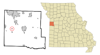
Lake Annette is a city in Cass County, Missouri, United States. The population was 100 at the 2010 census. It is part of the Kansas City metropolitan area.

<span class="mw-page-title-main">Clarkson Valley, Missouri</span> City in Missouri, United States

Clarkson Valley is a city in St. Louis County, Missouri, United States. The population was 2,609 at the 2020 census.

<span class="mw-page-title-main">Belmont, West Virginia</span> Town in West Virginia, United States

Belmont is a town in Pleasants County, West Virginia, United States. It is part of the Parkersburg–Vienna metropolitan area. The population was 872 at the 2020 census. Belmont was incorporated on April 19, 1946 by the Circuit Court of Pleasants County. The city was named for the beautiful hills in the area.

<span class="mw-page-title-main">Pennsboro, West Virginia</span> City in West Virginia, United States

Pennsboro is a city in Ritchie County, West Virginia, United States. The population was 1,050 at the 2020 census. The city is located at the junction of U.S. Route 50 and West Virginia Route 74; the North Bend Rail Trail also passes through the city.

References

  1. "ArcGIS REST Services Directory". United States Census Bureau. Retrieved August 28, 2022.
  2. 1 2 U.S. Geological Survey Geographic Names Information System: Leadington, Missouri
  3. 1 2 "U.S. Census website". United States Census Bureau . Retrieved 2008-01-31.
  4. "St. Francois County Place Names, 1928–1945". The State Historical Society of Missouri. Archived from the original on June 24, 2016. Retrieved November 27, 2016.
  5. "Post Offices". Jim Forte Postal History. Retrieved 27 November 2016.
  6. "US Gazetteer files 2010". United States Census Bureau. Archived from the original on 2012-07-02. Retrieved 2012-07-08.
  7. "Census of Population and Housing". Census.gov. Retrieved June 4, 2015.
  8. "U.S. Census website". United States Census Bureau . Retrieved 2012-07-08.