Related Research Articles

Small hydro is the development of hydroelectric power on a scale suitable for local community and industry, or to contribute to distributed generation in a regional electricity grid. Exact definitions vary, but a "small hydro" project is less than 50 megawatts (MW), and can be further subdivide by scale into "mini" (<1MW), "micro" (<100 kW), "pico" (<10 kW). In contrast many hydroelectric projects are of enormous size, such as the generating plant at the Three Gorges Dam at 22,500 megawatts or the vast multiple projects of the Tennessee Valley Authority.

Manipur is a state in northeast India, with the city of Imphal as its capital. It is bounded by the Indian states of Nagaland to the north, Mizoram to the south and Assam to the west. It also borders two regions of Myanmar, Sagaing Region to the east and Chin State to the south. The state covers an area of 22,327 km2 (8,621 sq mi). The official and most widely spoken language is the Meitei language. Native to the Meitei people, it is also used as a lingua franca by smaller communities, who speak a variety of other Tibeto-Burman languages. Manipur has been at the crossroads of Asian economic and cultural exchange for more than 2,500 years. This exchange connects the Indian subcontinent and Central Asia to Southeast Asia, East Asia, Siberia, regions in the Arctic, Micronesia and Polynesia enabling migration of people, cultures and religions.

Imphal is the capital city of the Indian state of Manipur. It is the second largest city after Guwahati metropolitan in Northeast India. The metropolitan centre of the city contains the ruins of Kangla Palace, the royal seat of the former Kingdom of Manipur, surrounded by a moat. Spread over parts of the districts of Imphal West and Imphal East, the former contains the majority of the city's area and population. Imphal is part of the Smart Cities Mission under the Ministry of Housing and Urban Affairs. Being a mega commercial hub, Imphal is known for its weaving, brass-ware, bronze-ware, and other cottage industries. Meitei language is the most widely spoken language in the city.

The Loktak Lake is a freshwater lake in Northeast India. It is the largest freshwater lake in South Asia. It is a pulsating lake, with a surface area varying from 250 sq km to 500 sq km during the rainy season with a typical area of 287 sq km. The lake is located at Moirang in Manipur state, India. The etymology of Loktak is Lok = "stream" and tak = "the end" in Meitei language. It is famous for the phumdi floating over it. The largest of all the phumdis covers an area of 40 km2 (15 sq mi) and is situated on the southeastern shore of the lake. Located on this phumdi, Keibul Lamjao National Park is the only floating national park in the world. The park is the last natural refuge of the endangered Sangai, Rucervus eldii eldii or Manipur brow-antlered deer, one of three subspecies of Eld's deer.

The Keibul Lamjao National Park is a national park in the Bishnupur district of the state of Manipur in Northeast India. It is 40 km2 (15.4 sq mi) in area, the only floating national park in the world, and an integral part of Loktak Lake. It is currently under the tentative lists of the UNESCO World Heritage Sites, under the title "Keibul Lamjao Conservation Area (KLCA)", additionally covering the buffer of Loktak Lake and Pumlen Pat.

Teesta River is a 414 km (257 mi) long river that rises in the Pauhunri Mountain of eastern Himalayas, flows through the Indian states of Sikkim and West Bengal and subsequently enters Bangladesh through Rangpur division. In Bangladesh, it falls into Brahmaputra River which after meeting some other major rivers of the Bengal delta finally falls into the Bay of Bengal. It drains an area of 12,540 km2 (4,840 sq mi). In India, the Teesta flows through Mangan District, Gangtok District, Pakyong District, Kalimpong district, Darjeeling District, Jalpaiguri District, Cooch Behar districts and the cities of Rangpo, Jalpaiguri and Mekhliganj. In Bangladesh, it flows through Lalmonirhat District, Rangpur District, Kurigram District and Gaibandha District. It joins the Brahmaputra River at Phulchhari Upazila in Bangladesh. 305 km (190 mi) of the river lies in India and 109 km (68 mi) in Bangladesh. The Teesta is the largest river of Sikkim and second largest river of West Bengal after the Ganges.
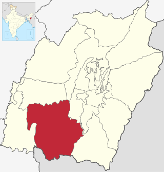
Churachandpur District, is one of the 16 districts of the Indian state of Manipur populated mainly by Kuki-Zo people. The name honours former Maharaja Sir Churachand Singh of Manipur. The district headquarters is located in the Churachandpur town, which is also locally known by the name Lamka.
The Balimela Reservoir is located in Malkangiri district, Odisha, India on the river Sileru which is a tributary of the Godavari river. The gross storage capacity of Balimela reservoir is 3610 million cubic meters.

Senapati, is one of the 16 districts of the Indian state of Manipur. The present Senapati district was formed in December 2016, after spawning off the Sadar Hills region in the south into a separate Kangpokpi district. The district headquarter is located in the municipality of Tahamzam.

Thoubal district is one of the sixteen districts of Manipur state in northeastern India. This district is bounded by Senapati district on the north, Ukhrul and Chandel districts on the east, Churchandpur and Bishnupur districts on the south and Imphal West and Imphal East districts on the west. The district occupies an area of 324 km2. The population as of 2011 is 286,687. Thoubal town is the district headquarters. This district is known for Khongjom, where the last battle of the independence of Manipur was fought in April 1891 against the British army.
Jiribam is a municipal council in the Jiribam district of the state of Manipur, India. It is one of the fastest-growing towns in Manipur.
Sugnu is a small town at the southern tip of the Kakching district in Manipur, India. It is on the bank of the Manipur River, to the east of Churachandpur district, Chandel district to the east and Bishnupur district.

The Burdekin Falls Dam, also known as the Burdekin Dam, is a concrete gravity dam with an uncontrolled spillway across the Burdekin River in the Whitsunday Region, Queensland, Australia. Built for the purpose of irrigation, the reservoir is called Lake Dalrymple, and is on the boundary of the Whitsunday Region and the Charters Towers Region. Burdekin Falls Dam is managed by SunWater. Water from the reservoir is also used to replenish downstream aquifers.

The Indian state Himachal Pradesh has a large number hydroelectricity resources, about twenty five percent of the national potential. About 27,436 MW of hydroelectric power can be generated in the state by the construction of various hydroelectric projects on the five perennial river basins. Out of total hydroelectric potential of the state, 10,519 MW is harnessed so far, out of which 7.6% is under the control of Himachal Pradesh Government while the rest is exploited by the Central Government. The state government has been giving the highest priority for its development, since hydroelectric generation can meet the growing need of power for industry, agriculture and rural electrification. It is also the biggest source of income to the state as it provides electricity to other states.
India is 5th globally for installed hydroelectric power capacity. As of 31 March 2020, India's installed utility-scale hydroelectric capacity was 46,000 MW, or 12.3% of its total utility power generation capacity. Additional smaller hydroelectric power units with a total capacity of 4,683 MW have been installed. India's hydroelectric power potential is estimated at 148,700 MW at 60% load factor. In the fiscal year 2019–20, the total hydroelectric power generated in India was 156 TWh with an average capacity factor of 38.71%.
The Imphal River, also known as the Turel Achouba, is a major river in Manipur state, northeastern India which originates from the northern side of Kangpokpi district. It is a tributary of the Manipur River, joining it in Thoubal district. It flows past Loktak Lake and the city of Imphal and joins the Lilong River, some 10 kilometres (6.2 mi) to the south. It flows towards Myanmar (Burma), marking the end point at 23°59'49.2"N 93°44'29.7"E. It then goes south meeting Myittha River at 22°53'24.19"N, 94° 5'1.79"E. Myittha river flows towards north and meets Chindwin River at 23°11'36.82"N, 94°18'38.28"E. Chindwin river then meets Irrawaddy River at 21°25'23.85"N, 95°16'47.56"E. Irrawaddy river then flows south till it ends at Andaman Sea, adjoining the Bay of Bengal and thereby connecting Imphal city to the sea. Imphal River was used by Japanese soldiers in boats to reach Imphal in World War II.

The Kateri (Katery) hydro electric power station is located in Nilgiris, Tamil Nadu, India. It is a series of dams and a power house with four 125 KW generators and one 500 KW. The plant powers the Cordite Factory at Aruvankadu.

Kopili River is an interstate river in Northeast India that flows through the states of Meghalaya and Assam and is the largest south bank tributary of the Brahmaputra in Assam.

Kulamavu Dam is a gravity/masonry dam on Kilivillithode which is a tributary of the Periyar river in Arakkulam village, Idukki district of Kerala, India. It is one of the three dams associated with the Idukki hydro electric power project in the Indian state of Kerala. This dam is located towards the western side of the Idukki Arch Dam. This is a gravity dam with the top portion in concrete and the bottom in masonry.
Leisang is a village in Kangpokpi district in the Indian state of Manipur. It is in a mountainous location and is inaccessible to vehicles; in April 2018 it was the last village in the country to be electrified.
References
- ↑ "Leimakhong Manipur". www.census2011.co.in. Retrieved 14 July 2018.
- ↑ "Army launches massive hunt operation in Manipur against militants after deadliest attack in 33 years". The Times of India. 5 June 2015.
- ↑ "Two Assam Rifles jawans die, 6 hurt in Manipur blast - Times of India". The Times of India. 14 November 2017.
- ↑ Ministry of Power 2023, p. 3.
- ↑ Irrigation & Power: The Journal of the Central Board of Irrigation & Power, Volumes 20-21, India. Central Board of Irrigation and Power, 1963, p. 194,
Following heavy rains, there were landslides in the upper reaches of the Leimakhong River, tributary of the Imphal and at the power house site. The mass of boulders and earth which came down filled the entire bed of the river and changed its course. The old power house, with its machinery and equipment, was washed away at 9:30 A.M. on the 10th June.
- ↑ Ministry of Power 2023, p. 11.
- ↑ Power supply and load development, Manipur State Power Company Limited, retrieved 15 January 2024.
- ↑ Four men feared dead in Manipur; combustible fluid mixes in rivulet, The Hindu, 11 January 2024.