
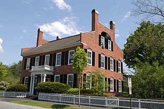
Longmeadow is a town in Hampden County, Massachusetts, in the United States. The population was 15,853 at the 2020 census.

The town of Washington, Virginia, is a historic village located in the eastern foothills of the Blue Ridge Mountains near Shenandoah National Park. The entire town is listed on the National Register of Historic Places as a historic district, Washington Historic District. It is the county seat of Rappahannock County, Virginia.
Woodstock is an incorporated village located within the town of Woodstock in Windsor County, Vermont, United States. As of the 2020 census, the village population was 900.

The New Haven Green is a 16-acre (65,000 m2) privately owned park and recreation area located in the downtown district of the city of New Haven, Connecticut, United States. It comprises the central square of the nine-square settlement plan of the original Puritan colonists in New Haven, and was designed and surveyed by colonist John Brockett. Today the Green is bordered by the modern paved roads of College, Chapel, Church, and Elm streets. Temple Street bisects the Green into upper (northwest) and lower (southeast) halves.

The Fernandina Beach Historic District is a U.S. historic district located in Fernandina Beach, Florida on Amelia Island. The Fernandina Beach Historic District was included on the National Register of Historic Places on July 20, 1973 and encompasses approximately 1,500 acres, bounded by North 9th Street, Broome, Ash, South 5th Street, Date, and South 8th Street. On April 20, 1987, the National Register listing was expanded to include an additional 970 acres (3.9 km²), bounded by Sixth, Broome, North 3rd, & Escambia Streets; Seventh & Date Streets, and Ash. Approximately 300 buildings are included in this district.
Elmwood is a neighborhood in the South Side of Providence, Rhode Island. The triangular region is demarcated by Broad Street, Elmwood Avenue, and Interstate 95.

Litchfield Historic District, in Litchfield, Connecticut, is a National Historic Landmark District designated in 1968 as a notable and well-preserved example of a typical late 18th century New England village. As a National Historic Landmark, it is listed on the National Register of Historic Places (NRHP). It is the core area of a larger NRHP-listed historic district that includes the entire borough of Litchfield and was designated a state historic district in 1959.

The Clinton Village Historic District encompasses the historic portion of the town center of Clinton, Connecticut. It is roughly linear and extends along East Main Street from the Indian River in the west to Old Post Road in the east. The area represents a well-preserved mid-19th century town center, with architecture dating from the late 17th to mid-20th centuries. The district was listed on the National Register of Historic Places in 1994.
The Central Troy Historic District is an irregularly shaped, 96-acre (39 ha) area of downtown Troy, New York, United States. It has been described as "one of the most perfectly preserved 19th-century downtowns in the [country]" with nearly 700 properties in a variety of architectural styles from the early 19th to mid-20th centuries. These include most of Russell Sage College, one of two privately owned urban parks in New York, and two National Historic Landmarks. Visitors ranging from the Duke de la Rochefoucauld to Philip Johnson have praised aspects of it. Martin Scorsese used parts of downtown Troy as a stand-in for 19th-century Manhattan in The Age of Innocence.

Norwichtown is a historic neighborhood in the city of Norwich, Connecticut. It is generally the area immediately north of the Yantic River between I-395 and Route 169.

Wolcott Green Historic District a historic district in the New England town of Wolcott, Connecticut. The district encompasses the town green and the surrounding buildings. The green is located in the town center of Wolcott along Center Road. It has a triangular shape and is surrounded by several houses, a church and the town hall. The other streets bounding the green are Bound Line Road and Kenea Avenue.
Wyoming Village Historic District is a national historic district located at the Village of Wyoming in Wyoming County, New York. The district covers about 45 acres (180,000 m2) and is organized as a New England village around a small triangular village green. The T-shaped district includes approximately 72 historic registered structures along two principal streets, Main and Academy Streets.

The Kingston Stockade District is an eight-block area in the western section of Kingston, New York, United States, commonly referred to as Uptown Kingston. It is the original site of the mid-17th century Dutch settlement of Wiltwyck, which was later renamed Kingston when it passed to English control.

Ellington Center Historic District is an 80-acre (32 ha) historic district in the town of Ellington, Connecticut that was listed on the National Register of Historic Places in 1990.

Jackson Square Park is an urban park in the Greenwich Village Historic District in Manhattan, New York City, United States. The 0.227 acres (920 m2) park is bordered by 8th Avenue on the west, Horatio Street on the south, and Greenwich Avenue on the east. The park interrupts West 13th Street.

The West Brattleboro Green Historic Districts encompasses the historic core of the village of West Brattleboro, Vermont. Centered in the triangular green at South Street and Western Avenue, it includes a modest collection of buildings constructed between about 1800 and 1910. It was listed on the National Register of Historic Places in 2002.

The Strafford Village Historic District encompasses the historic village center of Strafford, Vermont, United States. Founded in 1768, the village center was developed in the 1790s, and saw most of its growth before 1840, resulting in a fine assortment of predominantly Greek Revival buildings. Notable exceptions include the 1799 meetinghouse, and the Justin Smith Morrill Homestead, a fine example of Gothic Revival architecture built by native son Justin Smith Morrill. The district, centered on the town green at the junction of Morrill Highway and Brook Road, was listed on the National Register of Historic Places in 1974.
The Waitsfield Common Historic District encompasses the original town center settlement of Waitsfield, Vermont, at the junction of Joslin Hill, Common, East, and North Roads. Located about 1 mile (1.6 km) from the town's present main village and center, it was laid out in 1793, and includes the triangular town common, a cemetery, and a number of houses built mainly between 1793 and 1841. The district was listed on the National Register of Historic Places in 2001.

Woodbury Town Hall is center of town government of Woodbury, Vermont. It is located on the west side of Vermont Route 14 in the town's village center. Built in 1842, it is a well-preserved example of a vernacular Greek Revival municipal building. It was listed on the National Register of Historic Places in 1995.

The University Green Historic District encompasses the central green and surrounding buildings of the main campus of the University of Vermont (UVM) in Burlington, Vermont. The green took shape in 1801, and has been a central element of the campus since then. It is flanked by some of the university's oldest and most architecturally important buildings, and was listed on the National Register of Historic Places in 1975.

