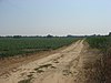
This is a list of archaeological sites on the National Register of Historic Places in Indiana.
Historic sites in the United States qualify to be listed on the National Register of Historic Places by passing one or more of four different criteria; Criterion D permits the inclusion of proven and potential archaeological sites. [1] More than fifty different sites in Indiana are listed under this criterion, including both Native American and European sites, and two others were once listed but have been removed. [2] This list includes all properties in Indiana that qualify under this criterion.
| [3] | Landmark name | Image | Location | County | Culture | Comments |
|---|---|---|---|---|---|---|
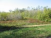
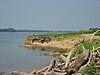
| 1 | Axsom Branch Archeological Site (12BR12) [54] | Washington Township: Lake Monroe shoreline, west of the Terrill Cemetery 39°3′22″N86°20′24″W / 39.05611°N 86.34000°W | Brown | Late Archaic | ||
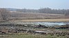
| 2 | Refuge No. 7 Archeological Site (12BR11) [55] | Washington Township: on the Lake Monroe shoreline, south of Deckard Ridge 39°3′44″N86°21′56″W / 39.06222°N 86.36556°W | Brown | Late Archaic |

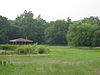
Angel Mounds State Historic Site, an expression of the Mississippian culture, is an archaeological site managed by the Indiana State Museum and Historic Sites that includes more than 600 acres of land about 8 miles (13 km) southeast of present-day Evansville, in Vanderburgh and Warrick counties in Indiana. The large residential and agricultural community was constructed and inhabited from AD 1100 to AD 1450, and served as the political, cultural, and economic center of the Angel chiefdom. It extended within 120 miles (190 km) of the Ohio River valley to the Green River in present-day Kentucky. The town had as many as 1,000 inhabitants inside the walls at its peak, and included a complex of thirteen earthen mounds, hundreds of home sites, a palisade (stockade), and other structures.

This is a list of properties and districts in Illinois that are on the National Register of Historic Places. There are over 1,900 in total. Of these, 85 are National Historic Landmarks. There are listings in all of the state's 102 counties.
This National Park Service list is complete through NPS recent listings posted August 4, 2023.
The Mound House is an archeological site located in Greene County, Illinois in the Illinois River floodplain. The site is a multicomponent site; however, the mounds were constructed during the Middle Woodland and are associated with the Havana Hopewell culture. The mound center has two identified mounds.

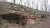
The Potts Creek Rockshelter Archeological Site, within Hoosier National Forest in Crawford County, Indiana, was a camp for Archaic, Woodland, and Paleo-Indian Indians. It is currently unoccupied by habitation.

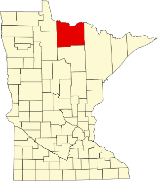
This is a list of the National Register of Historic Places listings in Otter Tail County, Minnesota. It is intended to be a complete list of the properties and districts on the National Register of Historic Places in Otter Tail County, Minnesota, United States. The locations of National Register properties and districts for which the latitude and longitude coordinates are included below, may be seen in an online map.

The Zimmerman Kame is a glacial kame and archaeological site in McDonald Township, Hardin County, Ohio, United States, near the community of Roundhead. A circular hill approximately 20 feet (6.1 m) in height, it was a commercial gravel pit for a time before being abandoned in the 1970s after artifacts of the ancient Glacial Kame culture of Native Americans were found at the site. Today, the kame is tree-covered and surrounded by farm fields; there are no obvious signs of its significance.

The Dunns Pond Mound is a historic Native American mound in northeastern Logan County, Ohio, United States. Located near Huntsville, it lies along the southeastern corner of Indian Lake in Washington Township. In 1974, the mound was listed on the National Register of Historic Places as a potential archeological site, with much of its significance deriving from its use as a burial site for as much as nine centuries.

This is a list of the National Register of Historic Places listings in Mille Lacs County, Minnesota.
This is a list of the National Register of Historic Places listings in Koochiching County, Minnesota. It is intended to be a complete list of the properties and districts on the National Register of Historic Places in Koochiching County, Minnesota, United States. The locations of National Register properties and districts for which the latitude and longitude coordinates are included below, may be seen in an online map.

The Goodall focus was a Hopewellian culture from the Middle Woodland period peoples that occupied Western Michigan and northern Indiana from around 200 BCE to 500 CE. Extensive trade networks existed at this time, particularly among the many local cultural expressions of the Hopewell communities. The Goodall pattern stretched from the southern tip of Lake Michigan, east across northern Indiana, to the Ohio border, then northward, covering central Michigan, almost reaching to Saginaw Bay on the east and Grand Traverse Bay to the north. The culture is named for the Goodall site in northwest Indiana.

The Lake Ridge Island Mounds are a group of small hills in Logan County, Ohio, United States that have been thought to be Native American mounds. Located in an area of about 5 acres (2.0 ha) at the northern end on Lake Ridge Island in Indian Lake, the mounds are near the village of Russells Point in the southeastern corner of Stokes Township. State Route 368 passes a short distance to the east of the mounds, even weaving at one point to avoid them. The four mounds on the island are small, not reaching a height greater than 3 feet (0.91 m) or a diameter greater than 40 feet (12 m); they are small enough that they appear to be natural knolls. A report produced in the 1970s observed that the mounds were in "excellent" condition at the time, never having been disturbed by artifact seekers.

The Carl Potter Mound is a historic Native American mound in southern Champaign County, Ohio, United States. Located near Mechanicsburg, it lies on a small ridge in a pasture field in southeastern Union Township. In 1974, the mound was listed on the National Register of Historic Places as a potential archaeological site, primarily because of its use as a burial mound.

The Mitchell Archaeological Site is a pre-Columbian archaeological site located at the western end of University Drive in Mitchell, Illinois. The site includes a platform mound and the remains of a village; while it once included several other mounds, they have been destroyed by modern activity. Mississippian peoples inhabited the site c. 1150–1200. The site is affiliated with the Cahokia settlement system and was the largest site in the system except for Cahokia itself. However, the majority of the site was destroyed by the construction of Interstate 270; known information about the site mainly comes from salvage excavations conducted before the highway was built.

Esplanade Apartments is a historic apartment building located at Indianapolis, Indiana. It was built in 1912 and opened for business with ads in the Indianapolis Star on September 1, 1912, and is a two to three-story, "U"-shaped, brick veneered building. It has simulated half-timbering and hipped roof with wide overhanging boxed eaves in the Prairie School and Bungalow / American Craftsman style.

Marott's Shoes Building is a historic commercial building located at Indianapolis, Indiana. It was built in 1899–1900, and is a seven-story, four bay, rectangular, Tudor Revival style building faced in white terra cotta. It has large Chicago style window openings on the upper floors. It features Tudor arched windows on the top floor and a crenellated parapet. It is located next to the Lombard Building.
The Orwell site, designated 21OT7 in the state archaeological inventory, is a historic site located near Fergus Falls, Minnesota, United States. It consists of twelve Middle or Late Woodland period burial mounds, four of which are enclosed by an earthwork. They were built from about A.D. 350–600. They share similarities with the mounds found at Fort Juelson, also in Otter Tail County, with their central burial chamber. The site was listed on the National Register of Historic Places in 1974.
| Topics | |
|---|---|
| Lists by state |
|
| Lists by insular areas | |
| Lists by associated state | |
| Other areas | |
| Related | |