

This list of barrios of Ponce consists of the 31 barrios in the municipality of Ponce, Puerto Rico. With 31 barrios, Ponce is Puerto Rico's municipality with the largest number of barrios. [1] [2] [3] [4]
This list of barrios of Ponce consists of the 31 barrios in the municipality of Ponce, Puerto Rico. With 31 barrios, Ponce is Puerto Rico's municipality with the largest number of barrios. [1] [2] [3] [4]
In Puerto Rico, the term barrio has two very different meanings. Officially, Ponce has 31 barrios; this is according to local, insular, and federal governments. However, there is a second meaning for barrio that does not correlate with the official meaning and one that is meant to refer, loosely, to a sector or portion of an official barrio. It is a meaning that makes reference to a community that shares certain common characteristics (types of homes, income range of its dwellers, its natural or human-made boundaries, etc.). Some examples of these so-called barrios are barrio Mameyes [5] (a sector of barrio Portugues Urbano), barrio Corral Viejo [6] (a community within Barrio Magueyes), barrio Clausells [7] (a portion of Barrio Segundo), barrio Tenerías [8] (part of Barrio Machuelo Abajo), and barrio Caracoles [9] (a community in Barrio Canas). These so-called barrios, unlike the 31 official barrios, do not have well defined borders, and their names ordinarily reference a general, not a precise, sector or area. [10]
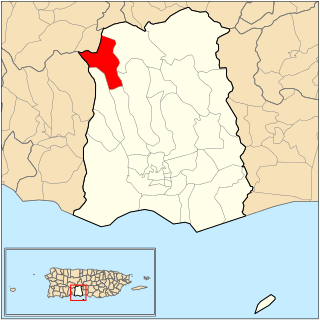
The territorial areas known as barrios started to take shape during the 18th century (1700s), and the first barrios named were Cana, Montones, Capitanejo, Quebrada Limón, and Bucana. [11] Throughout the 19th century, Ponce's jurisdictional zone increased to where it included both urban and rural barrios. With an expanding urban zone, in the 20th century Ponce's list of barrios came to number 31, with 13 located in the urban area of the city plus 18 outside the urban zone. [12] [13] [14] Of these 18, and as the urban area continues to expand, seven were considered suburban in 1999. These 7 suburban barrios were: Canas, Magueyes, Portugués, Machuelo Arriba, Sabanetas, Coto Laurel, and Cerrillos. [15] The remaining 11 are entirely rural barrios. [16] A 2000 report by the U.S. Census Bureau provides detailed demographics statistics for each of Ponce's barrios. [17]
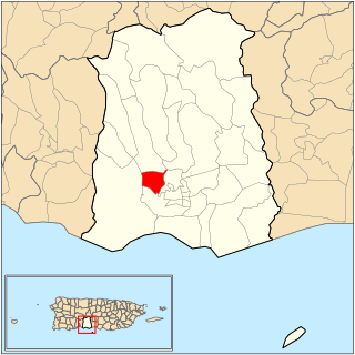
From a demographics perspective, the 2000 Census showed that Montes Llanos is the least populated barrio in the municipality. Thanks to its larger area, barrio Canas was by far the most populated ward of the municipality. [18] At 68 persons per square mile, San Patricio was the least dense, while Cuarto was the most densely populated at 18,819 persons per square mile. [19] [20]
Geographically speaking, Ponce has nine barrios that border neighboring municipalities. These are Anón, Canas, Capitanejo, Coto Laurel, Guaraguao, Marueño, Quebrada Limón, Real, San Patricio. Canas and Capitanejo are also coastal barrios, and together with three other coastal barrios (Playa, Bucaná, and Vayas) make up the municipality's five coastal barrios. [21]
There are also seven barrios within the city limits (Bucana, Canas Urbano, Machuelo Abajo, Magueyes Urbano, Playa, Portugués Urbano, and San Antón) that in addition to the original six city core barrios — named Primero, Segundo, Tercero, Cuarto, Quinto, and Sexto — make up the 13 urban barrios of the municipality. The historic zone of the city is within these original six core city barrios. These twelve barrios compose what is known as the urban zone of the municipality.
The remaining eight barrios (Magueyes, Tibes, Montes Llanos, Maragüez, Portugués, Machuelo Arriba, Cerrillos, Sabanetas) are located in the interior of the municipality. These last eight are outside the city limits and are neither coastal nor bordering barrios. [22]
A summary of all the barrios of the municipality, their population, population density, and land and water areas as given by the U.S. Census Bureau is as follows: [23] [24] [25]
| No. | Barrio | Population (Census 2000) | Density (/sq mi) | Total Area (sq mi) | Land Area (sq mi) | Water Area (sq mi) |
|---|---|---|---|---|---|---|
| 1 | Anón | 1669 | 129.9 | 12.85 | 12.85 | 0.00 |
| 2 | Bucaná | 3963 | 2957.5 | 2.16 | 1.34 | 0.81 |
| 3 | Canas | 34065 | 2349.3 | 22.82 | 14.50 | 8.32 |
| 4 | Canas Urbano | 21482 | 9299.6 | 2.31 | 2.31 | 0.00 |
| 5 | Capitanejo | 1401 | 355.4 | 4.82 | 3.95 | 0.88 |
| 6 | Cerrillos | 4284 | 1377.5 | 3.31 | 3.11 | 0.20 |
| 7 | Coto Laurel | 5285 | 1492.9 | 3.60 | 3.54 | 0.06 |
| 8 | Cuarto | 3011 | 18818.8 | 0.17 | 0.16 | 0.00 |
| 9 | Guaraguao | 1017 | 247.4 | 4.11 | 4.11 | 0.00 |
| 10 | Machuelo Abajo | 13302 | 7515.3 | 1.86 | 1.77 | 0.90 |
| 11 | Machuelo Arriba | 13727 | 2124.9 | 6.61 | 6.46 | 0.15 |
| 12 | Magueyes | 6134 | 1345.2 | 4.56 | 4.56 | 0.00 |
| 13 | Magueyes Urbano | 1332 | 1074.2 | 1.24 | 1.24 | 0.00 |
| 14 | Maragüez | 754 | 142.0 | 6.42 | 5.31 | 1.11 |
| 15 | Marueño | 1474 | 350.1 | 4.21 | 4.21 | 0.00 |
| 16 | Montes Llanos | 462 | 214.9 | 2.15 | 2.15 | 0.00 |
| 17 | Playa | 16926 | 3864.4 | 14.98 | 4.38 | 10.60 |
| 18 | Portugués Rural | 4882 | 1386.9 | 3.56 | 3.52 | 0.04 |
| 19 | Portugués Urbano | 5886 | 5163.2 | 1.14 | 1.14 | 0.00 |
| 20 | Primero | 3550 | 14200.0 | 0.25 | 0.25 | 0.00 |
| 21 | Quebrada Limón | 804 | 301.1 | 2.67 | 2.67 | 0.00 |
| 22 | Quinto | 724 | 6581.8 | 0.11 | 0.11 | 0.00 |
| 23 | Real | 3139 | 595.6 | 5.28 | 5.27 | 0.01 |
| 24 | Sabanetas | 6420 | 2351.6 | 2.79 | 2.73 | 0.06 |
| 25 | San Antón | 11271 | 10063.4 | 1.17 | 1.12 | 0.04 |
| 26 | San Patricio | 465 | 67.8 | 6.86 | 6.86 | 0.00 |
| 27 | Segundo | 11321 | 17416.9 | 0.65 | 0.65 | 0.00 |
| 28 | Sexto | 4745 | 18250.0 | 0.27 | 0.26 | 0.01 |
| 29 | Tercero | 773 | 9662.5 | 0.08 | 0.08 | 0.00 |
| 30 | Tibes | 866 | 123.5 | 7.01 | 7.01 | 0.00 |
| 31 | Vayas | 1338 | 187.9 | 10.47 | 7.12 | 3.35 |
| Ponce | 186475 | 1625.5 | 193.6 | 114.7 | 78.9 | |
There are 13 barrios in the urban zone of the city of Ponce. [26] [27] These are the original six urban barrios — named Primero, Segundo, Tercero, Cuarto, Quinto, and Sexto - plus seven others that the urban area has expanded to cover as well and which, with time, were incorporated into the city limits, namely, Bucaná, Canas Urbano, Machuelo Abajo, Magueyes Urbano, Portugués Urbano, and San Antón. [28] [29] The historic zone of the city is within the original six urban zone barrios.
According to the 2000 Census, Cuarto - an urban barrio - was the most densely populated with 18,819 persons per square mile, [30]
| No. | Barrio | Population (Census 2000) | Density (/sq mi) | Total Area (sq mi) | Land Area (sq mi) | Water Area (sq mi) |
|---|---|---|---|---|---|---|
| 1 | Bucaná | 3963 | 2957.5 | 2.16 | 1.34 | 0.81 |
| 2 | Canas Urbano | 21482 | 9299.6 | 2.31 | 2.31 | 0.00 |
| 3 | Cuarto | 3011 | 18818.8 | 0.17 | 0.16 | 0.00 |
| 4 | Machuelo Abajo | 13302 | 7515.3 | 1.86 | 1.77 | 0.90 |
| 5 | Magueyes Urbano | 1332 | 1074.2 | 1.24 | 1.24 | 0.00 |
| 6 | Playa | 16926 | 3864.4 | 14.98 | 4.38 | 10.60 |
| 7 | Portugués Urbano | 5886 | 5163.2 | 1.14 | 1.14 | 0.00 |
| 8 | Primero | 3550 | 14200.0 | 0.25 | 0.25 | 0.00 |
| 9 | Quinto | 724 | 6581.8 | 0.11 | 0.11 | 0.00 |
| 10 | San Antón | 11271 | 10063.4 | 1.17 | 1.12 | 0.04 |
| 11 | Segundo | 11321 | 17416.9 | 0.65 | 0.65 | 0.00 |
| 12 | Sexto | 4745 | 18250.0 | 0.27 | 0.26 | 0.01 |
| 13 | Tercero | 773 | 9662.5 | 0.08 | 0.08 | 0.00 |
| Ponce | 186475 | 1625.5 | 193.6 | 114.7 | 78.9 | |

When barrios were first created around 1831, [31] the urban zone of the municipality of Ponce was divided into four barrios, centered at the intersection of Marina and Comercio streets (as it continues to be today). By 1878, barrio Quinto was added to the urban zone, [32] and by 1898 Cantera had been renamed as barrio Sexto to take its place among the urban barrios as well. (The port of La Playa, not the entire extension of barrio Playa, was also considered an urban zone in 1898.) These six original barrios that made up the urban zone of the municipality are detailed below. [33]
| No. | Barrio | Population (Census 2000) | Density (/sq mi) | Total Area (sq mi) | Land Area (sq mi) | Water Area (sq mi) |
|---|---|---|---|---|---|---|
| 1 | Cuarto | 3011 | 18818.8 | 0.17 | 0.16 | 0.00 |
| 2 | Primero | 3550 | 14200.0 | 0.25 | 0.25 | 0.00 |
| 3 | Quinto | 724 | 6581.8 | 0.11 | 0.11 | 0.00 |
| 4 | Segundo | 11321 | 17416.9 | 0.65 | 0.65 | 0.00 |
| 5 | Sexto | 4745 | 18250.0 | 0.27 | 0.26 | 0.01 |
| 6 | Tercero | 773 | 9662.5 | 0.08 | 0.08 | 0.00 |
| Ponce | 186475 | 1625.5 | 193.6 | 114.7 | 78.9 | |

The municipality has 18 rural barrios. [34] [35] The 2000 Census showed that Montes Llanos, one of the 18 rural barrios, was the least populated barrio in the municipality. [36] At 68 persons per square mile, San Patricio - another rural barrio - was the least populated, while Cuarto was the most densely populated at 18,819 persons per square mile. [37]
| No. | Barrio | Population (Census 2000) | Density (/sq mi) | Total Area (sq mi) | Land Area (sq mi) | Water Area (sq mi) |
|---|---|---|---|---|---|---|
| 1 | Anón | 1669 | 129.9 | 12.85 | 12.85 | 0.00 |
| 2 | Canas | 34065 | 2349.3 | 22.82 | 14.50 | 8.32 |
| 3 | Capitanejo | 1401 | 355.4 | 4.82 | 3.95 | 0.88 |
| 4 | Cerrillos | 4284 | 1377.5 | 3.31 | 3.11 | 0.20 |
| 5 | Coto Laurel | 5285 | 1492.9 | 3.60 | 3.54 | 0.06 |
| 6 | Guaraguao | 1017 | 247.4 | 4.11 | 4.11 | 0.00 |
| 7 | Machuelo Arriba | 13727 | 2124.9 | 6.61 | 6.46 | 0.15 |
| 8 | Magueyes | 6134 | 1345.2 | 4.56 | 4.56 | 0.00 |
| 9 | Maragüez | 754 | 142.0 | 6.42 | 5.31 | 1.11 |
| 10 | Marueño | 1474 | 350.1 | 4.21 | 4.21 | 0.00 |
| 11 | Montes Llanos | 462 | 214.9 | 2.15 | 2.15 | 0.00 |
| 12 | Portugués | 4882 | 1386.9 | 3.56 | 3.52 | 0.04 |
| 13 | Quebrada Limón | 804 | 301.1 | 2.67 | 2.67 | 0.00 |
| 14 | Real | 3139 | 595.6 | 5.28 | 5.27 | 0.01 |
| 15 | Sabanetas | 6420 | 2351.6 | 2.79 | 2.73 | 0.06 |
| 16 | San Patricio | 465 | 67.8 | 6.86 | 6.86 | 0.00 |
| 17 | Tibes | 866 | 123.5 | 7.01 | 7.01 | 0.00 |
| 18 | Vayas | 1338 | 187.9 | 10.47 | 7.12 | 3.35 |
| Ponce | 186475 | 1625.5 | 193.6 | 114.7 | 78.9 | |

Of the 18 barrios outside the Ponce urban zone, seven were considered suburban in 1999. The suburban barrios were: Canas, Magueyes, Portugues, Machuelo Arriba, Sabanetas, Coto Laurel, and Cerrillos. [38] A 2000 report by the U.S. Census Bureau provides detailed demographics statistics for each of Ponce's barrios. [39] Thanks to its larger area, barrio Canas was by far the most populated ward of the municipality. [40]
| No. | Barrio | Population (Census 2000) | Density (/sq mi) | Total Area (sq mi) | Land Area (sq mi) | Water Area (sq mi) |
|---|---|---|---|---|---|---|
| 1 | Canas | 34065 | 2349.3 | 22.82 | 14.50 | 8.32 |
| 2 | Cerrillos | 4284 | 1377.5 | 3.31 | 3.11 | 0.20 |
| 3 | Coto Laurel | 5285 | 1492.9 | 3.60 | 3.54 | 0.06 |
| 4 | Machuelo Arriba | 13727 | 2124.9 | 6.61 | 6.46 | 0.15 |
| 5 | Magueyes | 6134 | 1345.2 | 4.56 | 4.56 | 0.00 |
| 6 | Portugués | 4882 | 1386.9 | 3.56 | 3.52 | 0.04 |
| 7 | Sabanetas | 6420 | 2351.6 | 2.79 | 2.73 | 0.06 |
| Ponce | 186475 | 1625.5 | 193.6 | 114.7 | 78.9 | |

Ponce has nine barrios that border neighboring municipalities. These are Canas (borders Peñuelas), Quebrada Limón (borders Peñuelas), Marueño (borders Peñuelas), Guaraguao (borders Peñuelas and Adjuntas), San Patricio (borders Adjuntas, Utuado, and Jayuya), Anón (borders Jayuya and Juana Diaz), Real (borders Juana Diaz), Coto Laurel (borders Juana Diaz), and Capitanejo (borders Juana Diaz). Canas and Capitanejo are also coastal barrios, and together with three others (Playa, Bucaná, and Vayas) make up the municipality's five coastal barrios.
| No. | Barrio | Population (Census 2000) | Density (/sq mi) | Total Area (sq mi) | Land Area (sq mi) | Water Area (sq mi) |
|---|---|---|---|---|---|---|
| 1 | Anón | 1669 | 129.9 | 12.85 | 12.85 | 0.00 |
| 2 | Canas | 34065 | 2349.3 | 22.82 | 14.50 | 8.32 |
| 3 | Capitanejo | 1401 | 355.4 | 4.82 | 3.95 | 0.88 |
| 4 | Coto Laurel | 5285 | 1492.9 | 3.60 | 3.54 | 0.06 |
| 5 | Guaraguao | 1017 | 247.4 | 4.11 | 4.11 | 0.00 |
| 6 | Marueño | 1474 | 350.1 | 4.21 | 4.21 | 0.00 |
| 7 | Quebrada Limón | 804 | 301.1 | 2.67 | 2.67 | 0.00 |
| 8 | Real | 3139 | 595.6 | 5.28 | 5.27 | 0.01 |
| 9 | San Patricio | 465 | 67.8 | 6.86 | 6.86 | 0.00 |
| Ponce | 186475 | 1625.5 | 193.6 | 114.7 | 78.9 | |

Ponce has five barrios that face the Caribbean Sea. These are: Bucaná, Canas, Capitanejo, Playa, and Vayas. These five make up the municipality's coastal barrios. Two of these—Canas and Capitanejo—are also bordering barrios.
| No. | Barrio | Population (Census 2000) | Density (/sq mi) | Total Area (sq mi) | Land Area (sq mi) | Water Area (sq mi) |
|---|---|---|---|---|---|---|
| 1 | Bucaná | 3963 | 2957.5 | 2.16 | 1.34 | 0.81 |
| 2 | Canas | 34065 | 2349.3 | 22.82 | 14.50 | 8.32 |
| 3 | Capitanejo | 1401 | 355.4 | 4.82 | 3.95 | 0.88 |
| 4 | Playa | 16926 | 3864.4 | 14.98 | 4.38 | 10.60 |
| 5 | Vayas | 1338 | 187.9 | 10.47 | 7.12 | 3.35 |
| Ponce | 186475 | 1625.5 | 193.6 | 114.7 | 78.9 | |

The municipality has eight barrios -- Cerrillos, Machuelo Arriba, Magueyes, Maragüez, Montes Llanos, Portugués, Sabanetas, Tibes—that are located entirely in the interior of the municipality. '"Interior" here means that these are non urban zone barrios which border neither the Caribbean Sea nor adjacent municipalities. [41]
| No. | Barrio | Population (Census 2000) | Density (/sq mi) | Total Area (sq mi) | Land Area (sq mi) | Water Area (sq mi) |
|---|---|---|---|---|---|---|
| 1 | Cerrillos | 4284 | 1377.5 | 3.31 | 3.11 | 0.20 |
| 2 | Machuelo Arriba | 13727 | 2124.9 | 6.61 | 6.46 | 0.15 |
| 3 | Magueyes | 6134 | 1345.2 | 4.56 | 4.56 | 0.00 |
| 4 | Maragüez | 754 | 142.0 | 6.42 | 5.31 | 1.11 |
| 5 | Montes Llanos | 462 | 214.9 | 2.15 | 2.15 | 0.00 |
| 6 | Portugués | 4882 | 1386.9 | 3.56 | 3.52 | 0.04 |
| 7 | Sabanetas | 6420 | 2351.6 | 2.79 | 2.73 | 0.06 |
| 8 | Tibes | 866 | 123.5 | 7.01 | 7.01 | 0.00 |
| Ponce | 186475 | 1625.5 | 193.6 | 114.7 | 78.9 | |

Cañas River, also known as Río Cañas, is a river in the municipality of Ponce, Puerto Rico. It is also known as Río Magueyes in the area where it flows through Barrio Magueyes, also in the municipality of Ponce. This river is one of the 14 rivers in the municipality.

Barrio Playa, also known as Playa de Ponce, Ponce Playa, or La Playa, is one of the thirty-one barrios that comprise the municipality of Ponce, Puerto Rico. Along with Bucaná, Canas, Vayas, and Capitanejo, Playa is one of the municipality's five coastal barrios. Barrio Playa also incorporates several islands, the largest of which is Caja de Muertos. It was founded in 1831.

Anón is one of the 31 barrios in the municipality of Ponce, Puerto Rico. Along with Marueño, Coto Laurel, Guaraguao, Quebrada Limon, Real, and San Patricio, and the coastal barrios of Canas and Capitanejo, Anón is one of the municipality's nine bordering barrios. Anón borders the municipalities of Jayuya and Juana Diaz. The name of this barrio is of native Indian origin. It was founded in 1878. Barrio Anón is one of three Ponce barrios located on the Cordillera Central mountain range.

Tibes is one of the 31 barrios in the municipality of Ponce, Puerto Rico. Together with Magueyes, Portugués, Montes Llanos, Maragüez, Machuelo Arriba, Sabanetas, and Cerrillos, barrio Tibes is one of the municipality's eight rural interior barrios. Tibes attracted attention recently when, in 1975, what was to become the discovery of the oldest cemetery in the West Indies came about as a result of rainstorms. The name of this barrio is of native Indian origin. It was organized in 1831.

Canas is one of the 31 barrios in the municipality of Ponce, Puerto Rico. Along with Anón, Coto Laurel, Guaraguao, Quebrada Limón, Real, San Patricio, and Marueño, and the coastal barrio of Capitanejo, Canas is one of the municipality's nine bordering barrios. It borders the municipality of Peñuelas. Along with Playa, Bucana, Vayas and Capitanejo, Canas is also one of Ponce's five coastal barrios. It was founded in 1831.

Magueyes is one of the 31 barrios of the municipality of Ponce, Puerto Rico. Together with Cerrillos, Machuelo Arriba, Maragüez, Montes Llanos, Portugués, Sabanetas, and Tibes, Magueyes is one of the municipality's eight interior barrios. The name of this barrio is of native Indian origin. It was created in 1831.

San Antón is one of the 31 barrios of the municipality of Ponce, Puerto Rico. Along with Canas Urbano, Machuelo Abajo, Magueyes Urbano, and Portugués Urbano, San Antón is one of the municipality's five originally rural barrios that are now also part of the urban zone of the city of Ponce. It is totally enclosed within the Ponce city limits. It was founded in 1818.
Guaraguao is one of the 31 barrios in the municipality of Ponce, Puerto Rico. Along with Anón, Coto Laurel, Marueño, Quebrada Limón, Real, and San Patricio, and the coastal barrios of Canas and Capitanejo, Guaraguao is one of the municipality's nine bordering barrios. It borders the municipalities of Adjuntas and Peñuelas. The name of this barrio is of native Taino Indian origin. It was created in 1878. Barrio Guaraguao is one of three Ponce barrios located on the Cordillera Central mountain range.

Portugués Rural or, more commonly, simply Portugués, is one of the 31 barrios in the municipality of Ponce, Puerto Rico. Along with Magueyes, Tibes, Montes Llanos, Maragüez, Machuelo Arriba, Sabanetas, and Cerrillos, Portugués is one of the municipality's eight rural interior barrios. It was founded in 1831.

Vayas is one of the 31 barrios of the municipality of Ponce, Puerto Rico. Along with Playa, Bucana, Canas and Capitanejo, Vayas is also one of Ponce's five coastal barrios. Together with Capitanejo, Vayas is also one of two rural coastal barrios in the municipality. It was organized in 1831, at which time it was divided into Vayas Norte and Vayas Sur; in 1878 the two were subsequently merged into today's Vayas.
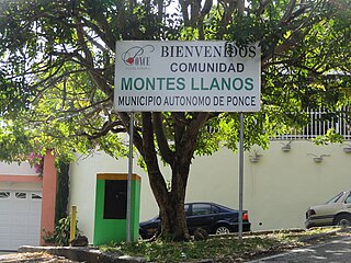
Montes Llanos, is one of the 31 barrios in the municipality of Ponce, Puerto Rico. Along with Magueyes, Tibes, Portugués, Maragüez, Machuelo Arriba, and Cerrillos, Montes Llanos is one of the municipality's seven rural interior barrios. It was created in 1898.

Bucaná is one of the 31 barrios of the municipality of Ponce, Puerto Rico. Together with Canas, Playa, Vayas, and Capitanejo, Bucaná is one of the municipality's five coastal barrios. The name of this barrio is of native Indian origin. It was founded in 1831.

Capitanejo is one of the 31 barrios of the municipality of Ponce, Puerto Rico. Along with Anón, Coto Laurel, Guaraguao, Quebrada Limón, Real, San Patricio, and Marueño, and the coastal barrio of Canas, Capitanejo is one of the municipality's nine bordering barrios. It borders the municipality of Juana Diaz. Along with Playa, Bucana, Vayas and Canas, Capitanejo is also one of Ponce's five coastal barrios. Together with Vayas, Capitanejo is also one of two rural coastal barrios in the municipality. It was founded in 1822.

Marueño is one of the 31 barrios of the municipality of Ponce, Puerto Rico. Along with Anón, Coto Laurel, Guaraguao, Quebrada Limón, Real, and San Patricio, and the coastal barrios of Canas and Capitanejo, Marueño is one of the municipality's nine bordering barrios. Marueño borders the municipality of Peñuelas. The name of this barrio is of native Indian origin. It was created in 1831.

Machuelo Abajo is one of the 31 barrios of the municipality of Ponce, Puerto Rico. Along with Canas Urbano, Magueyes Urbano, Portugués Urbano, and San Antón, Machuelo Abajo is one of the municipality's five originally rural barrios that are now also part of the urban zone of the city of Ponce. It was founded in 1818.

Machuelo Arriba is one of the 31 barrios of the municipality of Ponce, Puerto Rico. Along with the barrios of Magueyes, Tibes, Portugués, Montes Llanos, Maragüez, and Cerrillos, Machuelo Arriba is one of the municipality's seven rural interior barrios. It was established in 1831.

Canas Urbano is one of the 31 barrio of the municipality of Ponce, Puerto Rico. Along with Machuelo Abajo, Magueyes Urbano, Portugués Urbano, and San Antón, Canas Urbano is one of the municipality's five originally rural barrios that are now also part of the urban zone of the city of Ponce. The name of this barrio is of native indigenous origin. It was created in 1953.

San Patricio is one of the 31 barrios of the municipality of Ponce, Puerto Rico. It is one of the municipality's nine bordering barrios, along with Anón, Coto Laurel, Guaraguao, Quebrada Limón, Real, and Marueño, and the coastal barrios of Canas and Capitanejo. Its northern edge borders the municipalities of Utuado and Jayuya. It was founded in 1878. Barrio San Patricio is one of three Ponce barrios located on the Cordillera Central mountain range.
Portugués Urbano is one of the 31 barrios in the municipality of Ponce, Puerto Rico. Along with Canas Urbano, Machuelo Abajo, Magueyes Urbano, and San Antón, Portugués Urbano is one of the municipality's five originally rural barrios that are now also part of the urban zone of the city of Ponce. It was founded in 1953.
Magueyes Urbano is one of the 31 barrios in the municipality of Ponce, Puerto Rico. Along with Canas Urbano, Machuelo Abajo, Portugués Urbano, and San Antón, Magueyes Urbano is one of the municipality's five originally rural barrios that are now also part of the urban zone of the city of Ponce. The name of this barrio is of native Indian origin. It was created in 1953.