List


The following table lists the 41 cities and communes in Saxony with a population of at least 25,000 on December 31, 2017, as estimated by the Federal Statistical Office of Germany. [2] A city is displayed in bold if it is a state or federal capital.
- The city rank by population as of December 31, 2017, as estimated by the Federal Statistical Office of German [2]
- The city name [2]
- The name of the district (Landkreis) in which the city lies (some cities are districts on their own called urban districts) [2]
- The city population as of December 31, 2017, as estimated by the Federal Statistical Office of Germany [2]
- The city population as of May 9, 2011, as enumerated by the 2011 European Union census [3]
- The city land area as of December 31, 2017 [2]
- The city population density as of December 31, 2017 (residents per unit of land area) [2]
| 2017 Rank | City | district | 2017 estimate | 2011 Census | 2017 land area | 2017 pop. density |
|---|---|---|---|---|---|---|
| 1 | Leipzig | urban district | 581,980 | 502,979 | 298 km2 | 1,954/km2 |
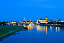
| 2 | Dresden | urban district | 551,072 | 512,354 | 328 km2 | 1,678/km2 |
| 3 | Chemnitz | urban district | 246,855 | 240,253 | 221 km2 | 1,117/km2 |
| 4 | Zwickau | Zwickau (district) | 90,192 | 93,081 | 103 km2 | 879.2/km2 |
| 5 | Plauen | Vogtlandkreis | 65,148 | 64,468 | 102 km2 | 638.0/km2 |
| 6 | Görlitz | Görlitz (district) | 56,391 | 54,441 | 67.5 km2 | 835.2/km2 |
| 7 | Freiberg | Mittelsachsen | 41,496 | 39,825 | 48.3 km2 | 858.8/km2 |
| 8 | Bautzen | Bautzen (district) | 39,429 | 40,273 | 66.7 km2 | 591.2/km2 |
| 9 | Freital | Sächsische Schweiz-Osterzgebirge | 39,300 | 38,388 | 40.5 km2 | 971.6/km2 |
| 10 | Pirna | Sächsische Schweiz-Osterzgebirge | 38,276 | 37,451 | 53.1 km2 | 721.4/km2 |
| 11 | Radebeul | Meissen (district) | 33,954 | 33,201 | 26.1 km2 | 1,299/km2 |
| 12 | Hoyerswerda | Bautzen (district) | 33,116 | 36,107 | 95.5 km2 | 346.7/km2 |
| 13 | Riesa | Meissen (district) | 30,392 | 32,539 | 58.9 km2 | 515.9/km2 |
| 14 | Grimma | Leipzig (district) | 28,153 | 29,271 | 218 km2 | 129.0/km2 |
| 15 | Meissen | Meissen (district) | 28,061 | 27,055 | 30.9 km2 | 907.5/km2 |
| 16 | Zittau | Görlitz (district) | 25,575 | 26,777 | 66.8 km2 | 383.1/km2 |
| 17 | Delitzsch | Delitzsch (district) | 24,794 | 25,361 | 85.9 km2 | 288.6/km2 |
| 18 | Markkleeberg | Leipzig (district) | 24,644 | 23,672 | 31.4 km2 | 783.8/km2 |
| 19 | Limbach-Oberfrohna | Zwickau (district) | 24,066 | 24,721 | 50.2 km2 | 479.3/km2 |
| 20 | Döbeln | Döbeln (district) | 23,728 | 24,485 | 91.7 km2 | 258.6/km2 |
| 21 | Glauchau | Zwickau (district) | 22,718 | 23,578 | 51.6 km2 | 440.1/km2 |
| 22 | Coswig | Meissen (district) | 20,899 | 20,689 | 25.9 km2 | 807.5/km2 |
| 23 | Reichenbach im Vogtland | Vogtlandkreis | 20,882 | 22,399 | 34.5 km2 | 606.0/km2 |
| 24 | Werdau | Zwickau (district) | 20,795 | 21,712 | 65.6 km2 | 316.9/km2 |
| 25 | Torgau | Torgau-Oschatz | 20,088 | 20,700 | 103 km2 | 195.4/km2 |
| 26 | Annaberg-Buchholz | Erzgebirgskreis | 20,000 | 21,105 | 28.1 km2 | 710.5/km2 |
| 27 | Borna | Leipzig (district) | 19,263 | 19,784 | 62.4 km2 | 308.5/km2 |
| 28 | Crimmitschau | Zwickau (district) | 18,746 | 20,078 | 61.1 km2 | 306.6/km2 |
| 29 | Auerbach (Vogtland) | Vogtlandkreis | 18,562 | 19,604 | 55.5 km2 | 334.3/km2 |
| 30 | Radeberg | Bautzen (district) | 18,451 | 18,039 | 29.8 km2 | 618.5/km2 |
| 31 | Großenhain | Meissen (district) | 18,230 | 18,797 | 130 km2 | 139.8/km2 |
| 32 | Schkeuditz | Nordsachsen | 17,905 | 16,922 | 81.5 km2 | 219.8/km2 |
| 33 | Marienberg | Erzgebirgskreis | 17,140 | 18,033 | 134 km2 | 128.4/km2 |
| 34 | Schwarzenberg | Erzgebirgskreis | 16,912 | 18,109 | 46.3 km2 | 365.2/km2 |
| 35 | Heidenau | Sächsische Schweiz-Osterzgebirge | 16,598 | 15,953 | 11.1 km2 | 1,499/km2 |
| 36 | Weißwasser | Görlitz (district) | 16,348 | 18,175 | 63.4 km2 | 257.8/km2 |
| 37 | Wurzen | Leipzig (district) | 16,220 | 16,928 | 69.0 km2 | 234.9/km2 |
| 38 | Aue | Erzgebirgskreis | 16,012 | 16,981 | 20.9 km2 | 765.4/km2 |
| 39 | Eilenburg | Nordsachsen | 15,607 | 15,794 | 46.8 km2 | 333.2/km2 |
| 40 | Markranstädt | Leipzig (district) | 15,551 | 14,763 | 58.5 km2 | 266.0/km2 |
| 41 | Taucha | Nordsachsen | 15,543 | 14,128 | 33.2 km2 | 467.7/km2 |