Damai is an occupational caste found among Khas people comprising 45 subgroups. Their surnames take after the subgroup they belong to. People belonging to this caste are traditionally tailors and musicians capable of using the naumati baja - an ensemble of nine traditional musical instruments. The term Damai is coined from the musical instrument Damaha. The 1854 Nepalese Muluki Ain categorized Damai as "Lower caste” category. Thus, the tribal designation of Khas is given only in few context to Kami, Damai and Sarki due to traditional status.

Nawalparasi District, part of which belongs to Gandaki Province and part to Lumbini Province, was one of the 75 districts of Nepal before being divided into Parasi District and Nawalpur District in 2015.
Magar Dhut is a Sino-Tibetan language spoken mainly in Nepal, southern Bhutan, and in Darjeeling and Sikkim, India, by the Magar people. It is divided into two groups and further dialect divisions give distinct tribal identity. In Nepal 810,000 people speak the language.
Sarki/Mijar is an occupational caste in Nepal. They are found in the region of the Himalayas, Nepal, across the hills of Darjeeling & Kalimpong and in Terai area of Dooars. They are experts in playing their musical instrument "Madal" and performing dance in a group which is also called “Khayali Marooni”. According to the 2021 Nepal census, Sarki makes up 1.55% of Nepal's population. Sarki are referred to in the Nepali and Thakali languages.
A zilā, zilla, zillah, jela, or jilha is a country subdivision mostly used officially in South Asian countries such as Bangladesh, India, Nepal and Pakistan. It is translated as district.

The Tharu or Tharuhat languages are any of the Indo-Aryan languages spoken by the Tharu people of the Terai region in Nepal, and neighboring regions of Uttarakhand, Uttar Pradesh and Bihar in India.
Bhujel or Gharti are a Tibeto-Burman ethnic group in Nepal.They are scattered in several districts, mostly in Tanahu and Syangja. The inhabitants living near the Bhuji Khola river called Bhujel. Bhujel are divided into four subcaste – Bhujyal, Gharti, Nisel and Khawas.

The Autonomous Nepalese Provinces were formed on 20 September 2015 in accordance with Schedule 4 of the Constitution of Nepal. The seven provinces were formed by grouping the existing districts. The current system of seven provinces replaced an earlier system where Nepal was divided into 14 administrative zones which were grouped into five development regions.

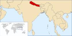
Gandaki Province ), is one of the seven federal provinces established by the current constitution of Nepal which was promulgated on 20 September 2015. Pokhara is the province's capital city. It borders the Tibet Autonomous Region in Southwest China to the north, Bagmati Province to the east, Karnali Province to the west, and Lumbini Province and Bihar of India to the south. The total area of the province is 21,504 km2 - constituting 14.57% of Nepal's total area. According to the latest census, the population of the province was 2,479,745. The newly elected Provincial Assembly adopted Gandaki Province as the permanent name by replacing its initial name Province No. 4 in July 2018. Surendra Raj Pandey is the present chief minister of Gandaki Province.

Lumbini Province is a province in western Nepal. The country's third largest province in terms of area as well as population, Lumbini is home to the World Heritage Site of Lumbini, where according to the Buddhist tradition, the founder of Buddhism, Gautama Buddha was born.
Historically, the "Thakuri" is one of influential tribe in Nepal that held significant history in Nepal, forming the core of the country's ruling class. The origins of the Thakuris trace back to the ancient Khasa Kingdom rulers in Baisi and the Lineal descendant of Magars in Chaubisi Rajye According to Iman Xin Chemjong. These regions were renowned for their rich cultural heritage and political power.

Former administrative units of Nepal are administrative divisions during Kingdom of Nepal. In 2008 Nepal was proclaimed a federal republic and old administrative units restricted after adoption of new constitution on 20 September 2015.

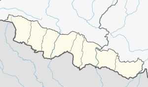
Nawalparasi (West of Bardaghat Susta) district or Nawalparasi West, as known commonly (Nepali: नवलपरासी (बर्दघाट सुस्ता पश्चिम) वा नवलपरासी पश्चिम ), also frequently referred to as just Parasi District, is a district located in Lumbini Province of Nepal. It is 1 out of 12 districts of Lumbini Province. The headquarter of the district is located in Ramgram.

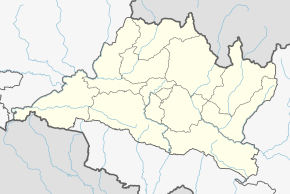
Nawalparasi 2 is one of two parliamentary constituencies of Nawalparasi district in Nepal. This constituency came into existence on the Constituency Delimitation Commission (CDC) report submitted on 31 August 2017.

Nawalparasi 1 is one of two parliamentary constituencies of Parasi District in Nepal. This constituency came into existence on the Constituency Delimitation Commission (CDC) report submitted on 31 August 2017.

Nawalparasi 1 is one of two parliamentary constituencies of Nawalpur District in Nepal. This constituency came into existence on the Constituency Delimitation Commission (CDC) report submitted on 31 August 2017.
 Districts of Nepal in 1942
 Districts of Nepal in 1952
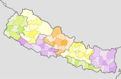 Districts of Nepal in 2015
 Districts of Nepal in 2020