List of highest points of African countries

Last updated

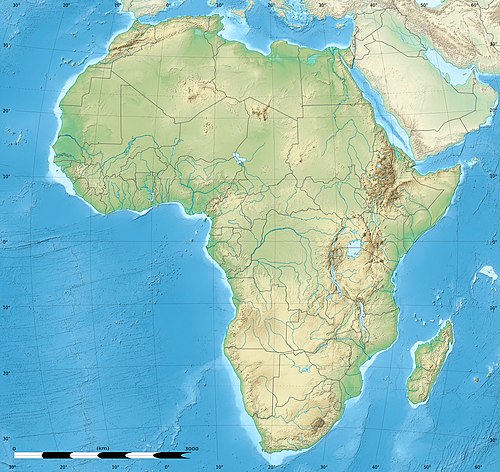
This article lists the highest natural elevation of each sovereign state on the continent of Africa defined physiographically.

Not all points in this list are mountains or hills, some are simply elevations that are not distinguishable as geographical features.

Notes are provided where territorial disputes or inconsistencies affect the listings. Egypt has part of their territory and their high point outside of Africa; their non-Asian high point are listed with a N/A rank entry underneath their continental peak. On the other hand, Spain has part of their territory and their high point inside of Africa.

One partially recognized country with the highest point in Africa is listed and ranked in Italic. For more details see List of states with limited recognition.

RankCountryHighest pointElevation
18Flag of Algeria.svg  Algeria Mount Tahat 2,908 m (9,541 ft)
22Flag of Angola.svg  Angola Morro de Môco 2,620 m (8,596 ft)
52Flag of Benin.svg  Benin Mont Sokbaro 658 m (2,159 ft)
40Flag of Botswana.svg  Botswana Otse Hill [1] 1,491 m (4,892 ft)
51Flag of Burkina Faso.svg  Burkina Faso Tena Kourou 749 m (2,457 ft)
21Flag of Burundi.svg  Burundi Southeast of Mount Heha [2] 2,684 m (8,806 ft)
8Flag of Cameroon.svg  Cameroon Fako on Mount Cameroon [2] 4,040 m (13,255 ft)
20Flag of Cape Verde.svg  Cape Verde Mount Fogo 2,829 m (9,281 ft)
42Flag of the Central African Republic.svg  Central African Republic Mont Ngaoui 1,420 m (4,659 ft)
12Flag of Chad.svg  Chad Emi Koussi [2] 3,445 m (11,302 ft)
28Flag of the Comoros.svg  Comoros Mount Karthala [3] 2,361 m (7,746 ft)
3Flag of the Democratic Republic of the Congo.svg  Democratic Republic of the Congo Margherita Peak on Mount Stanley 5,110 m (16,765 ft)
45Flag of the Republic of the Congo.svg  Republic of the Congo Mont Nabeba 1,020 m (3,346 ft)
37Flag of Cote d'Ivoire.svg  Côte d'Ivoire Mont Nimba 1,752 m (5,748 ft)
31Flag of Djibouti.svg  Djibouti Mousa Ali 2,028 m (6,654 ft)
34Flag of Egypt.svg  Egypt Gabal Sha'ib El Banat [4] 2,187 m (7,175 ft)
N/AFlag of Egypt.svg  Egypt Mount Catherine [4] 2,629 m (8,625 ft)
16Flag of Equatorial Guinea.svg  Equatorial Guinea Pico Basile 3,008 m (9,869 ft)
15Flag of Eritrea.svg  Eritrea Emba Soira 3,018 m (9,902 ft)
36Flag of Eswatini.svg  Eswatini Emlembe 1,862 m (6,109 ft)
5Flag of Ethiopia.svg  Ethiopia Ras Dashen [2] 4,550 m (14,928 ft)
44Flag of Gabon.svg  Gabon Mont Bengoué [5] 1,070 m (3,510 ft)
55Flag of The Gambia.svg  Gambia Unnamed location (unofficially Red Rock)53 m (174 ft)
49Flag of Ghana.svg  Ghana Mount Afadja [6] 885 m (2,904 ft)
38Flag of Guinea.svg  Guinea Mont Nimba 1,752 m (5,748 ft)
54Flag of Guinea-Bissau.svg  Guinea-Bissau Monte Torin 262 m (860 ft)
2Flag of Kenya.svg  Kenya Batian on Mount Kenya 5,199 m (17,057 ft)
10Flag of Lesotho.svg  Lesotho Thabana Ntlenyana 3,482 m (11,424 ft)
41Flag of Liberia.svg  Liberia Mount Wuteve [2] 1,440 m (4,724 ft)
30Flag of Libya.svg  Libya Bikku Bitti 2,267 m (7,438 ft)
19Flag of Madagascar.svg  Madagascar Maromokotro 2,876 m (9,436 ft)
17Flag of Malawi.svg  Malawi Sapitwa (Mulanje Massif)3,002 m (9,849 ft)
43Flag of Mali.svg  Mali Hombori Tondo 1,155 m (3,789 ft)
47Flag of Mauritania.svg  Mauritania Kediet ej Jill 915 m (3,002 ft)
50Flag of Mauritius.svg  Mauritius Piton de la Petite Rivière Noire 828 m (2,717 ft)
7Flag of Morocco.svg  Morocco Jbel Toubkal 4,165 m (13,665 ft)
26Flag of Mozambique.svg  Mozambique Monte Binga 2,436 m (7,992 ft)
23Flag of Namibia.svg  Namibia Konigstein 2,606 m (8,550 ft)
33Flag of Niger.svg  Niger Mont Idoukal-n-Taghès 2,022 m (6,634 ft)
27Flag of Nigeria.svg  Nigeria Chappal Waddi 2,419 m (7,936 ft)
6Flag of Rwanda.svg  Rwanda Mount Karisimbi 4,507 m (14,787 ft)
32Flag of Sao Tome and Principe.svg  São Tomé and Príncipe Pico de São Tomé 2,024 m (6,640 ft)
53Flag of Senegal.svg  Senegal Baunez ridge near Nepen Diakha 648 m (2,126 ft)
48Flag of Seychelles.svg  Seychelles Morne Seychellois [7] 905 m (2,969 ft)
35Flag of Sierra Leone.svg  Sierra Leone Mount Bintumani (Loma Mansa)1,948 m (6,391 ft)
25Flag of Somalia.svg  Somalia Shimbiris [8] 2,460 m (8,071 ft)
11Flag of South Africa.svg  South Africa Mafadi 3,450 m (11,319 ft)
13Flag of South Sudan.svg  South Sudan Kinyeti 3,187 m (10,456 ft)
14Flag of Sudan.svg  Sudan Deriba Caldera 3,042 m (9,980 ft)
9Flag of Spain.svg  Spain Teide 3,718 m (12,198 ft)
1Flag of Tanzania.svg  Tanzania Mount Kilimanjaro [9] 5,892 m (19,331 ft)
46Flag of Togo.svg  Togo Mont Agou 986 m (3,235 ft)
39Flag of Tunisia.svg  Tunisia Jebel ech Chambi 1,544 m (5,066 ft)
4Flag of Uganda.svg  Uganda Margherita Peak on Mount Stanley 5,110 m (16,765 ft)
N/AFlag of the Sahrawi Arab Democratic Republic.svg  Western Sahara Tikhzoukhane605 m (1,985 ft)
29Flag of Zambia.svg  Zambia Unnamed location in Mafinga Hills 2,329 m (7,641 ft)
24Flag of Zimbabwe.svg  Zimbabwe Mount Nyangani 2,592 m (8,504 ft)

See also

Related Research Articles

<span class="mw-page-title-main">Summit</span> Point on a surface with a higher elevation than all immediately adjacent points

A summit is a point on a surface that is higher in elevation than all points immediately adjacent to it. The topographic terms acme, apex, peak, and zenith are synonymous.

Ras Dashen or Ras Dejen is the highest mountain in Ethiopia. Located in the Simien Mountains National Park in the North Gondar Zone of the Amhara Region, it reaches an elevation of 4,550 metres (14,930 ft).

<span class="mw-page-title-main">Highpointing</span> Activity of ascending to the highest point in a given area.

Highpointing is the sport of ascending to the point with the highest elevation within a given area. Examples include climbing the highest point of each U.S. state, reaching the highest point of each county within a specific state, and ascending the highest mountain on each continent.

<span class="mw-page-title-main">Alam-Kuh</span> Mountain in Iran

Alam-KūhMount Alam – is a mountain in Alborz mountain range in northern Iran, Mazandaran Province, forming a peak of Takht-e Suleyman Massif. It is located in Kelardasht District of Mazandaran Province. With an elevation of 4,828 meters, it is the second-highest peak in Iran after Mount Damavand.

<span class="mw-page-title-main">Topographic isolation</span> Topography measuring minimum distance to a point of equal elevation

The topographic isolation of a summit is the minimum distance to a point of equal elevation, representing a radius of dominance in which the peak is the highest point. It can be calculated for small hills and islands as well as for major mountain peaks and can even be calculated for submarine summits.

<span class="mw-page-title-main">Mountain peaks of Canada</span>

This article comprises three sortable tables of major mountain peaks of Canada.

<span class="mw-page-title-main">Mount Dulang-dulang</span> A highest peak in Kitanglad Mountain Range

Mount Dulang-dulang, dubbed by Filipino mountaineers as "D2" and also known as Mount Katanglad, is the highest elevation peak in the Kitanglad Mountain Range, located in the north central portion of the province of Bukidnon in the island of Mindanao. It is the second highest mountain of the Philippines at 2,941 metres (9,649 ft) above sea level, second only to Mount Apo of Davao at 2,956 m (9,698 ft) and slightly higher than Mount Pulag of Luzon, the third highest at 2,928 m (9,606 ft).

<span class="mw-page-title-main">Monalanong Hill</span>

Monalanong Hill is a mountain often considered the highest point of Botswana, with an altitude derived from SRTM data of 1,494 metres.

<span class="mw-page-title-main">Keokradong</span> Mountain in Bangladesh

Keokradong is a peak located in Bandarban, Bangladesh, with an elevation of 986 metres (3,235 ft). Some sources claim it as the highest point of Bangladesh.

Otse Hill is a peak often cited as the highest point of Botswana, with a reported altitude of 1,491 metres (4,891 feet). It is located in the village of Otse, South-East District. Its highest cell on SRTM data is 1,486 meters - 4875 feet. The 1999 Department of Surveys and Mapping (Gaborone) 1:50,000 scale topographic map shows a "trigonometrical station" on the Otse Peak summit with an elevation of 1,491 meters - 4892 feet.

<span class="mw-page-title-main">Saka Haphong</span> Mountain peak in Bangladesh

Saka Haphong is a peak in Southeast Asia and South Asia which was discovered by A.K.M Shahidullah Kaiser Sazzad Hossain and many others. Located on the Bangladesh–Myanmar border, it is situated between Thanchi, Bandarban, Bangladesh and the Chin State of Myanmar.

Khazret Sultan is a mountain formerly considered to be the highest point of Uzbekistan, with an elevation of 4,643 metres (15,233 ft).

References

  1. Monalanong Hill is a mountain often considered the highest point of Botswana, with a questioned altitude of 1,494 metres (4,900 feet). This datum comes from the SRTM database just as the 1,491 m for Otse. The error range of these data is significantly higher (approximately 15 m), but a British explorer did a GPS reading on the top of both hills, and his measurement showed Otse slightly higher.
  2. 1 2 3 4 5 Some authorities give other elevations for these national high points. For more information, see the appropriate summit pages.
  3. Listed as "Le Kartala" on Peaklist.org Retrieved 27 September 2011
  4. 1 2 Gabal Sha'ib El Banat is the highest peak in the African part of Egypt, while the highest peak of the country is Mount Catherine, located in the Asian part of Egypt.
  5. Claims that Mont Iboundji is the highest point and more than 1500 metres high are not supported by SRTM data.
  6. "Mount Afadjoto, Ghana". Peakbagger.com. 2019. Retrieved 2019-03-24.
  7. "Morne Seychellois" on Peakbagger.com Retrieved 2 October 2011
  8. Shimbiris is also the highest point in Flag of Somaliland.svg  Somaliland
  9. Highest point in Africa.