This list of islands in Spain incapsulates the country's islands both within its territorial borders and its overseas possessions. The total number of islands is 179.
Country | Sea | Name | Archipelago | Autonomous Community | Province | Municipality | Area | Population | Density |
---|---|---|---|---|---|---|---|---|---|
046 | A-0 | Isla de Ízaro | – | Basque Country | Vizcaya | Bermeo | 0.144 | – | – |
0 | A-0 | Garraitz | – | Basque Country | Vizcaya | Lequeitio | 0.065 | – | – |
0 | A-0 | Santa Clara | – | Basque Country | Guipúzcoa | San Sebastián | 0.056 | – | – |
0 | A-0 | Isla de Aquech | – | Basque Country | Vizcaya | Bermeo | 0.03 | – | – |
0 | A-0 | Isla de Txatxarramendi | – | Basque Country | Vizcaya | Pedernales | 0.027 | – | – |
0 | A-0 | Isla Villano | – | Basque Country | Vizcaya | Górliz | 0.018 | – | – |
0 | A-0 | Isla de los Faisanes | – | Basque Country | Guipúzcoa (shared with France) | Irún | 0.0078 | – | – |
0 | A-0 | Isla de Zuaza | – | Basque Country | Álava | Arratzua-Ubarrundia | n/d | – | – |
031 | A-0 | Isla de Montehano | – | Cantabria | Cantabria | Escalante | 0.37 | – | – |
038 | A-0 | Isla de Santa Marina | – | Cantabria | Cantabria | Ribamontán al Mar | 0.2178 | – | – |
050 | A-0 | Isla de Pedrosa | – | Cantabria | Cantabria | Marina de Cudeyo | 0.104 | – | – |
0 | A-0 | Isla de la Virgen del Mar | – | Cantabria | Cantabria | Santander | 0.0795 | – | – |
0 | A-0 | Isla del Castro | – | Cantabria | Cantabria | Santa Cruz de Bezana | 0.0349 | – | – |
0 | A-0 | Isla de San Pedruco | – | Cantabria | Cantabria | Noja | 0.0304 | – | – |
0 | A-0 | Isla de la Oliva | – | Cantabria | Cantabria | Noja | 0.027 | – | – |
0 | A-0 | Isla Conejera | – | Cantabria | Cantabria | Suances | 0.023 | – | – |
0 | A-0 | Urros de Liencres | – | Cantabria | Cantabria | Liencres | 0.022 | – | – |
0 | A-0 | Isla Sarnosa | – | Cantabria | Cantabria | Val de San Vicente | 0.02 | – | – |
0 | A-0 | Isla de Mouro | – | Cantabria | Cantabria | Santander | 0.0209 | – | – |
0 | A-0 | Isla del Castril | – | Cantabria | Cantabria | Val de San Vicente | 0.013 | – | – |
0 | A-0 | Isla Solita | – | Cantabria | Cantabria | Miengo | 0.0063 | – | – |
0 | A-0 | Isla de la Torre | – | Cantabria | Cantabria | Santander | 0.005 | – | – |
0 | A-0 | Peñón de Moja el Rabo | – | Cantabria | Cantabria | Noja | 0.004 | – | – |
0 | A-0 | Isla de los Ratones | – | Cantabria | Cantabria | Marina de Cudeyo | 0.002 | – | – |
0 | A-0 | Isla de la Horadada | – | Cantabria | Cantabria | Santander | 0.0015 | – | – |
0 | A-0 | Islote de Ansión | – | Cantabria | Cantabria | Santander | 0.0015 | – | – |
0 | A-0 | Isla Segunda | – | Cantabria | Cantabria | Miengo | 0.00124 | – | – |
0 | A-0 | Isla Casilda | – | Cantabria | Cantabria | Miengo | 0.001 | – | – |
0 | A-0 | Islote d Neptuno Niño | – | Cantabria | Cantabria | Santander | n/d | – | – |
0 | A-0 | Oriñón | – | Cantabria | Cantabria | Castro Urdiales | n/d | – | – |
0 | A-0 | Castro | – | Cantabria | Cantabria | Noja | n/d | – | – |
0 | A-0 | Cuarezo | – | Cantabria | Cantabria | Noja | n/d | – | – |
0 | A-0 | Llera | – | Cantabria | Cantabria | Noja | n/d | – | – |
0 | A-0 | Águila | – | Cantabria | Cantabria | Noja | n/d | – | – |
0 | A-0 | Suaces | – | Cantabria | Cantabria | Noja | n/d | – | – |
0 | A-0 | Garfanta | – | Cantabria | Cantabria | Noja | n/d | – | – |
0 | A-0 | Isla de la Hierba | – | Cantabria | Cantabria | Elechas | n/d | – | – |
0 | A-0 | La Campanuca | – | Cantabria | Cantabria | Elechas | n/d | – | – |
0 | A-0 | Isla de La Deva y Playón de Bayas | – | Asturias | Asturias | Castrillón | 0.07 | – | – |
0 | A-0 | Pantorgas | – | Asturias | Asturias | Tapia de Casariego | 0.069 | – | – |
0 | A-0 | Islas de Póo | – | Asturias | Asturias | Llanes | 0.052 | – | – |
0 | A-0 | Isla Herbosa | – | Asturias | Asturias | Gozón | 0.042 | – | – |
0 | A-0 | Isla del Castrón de Santiuste | – | Asturias | Asturias | Llanes | 0.03 | – | – |
0 | A-0 | Isla del Forcón | – | Asturias | Asturias | El Franco | 0.028 | – | – |
0 | A-0 | Isla de Borizo | – | Asturias | Asturias | Llanes | 0.028 | – | – |
0 | A-0 | Isla del Carmen | – | Asturias | Asturias | Gozón | 0.022 | – | – |
0 | A-0 | La Islona | – | Asturias | Asturias | Llanes | 0.021 | – | – |
0 | A-0 | Isla de Tapia | – | Asturias | Asturias | Tapia de Casariego | 0.02 | – | – |
0 | A-0 | Isla de Veiga | – | Asturias | Asturias | Navia | 0.02 | – | – |
0 | A-0 | Isla Ballota | – | Asturias | Asturias | Llanes | 0.011 | – | – |
015 | A-0 | Illa de Arousa | – | Galicia | Pontevedra | A Illa de Arousa | 6.32 | 4,958 | – |
018 | A-0 | Islas Cíes | – | Galicia | Pontevedra | Vigo | 4.34 | 3 | – |
019 | A-0 | Ons | – | Galicia | Pontevedra | Bueu | 4.14 | 81 | – |
021 | A-0 | Isla de Sálvora | – | Galicia | A Coruña | Ribeira | 1.88 | – | – |
024 | A-0 | Isla de La Toja | – | Galicia | Pontevedra | O Grove | 1.10 | 47 | – |
049 | A-0 | Isla de Toralla | – | Galicia | Pontevedra | Vigo | 0.106 | 135 | – |
026 | A-0 | Islas Sisargas | – | Galicia | A Coruña | Malpica de Bergantiños | 0.68 | – | – |
028 | A-0 | Isla de Cortegada | – | Galicia | Pontevedra | Vilagarcía de Arousa | 0.54 | – | – |
033 | A-0 | Isla de Onza | – | Galicia | Pontevedra | Bueu | 0.32 | – | – |
035 | A-0 | Isla de Tambo | – | Galicia | Pontevedra | Poio | 0.28 | – | – |
039 | A-0 | Islas Estelas | – | Galicia | Pontevedra | Nigrán | 0.19 | – | – |
043 | A-0 | Isla Coelleira | – | Galicia | Lugo | O Vicedo | 0.16 | – | – |
044 | A-0 | Isla de Tourís Novo | – | Galicia | Pontevedra | O Grove | 0.15 | – | – |
045 | A-0 | Islas de San Pedro | – | Galicia | A Coruña | A Coruña | 0.15 | – | – |
047 | A-0 | Islas Sagres | – | Galicia | A Coruña | Ribeira | 0.135 | – | – |
048 | A-0 | Isla de Vionta | – | Galicia | A Coruña | Ribeira | 0.115 | – | – |
051 | A-0 | Isla de Toralla | – | Galicia | Pontevedra | Vigo | 0.1 | – | – |
050 | A-0 | Isla da Marma | – | Galicia | Pontevedra | Sanxenxo | 0.10 | – | – |
050 | A-0 | Isla de La Toja Pequeña | – | Galicia | Pontevedra | Cambados | 0.10 | – | – |
050 | A-0 | Isla Ansarón | – | Galicia | Lugo | Xove | 0.10 | – | – |
0 | A-0 | Isla Guidoiro Areoso | – | Galicia | Pontevedra | A Illa de Arousa | 0.09 | – | – |
0 | A-0 | Isla de A Creba | – | Galicia | A Coruña | Muros | 0.075 | – | – |
0 | A-0 | Lobeiras | – | Galicia | A Coruña | Carnota | 0.07 | – | – |
0 | A-0 | Centoleiras | – | Galicia | A Coruña | Ribeira | 0.065 | – | – |
0 | A-0 | Beiro | – | Galicia | Pontevedra | Cambados | 0.06 | – | – |
0 | A-0 | Farallóns | – | Galicia | Lugo | Cervo | 0.06 | – | – |
0 | A-0 | Guidoiro Pedregoso | – | Galicia | Pontevedra | A Illa de Arousa | 0.056 | – | – |
0 | A-0 | Malveiras | – | Galicia | Pontevedra | Vilagarcía de Arousa | 0.055 | – | – |
0 | A-0 | Isla de Os Forcados | – | Galicia | A Coruña | Carnota | 0.05 | – | – |
0 | A-0 | Isla de Santa Comba | – | Galicia | A Coruña | Ferrol | 0.05 | – | – |
0 | A-0 | Isla de Noro | – | Galicia | A Coruña | Ribeira | 0.04 | – | – |
0 | A-0 | Islas Briñas | – | Galicia | Pontevedra | Vilagarcía de Arousa | 0.04 | – | – |
0 | A-0 | Isla de La Rúa | – | Galicia | A Coruña | Ribeira | 0.04 | – | – |
0 | A-0 | Isla de San Simón | – | Galicia | Pontevedra | Redondela | 0.03 | – | – |
0 | A-0 | Isla de Area | – | Galicia | Lugo | Viveiro | 0.03 | – | – |
0 | A-0 | Isla de Pombeiro | – | Galicia | Pontevedra | O Grove | 0.02 | – | – |
0 | A-0 | Isla de Santa Cruz | – | Galicia | A Coruña | Oleiros | 0.019 | – | – |
0 | A-0 | Isla del Penedo da Ínsua | – | Galicia | Lugo | Ribadeo | 0.019 | – | – |
0 | A-0 | Isla Herbosa | – | Galicia | A Coruña | Ribeira | 0.016 | – | – |
0 | A-0 | San Clemente | – | Galicia | Pontevedra | Marín | 0.014 | – | – |
0 | A-0 | Isla de San Vicente | – | Galicia | A Coruña | Ortigueira | 0.013 | – | – |
0 | A-0 | San Antón (Pontevedra) | – | Galicia | Pontevedra | Redondela | 0.012 | – | – |
0 | A-0 | San Antón (La Coruña) | – | Galicia | A Coruña | A Coruña | 0.011 | – | – |
0 | A-0 | Pancha | – | Galicia | Lugo | Ribadeo | 0.011 | – | – |
0 | A-0 | Gavoteira | – | Galicia | A Coruña | Ribeira | 0.011 | – | – |
0 | M-0 | Isla de Santa Catalina | – | Ceuta | Ceuta | Ceuta | 0.001 | – | – |
0 | A-0 | Isla Canela | – | Andalusia | Huelva | Ayamonte | 1.5 | 1,213 | – |
0 | Isla de La Gaviota | – | Andalusia | Huelva | Isla Cristina | n/d | – | – | |
0 | A-0 | Isla de Saltés | – | Andalusia | Huelva | Huelva | n/d | – | – |
0 | A-0 | Isla Mayor | – | Andalusia | Sevilla | Isla Mayor | n/d | – | – |
0 | A-0 | Isla de Las Palomas | – | Andalusia | Cádiz | Tarifa | n/d | – | – |
0 | A-0 | Isla de León | – | Andalusia | Cádiz | San Fernando | n/d | – | – |
016 | A-0 | Isla del Trocadero | – | Andalusia | Cádiz | Puerto Real | 5.24 | – | – |
0 | A-0 | Islote de Sancti Petri | – | Andalusia | Cádiz | San Fernando | 0.097 | – | – |
0 | M-0 | Isla de San Andrés | – | Andalusia | Almería | Carboneras | 0.0703 | – | – |
0 | M-0 | Isla de Terreros | – | Andalusia | Almería | Pulpí | 0.0111 | – | – |
0 | M-0 | Isla Negra | – | Andalusia | Almería | Pulpí | 0.006 | – | – |
0 | M-0 | Isla de Alborán | – | Andalusia | Almería | Almería | 0.068 | – | – |
0 | A-0 | Isla de San Sebastián | – | Andalusia | Cádiz | Cádiz | 0.045 | – | – |
0 | A-0 | Piedra Salmedina | – | Andalusia | Cádiz | Chipiona | 0.0008 | – | – |
0 | A-0 | Isla Piedra del Hombre | – | Andalusia | Cádiz | San Roque | 0.0002 | – | – |
025 | M-0 | Isla Mayor | – | Murcia | Región de Murcia | San Javier | 0.938 | – | – |
036 | M-0 | Isla Perdiguera | – | Murcia | Región de Murcia | San Javier | 0.258 | – | – |
041 | M-0 | Isla Grosa | – | Murcia | Región de Murcia | San Javier | 0.165 | – | – |
042 | M-0 | Isla del Ciervo | – | Murcia | Región de Murcia | Cartagena | 0.163 | – | – |
0 | M-0 | Isla del Fraile | – | Murcia | Región de Murcia | Águilas | 0.063 | – | – |
0 | M-0 | Isla de Mazarrón | – | Murcia | Región de Murcia | Mazarrón | 0.08 | – | – |
0 | M-0 | Isla de Escombreras | – | Murcia | Región de Murcia | Cartagena | 0.04 | – | – |
0 | M-0 | Isla del Sujeto | – | Murcia | Región de Murcia | Cartagena | 0.024 | – | – |
0 | M-0 | Isla Rondella | – | Murcia | Región de Murcia | Cartagena | 0.022 | – | – |
0 | M-0 | Isla de Las Palomas | – | Murcia | Región de Murcia | Cartagena | 0.012 | – | – |
0 | M-0 | Isla Plana | – | Murcia | Región de Murcia | Cartagena | 0.01 | – | – |
030 | M-0 | Isla de Tabarca | – | Valencian Community | Alicante | Alicante | 0.403 | 203 | – |
040 | M-0 | Islas Columbretes | – | Valencian Community | Castellón | Castellón de la Plana | 0.19 | – | – |
0 | M-0 | Isla de Benidorm | – | Valencian Community | Alicante | Benidorm | 0.072 | – | – |
0 | M-0 | Portichol | – | Valencian Community | Alicante | Jávea | 0.083 | – | – |
0 | M-0 | Descubridor | – | Valencian Community | Alicante | Jávea | 0.025 | – | – |
037 | M-0 | Medas | – | Catalonia | Gerona | L'Estartit | 0.22 | – | – |
0 | M-0 | Port Lligat | – | Catalonia | Gerona | Cadaqués | 0.084 | – | – |
0 | M-0 | Encalladora | – | Catalonia | Gerona | Cadaqués | 0.055 | – | – |
0 | M-0 | Isla de S'Arenella | – | Catalonia | Gerona | Cadaqués | 0.025 | – | – |
0 | M-0 | Isla del Castellar | – | Catalonia | Gerona | Llançá | 0.022 | – | – |
0 | M-0 | Islas Formigues | – | Catalonia | Gerona | Palamós | 0.018 | – | – |
0 | M-0 | Isla de Buda | – | Catalonia | Tarragona | Sant Jaume d'Enveja | 10 | 4 | – |
0 | M-0 | Isla de Gracia | – | Catalonia | Tarragona | Deltebre | 1.3 | – | – |
0 | M-0 | Isla Massa d'Or | – | Catalonia | Gerona | Cadaqués | 0.007 | – | – |
001 | M-0 | Mallorca | – | Balearic Islands | Islas Baleares | – | 3,620.42 | 896,038 | – |
007 | M-0 | Menorca | – | Balearic Islands | Islas Baleares | – | 694.39 | 93,397 | – |
008 | M-0 | Ibiza | – | Balearic Islands | Islas Baleares | – | 571.04 | 147,914 | – |
011 | M-0 | Formentera | – | Balearic Islands | Islas Baleares | Formentera | 83.20 | 12,111 | – |
013 | M-0 | Cabrera | – | Balearic Islands | Islas Baleares | Palma de Mallorca | 11.53 | 20 | – |
020 | M-0 | Isla Dragonera | – | Balearic Islands | Islas Baleares | Andraitx | 2.52 | – | – |
023 | M-0 | Isla de Espalmador | – | Balearic Islands | Islas Baleares | Formentera | 1.37 | – | – |
023 | M-0 | S'Illot | – | Balearic Islands | Islas Baleares | Alcúdia | n/d | – | – |
027 | M-0 | Isla de Colom | – | Balearic Islands | Islas Baleares | Mahón | 0.58 | – | – |
032 | M-0 | Isla del Aire | – | Balearic Islands | Islas Baleares | San Luís | 0.34 | – | – |
0 | M-0 | Isla del Rey | – | Balearic Islands | Islas Baleares | Mahón | 0.044 | – | – |
0 | M-0 | Isla de Tosqueta | – | Balearic Islands | Islas Baleares | Mercadal | 0.005 | – | – |
0 | M-0 | Islote de Binicodrell | – | Balearic Islands | Islas Baleares | Es Migjorn | 0.004 | – | – |
0 | M-0 | Isla de Tagomago | – | Balearic Islands | Islas Baleares | Santa Eulalia del Río | 0.4 | – | – |
0 | M-0 | Isla de Es Vedrá | – | Balearic Islands | Islas Baleares | Sant Josep | 0.6 | – | – |
0 | Islote de Mel | – | Balearic Islands | Islas Baleares | Mahón | 0.0024 | – | – | |
0 | M-0 | Illot des Porros | – | Balearic Islands | Islas Baleares | Santa Margarita | 0.00305 | – | – |
0 | M-0 | Isla Sargantana | – | Balearic Islands | Islas Baleares | Es Mercadal | 0.025 | – | – |
002 | A-0 | Tenerife | – | Canary Islands | Santa Cruz de Tenerife | – | 2,034.38 | 966,354 | – |
003 | A-0 | Fuerteventura | – | Canary Islands | Las Palmas | – | 1,659.74 | 126,227 | – |
004 | A-0 | Gran Canaria | – | Canary Islands | Las Palmas | – | 1,560.10 | 870,595 | – |
005 | A-0 | Lanzarote | – | Canary Islands | Las Palmas | – | 845.94 | 154,530 | – |
006 | A-0 | La Palma | – | Canary Islands | Santa Cruz de Tenerife | – | 708.32 | 85,840 | – |
009 | A-0 | La Gomera | – | Canary Islands | Santa Cruz de Tenerife | – | 369.76 | 22,426 | – |
010 | A-0 | El Hierro | – | Canary Islands | Santa Cruz de Tenerife | – | 268.71 | 11,338 | – |
012 | A-0 | La Graciosa | – | Canary Islands | Las Palmas | Teguise | 29.00 | 734 | – |
014 | A-0 | Alegranza | – | Canary Islands | Las Palmas | Teguise | 10.30 | – | – |
017 | A-0 | Lobos | – | Canary Islands | Las Palmas | La Oliva | 4.50 | 4 | – |
022 | A-0 | Montaña Clara | – | Canary Islands | Las Palmas | Teguise | 1.48 | – | – |
050 | A-0 | Roques de Anaga | – | Canary Islands | Santa Cruz de Tenerife | Santa Cruz de Tenerife | 0.100 | – | – |
0 | A-0 | Roque de Garachico | – | Canary Islands | Santa Cruz de Tenerife | Garachico | 0.050 | – | – |
0 | A-0 | Roque del Este | – | Canary Islands | Las Palmas | Teguise | 0.045 | – | – |
0 | A-0 | Roques de Salmor | – | Canary Islands | Santa Cruz de Tenerife | Frontera y Valverde | 0.035 | – | – |
0 | A-0 | Roque del Oeste | – | Canary Islands | Las Palmas | Teguise | 0.021 | – | – |
0 | A-0 | Roque de Santo Domingo | – | Canary Islands | Santa Cruz de Tenerife | Garafía | n/d | – | – |
0 | A-0 | Islote de Fermina | – | Canary Islands | Las Palmas | Arrecife | n/d | – | – |
0 | A-0 | Islote de Cruces | – | Canary Islands | Las Palmas | Arrecife | n/d | – | – |
0 | Isla de Valdecañas | – | Extremadura | Cáceres | El Gordo | 1.34 | - | – | |
0 | Isla del Burguillo | – | Castile and León | Ávila | El Barraco | n/d | – | – | |
0 | Isla la Centinela | – | Castile and León | Ávila | El Barraco | 0.01 | – | – | |
029 | M-0 | Islas Chafarinas | – | Plaza de Soberanía | Ninguna | Ninguno | 0.52 | – | – |
034 | M-0 | Islas Alhucemas | – | Plaza de Soberanía | Ninguna | Ninguno | 0.30 | – | – |
034 | A-0 | Isla de Perejil | – | Plaza de Soberanía | Ninguna | Ninguno | 0.30 | – | – |
Spain owned several Pacific islands as part of the Spanish East Indies. After its defeat in the Spanish–American War of 1898, it lost the Philippines. The German–Spanish Treaty (1899) sold the Carolinas, Marianas and Palau to the German Empire. In 1948, Emilio Pastor Santos of the Spanish National Research Council found that the charts and maps up to 1899 had shown that Kapingamarangi and a few other islands had never been considered part of the Caroline Islands, were not included in the description of the territory transferred to Germany and were never ceded by Spain; therefore, Spain would retain sovereignty. [1] [2] In 2014, the Spanish government closed any speculation on the issue of its possession in the Pacific with an answer in the Congress to the deputy Jon Iñarritu. According to its interpretation, Spain yielded in 1899 every remaining possession in the Pacific. [3] [4]
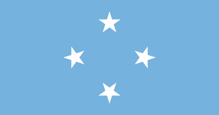
The Federated States of Micronesia, or simply Micronesia, is an island country in Oceania. It consists of four states – from west to east, Yap, Chuuk, Pohnpei and Kosrae – that are spread across the western Pacific. Together, the states comprise around 607 islands that cover a longitudinal distance of almost 2,700 km (1,678 mi) just north of the equator. They lie northeast of Indonesia and Papua New Guinea, south of Guam and the Marianas, west of Nauru and the Marshall Islands, east of Palau and the Philippines, about 2,900 km (1,802 mi) north of eastern Australia, 3,400 km (2,133 mi) southeast of Japan, and some 4,000 km (2,485 mi) southwest of the main islands of the Hawaiian Islands.
Kiritimati is a Pacific Ocean atoll in the northern Line Islands. It is part of the Republic of Kiribati. The name is derived from the English word "Christmas" written in Gilbertese according to its phonology, in which the combination ti is pronounced s, giving [kiˈrɪsmæs].
Micronesia is a subregion of Oceania, consisting of about 2,000 small islands in the western Pacific Ocean. It has a close shared cultural history with three other island regions: the Philippines to the west, Polynesia to the east, and Melanesia to the south—as well as with the wider community of Austronesian peoples.
The plazas de soberanía is a term describing a series of Spanish overseas minor territories scattered along the Mediterranean coast bordering Morocco or that are closer to Africa than Europe. This term is used for those territories that have been a part of Spain since the formation of the modern country (1492–1556), as opposed to African territories acquired by Spain during the 19th and early 20th centuries in the Scramble for Africa.
In the law of the United States, an insular area refers to U.S.-associated jurisdictions not part of the 50 states or the District of Columbia. This includes fourteen U.S. territories administered under U.S. sovereignty, as well as three sovereign states each with a Compact of Free Association with the United States. The term also may be used to refer to the previous status of the Philippine Islands and the Trust Territory of the Pacific Islands when it existed.
Spanish Sahara, officially the Spanish Possessions in the Sahara from 1884 to 1958 then Province of the Sahara between 1958 and 1976, was the name used for the modern territory of Western Sahara when it was occupied and ruled by Spain between 1884 and 1976. It had been one of the most recent acquisitions of, as well as one of the last remaining holdings of the Spanish Empire, which had once extended from the Americas to the Spanish East Indies.
Spanish Guinea was a set of insular and continental territories controlled by Spain from 1778 in the Gulf of Guinea and on the Bight of Bonny, in Central Africa. It gained independence in 1968 as Equatorial Guinea.
Rongerik Atoll or Rongdrik Atoll is a coral atoll of 17 islands in the Pacific Ocean, and is located in the Ralik Chain of the Marshall Islands, approximately 200 kilometres (120 mi) east of Bikini Atoll. Its total land area is only 1.68 square kilometres (0.65 sq mi), but it encloses a lagoon of 144 square kilometres (56 sq mi).
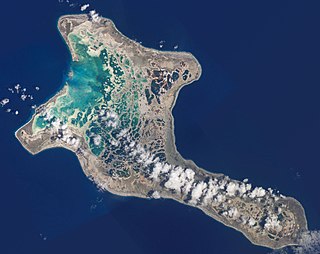
Kapingamarangi is an atoll and a municipality in the state of Pohnpei of the Federated States of Micronesia. It is by far the most southerly atoll or island of the country and of the Caroline Islands, 300 km (190 mi) south of the next southerly atoll, Nukuoro, and 740 km (460 mi) southwest of the main island of Pohnpei state; it forms a Polynesian outlier.
The Beagle conflict was a border dispute between Chile and Argentina over the possession of Picton, Lennox and Nueva islands and the scope of the maritime jurisdiction associated with those islands that brought the countries to the brink of war in 1978.
The Spanish East Indies were the overseas territories of the Spanish Empire in Asia and Oceania from 1565 to 1901, governed from Mexico City and Madrid through the captaincy general in Manila.
Guayana Esequiba, sometimes also called Esequibo or Essequibo, is a disputed territory of 159,500 km2 (61,600 sq mi) west of the Essequibo River that is administered and controlled by Guyana but claimed by Venezuela. The boundary dispute was inherited from the colonial powers and has been complicated by the independence of Guyana from the United Kingdom in 1966.
The German–Spanish Treaty of 1899, signed by the German Empire and the Kingdom of Spain, involved Spain selling the majority of its Pacific possessions not lost in the Spanish–American War to Germany for 25 million pesetas.
On 22 July 1971 Salvador Allende and Alejandro Lanusse, the Presidents of Chile and Argentina, signed an arbitration agreement. This agreement related to their dispute over the territorial and maritime boundaries between them, and in particular the title to the Picton, Nueva and Lennox islands near the extreme end of the American continent, which was submitted to binding arbitration under the auspices of the United Kingdom government.
The Retroversion of the sovereignty to the people, which challenged the legitimacy of the colonial authorities, was the principle underlying the self-government temporarily in the absence of the legitimate king.
The political division of the Kingdom of Spain is defined in Part VIII of the Spanish constitution of 1978, which establishes three levels of territorial organization: municipalities, provinces and autonomous communities, the first group constituting the subdivisions of the second, and the second group constituting the subdivisions of the last. The State guarantees the realization of the principle of solidarity by endeavouring to establish an economic balance between the different areas of the Spanish territory.
The nationality law of the Federated States of Micronesia determines who is or may become a citizen or national of the Federated States of Micronesia (FSM). Article III of the Constitution of the Federated States of Micronesia provides the basis for nationality law, while specific provisions are elaborated in 7 FSMC § 201 et seq.
Mapia Atoll, historically known as the Freewill Islands or San David, is an atoll in the Pacific Ocean. It is located in Papua province of Indonesia, approximately 290 kilometers north of the city of Manokwari and 630 kilometers from the islands of Palau. It consists of two main islands, Bras (Berasi) and Pegun (Mapia), the smaller Fanildo, and two minor islands, Bras Kecil and Fanildo Kecil. The islands constitute a part of West Supiori District within Supiori Regency, Papua. The population at the 2020 Census was 199.
Palauan nationality law is regulated by the 1980 Constitution of Palau, as amended; the 1994 Palau Citizenship Act, and its revisions; and international agreements entered into by the Palauan government. These laws determine who is, or is eligible to be, a national of Palau. The legal means to acquire nationality, formal legal membership in a nation, differ from the domestic relationship of rights and obligations between a national and the nation, known as citizenship. Palauan nationality is typically obtained either on the principle of jus soli, i.e. by birth in Palau or under the rules of jus sanguinis, i.e. by birth abroad to parents with Palauan nationality. It can be granted to persons with an affiliation to the country through naturalization.
Hispanic Africa is a cultural region integrated by the territories and countries of Africa where Spanish has an official presence. The people from this region are called "Hispanic Africans".