Mountain Ranges of Internal Tien-Shan
| | This section needs expansion. You can help by adding to it. (January 2011) |
A list of mountain ranges in Kyrgyzstan includes 158 mountain ranges in Central Tien-Shan (16), North Tien-Shan (19), Internal Tien-Shan (48), West Tien-Shan (30), South Tien-Shan (41), and Pamir-Alay (4). [1]
| Range | Maximum height, m | Highest peak | Length of range, km | Maximum width of range, km |
|---|---|---|---|---|
| Adyr-Ter | 4550 | 34 | 8 | |
| Ak-Shyyrak | 5125 | 60 | 28 | |
| At-Jayloo | 4477 | 36 | 9 | |
| Ashuu-Ter | 32 | 15 | ||
| Boz-Kyr | 38 | 7 | ||
| Kayingdy | 5784 | 78 | 14 | |
| Kakshaal Too | 7439 | Jengish Chokusu | 582 | 54 |
| Kan Too | 6995 | Khan Tengri | 38 | 9 |
| Keykap | 5100 | 18 | 7 | |
| Keolyu | 5281 | Sovietskaya Konstitutsiya Peak | 52 | 21 |
| May-Bash | 5361 | 22 | 16 | |
| Meridianalyi | Druzhba Peak | 22(in Kyrgyzstan) | 40 | |
| Sary Jazz | 5816 | Semenov Peak | 93 (in Kyrgyzstan) | 16 |
| Terekti | 4930 | 48 | 11 | |
| Engilchek Too | 5722 | Shokal'skiy Peak | 60 | 12 |
| Eshekart | 4384 | 50 | 12 |
| Range | Maximum height, m | Highest peak | Length of range, km | Maximum width of range, km |
|---|---|---|---|---|
| Arpa-Tektir | 25 | 9 | ||
| Trans-Ili Alatau | 4973 | Talgar Peak | 120(in Kyrgyzstan) | 30 |
| Kalba-Too | 4146 | Atchypas Peak | 25 | 14 |
| Karagatty | Semenov Peak | 93 (in Kyrgyzstan) | 16 | |
| Kara Jylga | 28 | 7 | ||
| Kastek Range | 2782 | 32 (in Kyrgyzstan) | 10 | |
| Kemin Range | 3884 | 36 | 10 | |
| Kyrgyz Ala-Too | 4895 | Semenova Tian-Shanski Peak | 454 | 40 |
| Koshoy Too | 3921 | 36 | 8 | |
| Kuru Ayryk | 26 | 9 | ||
| Kyzyl Ompol | 3183 | 20 | 13 | |
| Kylak Bulak | 32 | 7 | ||
| Kyumyushtak | 36 | 18 | ||
| Kyungey Ala-Too | 4770 | Chok-Tal Peak | 285 | 32 |
| Oktorkoy | 3125 | Cholok Peak | 30 | 7 |
| Ortok Too | 2501 | Shumkar Peak | 35 | 8 |
| Sary Jon | 3230 | 30 | 9 | |
| Talas Ala-Too Range | 4482 | Manas Peak | 260 | 40 |
| Echkili Too | 2160 | 42 | 9 |
| | This section needs expansion. You can help by adding to it. (January 2011) |
| Range | Maximum height, m | Highest peak | Length of range, km | Maximum width of range, km |
|---|---|---|---|---|
| Alash Too | 3574 | 20 | 8 | |
| At Oynok Range | 3896 | 70 | 16 | |
| Babash Ata Range | 4427 | Babash Ata | 54 | 8 |
| Bozbu Too | 2875 | 30 | 14 | |
| Jalgyz Kyr Range | 20 | 5 | ||
| Donguz-Too (range) | 2354 | 28 | 6 | |
| Isfan Jayloo Range | 3701 | 34 | 6 | |
| Kadoo Range | 20 | 6 | ||
| Kara Kyr Range | 4634 | Kashka Suu | 36 | 12 |
| Kardy Too | 4129 | 31 | 7 | |
| Kachura Range | 4497 | 34 | 10 | |
| Kenkol Range | 26 | 5 | ||
| Kek Suu Range | 3828 | Chatyr Debe | 60 | 15 |
| Kochkor Dobo Range | 2534 | 21 | 6 | |
| Kulun Range | 30 | 10 | ||
| Kuramy Range | 3769 | 30 | 25 | |
| Kuturgan Range | 24 | 5 | ||
| Pskem Range | 4395 | 120 | 20 | |
| Sary Jon Range | 24 | 5 | ||
| Seruyun Dobo Range | 2469 | 30 | 12 | |
| Suuk Range | 2991 | 22 | 6 | |
| Ters Range | 3890 | 30 | 16 | |
| Toguz Bulak Range | 20 | 7 | ||
| Uzgen Range | 4381 | 56 | 26 | |
| Uzun Akmat Range | 4165 | 40 | 14 | |
| Fergana Range | 4893 | 206 | 62 | |
| Chaar Tash Range | 3143 | 20 | 7 | |
| Chandalash Range | 4114 | 72 | 10 | |
| Chatkal Range | 4503 | 165 | 30 | |
| Chong Boor Too | 3907 | 42 | 10 |
| Range | Maximum height, m | Highest peak | Length of range, km | Maximum width of range, km |
|---|---|---|---|---|
| Achyk Tash Range | 5920 | 21 | 6 | |
| Trans-Alay Range | 7134 | Lenin Peak | 250 | 40 |
| Kek Tumshuk Range | 5459 | Ledyanoy Mys Peak | 26 | 10 |
| Putoo Range | 4139 | 22 | 5 |
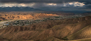
Kyrgyzstan is a landlocked nation in Central Asia, west of the People's Republic of China. Less than a ninth the size of Kazakhstan, at 199,951 square kilometers, Kyrgyzstan is one of the smaller Central Asian states. The national territory extends about 900 km (560 mi) from east to west and 410 km (250 mi) from north to south.

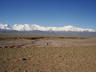
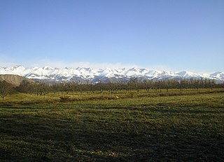
The Tian Shan, also known as the Tengri Tagh or Tengir-Too, meaning the "Mountains of God/Heaven", is a large system of mountain ranges in Central Asia. The highest peak is Jengish Chokusu at 7,439 metres (24,406 ft) high. Its lowest point is the Turpan Depression, which is 154 m (505 ft) below sea level.

The Alay or Alai Range is a mountain range that extends from the Tien Shan mountain range in Kyrgyzstan west into Tajikistan. It is part of the Pamir-Alay mountain system. The range runs approximately east to west. Its highest summit is Pik Tandykul, reaching 5544 m. It forms the southern border of the Fergana Valley, and in the south it falls steeply to the Alay Valley. The southern slopes of the range drain into the Kyzylsuu or Vakhsh River, a tributary of the Amu Darya. The streams that drain the northern slopes of the range are tributaries of the Syr Darya, and empty into the Fergana Valley to the north of the range. Pik Skobeleva, 5,051 metres (16,572 ft), is also a well-known summit. European route E007: Tashkent – Kokand – Andijan – Osh – Irkeshtam crosses the range by the Taldyk Pass. The range is also traversed by Pamir highway.

Jengish Chokusu or Victory Peak is the highest mountain in the Tian Shan mountain system at 7,439 metres (24,406 ft). It lies on the China–Kyrgyzstan border between the Ak-Suu District in the Issyk-Kul Region of far Eastern Kyrgyzstan and Wensu County, Xinjiang, China. It is part of the Kakshaal Too, the highest part of the Tian Shan, and is southeast of lake Issyk-Kul.

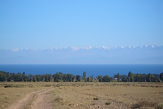
Issyk-Kul Region is one of the regions of Kyrgyzstan. Its capital is Karakol. It is surrounded by Almaty Region, Kazakhstan (north), Chüy Region (west), Naryn Region (southwest) and Xinjiang, China (southeast). It takes its name from Lake Issyk-Kul, the world's second-largest high altitude lake. Its total area is 43,735 km2 (16,886 sq mi). The resident population of the region was 501,933 as of January 2021. The region has a sizeable Russian minority.

Khan Tengri is a mountain of the Tian Shan mountain range. It is on the China—Kyrgyzstan—Kazakhstan tripoint, east of lake Issyk Kul. Its geologic elevation is 6,995 m (22,949 ft), but its glacial icecap rises to 7,010 m (22,999 ft). For this reason, in mountaineering circles, including for the Soviet Snow Leopard award criteria, it is considered a 7,000-metre peak.
The Trans-Alay Range is the northernmost range of the Pamir Mountain System.

Alatau or Ala-Too is a generic name for a number of mountain ranges in Central Asia, characterized by interleaving areas of vegetation, scattered rocks and snows.
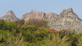
The Sulayman Mountain is the only World Heritage Site located entirely in the country of Kyrgyzstan. It is located in the city of Osh and was once a major place of pre-Muslim pilgrimage. The rock rises abruptly from the surrounding plains of the Fergana Valley and is a popular place among locals and visitors, with a splendid view.

The Ala-Archa Nature Park is an alpine national park in the Tian Shan mountains of Kyrgyzstan, located approximately 35 km south of the capital city of Bishkek. Established in 1976, it currently covers 16,485 hectares.

The Toshkan is a river in the Tien Shan mountains in the border area between China and Kyrgyzstan. It is 345 kilometres (214 mi) long, and has a drainage basin of 8,270 square kilometres (3,190 sq mi) in Kyrgyzstan. The Toshkan has its sources in the At-Bashy Range and Kakshaal Too south of the Kyrgyzstani city of Naryn. In its uppermost course, upstream of the confluences with the rivers Müdürum and Kökkyya, it is called Aksay; from these confluences to the border with China, it is called Kakshaal. It then flows towards the east and into the Xinjiang province of China. It continues east, running parallel to the Tien Shan mountains, until its confluence with the Aksu River near the city Aksu. The Toshkan is the largest tributary of the Aksu.

The Kirghiz Soviet Socialist Republic, also known as the Kyrgyz Soviet Socialist Republic or Kirgiz Soviet Socialist Republic, was one of the constituent republics of the Soviet Union (USSR) from 1936 to 1991. It was also known by the names Kyrgyzstan and Soviet Kyrgyzstan in the Kyrgyz language, and as Kirghizia and Soviet Kirghizia in the Russian language. Landlocked and mountainous, it bordered Tajikistan and China to the south, Uzbekistan to the west and Kazakhstan to the north. The Kirghiz branch of the Communist Party of the Soviet Union governed the republic from 1936 until 1990.
The Teskey Ala-Too is a mountain range in the Tian Shan mountains in Kyrgyzstan. It stretches south and southeast of Lake Issyk-Kul, from the river Joon-Aryk near Kochkor in the west to the far northeastern part of Kyrgyzstan. The length of the range is 354 km and its width is 40 km. Its highest peak is Karakol Peak. Another high peak is Boris Yeltsin Peak.
The Pskem Mountain Range or Piskom Mountains, is a mountain range located within the west Tien Shan range of Central Asia, and is a natural border between Kyrgyzstan and Uzbekistan. It extends over 160 km (99 mi) from north-east to south-west in the extreme north-eastern finger of Uzbekistan's Tashkent Region. The range is a water divide between the Pskem river to the north and the Chandalash, Chatkal, and Koʻksu rivers to the south. The highest elevations are attained in the north-east of the range: Mount Adelung and Mount Beshtor.

The Pamir-Alay is a mountain system in Tajikistan, Kyrgyzstan and Uzbekistan, encompassing four main mountain ranges extending west from the Tian Shan Mountains, and located north of the main range of Pamir. They are variously considered part of the Tian Shan, of the Pamir, or a separate mountain system. The term "Pamiro-Alay" is also used to refer to the mountain region encompassing the Pamir, the Pamir-Alay proper and the Tajik Depression.
The Kungey Alatau, also spelled Kungoy Ala-Too, and Kungey Alataw, is a mountain range, which forms the northern Tien Shan with Zailiyskiy Alatau. The word "Alatau" or "Ala-too" means "variegated mountains", a designation indicating a pronounced high-altitude zone of mountains, partly white due to snow, partly dark on snowless areas. The word "Kungey" or "Kyungei" means "the side facing to the South".

The Kakshaal Too is a large mountain range in the Central Tien-Shan. It stretches for a length of 582 kilometres (362 mi) between Kyrgyzstan and China. The width of the range is 54 kilometres (34 mi) and the highest point – Jengish Chokusu. The landscapes include high-altitude steppes, Alpine meadows, high-altitude tundra steppes, and glacial-nival belt. The range is mainly composed of limestones, siltstones, sandstones, conglomerates, and argillites of Paleozoic intruded by granites, granosyenite, and syenite.
The Kara-Suu or is a right tributary of the Naryn in Aksy District, Jalal-Abad Region, Kyrgyzstan. The river originates in the Chatkal Range, western Tian Shan mountains. It flows through the villages Chaldybar and Jangy-Jol. The river discharges into the Naryn north of Tash-Kömür. It is 85 kilometres (53 mi) long, and the average yearly discharge is 41.2 m3/s (1,450 cu ft/s). The Kara-Suu's peak flow is in May, and the minimum flow in January. The basin area is 2,740 square kilometres (1,060 sq mi). The main tributaries are Ak-Jol, Turduk, Avletim, and Kojata. The lake is located at 2022 meters above sea level.
The Moldo Too is a mountain range in the inner Tien Shan, Kyrgyzstan. The length of the range is approximately 110 km and the width - 26 km. The average altitude is about 3,600 m and the highest peak - 4,185 m. The range is mainly composed of sedimentary rocks of Middle Paleozoic.

The geology of Kyrgyzstan began to form during the Proterozoic. The country has experienced long-running uplift events, forming the Tian Shan mountains and large, sediment filled basins.