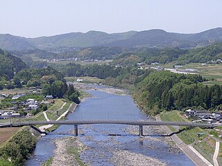
List of rivers of Japan

Last updated

Rivers of Japan are characterized by their relatively short lengths and considerably steep gradients due to the narrow and mountainous topography of the country. An often-cited quote is 'this is not a river, but a waterfall' by the Dutch engineer (o-yatoi gaikokujin) Johannis de Rijke who had visited the Jōganji River, Toyama Prefecture. The Mogami, the Fuji and the Kuma are regarded as the three most rapid rivers of Japan.

Contents

Typical rivers of Japan rise from mountainous forests and cut out deep V-shaped valleys in their upper reaches, and form alluvial plains in their lower reaches which enable the Japanese to cultivate rice fields and to set up cities. Most rivers are dammed to supply both water and electricity.

The longest river of Japan is the Shinano, which flows from Nagano to Niigata. The Tone has the largest watershed and serves water to more than 30 million inhabitants of Tokyo metropolitan area.

Hokkaidō

There are 326 rivers in Hokkaido, including 13 class A river systems (1級水系 or 一級河川, ikkyū suikei) designated by the central government. [1] [2] The class A rivers are administered by Hokkaidō Regional Development Bureau ( 北海道開発局 , Hokkaidō kaihatsukyoku). There are six class B river systems. [3]

The following table lists the of rivers of Hokkaidō by length. Use the column headers to sort by name, class, or tributary status.

River nameLength Class Tributary ofRefs
Ishikari (石狩川, Ishikari-gawa)268 km (167 mi)A  [1] [2] [3] [4]
Teshio (天塩川, Teshio-gawa)256 km (159 mi)A  [1] [2] [3] [4]
Tokachi (十勝川, Tokachi-gawa)156 km (97 mi)A  [1] [2] [3] [4]
Kushiro (釧路川, Kushiro-gawa)154 km (96 mi)A  [1] [2] [3] [4]
Yūbari (夕張川, Yūbari-gawa)136 km (85 mi)A Ishikari [1] [2] [3] [4]
Mu (鵡川, Mu-kawa)135 km (84 mi)A  [1] [2] [3] [4]
Shiribetsu (尻別川, Shiribetsu-gawa)126 km (78 mi)A  [1] [2] [3] [4]
Tokoro (常呂川, Tokoro-gawa)120 km (75 mi)A  [1] [2] [3] [4]
Abashiri (網走川, Abashiri-gawa)115 km (71 mi)A  [1] [2] [3] [4]
Chitose (千歳川, Chitose-gawa)108 km (67 mi)A Ishikari [1] [2] [3] [4]
Saru (沙流川, Saru-gawa)104 km (65 mi)A  [1] [2] [3] [4]
Akan (阿寒川, Akan-gawa)98 km (61 mi)B  [1] [2] [3] [4]
Yūbetsu (湧別川, Yūbetsu-gawa)87 km (54 mi)A  [1] [2] [3] [4]
Shokotsu (渚滑川, Shokotsu-gawa)84 km (52 mi)A  [1] [2] [3] [4]
Niikappu (新冠川, Niikappu-gawa)80 km (50 mi)B  [1] [2] [3] [4]
Shiribeshi-Toshibetsu (後志利別川, Shiribeshi-Toshibetsu-gawa)80 km (50 mi)A  [1] [2] [3] [4]
Shibetsu (標津川, Shibetsu-gawa)78 km (48 mi)B  [1] [2] [3] [4]
Toyohira (豊平川, Toyohira-gawa)72.5 km (45.0 mi)A Ishikari [1] [2] [3] [4]
Shizunai (静内川, Shizunai-gawa)69.9 km (43.4 mi)B  [1] [2] [3] [4]
Rumoi (留萌川, Rumoi-gawa)44 km (27 mi)A  [1] [2] [3] [4]
Koetoi (声問川, Koetoi-gawa)41.9 km (26.0 mi)B  [1] [2] [3] [4]
Mitsuishi (三石川, Mitsuishi-gawa)31.6 km (19.6 mi)B  [1] [2] [3] [4]
Shikiu (敷生川, Shikiu-gawa)22.8 km (14.2 mi)A  [1] [2] [3] [4]
Makomanai (真駒内川, Makomanai-gawa)21 km (13 mi)A Toyohira [1] [2] [3] [4]
Anano (穴の川, Ana-no-kawa)9.4 km (5.8 mi)A Toyohira [1] [2] [3] [4]

Honshu

Rivers are listed by length. Columns can also be sorted by name, class, and tributary status.

River nameLength Class Tributary ofRefs
Shinano (信濃川, Shinano-gawa)367 km (228 mi)A [5]
Tone (利根川, Tone-gawa)322 km (200 mi)A [5]
Kitakami (北上川, Kitakami-gawa)249 km (155 mi)A [5]
Abukuma (阿武隈川, Abukuma-gawa)239 km (149 mi)A [5]
Kiso (木曽川, Kiso-gawa)229 km (142 mi)A [5]
Mogami (最上川, Mogami-gawa)229 km (142 mi)A [5]
Tenryū (天竜川, Tenryū-gawa)213 km (132 mi)A [5]
Agano (阿賀野川, Agano-gawa)210 km (130 mi)A [5]
Gōnokawa (江の川 or 江川, -gawa)
Enokawa River (可愛川, Eno-kawa)
194 km (121 mi)A [5]
Kumano (熊野川, Kumano-gawa)
Shingu River (新宮川, Shingu-gawa)
183 km (114 mi)A [5]
Arakawa (荒川, Arakawa)173 km (107 mi)A [5]
Ōi (大井川, Ōi-gawa)168 km (104 mi)A [5]
Nagara (長良川, Nagara-gawa)166 km (103 mi)A [5]
Hii (斐伊川, Hii-gawa)153 km (95 mi)A [5]
Naka (那珂川, Naka-gawa)150 km (93 mi)A [5]
Yura (由良川, -gawa)146 km (91 mi)A [5]
Asahi (旭川, Asahi-gawa)142 km (88 mi)A [5]
Mabechi (馬淵川, Mabechi-gawa)142 km (88 mi)A [5]
Tama (多摩川, Tama-gawa)138 km (86 mi)A [5]
Kinokawa (紀ノ川 or 紀の川)
Yoshino River (吉野川, Yoshino-kawa)
136 km (85 mi)A [5]
Yoneshiro (米代川, Yoneshiro-gawa)136 km (85 mi)A [5]
Omono (雄物川, Omono-gawa)133 km (83 mi)A [5]
Yoshii (吉井川, Yoshii-gawa)133 km (83 mi)A [5]
Fuji (富士川, Fuji-kawa)128 km (80 mi)A [5]
Kuji (久慈川, Kuji-gawa)124 km (77 mi)A [5]
Ibi (揖斐川, Ibi-gawa)121 km (75 mi)A [5]
Jinzū (神通川, Jinzū-gawa)120 km (75 mi)A [5]
Yahagi (矢作川, Yahagi-gawa)117 km (73 mi)A [5]
Kuzuryū (九頭竜川, Kuzuryū-gawa)116 km (72 mi)A [5]
Shō (庄川, Shō-gawa)115 km (71 mi)A [5]
Takahashi (高梁川, Takahashi-gawa)111 km (69 mi)A [5]
Sagami (相模川, Sagami-gawa)109 km (68 mi)A [5]
Katsura (桂川, Katsura-gawa)
Ōi River (大堰川, Ōi-gawa)
107 km (66 mi)A Yodo [5]
Ōta (太田川, Ōta-gawa)103 km (64 mi)A [5]
Iwaki (岩木川, Iwaki-gawa)102 km (63 mi)A [5]
Kizu (木津川, Kizu-gawa)99 km (62 mi)A Yodo [5]
Kako (加古川, Kako-gawa)96 km (60 mi)A [5]
Shōnai (庄内川, Shōnai-gawa)96 km (60 mi)A [5]
Miya (宮川, Miya-gawa)91 km (57 mi)A [5]
Naruse (鳴瀬川, Naruse-gawa)89 km (55 mi)A [5]
Ashida (芦田川, Ashida-gawa)86 km (53 mi)A [5]
Kurobe (黒部川, Kurobe-gawa)85 km (53 mi)A [5]
Kushida (櫛田川, Kushida-gawa)85 km (53 mi)A [5]
Takatsu (高津川, Takatsu-gawa)81 km (50 mi)A [5]
Hino (日野川, Hino-gawa)77 km (48 mi)A [5]
Toyo (豊川, Toyo-gawa)77 km (48 mi)A [5]
Yodo (淀川, Yodo-gawa)
Seta River (瀬田川, Seta-gawa)
Uji River (宇治川, Uji-gawa)
75 km (47 mi)A [5]
Ara (荒川, Ara-kawa)73 km (45 mi)A [5]
Tedori (手取川, Tedori-gawa)72 km (45 mi)A [5]
Aka (赤川, Aka-gawa)70 km (43 mi)A [5]
Ibo (揖保川, Ibo-gawa)69.75 km (43.34 mi)A [5]
Maruyama (円山川, Maruyama-gawa)68 km (42 mi)A [5]
Oyabe (小矢部川, Oyabe-gawa)68 km (42 mi)A [5]
Yamato (大和川, Yamato-gawa)68 km (42 mi)A [5]
Oirase (奥入瀬川, Oirase-gawa)67 km (42 mi)B
Muko (武庫川, Muko-gawa)66 km (41 mi)A [5]
Yasu (野洲川, Yasu-gawa)65.25 km (40.54 mi)A Yodo [5]
Seki (関川, -gawa)64 km (40 mi)A [5]
Takase (高瀬川, Takase-gawa)63.7 km (39.6 mi)A [5]
Koyoshi (子吉川, Koyoshi-gawa)61 km (38 mi)A [5]
Hime (姫川, Hime-gawa)60 km (37 mi)A [5]
Edo (江戸川, Edo-gawa)59.5 km (37.0 mi)A Tone [5]
Oze (小瀬川, Oze-gawa)
Kono River (木野川, Kono-gawa)
59 km (37 mi)A [5]
Saba (佐波川, Saba-gawa)57 km (35 mi)A [5]
Jōganji (常願寺川, Jōganji-gawa)56 km (35 mi)A [5]
Kumozu (雲出川, Kumozu-gawa)55 km (34 mi)A [5]
Natori (名取川, Natori-gawa)55 km (34 mi)A [5]
Abe (安倍川, Abe-kawa)53.3 km (33.1 mi)A [5]
Sendai (千代川, Sendai-gawa)52 km (32 mi)A [5]
Kano (狩野川, Kano-gawa)46 km (29 mi)A [5]
Sakawa (酒匂川, Sakawa-gawa)46 km (29 mi)A [5]
Kakehashi (梯川, Kakehashi-gawa)42 km (26 mi)A [5]
Suzuka (鈴鹿川, Suzuka-gawa)40 km (25 mi)A [5]
Tenjin (天神川, Tenjin-gawa)32 km (20 mi)A [5]
Kamo (鴨川, Kamo-gawa)31 km (19 mi)A Yodo [5]
Kita (北川, Kita-gawa)30 km (19 mi)A [5]
Kiku (菊川, Kiku-gawa)28 km (17 mi)A [5]
Kanda (神田川, Kanda-gawa)24.6 km (15.3 mi)A Arakawa [5]
Kibishima (Kibishima-gawa)24.1 km (15.0 mi)A [5]
Sumida (隅田川, Sumida-gawa)23.5 km (14.6 mi)A Arakawa [5]
Tsurumi (鶴見川, Tsurumi-gawa)22 km (14 mi)A [5]
Aikawa (相川, Aikawa -gawa)4.8 km (3.0 mi)B
Dōtonbori (道頓堀)2.7 km (1.7 mi)A Yodo [5]

Shikoku

First class rivers under control of Shikoku Regional Bureau (四国地方整備局)

Kyūshū

First class rivers under control of Kyushu Regional Bureau (九州地方整備局)

See also

Related Research Articles

<span class="mw-page-title-main">Ōno River</span> River in Ōita, Japan

The Ōno River is a river that originates in Ōita Prefecture, Japan. After running through the southern and central portions of Ōita Prefecture, it runs through the eastern part of Kumamoto Prefecture and the northern part of Miyazaki Prefecture.

This page lists Japan-related articles with romanized titles beginning with the letter A. For names of people, please list by surname. Please also ignore particles when listing articles.

This page lists Japan-related articles with romanized titles beginning with the letter H. For names of people, please list by surname. Please also ignore particles when listing articles.

This page lists Japan-related articles with romanized titles beginning with the letter K. For names of people, please list by surname. Please also ignore particles when listing articles.

This page lists Japan-related articles with romanized titles beginning with the letter M. For names of people, please list by surname. Please also ignore particles when listing articles.

This page lists Japan-related articles with romanized titles beginning with the letter N. For names of people, please list by surname. Please also ignore particles when listing articles.

This page lists Japan-related articles with romanized titles beginning with the letter O. For names of people, please list by surname. Please also ignore particles when listing articles.

This page lists Japan-related articles with romanized titles beginning with the letter S. For names of people, please list by surname. Please also ignore particles when listing articles.

This page lists Japan-related articles with romanized titles beginning with the letter T. For names of people, please list by surname. Please also ignore articles when listing articles.

This page lists Japan-related articles with romanized titles beginning with the letters Y–Z. For names of people, please list by surname. Please also ignore particles when listing articles.
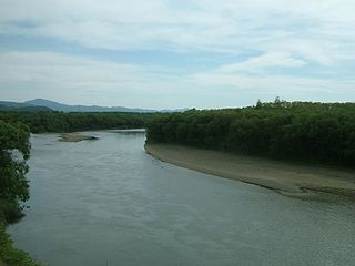
<span class="mw-page-title-main">Teshio River</span> River in Hokkaidō, Japan

The Teshio River is a river in Hokkaidō, Japan. At 256 kilometres (159 mi), it is the second-longest river on the island and the fourth-longest in the country. A Class A river, the Teshio is the northernmost major river in Japan, and has been designated Hokkaidō Heritage. Matsuura Takeshirō is said to have come up with the name "Hokkaidō" during his exploration of the river's interior.
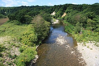
<span class="mw-page-title-main">Shiribeshi-Toshibetsu River</span> River in Hokkaidō, Japan

The Shiribeshi-Toshibetsu River is a Class A river in Hokkaidō, Japan. It flows through Hiyama District, and empties into the Sea of Japan.

<span class="mw-page-title-main">Watarase River</span> River in Japan

The Watarase River is a major river in the northern Kantō region of Japan. A tributary of the Tone River, it is 106.7 kilometres (66.3 mi) in length and drains an area of 2,621 square kilometres (1,012 sq mi). Its source is at Mount Sukai on the boundary of the city of Nikkō in Tochigi Prefecture and it empties into the Tone River at the boundary of the city of Koga in Ibaraki Prefecture and the city of Kazo in Saitama Prefecture. It is classed as a First-class river by the Japanese government.
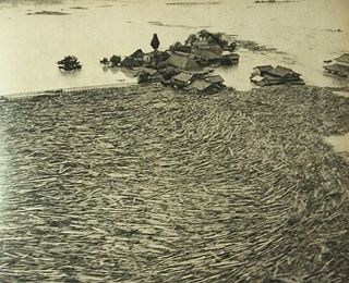
<span class="mw-page-title-main">1953 Northern Kyushu flood</span>

The 1953 North Kyushu flood was a flood which hit Northern Kyushu, Japan in June 1953. The flood was caused by cloudbursts and prolonged rain from the Meiyu rain front which dropped 1,000 mm of rain over Mount Aso and Mount Hiko. This downpour resulted in the overflow of many of the surrounding rivers, such as the Chikugo River.

<span class="mw-page-title-main">Koyoshi River</span> River in Honshu, Japan

Koyoshi River is a river in Akita Prefecture, Japan. It originates from Mount Chōkai, where the border of Akita Prefecture and Yamagata Prefecture is located, and flows through Yurihonjō and finally into Sea of Japan. The headstream of the river is called Chōkai River. It has the third largest drainage area of the class A rivers that flow through Akita Prefecture, after Omono River and Yoneshiro River.
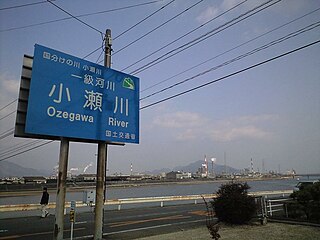
<span class="mw-page-title-main">Oze River</span> River in Honshu, Japan

The Oze River is a river in Hiroshima Prefecture and Yamaguchi Prefecture, Japan. The river forms part of the border between the two prefectures, which used to be the border between former Suō Province and Aki Province. It is also known as Kono River (木野川).

Each modern Japanese prefecture has a unique flag, most often a bicolour geometric highly stylised design (mon), often incorporating the characters of the Japanese writing system and resembling minimalistic company logos. A distinct feature of these flags is that they use a palette of colours not usually found in flags, including orange, purple, aquamarine and brown.

References

  1. 1 2 3 4 5 6 7 8 9 10 11 12 13 14 15 16 17 18 19 20 21 22 23 24 25 26 "河川概要 北海道開発局" (in Japanese). Ministry of Land, Infrastructure, Transport and Tourism. Retrieved December 31, 2017.
  2. 1 2 3 4 5 6 7 8 9 10 11 12 13 14 15 16 17 18 19 20 21 22 23 24 25 26 "一級河川水系別延長等" (in Japanese). Ministry of Land, Infrastructure, Transport and Tourism, Japan. Retrieved December 31, 2017.
  3. 1 2 3 4 5 6 7 8 9 10 11 12 13 14 15 16 17 18 19 20 21 22 23 24 25 26 "北海道河川一覧図 - 北海道庁" (PDF) (in Japanese). Hokkaido Prefecture. Retrieved December 31, 2017.
  4. 1 2 3 4 5 6 7 8 9 10 11 12 13 14 15 16 17 18 19 20 21 22 23 24 25 "穴の川遊砂地 北海道開発局" (in Japanese). Ministry of Land, Infrastructure, Transport and Tourism, Japan. Retrieved December 31, 2017.
  5. 1 2 3 4 5 6 7 8 9 10 11 12 13 14 15 16 17 18 19 20 21 22 23 24 25 26 27 28 29 30 31 32 33 34 35 36 37 38 39 40 41 42 43 44 45 46 47 48 49 50 51 52 53 54 55 56 57 58 59 60 61 62 63 64 65 66 67 68 69 70 71 72 73 74 75 76 77 78 79 80 81 "1級水系" (in Japanese). Ministry of Land, Infrastructure, Transport and Tourism. Retrieved December 31, 2017.