List of towns in Sri Lanka

Last updated

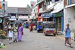
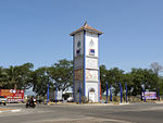
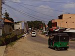
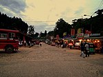
The following is a list of settlements in Sri Lanka with a population between 5,000 and 50,000.

Contents

Towns

TownImage DS
Division
District Province PopulationArea [1] Density
(/km²)
Co-
ordinates
Conurbation
(2012 est) [2]
Municipality
(2012 census) [3]
km²mi²
Vaddukoddai
வட்டுக்கோட்டை
Valikamam West Jaffna Northern 4,4074,129
Badulla
බදුල්ල
பதுளை
A look of a street in Badulla.jpg Badulla Badulla Uva 47,58742,2371044,224 6°59′05″N81°03′23″E / 6.98472°N 81.05639°E / 6.98472; 81.05639
Matara
මාතර
மாத்தறை
Matara Mobitel Building.jpg Matara Matara Southern 47,42074,1931355,707 5°57′00″N80°33′00″E / 5.95000°N 80.55000°E / 5.95000; 80.55000
Puttalam
පුත්තලම
புத்தளம்
Puttalam, Sri Lanka - panoramio (4).jpg Puttalam Puttalam North Western 45,40145,511 8°02′03″N79°50′07″E / 8.03417°N 79.83528°E / 8.03417; 79.83528
Chavakachcheri
චාවකච්චේරිය
சாவகச்சேரி
Thenmarachchi Jaffna Northern 41,40716,129 9°39′00″N80°09′00″E / 9.65000°N 80.15000°E / 9.65000; 80.15000
Kattankudy
කාත්තන්කුඩි
காத்தான்குடி
Kattankudy Batticaloa Eastern 40,88340,356 7°41′39″N81°44′12″E / 7.69417°N 81.73667°E / 7.69417; 81.73667
Matale
මාතලේ
மாத்தளை
Matale city skyline.jpg Matale Matale Central 40,85936,462934,051 7°28′00″N80°37′00″E / 7.46667°N 80.61667°E / 7.46667; 80.61667
Dambulla
දඹුල්ල
Dambulla Cave Temple.jpg Dambulla Matale Central 72,30623,8145421441 7°51′28″N80°39′09″E / 7.85778°N 80.65250°E / 7.85778; 80.65250
Kalutara
කළුතර
களுத்துறை
Kalutara Kalutara Western 39,61532,417 6°35′13″N79°57′37″E / 6.58694°N 79.96028°E / 6.58694; 79.96028
Mannar
මන්නාරම
மன்னார்
Mannar Causeway.jpg Mannar Mannar Northern 35,81724,417 8°58′00″N79°53′00″E / 8.96667°N 79.88333°E / 8.96667; 79.88333
Panadura
පානදුර
பாணந்துறை
Panadura Kalutara Western 35,71730,069 6°42′48″N79°54′15″E / 6.71333°N 79.90417°E / 6.71333; 79.90417
Beruwala
බේරුවල
பேருவளை
LK-beruwala-strand-01.jpg Beruwala Kalutara Western 35,31237,793 6°28′00″N79°59′00″E / 6.46667°N 79.98333°E / 6.46667; 79.98333
Ja-Ela
ජා-ඇල
ஜா-எல
Jaela5.jpg Ja-Ela Gampaha Western 32,38631,232 7°05′04″N79°53′41″E / 7.08444°N 79.89472°E / 7.08444; 79.89472
Point Pedro
පේදුරුතුඩුව
பருத்தித்துறை
Point Pedro (25467498806).jpg Vadamarachchi North Jaffna Northern 31,35112,334 9°49′00″N80°14′00″E / 9.81667°N 80.23333°E / 9.81667; 80.23333
Kelaniya
කැලණිය
களனி
Kelaniya Gampaha Western 31,307 6°57′00″N79°54′00″E / 6.95000°N 79.90000°E / 6.95000; 79.90000
Peliyagoda
පෑලියගොඩ
பேலியகொடை
Kelaniya Gampaha Western 31,30727,736 6°57′00″N79°54′00″E / 6.95000°N 79.90000°E / 6.95000; 79.90000
Kurunegala
කුරුණෑගල
குருனகல்
Kurunegala Sri Lanka (2).JPG Kurunegala Kurunegala North Western 30,31424,8331142,258 7°29′00″N80°22′00″E / 7.48333°N 80.36667°E / 7.48333; 80.36667
Wattala
වත්තල
வத்தளை
Wattala Gampaha Western 30,22928,031 6°59′00″N79°53′00″E / 6.98333°N 79.88333°E / 6.98333; 79.88333
Gampola
ගම්පොල
கம்பளை
Gampola.JPG Kandy Central 27,65937,871 7°59′53″N80°34′36″E / 7.99806°N 80.57667°E / 7.99806; 80.57667
Nuwara Eliya
නුවරඑළිය
நுவரேலியா
Nuwara Eliya 2013 04.JPG Nuwara Eliya Nuwara Eliya Central 27,32623,8041251,984 6°58′00″N80°46′00″E / 6.96667°N 80.76667°E / 6.96667; 80.76667
Valvettithurai
වෙල්වෙටිතුරේ
வல்வெட்டித்துறை
Valvettithurai Beach.JPG Vadamarachchi North Jaffna Northern 27,2108,283 9°49′00″N80°10′00″E / 9.81667°N 80.16667°E / 9.81667; 80.16667
Chilaw
හලාවත
சிலாபம்
ChilawTown.jpeg Chilaw Puttalam North Western 26,71421,441 7°35′00″N79°48′00″E / 7.58333°N 79.80000°E / 7.58333; 79.80000
Eravur
එරාවුර්
ஏறாவூர்
Eravur Markazul Islami.jpg Eravur Town Batticaloa Eastern 25,58224,643 7°46′00″N81°36′00″E / 7.76667°N 81.60000°E / 7.76667; 81.60000
Avissawella
අවිස්සාවේල්ල
அவிசாவலை
Hanwella Colombo Western 25,322 6°57′11″N80°13′06″E / 6.95306°N 80.21833°E / 6.95306; 80.21833
Weligama
වැලිගම
வெலிகமை
Weligama-Gare routiere.jpg Weligama Matara Southern 24,15922,377 5°58′24″N80°25′21″E / 5.97333°N 80.42250°E / 5.97333; 80.42250
Ambalangoda
අම්බලන්ගොඩ
அம்பலாங்கொட
Ambalangoda, Sri Lanka - panoramio.jpg Ambalangoda Galle Southern 21,57319,990 6°13′30″N80°03′24″E / 6.22500°N 80.05667°E / 6.22500; 80.05667
Ampara
අම්පාර
அம்பாறை
Ampara.jpg Ampara Ampara Eastern 20,30922,511 7°17′00″N81°40′00″E / 7.28333°N 81.66667°E / 7.28333; 81.66667
Kegalle
කෑගල්ල
கேகாலை
Kegalle Kegalle Sabaragamuwa 17,96215,993 7°15′00″N80°21′00″E / 7.25000°N 80.35000°E / 7.25000; 80.35000
Hatton
හැටන්
ஹற்றன்
City of Srilanka, Hatton.jpg Ambagamuwa Nuwara Eliya Central 16,23714,585 6°31′57″N80°21′19″E / 6.53250°N 80.35528°E / 6.53250; 80.35528
Nawalapitiya
නාවලපිටිය
நாவலபிட்டி
Pasbage Korale Kandy Central 15,41513,338 7°03′00″N80°32′00″E / 7.05000°N 80.53333°E / 7.05000; 80.53333
Balangoda
බලන්ගොඩ
பலங்கொடா
Balangoda Ratnapura Sabaragamuwa 13,58916,510 6°39′00″N80°41′00″E / 6.65000°N 80.68333°E / 6.65000; 80.68333
Hambantota
හම්බන්තොට
அம்பாந்தோட்டை
Hambantota Administrative Complex.jpg Hambantota Hambantota Southern 12,07123,2368332280 6°07′28″N81°07′21″E / 6.12444°N 81.12250°E / 6.12444; 81.12250
Tangalle
තංගල්ල
தங்கல்ல
Tangalle main road.jpg Tangalle Hambantota Southern 11,2588,473 6°01′00″N80°47′00″E / 6.01667°N 80.78333°E / 6.01667; 80.78333
Monaragala
මොණරාගල
மொனராகல
Moneragala Monaragala Uva 10,853 6°52′00″N81°21′00″E / 6.86667°N 81.35000°E / 6.86667; 81.35000
Gampaha
ගම්පහ
கம்பகா
Gampaha Gampaha Western 9,88962,33538151,640 7°05′30″N79°59′39″E / 7.09167°N 79.99417°E / 7.09167; 79.99417
Horana
හොරණ
ஹொரண
Horana Kalutara Western 9,7749,550 6°43′00″N80°03′00″E / 6.71667°N 80.05000°E / 6.71667; 80.05000
Wattegama
වත්තේගම
வத்தேகமை
Pathadumbara Kandy Uva 8,770 7°21′01″N80°40′57″E / 7.35028°N 80.68250°E / 7.35028; 80.68250
Minuwangoda
මිණුවන්ගොඩ
மினுவன்கொட
Minuwangoda Gampaha Western 8,0167,523 7°10′24″N79°57′43″E / 7.17333°N 79.96194°E / 7.17333; 79.96194
Bandarawela
බණ්ඩාරවෙල
பண்டாரவளை
BANDARAWELA BUS STATION SRI LANKA JUNE 2011 (5885943208).jpg Bandarawela Badulla Uva 7,87824,1682710895 6°50′00″N80°59′00″E / 6.83333°N 80.98333°E / 6.83333; 80.98333
Kuliyapitiya
කුලියාපිටිය
குளியாப்பிட்டிய
Kurunegala North Western 6,8505,509 7°28′14″N80°02′44″E / 7.47056°N 80.04556°E / 7.47056; 80.04556
Haputale
හපුතලේ
அப்புத்தளை
Haputale town 01 640.jpg Haputale Badulla Uva 5,5595,288 6°46′04″N80°57′31″E / 6.76778°N 80.95861°E / 6.76778; 80.95861

Related Research Articles

<span class="mw-page-title-main">Demographics of Sri Lanka</span>

This is a demography of the population of Sri Lanka including population density, ethnicity, education level, health of the populace, economic status, religious affiliations and other aspects of the population.

<span class="mw-page-title-main">Western Province, Sri Lanka</span> Province of Sri Lanka

The Western Province is one of the nine provinces of Sri Lanka, the first level administrative division of the country. The provinces have existed since the 19th century but did not have any legal status until 1987 when the 13th Amendment to the Constitution of Sri Lanka established provincial councils. Western Province is the most densely populated province in the country and is home to the legislative capital Sri Jayawardenepura Kotte as well as to Colombo, the nation's administrative and business center.

<span class="mw-page-title-main">Sabaragamuwa Province</span> Province of Sri Lanka

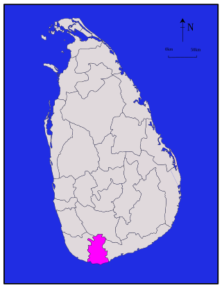
The Sabaragamuwa Province is one of the nine provinces of Sri Lanka. The city of Ratnapura is the capital of the province.

<span class="mw-page-title-main">North Central Province, Sri Lanka</span> Province of Sri Lanka

North Central Province is one of the nine provinces of Sri Lanka. The province has an area of 10,472 km2, making it the largest province by area, and a population of 1,266,663, making it the 3rd least populated province. The city of Anuradhapura is the capital of the province.

<span class="mw-page-title-main">Districts of Sri Lanka</span> Second-level administrative divisions of Sri Lanka

Districts are the second level administrative divisions of Sri Lanka, preceded by provinces. Sri Lanka has 25 districts organized into 9 provinces. Districts are further divided into a number of divisional secretariats, which are in turn subdivided into 14,022 grama niladhari divisions. There are 331 DS divisions in Sri Lanka.

<span class="mw-page-title-main">Gampaha District</span> Administrative District in Western, Sri Lanka

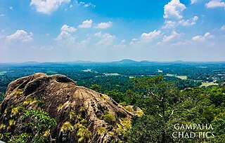
Gampaha District is one of the 25 districts of Sri Lanka, the second level administrative division of the country. It is the second most populous district of Sri Lanka after Colombo District. The district is administered by a District Secretariat headed by a District Secretary appointed by the central government of Sri Lanka. The capital of the district is the town of Gampaha. The district was carved out of the northern part of Colombo District in September 1978.

<span class="mw-page-title-main">Kalutara District</span> Administrative District in Western, Sri Lanka

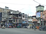
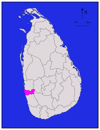
Kalutara District is one of the 25 districts of Sri Lanka, the second level administrative division of the country. The district is administered by a District Secretariat headed by a District Secretary appointed by the central government of Sri Lanka. The capital of the district is the city of Kalutara .

<span class="mw-page-title-main">Matara District</span> Administrative District in Southern Province, Sri Lanka

Matara is a district in Southern Province, Sri Lanka. It is one of 25 districts of Sri Lanka, the second level administrative division of the country. The district is administered by a District Secretariat headed by a District Secretary appointed by the central government of Sri Lanka.

<span class="mw-page-title-main">Ampara District</span> Administrative District in Eastern, Sri Lanka

Ampara District is one of the 25 districts of Sri Lanka, the second-level administrative divisions of the country. The district is administered by a District Secretariat headed by a District Secretary appointed by the central government of Sri Lanka. The capital of the district is the town of Ampara. The district was carved out of the southern part of Batticaloa District in April 1961.

<span class="mw-page-title-main">Colombo District</span> Administrative District in Western, Sri Lanka

Colombo District is one of the 25 districts of Sri Lanka, the second level administrative division of the country. The district is administered by a District Secretariat headed by a District Secretary appointed by the central government of Sri Lanka. The capital of the district is the city of Colombo. The district of Colombo was officially recorded in 2016 as having the highest income on average, per household.

<span class="mw-page-title-main">Jaffna District</span> Administrative District in Northern, Sri Lanka

Jaffna District is one of the 25 districts of Sri Lanka, the second level administrative division of the country. The district is administered by a District Secretariat headed by a District Secretary appointed by the central government of Sri Lanka. The capital of the district is the city of Jaffna.

<span class="mw-page-title-main">Kilinochchi District</span> Administrative District in Northern, Sri Lanka

Kilinochchi District is one of the 25 districts of Sri Lanka, the second level administrative division of the country. The district is administered by a District Secretariat headed by a District Secretary appointed by the central government of Sri Lanka. The capital of the district is the town of Kilinochchi.

<span class="mw-page-title-main">Batticaloa District</span> Administrative District in Eastern, Sri Lanka

Batticaloa District is one of the 25 districts of Sri Lanka, the second level administrative division of the country. The district is administered by a District Secretariat headed by a District Secretary appointed by the central government of Sri Lanka. The capital of the district is the city of Batticaloa. Ampara District was carved out of the southern part of Batticaloa District in April 1961.

<span class="mw-page-title-main">Mullaitivu District</span> Administrative District in Northern, Sri Lanka

Mullaitivu District is one of the 25 districts of Sri Lanka, the second level administrative division of the country. The district is administered by a District Secretariat headed by a District Secretary appointed by the central government of Sri Lanka. The capital of the district is the town of Mullaitivu.

<span class="mw-page-title-main">Trincomalee District</span> Administrative District in Eastern, Sri Lanka

Trincomalee District is one of the 25 districts of Sri Lanka, the second level administrative division of the country. The district is administered by a District Secretariat headed by a District Secretary appointed by the central government of Sri Lanka. The capital of the district is the city of Trincomalee.

<span class="mw-page-title-main">Vavuniya District</span> Administrative District in Northern, Sri Lanka

Vavuniya District is one of the 25 districts of Sri Lanka, the second level administrative division of the country. The district is administered by a District Secretariat headed by a District Secretary appointed by the central government of Sri Lanka. The capital of the district is the city of Vavuniya.

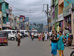
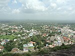
There are 24 Municipal councils in Sri Lanka, which are the legislative bodies that preside over the largest cities and first tier municipalities in the country. Introduced in 1987 through the 13th Amendment to the Constitution of Sri Lanka, municipal councils became a devolved subject under the Provincial Councils in the Local Government system of Sri Lanka. Until 2017 municipal councils collectively governed 2,765,533 people within a 698 square kilometer area. There were 445 Councillors in total, ranging from 53 to 9 per council.

There are 41 Urban councils in Sri Lanka, which are the legislative bodies that preside over the second tier municipalities in the country. Introduced in 1987 through the 13th Amendment to the Constitution of Sri Lanka, Urban councils became a devolved subject under the Provincial Councils in the Local Government system of Sri Lanka. The Urban councils collectively govern approximately 1,388,000 people. There are 417 Councillors in total, ranging from 22 to 7 per council.

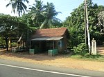
There are 276 Pradeshiya Sabhas in Sri Lanka, which are the legislative bodies that preside over the third tier municipalities in the country. Introduced in 1987 through the 13th Amendment to the Constitution of Sri Lanka, Pradeshiya Sabhas became a devolved subject under the Provincial Councils in the Local Government system of Sri Lanka. The Pradeshiya Sabhas collectively govern approximately 16,726,000 people. There are 3,624 Councillors in total, ranging from 5 to 23 per council.

References

  1. "Table 15.1: Area, Population, Registered voters and Employees of Municipalities, 2015" (PDF). Statistics Statistical Abstract 2016. Department of Census and Statistics, Sri Lanka.
  2. "Sri Lanka: largest cities and towns and statistics of their population". World Gazetteer. Archived from the original on 16 December 2012.
  3. "Table 2.4: Population of Municipal Councils and urban councils by sex, Census, 2012" (PDF). Statistics Statistical Abstract 2016. Department of Census and Statistics, Sri Lanka.