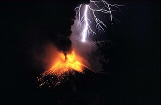
This is a list of active and extinct volcanoes in Myanmar (also known as Burma).
| Name | Elevation | Location | Last eruption | |
|---|---|---|---|---|
| meters | feet | Coordinates | ||
| Lower Chindwin | 385 | 1263 | 22°17′N95°06′E / 22.28°N 95.10°E | Holocene |
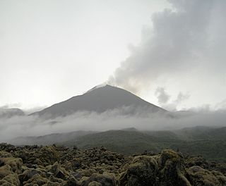
| Mount Popa | 1518 | 4980 | 20°55′N95°15′E / 20.92°N 95.25°E | Holocene |
| Singu Plateau | 507 | 1663 | 22°42′N95°59′E / 22.70°N 95.98°E | Holocene |
| Taungthonton | 1700+ | – | 24°58′N95°48′E / 24.96°N 95.80°E | Unknown |
| Namyong [1] | 508 | 1668 | 25°41′N96°26′E / 25.68°N 96.43°E | Pliocene to Pleistocene |

The Bukit Barisan or the Barisan Mountains are a mountain range on the western side of Sumatra, Indonesia, covering nearly 1,700 km (1,050 mi) from the north to the south of the island. The Bukit Barisan range consists primarily of volcanoes shrouded in dense jungle cover, including Sumatran tropical pine forests on the higher slopes. The highest peak of the range is Mount Kerinci at 3,800 metres (12,467 ft). The Bukit Barisan Selatan National Park is situated towards the southern end of the range Liwa, Indonesia.
The Decade Volcanoes are 16 volcanoes identified by the International Association of Volcanology and Chemistry of the Earth's Interior (IAVCEI) as being worthy of particular study in light of their history of large, destructive eruptions and proximity to densely populated areas. The Decade Volcanoes project encourages studies and public-awareness activities at these volcanoes, with the aim of achieving a better understanding of the volcanoes and the dangers they present, and thus being able to reduce the severity of natural disasters.
Reventador is an active stratovolcano which lies in the eastern Andes of Ecuador. It lies in a remote area of the national park of the same name, which is Spanish for "exploder". Since 1541, it has erupted over 25 times, although its isolated location means that many of its eruptions have gone unreported.

Volcán Tajumulco is a large stratovolcano in the department of San Marcos in western Guatemala. It is the highest mountain in Central America at 4,203 metres (13,789 ft). It is part of the mountain range of the Sierra Madre de Chiapas, which begins in Mexico's southernmost state of Chiapas.
The Volcano Number is a hierarchical geographical system to uniquely identify and tag volcanoes and volcanic features on Earth. The numbers consist of four numerals, a hyphen, then two or three more numerals. The first two numerals identify the region, the next two the subregion, and the last two or three the individual volcano.
The Smithsonian Institution's Global Volcanism Program (GVP) documents Earth's volcanoes and their eruptive history over the past 10,000 years. The mission of the GVP is to document, understand, and disseminate information about global volcanic activity.
A volcanic group is a stratigraphic group consisting of volcanic strata. They can be in the form of volcanic fields, volcanic complexes and cone clusters.
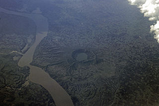
The Lower Chindwin is an area of around seven or eight explosion craters, located some 30 km (20 mi) northwest of the town of Monywa in the Sagaing Region, Burma (Myanmar).
| Sovereign states |
|
|---|---|
| States with limited recognition | |
| Dependencies and other territories | |