Locust Grove, Oklahoma

Last updated

Locust Grove, Oklahoma
Town
Nickname: 
The Wonder City
OKMap-doton-LocustGrove.PNG
Location of Locust Grove, Oklahoma
Coordinates: 36°11′53″N95°10′08″W / 36.19806°N 95.16889°W / 36.19806; -95.16889
CountryUnited States
State Oklahoma
County Mayes
Government
  MayorJason Williams[ citation needed ]
Area
[1]
  Total1.82 sq mi (4.72 km2)
  Land1.82 sq mi (4.72 km2)
  Water0.00 sq mi (0.00 km2)
Elevation
[2]
669 ft (204 m)
Population
 (2020)
  Total1,371
  Density752.06/sq mi (290.39/km2)
Time zone UTC-6 (Central (CST))
  Summer (DST) UTC-5 (CDT)
ZIP code
74352
Area code(s) 539/918
FIPS code 40-43500 [3]
GNIS feature ID2412908 [2]

Locust Grove is a town in Mayes County, Oklahoma, United States. The population was 1,423 at the 2010 census, a 4.2 percent increase over the figure of 1,366 recorded in 2000. [4]

Contents

History

Locust Grove was the site of the Battle of Locust Grove, a small Civil War engagement on July 3, 1862, in which approximately 250 Union troops surprised and destroyed a similar-sized Confederate contingent, killing about 100 and capturing another 100 while sustaining only minimal losses. The escaping Confederates retreated toward Tahlequah, leading to a loss of morale and desertions among the Cherokee Confederate supporters. [5]

A small community, named for the grove of locust trees where this battle took place, formed here, in the Cherokee Nation of Indian Territory. A post office was established here on March 26, 1873. Jim Bryan moved the post office to his store in 1908, after Oklahoma became a state and Mayes County was established. In 1910, Louie Ross bought the Bryan store and moved it to his father's ranch house. The community of Locust Grove soon relocated closer to the store, and soon had a cemetery, a gristmill, two blacksmith shops, and a separate building to house the post office. [6]

The existing townsite was established in 1912 by O.W. Killam, a lawyer, merchant, realtor and promoter who bought the Cherokee allotment that had belonged to Elzina Ross in connection with the construction of the Kansas, Oklahoma and Gulf Railway. Killam platted the townsite and incorporated it on March 4, 1913. [6]

The town has had its share of tragedy. In June 1952, the county attorney Jack Burris was assassinated at his home at Locust Grove in one of the most famous unsolved murders in Oklahoma history. In 1977 it was the location of the Oklahoma Girl Scout murders, in which three young girls were raped and murdered as they were camping at the nearby Camp Scott Girl Scout facility. Gene Leroy Hart was arrested and tried for the crime, but found not guilty in a jury trial. The case remains open. Also, a popular restaurant, "Country Cottage", was linked to a highly publicized August 2008 outbreak of E. coli O111, a rare strain of the bacterium. The outbreak resulted in more than 100 cases of gastrointestinal food poisoning and one death; [7] subsequent studies were unclear about the source of the bacteria, leading Oklahoma Attorney General Drew Edmondson to accuse the state health department of having "botched" the investigation. [8] [9]

Native American Cherokee sculptor Willard Stone lived near Locust Grove; a museum dedicated to his work is now located on the site. [10] [11]

Locust Grove is home to the Rural Oklahoma Museum of Poetry. There is only one other poetry museum in the U.S., the American Poetry Museum in Washington DC.[ citation needed ]

Geography

Locust Grove is 11 miles (18 km) south of Salina, at the intersection of State Highway 82 and U.S. Route 412. [6]

According to the United States Census Bureau, the town has a total area of 0.9 square miles (2.3 km2), all land.

Demographics

Historical population
CensusPop.Note
1920 587
1930 510−13.1%
1940 5456.9%
1950 73033.9%
1960 82813.4%
1970 1,09031.6%
1980 1,1798.2%
1990 1,32612.5%
2000 1,3663.0%
2010 1,4234.2%
2020 1,371−3.7%
U.S. Decennial Census [12]

As of the census [3] of 2010, there were 5,200 people, 819 households, and 363 families residing in the town. The population density was 1,606.7 inhabitants per square mile (620.4/km2). There were 567 housing units at an average density of 666.9 per square mile (257.5/km2). The racial makeup of the town was 57.32% White, 32.50% Native American, 0.22% Asian, 0.81% from other races, and 9.15% from two or more races. Hispanic or Latino of any race were 2.42% of the population.

There were 519 households, out of which 38.9% had children under the age of 18 living with them, 47.4% were married couples living together, 17.7% had a female householder with no husband present, and 29.9% were non-families. 26.8% of all households were made up of individuals, and 16.0% had someone living alone who was 65 years of age or older. The average household size was 2.63 and the average family size was 3.14.

In the town, the population was spread out, with 32.1% under the age of 18, 12.2% from 18 to 24, 25.5% from 25 to 44, 16.7% from 45 to 64, and 13.6% who were 65 years of age or older. The median age was 29 years. For every 100 females, there were 90.8 males. For every 100 females age 18 and over, there were 80.9 males.

The median income for a household in the town was $20,655, and the median income for a family was $24,821. Males had a median income of $25,500 versus $16,389 for females. The per capita income for the town was $9,191. About 22.1% of families and 23.0% of the population were below the poverty line, including 28.8% of those under age 18 and 19.5% of those age 65 or over.

Education

Locust Grove Public Schools is a K-12 public school system located in Locust Grove, OK. It serves the students from Locust Grove, Rose and Peggs.

The school system consists of four different schools: The Early Learning Center (Pre-K through 1st Grade), the Upper Elementary (2nd through 5th grades), the Middle School (6th through 8th grades), and the High School (9th through 12th grades).

Locust Grove High School is steeped in tradition. Every year the first football game of the season is Locust Grove versus Salina in the Battle of 82 (highway). [ citation needed ]

Points of interest

Locust Grove is eight miles west of the Saline Courthouse, the only remaining of nine rural Cherokee Nation courthouses built in the 1880s. The courthouse, near the Mayes/Delaware County line, was undergoing renovation in 2019. [13]

The Willard Stone Museum is currently at his homeplace in Locust Grove. [14] The museum's goal is to relocate to the historic building that housed the first bank in Locust Grove, located in downtown and built in 1912, to house the collection. [15] In 2019, the museum's board of directors authorized build-out of the new facility, and in September 2020 launched a fundraising campaign to finance the needed renovations. [16]

Locust Grove is directly south of Lake Hudson, southwest of Lake W. R. Holway, formerly Chimney Rock Lake, and northeast of Fort Gibson Lake. [17]

Notable residents

Related Research Articles

<span class="mw-page-title-main">Washington County, Oklahoma</span> County in Oklahoma, United States

Washington County is a county located in the northeastern part of the U.S. state of Oklahoma. As of the 2020 census, the population was 52,455. Its county seat is Bartlesville. Named for President George Washington, it is the second smallest county in Oklahoma in total area, adjacent to the largest county in Oklahoma, Osage County.

<span class="mw-page-title-main">Wagoner County, Oklahoma</span> County in Oklahoma, United States

Wagoner County is a county located in the U.S. state of Oklahoma. As of the 2020 census, the population was 80,981. Its county seat is Wagoner.

<span class="mw-page-title-main">Sequoyah County, Oklahoma</span> County in Oklahoma, United States

Sequoyah County is a county located in the U.S. state of Oklahoma. As of the 2020 census, the population was 39,281. The county seat is Sallisaw. Sequoyah County was created in 1907 when Oklahoma became a state. It was named after Sequoyah, who created the Cherokee syllabary and its written language.

<span class="mw-page-title-main">Rogers County, Oklahoma</span> County in Oklahoma, United States

Rogers County is located in the northeastern part of the U.S. state of Oklahoma. As of the 2020 census, the population was 95,240, making it the sixth-most populous county in Oklahoma. The county seat is Claremore. Rogers County is included in the Tulsa, OK metropolitan statistical area.

<span class="mw-page-title-main">Pawnee County, Oklahoma</span> County in Oklahoma, United States

Pawnee County is a county located in the U.S. state of Oklahoma. As of the 2020 census, the population was 15,553. Its county seat is Pawnee. The county is named after the Pawnee Nation, whose reservation used to encompass the county prior to allotment in 1893.

<span class="mw-page-title-main">Mayes County, Oklahoma</span> County in Oklahoma, United States

Mayes County is a county located in the U.S. state of Oklahoma. As of the 2020 census, the population was 39,046. Its county seat is Pryor Creek. Named for Samuel Houston Mayes, Principal Chief of the Cherokee Nation from 1895 to 1899, it was originally created at the Sequoyah Convention in August 1905.

<span class="mw-page-title-main">Delaware County, Oklahoma</span> County in Oklahoma, United States

Delaware County is a county located in the U.S. state of Oklahoma. As of the 2020 census, the population was 40,397. Its county seat is Jay. The county was named for the Delaware Indians, who had established a village in the area prior to the Cherokees being assigned to relocate to Indian Territory in the 1830s. Delaware County was created in 1907. Prior to becoming Delaware County, a large portion of the area was known as the Delaware District of the Cherokee Nation. Today, Delaware County continues to be recognized by the Cherokee Nation as the Delaware District.

<span class="mw-page-title-main">Cherokee County, Oklahoma</span> County in Oklahoma, United States

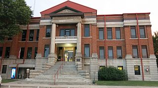
Cherokee County is a county located in the U.S. state of Oklahoma. As of the 2020 census, the population was 47,078. Its county seat is Tahlequah, which is also the capital of the Cherokee Nation.

<span class="mw-page-title-main">Shady Grove, Cherokee County, Oklahoma</span> Census-designated place in Oklahoma, United States

Shady Grove is an unincorporated community and census-designated place (CDP) in Cherokee County, Oklahoma, United States. The population was 556 at the 2010 census. This is not to be confused with the similarly-named Shady Grove in McIntosh County, or the Shady Grove in Pawnee County.

<span class="mw-page-title-main">Grove, Oklahoma</span> City in Oklahoma, United States

Grove is a city in Delaware County, Oklahoma, United States. The population was 6,623 at the 2010 census, an increase of 27.6 percent over the figure of 5,131 recorded in 2000. Grove is surrounded by Grand Lake o’ the Cherokees, a professional bass fishing tournament lake and recreational hotspot during the travel season of Memorial Day to Labor Day.

<span class="mw-page-title-main">Jay, Oklahoma</span> City in Oklahoma, United States

Jay is a city and county seat of Delaware County, Oklahoma, United States. The population was 2,448 at the 2010 census, compared to 2,482 at the 2000 census, a decrease of 1.4 percent. Almost 40% of its residents are Native American, thus Jay is home to numerous Cherokee tribal offices and a health clinic for the Delaware District of the Cherokee Nation. Jay has a council-manager system of government. Becki Farley is the mayor with Kyle Stump serving as Vice Mayor.

<span class="mw-page-title-main">Newkirk, Oklahoma</span> City in Oklahoma, United States

Newkirk is a city and county seat of Kay County, Oklahoma, United States. The population was 2,172 at the 2020 census.

<span class="mw-page-title-main">Oktaha, Oklahoma</span> Town in Oklahoma, United States

Oktaha is a town in Muskogee County, Oklahoma, United States.

<span class="mw-page-title-main">Webbers Falls, Oklahoma</span> Town in Oklahoma, United States

Webbers Falls is a town in southeastern Muskogee County, Oklahoma, United States. The population was 616 at the 2010 census, a decline of 14.9 percent from the figure of 724 recorded in 2000.

<span class="mw-page-title-main">Perry, Oklahoma</span> City in Oklahoma, United States

Perry is a city in, and county seat of, Noble County, Oklahoma, United States. As of the 2010 census, the city population was 5,126, a 2.0 percent decrease from the figure of 5,230 in 2000. The city is home of Ditch Witch construction equipment manufacture.

<span class="mw-page-title-main">Nowata, Oklahoma</span> City in Oklahoma, United States

Nowata is a city and county seat of Nowata County, Oklahoma, United States. The population was 3,731 at the United States Census, 2010, a 6.0 percent decline from the figure of 3,971 recorded in 2000. The area where it was established was then part of the Cherokee Nation in Indian Territory.

<span class="mw-page-title-main">Sperry, Oklahoma</span> Town in Oklahoma, United States

Sperry is a town in Tulsa County, Oklahoma, United States. The population was 1,115 at the time of the 2020 census. It is primarily a bedroom community, since approximately 85 percent of the employed residents commute to work in Tulsa and other nearby towns. Sperry also has an active retirement community.

<span class="mw-page-title-main">Skiatook, Oklahoma</span> City in Oklahoma, United States

Skiatook is a city in Osage and Tulsa counties in the U.S. state of Oklahoma located in the northeastern part of the state, approximately 20 miles north and west of Tulsa. Due to its location on the border between Osage County and Tulsa County, Skiatook has been referred to as "the Gateway to the Osage." The town includes the state highway junction of Oklahoma State Highway 11 and Oklahoma State Highway 20. The population was 8,450 at the 2020 census, an increase of 14.24 percent over the figure of 7,397 recorded in 2010.

<span class="mw-page-title-main">Catoosa, Oklahoma</span> City in Oklahoma, United States

Catoosa is a city in Rogers and Wagoner counties in the U.S. state of Oklahoma. The population was 7,440 at the 2020 census compared to 7,159 at the 2010 census.

<span class="mw-page-title-main">Willard Stone</span> American artist (1916–1985)

Willard Stone was an American artist best known for his wood sculptures carved in a flowing Art Deco style.

References

  1. "ArcGIS REST Services Directory". United States Census Bureau. Retrieved September 20, 2022.
  2. 1 2 U.S. Geological Survey Geographic Names Information System: Locust Grove, Oklahoma
  3. 1 2 "U.S. Census website". United States Census Bureau . Retrieved January 31, 2008.
  4. CensusViewer:Population of the City of Locust Grove, Oklahoma
  5. John D. May, "Locust Grove, Battle of", Encyclopedia of Oklahoma History and Culture.
  6. 1 2 3 Betty Lou Harper Thomas, "Locust Grove",Encyclopedia of Oklahoma History and Culture. Accessed March 23, 2009.
  7. Kim Archer and Michael Overall, "Locust Grove's economic powerhouse now silent", Tulsa World , August 31, 2008.
  8. Barbara Hoberock, "Edmondson: Locust Grove E. coli investigation 'botched'", Tulsa World , March 9, 2009.
  9. Kim Archer, "Getting back to normal: Locust Grove recovering from E. coli outbreak", Tulsa World , August 15, 2010.
  10. David C. Hunt, "Stone, Willard" Archived February 1, 2015, at the Wayback Machine at Oklahoma Historical Society Encyclopedia of Oklahoma History and Culture Archived April 16, 2009, at the Wayback Machine (retrieved March 20, 2009).
  11. "Stone Family History" at Willard Stone Museum official website (retrieved March 21, 2009).
  12. "Census of Population and Housing". Census.gov. Retrieved June 4, 2015.
  13. "Touring the Tribes? Where to go in northeast Oklahoma". Kelsy Schlotthauer, Tulsa World, May 11, 2019. May 11, 2019. Retrieved October 11, 2019.
  14. "Willard Stone Museum". Facebook . Retrieved October 11, 2019.
  15. "Willard Stone Museum Website" . Retrieved October 11, 2019.
  16. "Willard Stone Museum launches fundraiser to renovate new facility". James D. Watts Jr., Tulsa World, September 8, 2020. September 8, 2020.
  17. "Locust Grove, Oklahoma". Google Maps. Retrieved October 19, 2019.