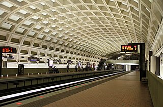
Farragut West station is a Washington Metro station in downtown Washington, D.C., United States. The side-platformed station was opened on July 1, 1977, and is operated by the Washington Metropolitan Area Transit Authority (WMATA). Providing service for the Blue, Silver, and Orange Lines, the station is located just west of Farragut Square with two entrances on I Street at 17th and 18th Streets NW.

McPherson Square station is a Washington Metro station in Downtown, Washington, D.C., United States. The side-platformed station is operated by the Washington Metropolitan Area Transit Authority (WMATA). Providing service for the Blue, Orange, and Silver Lines, the station is located between McPherson Square and Franklin Square, with two entrances on I Street at Vermont Avenue and 14th Street NW. This is the main station to access the White House, and the Vermont Avenue exit is directly underneath the Department of Veterans Affairs building.

Mount Vernon Square station is a Washington Metro station in Washington, D.C., on the Green and Yellow Lines. It is the northeastern terminus of the Yellow Line.
The Washington meridians are four meridians that were used as prime meridians in the United States which pass through Washington, D.C. The four that have been specified are:
- through the Capitol
- through the White House
- through the old Naval Observatory
- through the new Naval Observatory.

The Walter E. Washington Convention Center is a 2.3-million-square-foot (210,000 m2) convention center located in Washington, D.C., owned and operated by the city's convention arm, Events DC. Designed in a joint venture by the Atlanta-based architecture firm Tvsdesign, Washington, D.C.- based architects Devrouax & Purnell Architects Planners PC and Mariani and Associates, the convention center is located in a superblock bounded by Mount Vernon Square and 7th, 9th and N streets, N.W. It is served by the Mount Vernon Square station on the Yellow and Green lines of the Washington Metro. It was completed in 2003.


New Hampshire Avenue is a diagonal street in Washington, D.C., beginning at the Kennedy Center and extending northeast for about 5 miles (8 km) and then continuing into Maryland where it is designated Maryland Route 650. New Hampshire Avenue, however, is not contiguous. It stops at 15th and W Streets NW and resumes again on the other side of Columbia Heights at Park Road NW, a few blocks from Georgia Avenue. New Hampshire Avenue passes through several Washington neighborhoods including Foggy Bottom, Dupont Circle, Petworth and Lamond-Riggs.

The Army Medical Museum and Library (AMML) of the U.S. Army was a large brick building constructed in 1887 at South B Street and 7th Street, SW, Washington, D.C., which is directly on the National Mall. It was designated a National Historic Landmark in 1965 and added to the National Register of Historic Places in 1966. The building was demolished in 1969, and the collections at the focus of the landmark designation were dispersed.

Cathedral Heights is a small, affluent residential neighborhood located in the upper Northwest quadrant of Washington, D.C. It is approximately bounded by Woodley Road to the north, Fulton Street to the south, Wisconsin Avenue to the east, and Glover Archbold Park and Idaho Avenue to the west.

Downtown is the central business district of Washington, D.C., located in Northwest D.C. It is the fourth largest central business district in the United States. The "Traditional Downtown" has been defined as an area roughly between Union Station in the east and 16th Street NW in the west, and between the National Mall on the south and Massachusetts Avenue on the north, including Penn Quarter. However, nowadays, Downtown D.C. usually refers to a larger area, as the DC Office of Planning states:
…most residents, workers, and visitors think of Downtown in a broader sense — including areas as far north as Dupont Circle, as far west as Foggy Bottom, and as far east as Capitol Hill. Only about half of the central city workforce is located within the city’s traditional Downtown.
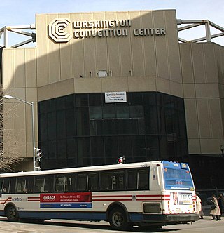
The Washington Convention Center in Washington, D.C. was a convention center located one block southwest at 909 H Street NW, occupying the city block bounded by New York Avenue, 9th Street, H Street, and 11th Street. Construction on the center began in 1980, and it opened on December 10, 1982. At 800,000 square feet (74,000 m2), it was the fourth largest facility in the United States at the time. However, during the 1980s and 1990s, numerous larger and more modern facilities were constructed around the country, and by 1997 the Washington Convention Center had become the 30th largest facility.
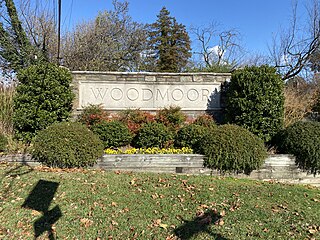
Woodmoor is a neighborhood in the northern section of Silver Spring, Maryland in southeastern Montgomery County, in the U.S. state of Maryland. Its borders extend from U.S. 29 to the west, Northwest Branch Park to the north, the Capital Beltway (I-95) to the east, and University Boulevard to the south. It lies on one of the "Four Corners" at the northeastern corner of the intersection of Colesville Road, and University Boulevard.
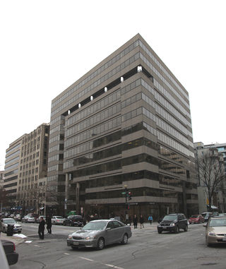
1090 Vermont Avenue NW is a high-rise modernist office building in Washington, D.C., which is tied with the Renaissance Washington DC Hotel as the fourth-tallest commercial building in the city. The building is 187 feet high and has 12 floors. It contained about 160,000 square feet of space when it first opened, but only 150,000 square feet by 1998. Internal build-outs increased the interior space to 187,000 square feet by 2006.

Georgetown Cupcake is a cupcakery based in the Georgetown neighborhood of Washington, D.C. Sisters Katherine Berman and Sophie LaMontagne opened the shop in February 2008.

The Daguerre Memorial is a bronze and granite sculpture by Jonathan Scott Hartley in Washington, D.C. It was erected in memory of Louis Daguerre.
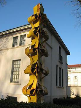
El Maiz is a modern sculpture, by Édgar Negret.

Chief Justice John Marshall is a bronze sculpture of John Marshall, by American sculptor William Wetmore Story. It is located at the Supreme Court, 1 First Street, Northeast, Washington, D.C. Cast in Rome by the founder Alessandro Nelli, the monument was dedicated on May 10, 1884, by Morrison Waite. It was relocated from the West Terrace, of the United States Capitol.
Union Square is an 11-acre public plaza at the foot of Capitol Hill in Washington, D.C., United States. It encompasses the Ulysses S. Grant Memorial (1924) and the 6-acre Capitol Reflecting Pool (1971) and is just west of the United States Capitol building. Views differ as to whether the Square is just east of the National Mall or is itself the eastern end.

St. Augustine Catholic Church is a Catholic parish in Washington, D.C. It is considered by many to be the "Mother Church of Black Catholics", as the first Black parish in the district and the administrator of DC's oldest Black school.
Rock Creek Forest is a mostly residential neighborhood in Silver Spring / Chevy Chase, Maryland. It is bordered by Chevy Chase to the east, Silver Spring to the west, Maryland Route 410 to the north, and the border with Washington, D.C., to the south. The historically African-American neighborhood of Lyttonsville is to the north, while Rock Creek Park and the neighborhoods of North Portal Estates / Colonial Village / Shepherd Park are to the south.

