
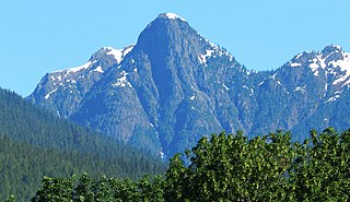
Bacon Peak is a mountain located in North Cascades National Park, in the Cascade Range in the U.S. state of Washington. Its glaciers cover 1.2 square miles (3.2 km2); the three main glaciers are Diobsud Creek Glacier, Green Lake Glacier and Noisy Creek Glacier.

Azurite Peak is an 8,434-foot (2,571-metre) double-summit mountain located at the common boundary point of Okanogan County, Skagit County, and Whatcom County in Washington state. It is part of the Okanogan Range which is a sub-range of the North Cascades Range. Azurite Peak ranks as the 81st-highest summit in the state. Azurite Peak is situated north of Azurite Pass on land administered by the Okanogan–Wenatchee National Forest. The nearest higher neighbor is Tower Mountain, 5.24 miles (8.43 km) to the south-southeast, and Mount Ballard lies 1.97 miles (3.17 km) to the north. Remnants of a small pocket glacier are found on the east aspect. Precipitation runoff from the peak drains north into tributaries of the Skagit River, and south into the Methow River. Topographic relief is significant as the summit rises over 3,000 feet above Mill Creek in one mile (1.6 km). The Pacific Crest Trail traverses the base of Azurite Peak.

Repulse Peak is a 7,923-foot (2,415-metre) mountain summit in the North Cascades in the U.S. state of Washington. It is located on the border of the Stephen Mather Wilderness and North Cascades National Park. It is situated midway between Black Peak and Fisher Peak, and can be seen from the North Cascades Highway. Precipitation runoff from Repulse Peak drains into tributaries of the Skagit River and Stehekin River. Topographic relief is significant as the east face rises over 2,900 feet in 0.53 mile (0.85 km).

Helen Buttes are two prominent summits near the western edge of the North Cascades, in Skagit County of Washington state. The buttes are located four miles northwest of Marblemount, Washington, in the Noisy-Diobsud Wilderness, on land administered by the Mount Baker-Snoqualmie National Forest. The nearest higher neighbor is Diobsud Buttes, 3.11 miles (5.01 km) to the north. Precipitation runoff from Helen Buttes drains into tributaries of the Skagit River.
Diobsud Buttes are summits near the western edge of the North Cascades, in Skagit County of Washington state. Diobsud Buttes are located north of Marblemount, Washington, and Helen Buttes, along the shared boundary of North Cascades National Park and the Noisy-Diobsud Wilderness. The nearest higher neighbor is Logger Butte, 0.85 mi (1.37 km) to the north. Precipitation runoff from Diobsud Buttes drains into tributaries of the Skagit River.
Porcupine Peak is a 7,762-foot-elevation (2,366-meter) mountain located in Skagit County of Washington state.

Elephant Butte is a remote 7,380-foot-elevation summit located in Whatcom County of Washington, United States. It is situated within North Cascades National Park and Stephen Mather Wilderness, and is part of the Picket Range, a subset of the North Cascades. Like many North Cascades peaks, Elephant Butte is more notable for its large, steep rise above local terrain than for its absolute elevation. Topographic relief is significant as the north aspect rises 5,200 feet above McMillan Creek in one mile, and the south aspect rises 5,000 feet above Stetattle Creek in two miles. Precipitation runoff from the mountain drains to the Skagit River via these two creeks. This geographical feature's name has been officially adopted by the United States Board on Geographic Names.

Crooked Bum is a 6,937-foot-elevation mountain summit on the crest of the North Cascades in the U.S. state of Washington. It is located in the Okanogan–Wenatchee National Forest on the shared border of Skagit County and Chelan County. It is situated immediately west of Rainy Pass and two miles east of Corteo Peak. The scenic and popular Maple Pass Trail traverses the south slope of the peak while staying above Lake Ann. Precipitation runoff from the north slope of Crooked Bum drains into Granite Creek which is a tributary of the Skagit River, whereas the south side drains into Bridge Creek which is a tributary of the Chelan River.
Molar Tooth is a 7,547-foot-elevation (2,300-meter) granite summit located on the shared border of Okanogan County and Skagit County, in Washington state. The mountain is part of the Okanagan Range which is a subrange of the Cascade Range. Set in the Okanogan–Wenatchee National Forest, Molar Tooth is situated south of Cutthroat Pass, and 0.57 miles (0.92 km) north of Cutthroat Peak, which is also the nearest higher peak. The easiest climbing route is class 4 scrambling, but solid rock provides class 5 technical routes as well. Precipitation runoff from the east side of Molar Tooth drains into tributaries of the Methow River, whereas runoff from the west side drains into tributaries of the Skagit River.

Red Mountain is a 7,662-foot (2,335-metre) summit in the North Cascades of Washington, United States. It is located in Skagit County, within North Cascades National Park and the Stephen Mather Wilderness. It is situated on a smooth ridge of brick-red color at the western culmination of Ragged Ridge. The nearest higher peak is Cosho Peak, 2.6 miles (4.2 km) to the east-southeast.

Round Mountain is a 5,369-foot mountain summit at the western edge of the North Cascades, in Skagit County of Washington state. It is located nine miles northwest of Darrington, Washington, and is situated on land administered by the Mount Baker-Snoqualmie National Forest. Round Mountain is remarkable for its 4,840 feet of prominence which ranks as the most in Skagit County, and eighth-most of all the mountains in Washington state. The nearest higher peak is Whitehorse Mountain, 7.85 miles (12.63 km) to the south-southeast. Precipitation runoff from Round Mountain drains into tributaries of the Stillaguamish River.

Mount Misch is a remote 7,435 ft mountain summit in the North Cascades, in Skagit County of Washington state. It is the highest point of the Buckindy Range, or Buckindy Ridge. It is located 19 miles east-northeast of Darrington, Washington, and 15 miles north-northwest of Glacier Peak which is one of the Cascade stratovolcanoes. It is situated in the Glacier Peak Wilderness on land administered by the Mount Baker-Snoqualmie National Forest. Mount Misch was named by mountaineer and author Fred Beckey for his friend Peter Misch (1909-1987), University of Washington geology professor and mountaineer, who was renowned for his study of the North Cascades. Precipitation runoff from Mount Misch and the unnamed Goat Creek glacier on its east slope drains into tributaries of the Suiattle River and ultimately the Skagit River.

Mount Chaval is a craggy 7,127-foot (2,172-metre) mountain summit located in Skagit County of Washington state. Situated within the Glacier Peak Wilderness, Mount Chaval is positioned west of the crest of the North Cascades Range, approximately 15 miles northeast of the town of Darrington. It has two subsidiary peaks, East Peak and Middle Peak, each 7040 ft. The nearest higher neighbor is Snowking Mountain, 2.51 miles (4.04 km) to the northeast. Precipitation runoff from Mount Chaval drains into tributaries of the Skagit River.

Electric Butte is an unofficially named 6,400-foot (2,000-metre) mountain summit near the western edge of the North Cascades, in Whatcom County of Washington state. It is located north of Marblemount and Logger Butte, within North Cascades National Park. The nearest higher neighbor is Canadian Bacon, 1.44 mi (2.32 km) to the north, with Bacon Peak, 2.01 mi (3.23 km) to the northwest. Precipitation runoff from Electric Butte drains into tributaries of the Skagit River.
Hagan Mountain is a multi-peak mountain located in Whatcom County, Washington state, within North Cascades National Park. It has an elevation of 7,080-feet (2,160-metres). The mountain is situated approximately 12 mi (19 km) north of Marblemount.

Mount Arriva is an 8,215 ft (2,500 m) elevation mountain summit located in the North Cascades in the U.S. state of Washington. It is situated in North Cascades National Park, on the shared border of Chelan County and Skagit County. Despite its position only 1.55 mi (2.49 km) southwest of Easy Pass, and 3.7 mi (6.0 km) west of the North Cascades Highway, it is not visible from either. Its nearest higher peak is Black Peak, 2.57 mi (4.14 km) to the southeast. Mount Arriva has a secondary summit, called East Peak, which was first climbed in August 1940 by Fred Beckey, Jim Crooks, and Ed Kennedy. The first ascent of the true summit was made July 6, 1966, by Joe and Joan Firey, John and Irene Meulemans.
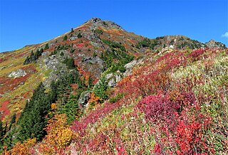
Yellow Aster Butte is a 6,241-foot (1,902-metre) Skagit Range summit located three miles south of the Canada–United States border, in Whatcom County of Washington state. It is situated within the Mount Baker Wilderness, on land managed by Mount Baker-Snoqualmie National Forest. The nearest higher neighbor is Winchester Mountain, 1.77 miles (2.85 km) to the east, and Mount Larrabee is set 2.3 miles (3.7 km) to the northeast. The summit offers views of Mount Larrabee, Tomyhoi Peak, American Border Peak, Canadian Border Peak, Mount Shuksan, and Mount Baker. Precipitation runoff on the north side of the mountain drains into Tomyhoi Creek, whereas the west side of the mountain drains into Damfino Creek, and the south slope is drained by Swamp Creek.

Rhino Butte is a remote 6,914-foot-elevation summit located in Whatcom County of Washington, United States. It is situated within North Cascades National Park and Stephen Mather Wilderness, and is part of the Picket Range, a subset of the North Cascades. Like many North Cascades peaks, Rhino Butte is more notable for its large, steep rise above local terrain than for its absolute elevation. Topographic relief is significant as the north aspect rises 4,350 feet above McMillan Creek in one mile, and the south aspect rises 4,700 feet above Stetattle Creek in two miles. Precipitation runoff from the mountain drains to the Skagit River via these two creeks. The nearest higher neighbor is Elephant Butte, 1.27 mile to the east-northeast, with Hippo Butte (6,889 ft) between the two. A high alpine ridge connects Rhino to McMillan Spire, 1.7 mile to the west-southwest, and Azure Lake lies below this ridge. The first ascent of the summit was made October 15, 1978, by John Roper. This geographical feature's name has not yet been officially adopted by the United States Board on Geographic Names.

North Big Bosom Butte is a 6,384-foot (1,946-metre) mountain summit located in Whatcom County of Washington state.
Mount Watson is a 6,220-foot-elevation (1,900-meter) summit located in the North Cascades, in Whatcom County of Washington state.


