Celle is a town and capital of the district of Celle, in Lower Saxony, Germany. The town is situated on the banks of the river Aller, a tributary of the Weser, and has a population of about 71,000. Celle is the southern gateway to the Lüneburg Heath, has a castle built in the Renaissance and Baroque style and a picturesque old town centre with over 400 timber-framed houses, making Celle one of the most remarkable members of the German Timber-Frame Road. From 1378 to 1705, Celle was the official residence of the Lüneburg branch of the dukes of Brunswick-Lüneburg who had been banished from their original ducal seat by its townsfolk.
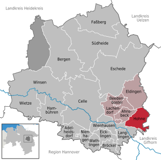
Hohne is a municipality in the state of Lower Saxony in Germany, east of the county town of Celle. It includes the three former parishes of Hohne, Helmerkamp and Spechtshorn. It should not be confused with the British Army camp of Hohne near Belsen about 30 km to the northwest.

Bad Fallingbostel is the district town (Kreisstadt) of the Heidekreis district in the German state of Lower Saxony. Since 1976 the town has had a state-recognised Kneipp spa and has held the title of Bad since 2002. It has close ties to Walsrode, a few miles to the west. Until 2015, there was a British Army base in Bad Fallingbostel, It also hosted Defender 2020, the largest US Army/NATO exercise since the Cold War. The town has around 11,000 inhabitants.

The Böhme is a right-bank, northeastern tributary of the Aller in the district of Soltau-Fallingbostel in the north German state of Lower Saxony. The river is 72 kilometres (45 mi) long.

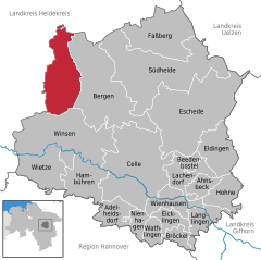
Bergen is a town in the north of Celle district on the Lüneburg Heath, in Lower Saxony, Germany. Administratively it acts as a municipal borough divided into 12 subordinate parishes based on the town and its surrounding villages: Becklingen, Belsen, Bergen, Bleckmar, Diesten, Dohnsen, Eversen, Hagen, Hassel, Offen, Sülze and Wardböhmen. Bergen-Belsen concentration camp was located in the area of Belsen.
Osterheide is an unincorporated area in the district of Heidekreis, in Lower Saxony, Germany.
The Osthannoversche Eisenbahnen AG (OHE) is a Celle based transportation company with railway network in North-eastern Lower Saxony around the Lüneburg Heath area of over 250 km.
Bergen-Hohne Training Area is a NATO military training area in the southern part of the Lüneburg Heath, in the state of Lower Saxony in northern Germany. It covers an area of 284 square kilometres, which makes it the largest military training area in Germany.
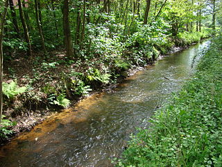
Meiße is a river of Lower Saxony, Germany that flows through part of the Lüneburg Heath. It is a right-hand tributary of the Aller.
Belsen is a village within the German borough of Bergen in the northern part of Celle district on the Lüneburg Heath in Lower Saxony. The village, whose original site lies about 3 kilometres (1.9 mi) southwest of Bergen, has 331 inhabitants (as at: 31 December 2000). The Belsen concentration camp was named after it. Today Belsen is dominated by the former British Army camp of Hohne on the edge of the NATO firing ranges.
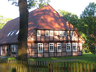
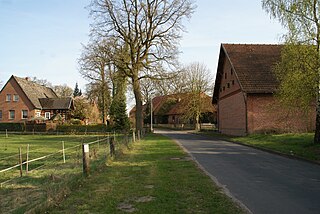
Becklingen is a German village in the Lower Saxon borough of Bergen in the northern part of Celle district on the Lüneburg Heath. Formerly an independent municipality, it is part of the town Bergen since 1971.

Oerbke is an unincorporated German village in Soltau-Fallingbostel district in the southern part of the Lüneburg Heath in Lower Saxony. Oerbke lies on the A7 autobahn east of Bad Fallingbostel and is the seat of administration for the Osterheide area.
The Heidmark is an area of the Lüneburg Heath, much of which has not been accessible to the population since about 1935–1936. The establishment of a large military training area by the German armed forces, the Wehrmacht, as part of their rearmament and preparation for war resulted in the evacuation of 24 villages and, since then the training area has been out-of-bounds to non-military personnel. Today it has become the Bergen-Hohne Training Area, the largest of its kind in Europe.
Sülze is a village in the local borough of Bergen located in the northern part of Celle district on the Lüneburg Heath in North Germany. The infamous Bergen-Belsen concentration camp was located not far from Sülze, one of several farming villages in the borough. The general Bergen area today is economically heavily dependent on the surrounding military bases and the Bergen-Hohne Training Area to the west, which is the largest military training area in Western Europe.

The Großes Moor near Becklingen is a nature reserve in Germany with an area of 850 hectares, of which 666 hectares lie in Celle district and 184 hectares in Soltau-Fallingbostel district. Since 16 December 1985 the area has been protected under conservation law. An area of 776.6 hectares is designated as a special area of conservation (FFH-Gebiet). The name literally means "Large Bog near Becklingen" and it lies on the Lüneburg Heath, south of Wietzendorf and east of Becklingen, part of the borough of Bergen. The River Meiße has its source in this raised bog.

Ettenbostel was a village in the old district (Altkreis) of Fallingbostel located in the Heidmark in the north German state of Lower Saxony. The villagers were 'relocated' in 1935/36 because the German Wehrmacht wanted to create a huge military training area on the heathland and forest of the Heidmark. Today this has become the Bergen-Hohne Training Area and is the largest in Europe.
Benhorn was a village in the old district of Fallingbostel, on the Heidmark in Lower Saxony in North Germany. It disappeared from the map in 1935/36, because the German Wehrmacht wanted to establish the Bergen-Hohne Training Area, today the largest military training area in Germany. The inhabitants were resettled.

Gloucester School was a British military secondary school in Hohne, Germany. It was one of several secondary schools operated by the Service Children's Education in support of British Forces Germany in the post-Cold War period. It served children of military personnel and civilian employees of Bergen-Hohne Garrison with its stations at Fallingbostel, Celle and Hohne. It was a day school only, with no boarding facilities.
Bergen-Hohne Garrison was a major British garrison in the post-Cold War period, with facilities located close to Bergen at Lager Hohne, at Lager Oerbke near Fallingbostel and at Celle in Lower Saxony, Germany. It was home to 7th Armoured Brigade and most of its subordinate units. It formed a major part of British Forces Germany.