Long-range identification and tracking (ships)

Last updated

The long-range identification and tracking (LRIT) of ships was established as an international system on 19 May 2006 by the International Maritime Organization (IMO) as resolution MSC.202 (81). [1] This resolution amends Chapter V of the International Convention for the Safety of Life at Sea (SOLAS), regulation 19-1 and binds all governments which have contracted to the IMO. [2]

Contents

The LRIT regulation will apply to the following ship types engaged on international voyages:

These ships must report their position to their flag administration at least four times a day. Most vessels set their existing satellite communications systems to automatically make these reports. Other contracting governments may request information about vessels in which they have a legitimate interest under the regulation.

The LRIT system consists of the already installed (generally) shipborne satellite communications equipment, communications service providers (CSPs), application service providers (ASPs), LRIT data centres, the LRIT data distribution plan and the International LRIT data exchange. Certain aspects of the performance of the LRIT system are reviewed or audited by the LRIT coordinator acting on behalf of the IMO and its contracting governments.

Some[ who? ] confuse the functions of LRIT with that of AIS (Automatic Identification System), a collision avoidance system also mandated by the IMO, which operates in the VHF radio band, with a range only slightly greater than line-of-sight. While AIS was originally designed for short-range operation as a collision avoidance and navigational aid, it has now been shown to be possible to receive AIS signals by satellite in many, but not all, parts of the world. This is becoming known as S-AIS and is completely different from LRIT. The only similarity is that AIS is also collected from space for determining location of vessels, but requires no action from the vessels themselves except they must have their AIS system turned on. LRIT requires the active, willing participation of the vessel involved, which is, in and of itself, a very useful indication as to whether the vessel in question is a lawful actor. Thus the information collected from the two systems, S-AIS and LRIT, are mutually complementary, and S-AIS clearly does not make LRIT superfluous in any manner. Indeed, because of co-channel interference near densely populated or congested sea areas satellites are having a difficult time in detecting AIS from space in those areas. Fixes are under development by several organizations, but how effective they will be remains to be seen.

European implementation

Following the EU Council Resolution of 2 October 2007, EU Member States (MS) decided to establish an EU LRIT Data Centre (EU LRIT DC). According to the Council Resolution, the Commission is in charge of managing the EU LRIT DC, in cooperation with Member States, through the European Maritime Safety Agency (EMSA). The Agency, in particular, is in charge of the technical development, operation and maintenance of the EU LRIT DC. It also “stresses that the objective of the EU LRIT DC should include maritime security, Search and Rescue (SAR), maritime safety and protection of the marine environment, taking into consideration respective developments within the IMO context.”

North American implementation

Canada

In January 2009 Canada become one of the first SOLAS contracting governments to implement a national data centre and comply with the LRIT regulation.

United States

In January 2009, the United States became one of the first SOLAS contracting governments to implement a National Data Centre and comply with the LRIT regulation. Currently the US Authorized Application Service Provider (ASP) is Pole Star Space Applications Ltd..

LRIT was proposed by the United States Coast Guard (USCG) at the International Maritime Organization (IMO) in London during the aftermath of the September 11, 2001 attacks to track the approximately 50,000 large ships around the world.

In the United States integration of LRIT information with that from sensors and enables the Coast Guard to correlate Long Range Identification and Tracking (LRIT) data with data from other sources, detect anomalies, and heighten overall Maritime Domain Awareness (MDA). The United States implementation of this regulation is consistent with the Coast Guard's strategic goals of maritime security and maritime safety, and the Department's strategic goals of awareness, prevention, protection, and response.

Every sovereign nation already has the right to request such information (and does so) for ships destined for their ports. The LRIT regulation and computer system will allow the USCG to receive information about all vessels within 1,000 nautical miles (1,900 km) of US territory providing the vessel's flag administration has not excluded the US from receiving such information.

For a more detailed description of the United States implementation of the LRIT system, please refer to the NPRM published October 3, 2007, in the US Government Federal Register (72 FR 56600). [3]

Marshall Islands

Marshall Islands, one of the largest ship registries in the world, established one of the first prototype Data Centres, using Pole Star Space Applications.

African States

Several African states have formed a LRIT Cooperative Data Centre. South Africa National Data Centre provides services to a number of African states, including Ghana and the Gambia.

Liberia

Liberia, the second largest ship registry in the world has established a LRIT Data Centre in 2008. The Recognised LRIT provider is Pole Star Space Applications.

South American implementation

Brazil

In January 2009 Brazil implemented a National Data Centre and was one of the first SOLAS contracting governments to become compliant with the LRIT regulation. And in August 11th 2010 implemented the Regional LRIT Data Centre Brazil, providing services for Brazil and Uruguay. In 2014, RDC BRAZIL providing services for Namibia.

Venezuela

The Venezuelan flag registry appointed Fulcrum Maritime Systems as the sole LRIT application service provider (ASP) and national data center (NDC) provider for all Venezuelan flagged vessels.

Chile

The Chilean flag registry appointed Collecte Localisation Satellites (CLS) as the sole LRIT application service provider (ASP). This Data Center provides services for all Chilean and Mexican flagged vessels.

Ecuador

The Republic of Ecuador entered in LRIT production environment at April 15 of 2010. Ecuador owns a National LRIT Data Center (NDC) and recognize their Maritime Authority as Application Service Provider (ASP).

Honduras

Honduras Flag appointed Pole Star Space Applications as ASP.

Panama

The Panama Flag Registry appointed the Pole Star Space Applications, Inc. / Absolute Maritime Tracking Services Inc. consortium as the sole LRIT Application Service Provider (ASP) and National Data Center (NDC) provider for all Panama flagged vessels. It is widely considered to be the world’s largest vessel monitoring centre, consisting of over 8,000 SOLAS ships and small-craft. The National Data Centre is based in Panama City, and operates on a 24 x 7 x 365 basis. Panama is the first flag administration to implement such a broad range of Maritime Domain Awareness (MDA) capabilities under a single LRIT service provision, which also includes advanced small-craft monitoring, vessel vetting and sanctions compliance, port-risk mitigation, and fleet-wide Ship Security Alert Service (SSAS) management - including testing, response escalation and notifications.

Pacific Ocean implementation

Vanuatu

The Vanuatu flag registry appointed Collecte Localisation Satellites (CLS) as the sole LRIT application service provider (ASP) and national data center (RDC) provider for all Vanuatu flagged vessels.

Singapore implementation

Singapore established its LRIT National Data Centre with CLS as its LRIT Recognised ASP.

Vietnam implementation

Vietnam entered in LRIT production environment at October 21 of 2013. Vietnam owns a National LRIT Data Center (NDC) and recognize VISHIPEL as Application Service Provider (ASP).

See also

Related Research Articles

<span class="mw-page-title-main">International Maritime Organization</span> Specialised agency of the United Nations

The International Maritime Organization is a specialised agency of the United Nations responsible for regulating shipping. The IMO was established following agreement at a UN conference held in Geneva in 1948 and the IMO came into existence ten years later, meeting for the first time on 17 March 1958. Headquartered in London, United Kingdom, IMO currently has 175 Member States and three Associate Members.

The Global Maritime Distress and Safety System (GMDSS) is a worldwide system for automated emergency signal communication for ships at sea developed by the United Nations' International Maritime Organization (IMO) as part of the SOLAS Convention.

<span class="mw-page-title-main">International Ship and Port Facility Security Code</span> Maritime treaty

The International Ship and Port Facility Security (ISPS) Code is an amendment to the Safety of Life at Sea (SOLAS) Convention (1974/1988) on Maritime security including minimum security arrangements for ships, ports and government agencies. Having come into force in 2004, it prescribes responsibilities to governments, shipping companies, shipboard personnel, and port/facility personnel to "detect security threats and take preventive measures against security incidents affecting ships or port facilities used in international trade."

The International Convention for the Safety of Life at Sea (SOLAS) is an international maritime treaty which sets out minimum safety standards in the construction, equipment and operation of merchant ships. The International Maritime Organization convention requires signatory flag states to ensure that ships flagged by them comply with at least these standards.

A Maritime Mobile Service Identity (MMSI) is effectively a maritime object's international maritime telephone number, a temporarily assigned UID issued by that object's current flag state.

<span class="mw-page-title-main">Automatic identification system</span> Automatic tracking system that uses transceivers on ships

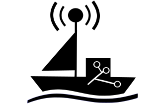
The automatic identification system (AIS) is an automatic tracking system that uses transceivers on ships and is used by vessel traffic services (VTS). When satellites are used to receive AIS signatures, the term Satellite-AIS (S-AIS) is used. AIS information supplements marine radar, which continues to be the primary method of collision avoidance for water transport. Although technically and operationally distinct, the ADS-B system is analogous to AIS and performs a similar function for aircraft.

<span class="mw-page-title-main">International Cospas-Sarsat Programme</span> International satellite-aided search and rescue initiative

The International Cospas-Sarsat Programme is a satellite-aided search and rescue (SAR) initiative. It is organized as a treaty-based, nonprofit, intergovernmental, humanitarian cooperative of 45 nations and agencies. It is dedicated to detecting and locating emergency locator radio beacons activated by persons, aircraft or vessels in distress, and forwarding this alert information to authorities that can take action for rescue. Member countries support the distribution of distress alerts using a constellation of around 65 satellites orbiting the Earth which carry transponders and signal processors capable of locating an emergency beacon anywhere on Earth transmitting on the Cospas-Sarsat frequency of 406 MHz.

ORBCOMM is an American company that offers industrial internet and machine to machine (M2M) communications hardware, software and services designed to track, monitor, and control fixed and mobile assets in markets including transportation, heavy equipment, maritime, oil and gas, utilities and government. The company provides hardware devices, modems, web applications, and data services delivered over multiple satellite and cellular networks.

The International Association of Classification Societies (IACS) is a technically based non-governmental organization that currently consists of twelve member marine classification societies. More than 90% of the world's cargo-carrying ships’ tonnage is covered by the classification standards set by member societies of IACS.

The Maritime Transportation Security Act of 2002 (MTSA) is an Act of Congress enacted by the 107th United States Congress to address port and waterway security. It was signed into law by President George W. Bush on November 25, 2002.

<span class="mw-page-title-main">Copernicus Programme</span> Programme of the European Commission

Copernicus is the Earth observation component of the European Union Space Programme, managed by the European Commission and implemented in partnership with the EU Member States, the European Space Agency (ESA), the European Organisation for the Exploitation of Meteorological Satellites (EUMETSAT), the European Centre for Medium-Range Weather Forecasts (ECMWF), the Joint Research Centre (JRC), the European Environment Agency (EEA), the European Maritime Safety Agency (EMSA), Frontex, SatCen and Mercator Océan.

<span class="mw-page-title-main">Vessel monitoring system</span>

Vessel Monitoring Systems (VMS) is a general term to describe systems that are used in commercial fishing to allow environmental and fisheries regulatory organizations to track and monitor the activities of fishing vessels. They are a key part of monitoring control and surveillance (MCS) programs at national and international levels. VMS may be used to monitor vessels in the territorial waters of a country or a subdivision of a country, or in the Exclusive Economic Zones (EEZ) that extend 200 nautical miles (370.4 km) from the coasts of many countries. VMS systems are used to improve the management and sustainability of the marine environment, through ensuring proper fishing practices and the prevention of illegal fishing, and thus protect and enhance the livelihoods of fishermen.

<span class="mw-page-title-main">IMO number</span> International ship identification number

The IMO number of the International Maritime Organization is a generic term covering two distinct meanings. The IMO ship identification number is a unique ship identifier; the IMO company and registered owner identification number is used to identify uniquely each company and/or registered owner managing ships of at least 100 gross tons (gt). The schemes are managed in parallel, but IMO company/owner numbers may also be obtained by managers of vessels not having IMO ship numbers. IMO numbers were introduced to improve maritime safety and reduce fraud and pollution, under the International Convention for the Safety of Life at Sea (SOLAS).

The Ship Security Alert System (SSAS) is provided to a ship for the purpose of transmitting a security alert to the shore to indicate to a competent authority that the security of the ship is under threat or has been compromised. In case of attempted piracy or terrorism, the ship's SSAS beacon can be activated by the crew to continuously send silent alerts to predefined recipients. Technically, the SSAS consists of a GPS receiver linked to a transmitter, a power supply, software and activation buttons.

The Ship Security Reporting System (SSRS) is a counter piracy system that has been developed to combat the increasing instances of hijack and ransom on cargo ships predominantly occurring in the Gulf of Aden and around the Horn of Africa.

e-Navigation is a strategy developed by the International Maritime Organization (IMO), a UN specialized agency, to bring about increased safety of navigation in commercial shipping through better organization of data on ships and on shore, and better data exchange and communication between ships and the ship and shore. The concept was launched when maritime authorities from seven nations requested the IMO's Maritime Safety Committee to add the development of an e-navigation strategy to the work programs of the IMO's NAV and COMSAR sub-committees. Working groups in three sub-committees and an intersessional correspondence group, led by Norway, has subsequently developed a Strategy Implementation Plan (SIP). Member states of IMO and a number of Intergovernmental and non-governmental organisations have contributed to the work, including the International Hydrographic Organization (IHO), Comité International Radio-Maritime (CIRM), the International Association of Lighthouse Authorities (IALA), the International Chamber of Shipping (ICS), the Baltic and International Maritime Council (BIMCO) and the International Electrotechnical Commission (IEC)

Lloyd's List Intelligence is an information service dedicated to the global maritime community. It is a sister company of Lloyd's List.

Sea traffic management (STM) is a methodology, developed by the Swedish Maritime Administration MonaLisa project, endorsed by the European Commission, sought to define a set of systems and procedures to guide and monitor sea traffic in a manner similar to air traffic management.

<span class="mw-page-title-main">Autonomous cargo ship</span>

Autonomous cargo ships, also known as autonomous container ships or maritime autonomous surface ships (MASS), are crewless vessels that transport either containers or bulk cargo over navigable waters with little or no human interaction. Different methods and levels of autonomy can be achieved through monitoring and remote control from a nearby manned ship, an onshore control center or through artificial intelligence and machine learning, letting the vessel itself decide the course of action.

Autonomous and Remote Navigation Trial Project is the trial of maritime autonomous surface ships (MASS) in commercial operations hold within 2020 in three different sea water areas of Russia.

References

  1. "LRIT CDC - Legal Basis". European Maritime Safety Agency. 2015-04-09.
  2. "Resolution MSC.202(81)" (PDF). 2006-05-19.
  3. Federal Register: April 29, 2008 (Volume 73, Number 83)