Maine Acadian Culture is an affiliated area of the United States national park system, which ties together a variety of sites on the U.S. side of the Saint John River Valley on the Maine – New Brunswick border. The common history of Acadians on both sides of the river is best understood by visiting and learning about sites and events in both Maine and New Brunswick, as well as Nova Scotia. However, the U.S. federal mandate ends at the border, hence the name of this affiliated unit. Its management is overseen by Acadia National Park, the closest staffed U.S. national park system unit, to promote the Maine Acadian Heritage Council's work in highlighting the unique ethnicity and culture of the region.

The National Park Service (NPS) is an agency of the United States federal government that manages all national parks, many national monuments, and other conservation and historical properties with various title designations. It was created on August 25, 1916, by Congress through the National Park Service Organic Act and is an agency of the United States Department of the Interior. The NPS is charged with a dual role of preserving the ecological and historical integrity of the places entrusted to its management, while also making them available and accessible for public use and enjoyment.

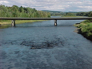
The Saint John River is a 673 kilometres (418 mi) long river that flows from Northern Maine into Canada, and runs south along the western side of New Brunswick, emptying into the Atlantic Ocean in the Bay of Fundy. Eastern Canada's longest river, its drainage basin is one of the largest on the east coast at about 55,000 square kilometres (21,000 sq mi).

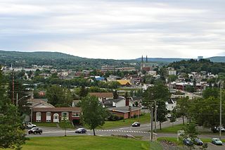
Maine is a state in the New England region of the northeastern United States. Maine is the 12th smallest by area, the 9th least populous, and the 38th most densely populated of the 50 U.S. states. It is bordered by New Hampshire to the west, the Atlantic Ocean to the southeast, and the Canadian provinces of New Brunswick and Quebec to the northeast and northwest respectively. Maine is the easternmost state in the contiguous United States, and the northernmost state east of the Great Lakes. It is known for its jagged, rocky coastline; low, rolling mountains; heavily forested interior; and picturesque waterways, as well as its seafood cuisine, especially lobster and clams. There is a humid continental climate throughout most of the state, including in coastal areas such as its most populous city of Portland. The capital is Augusta.
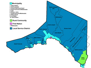
Sites included in the decentralized unit include:
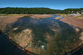
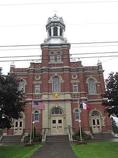
 The Acadian Landing Site, also known as the Acadian Cross Historic Shrine, is a site historically significant to the French-American Acadian population of far northern Maine. Located on the southern bank of the Saint John River east of Madawaska and marked by a large marble cross, it is the site traditionally recorded as the landing point of the first Acadians to settle this region of the upper Saint John River. The site was listed on the National Register of Historic Places in 1973.  Fort Kent State Historic Site is a Maine state park in the town of Fort Kent, Maine. Located at the confluence of the Fish and Saint John Rivers, it includes Fort Kent, the only surviving American fortification built during border tensions with neighboring New Brunswick known as the Aroostook War. The park features an original log blockhouse, which is open for visits in the summer. The fort was added to the National Register of Historic Places in 1969 and declared a National Historic Landmark in 1973.  The Fort Kent Railroad Station is a historic railroad station at Main and Market Streets in Fort Kent, Maine. It was built in 1902 by the Fish River Railroad, a line that was used in service until 1979. The station is now home to a museum operated by the Fort Kent Historical Society, dedicated to the local history of the railroad and its influence on the region. The building was listed on the National Register of Historic Places on April 21, 1989. |
 The Acadian Village is a museum of Acadian heritage on United States Route 1 in Van Buren, Maine. The museum includes a complex of six historic buildings in which the life and work of 19th-century French-Americans is showcased; this complex has been listed on the National Register of Historic Places. The museum is open daily between June to September.  The Musée Culturel du Mont-Carmel is a museum of local history on United States Route 1 in Grand Isle, Maine. It is located in the former Our Lady of Mount Carmel Catholic Church, one of the only surviving 19th-century Acadian churches in northern Maine. The architecturally distinctive building was listed on the National Register of Historic Places in 1973.  The Frenchville Railroad Station and Water Tank are a historic railroad museum property in Frenchville, Maine. The station and water tank were built in 1910 by the Bangor & Aroostook Railroad (B&A) and were added to the National Register of Historic Places on June 20, 1995. The station was retired in 1971. The water tower became obsolete in 1958 when the diesel locomotive replaced the steam locomotive. The Town of Frenchville purchased the water tank from Bangor & Aroostook Railroad and used it as a water reservoir for the fire department until 1981. The Frenchville Historical Society took over maintenance of the site in 1985. |