
Aroostook County is a county in the U.S. state of Maine along the Canada–U.S. border. As of the 2020 census, the population was 67,105. Its county seat is Houlton, with offices in Caribou and Fort Kent.
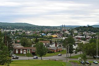
Edmundston is a city in Madawaska County, New Brunswick, Canada.

The Aroostook War, or the Madawaska War, was a military and civilian-involved confrontation in 1838–1839 between the United States and the United Kingdom over the international boundary between the British colony of New Brunswick and the U.S. state of Maine. The term "war" was rhetorical; local militia units were called out but never engaged in actual combat. The event is best described as an international incident.

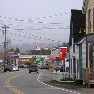
Fort Kent is a town in Aroostook County, Maine, United States, situated at the confluence of the Fish River and the Saint John River, on the border with New Brunswick, Canada. The population was 4,067 in the 2020 census. Fort Kent is home to an Olympic biathlete training center, an annual CAN-AM dogsled race, and the Fort Kent Blockhouse, built in reaction to the Aroostook War and in modern times designated a national historic site. Principal industries include agriculture and textiles. Fort Kent is the northern terminus of U.S. 1 and the ending point of the Northern Forest Canoe Trail.
Saint Croix Island, long known to locals as Dochet Island, is a small uninhabited island in Maine near the mouth of the Saint Croix River that forms part of the Canada–United States border separating Maine from New Brunswick. The island is in the heart of the traditional lands of the Passamaquoddy people who, according to oral tradition, used it to store food away from the dangers of mainland animals. The island was the site of an early attempt at French colonization by Pierre Dugua, Sieur de Mons in 1604. In 1984 it was designated by the United States Congress as Saint Croix Island International Historic Site. There is no public access to the island, but there is a visitor contact station on the U.S. mainland and a display on the Canadian mainland opposite the island.

The Saint John River is a 673-kilometre-long (418 mi) river that flows from Northern Maine into Canada, and runs south along the western side of New Brunswick, emptying into the Atlantic Ocean in the Bay of Fundy. Eastern Canada's longest river, its drainage basin is one of the largest on the east coast at about 55,000 square kilometres (21,000 sq mi).
Grand Falls is a town in northwestern New Brunswick, Canada, on the Saint John River. Its name comes from a waterfall created by a series of rock ledges over which the river drops 23 metres (75 ft).

The Republic of Madawaska was a putative republic in the northwest corner of Madawaska County, New Brunswick and adjacent areas of Aroostook County in the US state of Maine and of Quebec. The word "Madawaska" comes from the Miꞌkmaq words madawas and kak (porcupine). Thus, the Madawaska is "the country of the porcupine". The Madawaska River which flows into the Saint John River at Edmundston, New Brunswick, and Madawaska, Maine, flows through the region.
The New Brunswick Railway Company Limited (NBR) is currently a Canadian non-operating railway and land holding company headquartered in Saint John, New Brunswick that is part of Irving Transportation Services, a division within the J.D. Irving Limited (JDI) industrial conglomerate. It is not to be confused with another JDI company, New Brunswick Southern Railway (NBSR), established in 1995, which is an operational railway and considered a sister company of the NBR.
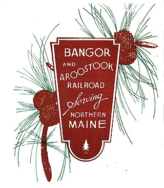
The Bangor and Aroostook Railroad was a United States railroad company that brought rail service to Aroostook County in northern Maine. Brightly-painted BAR boxcars attracted national attention in the 1950s. First-generation diesel locomotives operated on BAR until they were museum pieces. The economic downturn of the 1980s, coupled with the departure of heavy industry from northern Maine, forced the railroad to seek a buyer and end operations in 2003. It was succeeded by the Montreal, Maine and Atlantic Railway.
St. Peter's is a small incorporated village located on Cape Breton Island in Richmond County, Nova Scotia, Canada.

The history of New Brunswick covers the period from the arrival of the Paleo-Indians thousands of years ago to the present day. Prior to European colonization, the lands encompassing present-day New Brunswick were inhabited for millennia by the several First Nations groups, most notably the Maliseet, Mi'kmaq, and the Passamaquoddy.
Acadian House may refer to:

Fort Kent, located at the confluence of the Fish and Saint John rivers in the town of Fort Kent, Maine, United States, is the only surviving American fortification built during the border tensions with neighboring New Brunswick known as the Aroostook War. It is preserved as the Fort Kent State Historic Site, which features an original log blockhouse that is open for visits in the summer. The fort was added to the National Register of Historic Places in 1969 and declared a National Historic Landmark in 1973.

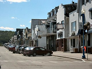
Madawaska is a town in Aroostook County, Maine, United States. The population was 3,867 at the 2020 census. Madawaska is opposite Edmundston, Madawaska County in New Brunswick, Canada, to which it is connected by the Edmundston–Madawaska Bridge over the Saint John River. The majority of its residents speak French; 83.4% of the population speak French at home.

St. David Catholic Church is a historic church at 774 Main Street in Madawaska, Maine. Built in 1911, it is an architecturally distinctive blend of Baroque revival and Italian Renaissance revival architecture. The congregation was the first separate Roman Catholic congregation established in Madawaska, the result of many years' struggle, after the international border divided the French Catholic community here in 1842. The building was listed on the National Register of Historic Places in 1973.
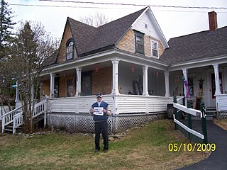
The Isaie and Scholastique Martin House at 137 Saint Catherine Street in Madawaska, Maine, is a well-preserved example of an Acadian log house built following traditional regional techniques. The house was listed on the National Register of Historic Places in 2009.
The Jean-Baptiste Daigle House is a historic house at 4 Dubé Street in Fort Kent, Maine. Built c. 1840, it is a rare surviving example of an Acadian log house, and the only one known to be near its original location. It was built by one of a father-son pair, each named Jean-Baptiste Daigle, and moved a short distance about 20 years after its construction. It is now covered by weatherboard siding, obscuring its log structure. The house was listed on the National Register of Historic Places in 2013.

The Musée Culturel du Mont-Carmel is a museum of local history on United States Route 1 in Grand Isle, Maine. It is located in the former Our Lady of Mount Carmel Catholic Church, one of the only surviving 19th-century Acadian churches in northern Maine. The architecturally distinctive building was listed on the National Register of Historic Places in 1973.

Wolastoq, changed in 1604 by Samuel de Champlain to Fleuve Saint-Jean, is a river flowing within the Dawnland region for approximately 418 miles (673 km) from headwaters in the Notre Dame Mountains near the Maine-Quebec border through New Brunswick to the northwest shore of the Bay of Fundy. The river and its tributary drainage basin formed the territorial countries of the Wolastoqiyik and Passamaquoddy First Nations prior to European colonization, and it remains a cultural centre of the Wabanaki Confederacy to this day.


