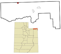
Manila, Utah

Last updated
Manila, Utah
Daggett County Utah incorporated and unincorporated areas Manila highlighted.svg
Location in Daggett County and the state of Utah
Map of USA UT.svg
Location of Utah in the United States
Coordinates: 40°59′33″N109°43′10″W / 40.99250°N 109.71944°W / 40.99250; -109.71944 Coordinates: 40°59′33″N109°43′10″W / 40.99250°N 109.71944°W / 40.99250; -109.71944
CountryUnited States
State Utah
County Daggett
Founded1898
Incorporated 1936
Named for Manila [1]
Government
   Mayor David Coombs
Area
[2]
  Total1.03 sq mi (2.68 km2)
  Land1.03 sq mi (2.68 km2)
  Water0.00 sq mi (0.00 km2)
Elevation
[3]
6,348 ft (1,935 m)
Population
 (2020)
  Total308
  Density296.62/sq mi (114.50/km2)
Time zone UTC−7 (Mountain (MST))
  Summer (DST) UTC−6 (MDT)
ZIP code
84046
Area code 435
FIPS code 49-47620 [4]
GNIS feature ID1443126 [3]
Website www.manilautah.com

Manila is a small city located on the northern edge of Daggett County, Utah, United States, just south of the Wyoming border. The town is at the junction of State Route 43 and State Route 44, and is the county seat of Daggett County. [5] Nearby sites include the Flaming Gorge National Recreation Area and the Flaming Gorge Reservoir just east of town, and to the south is Ashley National Forest, which includes Kings Peak (13,528 ft), the highest point in Utah.

Contents

The population of Manila was 310 at the 2010 census. [6] The settlement was named in 1898, commemorating the American naval victory at the Battle of Manila Bay [7] in the Philippines.

Daggett County courthouse in Manila Daggett County Courthouse, Manila, Utah.jpg
Daggett County courthouse in Manila
Map of the city limits and surrounding area Manila, Utah map.svg
Map of the city limits and surrounding area

Demographics

Historical population
CensusPop.
1910 196
1920 2128.2%
1930 25620.8%
1950 147
1960 329123.8%
1970 226−31.3%
1980 27220.4%
1990 207−23.9%
2000 30848.8%
2010 3100.6%
2019 (est.)307 [8] −1.0%
U.S. Decennial Census [9]

As of the census [4] of 2000, there were 308 people, 105 households, and 66 families residing in the town. The population density was 379.3 people per square mile (146.8/km2). There were 401 housing units at an average density of 493.9 per square mile (191.1/km2). The racial makeup of the town was 91.56% White, 1.95% African American, 0.97% Native American, 4.55% from other races, and 0.97% from two or more races. Hispanic or Latino of any race were 9.09% of the population.

There were 105 households, out of which 21.0% had children under the age of 18 living with them, 51.4% were married couples living together, 6.7% had a female householder with no husband present, and 37.1% were non-families. 34.3% of all households were made up of individuals, and 11.4% had someone living alone who was 65 years of age or older. The average household size was 2.20 and the average family size was 2.83.

In the town, the population was spread out, with 15.9% under the age of 18, 11.7% from 18 to 24, 28.9% from 25 to 44, 27.3% from 45 to 64, and 16.2% who were 65 years of age or older. The median age was 40 years. For every 100 females, there were 170.2 males. For every 100 females age 18 and over, there were 194.3 males.

The median income for a household in the town was $26,458, and the median income for a family was $28,250. Males had a median income of $23,333 versus $15,833 for females. The per capita income for the town was $12,184. About 5.5% of families and 6.2% of the population were below the poverty line, including 9.3% of those under the age of 18 and 4.2% of those 65 or over.

Flaming Gorge National Recreation Area south of Manila Flaming Gorge (National Recreational Area) (7063604715).jpg
Flaming Gorge National Recreation Area south of Manila

Geography and climate

Manila is located in northeastern Utah, north of the Uinta Mountains and west of the Flaming Gorge Reservoir on the Green River. The northern border of the town is the Wyoming state line.

Manila has five streets which run east to west. The southernmost, and main east-west street, is Utah State Route 43, with the remaining four streets numbered sequentially south to north (1st through 4th Street). The primary north-south street is Main Street, and subsequent north-south streets in Manila are also numbered, with 1st East Street through 5th East Street to the east and 1st and 2nd West Street to the west. State Route 43 runs northeast 2.5 miles (4.0 km) to the Wyoming border, whereupon Wyoming Highway 530 continues north 44 miles (71 km) to the city of Green River. In the other direction from Manila, Route 43 leads west then north 8 miles (13 km) to the Wyoming border, beyond which Wyoming Highway 414 leads 45 miles (72 km) to Fort Bridger. Utah State Route 44 (Main Street) leads south then east from Manila 28 miles (45 km) to U.S. Route 191 near Red Canyon.

According to the United States Census Bureau, Manila has a total area of 0.89 square miles (2.3 km2), all land. [6]

Climate

Manila has a cold semi-arid climate (Köppen BSk).

Climate data for Manila, Utah, 1991–2020 normals, extremes 1911–present
MonthJanFebMarAprMayJunJulAugSepOctNovDecYear
Record high °F (°C)66
(19)
67
(19)
73
(23)
84
(29)
94
(34)
98
(37)
102
(39)
97
(36)
96
(36)
98
(37)
76
(24)
65
(18)
102
(39)
Mean maximum °F (°C)49.7
(9.8)
54.7
(12.6)
64.5
(18.1)
73.1
(22.8)
80.8
(27.1)
87.8
(31.0)
91.3
(32.9)
89.3
(31.8)
83.9
(28.8)
74.7
(23.7)
63.4
(17.4)
52.9
(11.6)
91.8
(33.2)
Average high °F (°C)35.5
(1.9)
38.8
(3.8)
49.1
(9.5)
55.5
(13.1)
65.3
(18.5)
75.9
(24.4)
82.5
(28.1)
80.7
(27.1)
71.6
(22.0)
59.7
(15.4)
45.4
(7.4)
34.1
(1.2)
57.8
(14.4)
Daily mean °F (°C)23.8
(−4.6)
26.8
(−2.9)
36.3
(2.4)
42.9
(6.1)
52.0
(11.1)
60.8
(16.0)
68.2
(20.1)
65.9
(18.8)
57.3
(14.1)
45.7
(7.6)
33.3
(0.7)
23.8
(−4.6)
44.7
(7.1)
Average low °F (°C)12.0
(−11.1)
14.9
(−9.5)
23.6
(−4.7)
30.3
(−0.9)
38.6
(3.7)
45.7
(7.6)
53.8
(12.1)
51.1
(10.6)
43.0
(6.1)
31.6
(−0.2)
21.2
(−6.0)
13.6
(−10.2)
31.6
(−0.2)
Mean minimum °F (°C)−5.2
(−20.7)
−4.7
(−20.4)
8.4
(−13.1)
16.1
(−8.8)
23.9
(−4.5)
33.7
(0.9)
45.3
(7.4)
42.4
(5.8)
30.9
(−0.6)
16.1
(−8.8)
5.0
(−15.0)
−5.0
(−20.6)
−12.0
(−24.4)
Record low °F (°C)−33
(−36)
−33
(−36)
−20
(−29)
−6
(−21)
12
(−11)
20
(−7)
20
(−7)
27
(−3)
18
(−8)
−10
(−23)
−20
(−29)
−28
(−33)
−33
(−36)
Average precipitation inches (mm)0.51
(13)
0.55
(14)
0.55
(14)
1.02
(26)
1.56
(40)
1.19
(30)
1.08
(27)
1.32
(34)
1.04
(26)
1.53
(39)
0.53
(13)
0.58
(15)
11.46
(291)
Average snowfall inches (cm)4.2
(11)
6.4
(16)
10.2
(26)
5.9
(15)
1.7
(4.3)
0.0
(0.0)
0.0
(0.0)
0.0
(0.0)
0.4
(1.0)
1.2
(3.0)
2.5
(6.4)
5.1
(13)
37.6
(95.7)
Average extreme snow depth inches (mm)3.8
(9.7)
4.1
(10)
4.0
(10)
1.6
(4.1)
0.9
(2.3)
0.1
(0.25)
0.0
(0.0)
0.0
(0.0)
0.0
(0.0)
1.9
(4.8)
1.3
(3.3)
4.8
(12)
6.7
(17)
Average precipitation days (≥ 0.01 in)2.42.85.04.34.64.86.96.05.24.22.42.851.4
Average snowy days (≥ 0.1 in)2.52.94.21.60.30.00.00.00.10.71.92.817.0
Source 1: NOAA (precip days, snow/snow days 19812010) [10] [11]
Source 2: National Weather Service [12]

See also

Flag of Utah.svg  Utahportal

Related Research Articles

<span class="mw-page-title-main">Daggett County, Utah</span> County in Utah, United States

Daggett County is a county in the northeastern corner of the U.S. state of Utah. As of the 2020 United States Census, the population was 935, making it the least populous county in Utah. Its county seat is Manila. The county was named for Ellsworth Daggett, the first surveyor-general of Utah. The small community of Dutch John, located near the state line with Colorado and Wyoming, became an incorporated town in January 2016.

<span class="mw-page-title-main">Sweetwater County, Wyoming</span> County in Wyoming, United States

Sweetwater County is a county in southwestern Wyoming, United States. As of the 2020 United States Census, the population was 42,272, making it the fourth-most populous county in Wyoming. Its county seat is Green River. By area, it is the largest county in Wyoming. Its southern boundary line abuts the north lines of the states of Colorado and Utah.

<span class="mw-page-title-main">Wyoming, Delaware</span> Town in Delaware, United States

Wyoming is a town in Kent County, Delaware, United States. It was named after the Wyoming Valley in Pennsylvania. It is part of the Dover, Delaware, Metropolitan Statistical Area. The population was 1,313 at the 2010 census.

Hume is a town in Allegany County, New York, United States. The population was 2,094 at the 2020 census. The town is on the northern border of Allegany County.

Freedom is a town in Cattaraugus County, New York, United States. The population was 2,267 at the 2020 census. The town is in the northeast corner of Cattaraugus County.

<span class="mw-page-title-main">AuSable, New York</span> Town in New York, United States

Au Sable, or Ausable, is a town in Clinton County, New York, United States. The population was 3,146 at the 2010 census. The name is from the Ausable River that flows through the town and means "of sand".

<span class="mw-page-title-main">Roxbury, New York</span> Town in New York, United States

Roxbury is a town in Delaware County, New York, United States. The population was 2,247 at the 2020 census. The town is at the eastern end of the county.

<span class="mw-page-title-main">Pavilion, New York</span> Town in New York, United States

Pavilion is a town in Genesee County, New York, United States. The population was 2,495 at the 2010 census. The town was named after a hotel in Saratoga Springs, New York, by an early resident. The town of Pavilion is in the southeastern corner of Genesee County and is southeast of the city of Batavia.

<span class="mw-page-title-main">Java, New York</span> Town in New York, United States

Java is a town in Wyoming County, New York. The population was 2,057 at the 2010 census. The Town of Java is on the western border of Wyoming County.

<span class="mw-page-title-main">Middlebury, New York</span> Town in New York, United States

Middlebury is a town in Wyoming County, New York. The population was 1,508 at the 2000 census. The town is on the north border of the county.

<span class="mw-page-title-main">Exeter, Pennsylvania</span> Borough in Pennsylvania, United States

Exeter is a borough in the Greater Pittston-Wilkes-Barre area of Luzerne County, Pennsylvania, United States, about 10 miles (16 km) west of Scranton and a few miles north of Wilkes-Barre. It is located on the western bank of the Susquehanna River and has a total area of 5.0 square miles (12.9 km2). As of 2020, Exeter had a population of 5,513.

<span class="mw-page-title-main">Morris Township, Tioga County, Pennsylvania</span> Township in Pennsylvania, United States

Morris Township is a township in Tioga County, Pennsylvania, United States. The population was 562 at the 2020 census.

<span class="mw-page-title-main">Vernal, Utah</span> City in Utah, United States

Vernal, the county seat and largest city in Uintah County is in northeastern Utah, approximately 175 miles (280 km) east of Salt Lake City and 20 miles (32 km) west of the Colorado border. As of the 2010 census, the city population was 9,089. The population has since grown to 10,370 as of the 2018 population estimate.

<span class="mw-page-title-main">Torrey, Utah</span> Town in the state of Utah, United States

Torrey is a town located on State Route 24 in Wayne County, Utah, United States, 8 miles (13 km) from Capitol Reef National Park. As of the 2010 census, the town had a population of 182.

<span class="mw-page-title-main">Ridgefield (CDP), Connecticut</span> Census-designated place in Connecticut, United States

Ridgefield is a census-designated place (CDP) in Fairfield County, Connecticut, United States. It consists of the primary central village in the town of Ridgefield and surrounding residential areas. As of the 2010 census, the population of the CDP was 7,645, out of 24,638 in the entire town.

Portage is a town in the southwest corner of Livingston County, New York, United States. The town is at the south end of Letchworth State Park. The name of the town stems from the need to portage (carry) canoes around the falls of the Genesee River. The population of Portage was 884 at the 2010 census.

<span class="mw-page-title-main">Utah State Route 43</span>

State Route 43 (SR-43) is a state highway in the U.S. state of Utah. Running for 10.6 miles (17.1 km), the highway is a Utah connection between Wyoming Highways 414 and 530. While running east–west from border-to-border, the route passes through Manila.

<span class="mw-page-title-main">Utah State Route 44</span>

State Route 44 (SR-44) is a state highway in the U.S. state of Utah that runs from US-191 at Greendale Junction, southwest of Dutch John, to SR-43 in Manila. The route spans 27.99 miles (45.05 km) as it straddles the southern and western border of the Flaming Gorge National Recreation Area, and, along with US-191 is part of the Flaming Gorge-Uintas Scenic Byway.

<span class="mw-page-title-main">Wyoming Highway 530</span> State highway in Wyoming, United States

Wyoming Highway 530 is a 45.34-mile-long (72.97 km) state road that lies in southwestern Sweetwater County, Wyoming that runs along the west side of the Green River/Flaming Gorge Reservoir

Colebrook is a census-designated place (CDP) and the main village in the town of Colebrook, Coös County, New Hampshire, United States. The population of the CDP was 1,201 at the 2020 census, out of 2,084 in the entire town. The CDP population had dropped from 1,394 at the 2010 census.

References

  1. Van Atta, Dale (Jan 22, 1977). "You name it - there's a town for it". The Deseret News. pp. W6. Retrieved 18 October 2015.
  2. "2019 U.S. Gazetteer Files". United States Census Bureau. Retrieved August 7, 2020.
  3. 1 2 U.S. Geological Survey Geographic Names Information System: Manila
  4. 1 2 "U.S. Census website". United States Census Bureau . Retrieved 2008-01-31.
  5. "Find a County". National Association of Counties. Retrieved 2011-06-07.
  6. 1 2 "Geographic Identifiers: 2010 Demographic Profile Data (G001): Manila town, Utah". American Factfinder. U.S. Census Bureau. Archived from the original on February 13, 2020. Retrieved January 8, 2016.
  7. Van Cott, John W. (1990). Utah Place Names. Salt Lake City: University of Utah Press. p. 243. ISBN   0-87480-345-4.
  8. "Population and Housing Unit Estimates". United States Census Bureau. May 24, 2020. Retrieved May 27, 2020.
  9. "Census of Population and Housing". Census.gov. Retrieved June 4, 2015.
  10. "U.S. Climate Normals Quick Access – Station: Manila, UT (19912020)". National Oceanic and Atmospheric Administration. Retrieved November 13, 2022.
  11. "U.S. Climate Normals Quick Access – Station: Manila, UT (19812010)". National Oceanic and Atmospheric Administration. Retrieved November 13, 2022.
  12. "NOAA Online Weather Data – NWS Grand Junction". National Weather Service. Retrieved November 13, 2022.