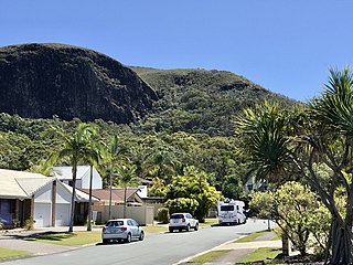
Mount Coolum is a hill in Mount Coolum National Park in a suburb of the same name in Queensland, Australia. Mount Coolum is located on the Sunshine Coast, 101 km north of Brisbane. It lies between the Sunshine Motorway to the west, the shoreline to the east, Coolum Beach township to the north and Marcoola township to the south.

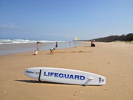
The Sunshine Coast is a peri-urban region in South East Queensland, Australia. It is the district defined in 1967 as "the area contained in the Shires of Landsborough, Maroochy and Noosa, but excluding Bribie Island". Located 100 km (62 mi) north of the centre of Brisbane in South East Queensland, on the Coral Sea coastline, its urban area spans approximately 60 km (37 mi) of coastline and hinterland from Pelican Waters to Tewantin.

Nambour is a rural town and locality in the Sunshine Coast Region, Queensland, Australia. In the 2016 census, the locality of Nambour had a population of 11,187 people.

Peregian Beach is a beach and small coastal town on the Sunshine Coast, Queensland, Australia. It is a suburb split between two local government areas with the eastern coastal in the Shire of Noosa and the western hinterland part in the Sunshine Coast Region. In the 2021 census, the suburb of Peregian Beach had a population of 4,972 people.
The Sunshine Motorway is a thirty-three kilometre Australian motorway on the Sunshine Coast region of Queensland, just north of Brisbane. It was initially a tolled motorway before these were removed in 1996 after excessive complaints regarding the need of a toll. It is part of State Route 70, which extends north a further 12.3 kilometres to Noosaville.

Sunshine Coast Airport is an Australian international airport located in Marcoola, 10 km (6.2 mi) north of Maroochydore, at the northern end of the Sunshine Coast. It is approximately 90 km (56 mi) north of centre of Brisbane, within the South East Queensland agglomeration. The airport is owned by Sunshine Coast Regional Council and is the principal and only jet-capable airport serving an urban area of nearly 400,000 residents.

Maroochydore is a coastal town in the Sunshine Coast Region, Queensland, Australia.

Bli Bli is a rural town and locality in the Sunshine Coast Region, Queensland, Australia. In the 2021 census, Bli Bli had a population of 10,750 people.

Coolum Beach is a beachside town and coastal suburb in the Sunshine Coast Region, Queensland, Australia.In the 2021 census, the suburb of Coolum Beach had a population of 9,152 people.
Doonan is a rural residential locality split between the Sunshine Coast Region and the Shire of Noosa, both in Queensland, Australia. In the 2021 census, Doonan had a population of 3,727 people.
Peregian Springs is a suburb in the Sunshine Coast Region, Queensland, Australia. In the 2016 census, Peregian Springs had a population of 7,065 people.
Pacific Paradise is a suburb of Maroochydore in the Sunshine Coast Region, Queensland, Australia. In the 2016 census, Pacific Paradise had a population of 2,190 people.
Mount Coolum is a coastal suburb in the Sunshine Coast Region, Queensland, Australia. In the 2016 census, Mount Coolum had a population of 4,265 people.

Twin Waters is a coastal suburb of Maroochydore in the Sunshine Coast Region, Queensland, Australia. In the 2016 census, Twin Waters had a population of 2,687 people.
Yandina Creek is a rural locality in the Sunshine Coast Region, Queensland, Australia. In the 2021 census, Yandina Creek had a population of 872 people.

Maroochy River is a rural hinterland locality in the Sunshine Coast Region, Queensland, Australia. In the 2021 census, Maroochy River had a population of 1,667 people.

Ninderry is a rural town and locality in the Sunshine Coast Region, Queensland, Australia. In the 2016 census, the locality of Ninderry had a population of 1,087 people.

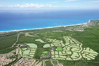
The Sunshine Coast Region is a local government area located in the Sunshine Coast region of South East Queensland, Australia.

The Maroochy River is a river in South East Queensland, Australia. The river rises from the eastern slopes of the Blackall Range and flows east through Eumundi before entering the sea at Cotton Tree, Maroochydore. Other populated centres in the catchment include Nambour, Eudlo, Yandina and Coolum.