Maxton, North Carolina

Last updated

Maxton, North Carolina
Maxton.jpg
Maxton, North Carolina
USA North Carolina location map.svg
Red pog.svg
Maxton, North Carolina
Location within the state of North Carolina
Coordinates: 34°44′11″N79°21′10″W / 34.73639°N 79.35278°W / 34.73639; -79.35278
Country United States
State North Carolina
Counties Robeson, Scotland
Incorporated1874
Government
  TypeTown Council
  MayorChristopher Bethea-McDougal
Area
[1]
  Total2.70 sq mi (6.99 km2)
  Land2.70 sq mi (6.99 km2)
  Water0.00 sq mi (0.00 km2)
Elevation
[2]
197 ft (60 m)
Population
 (2020)
  Total2,110
  Density782.06/sq mi (301.94/km2)
Time zone UTC-5 (Eastern (EST))
  Summer (DST) UTC-4 (EDT)
ZIP code
28364
Area codes 910, 472
FIPS code 37-42020 [3]
GNIS feature ID2406111 [2]
Website www.ci.maxton.nc.us

Maxton is a town in Robeson and Scotland counties, North Carolina, United States. The population was 2,426 at the time of the 2010 U.S. Census.

Contents

History

The Maxton area was first settled in the 18th century. The community was incorporated in 1874 under the name of Shoe Heel. The name changed to Tilden, in honor of 1876 U.S. President candidate Samuel J. Tilden. The name reverted to Shoe Heel in 1881 before finally settling on Maxton in 1887. [4]

As agriculture in the industry consolidated into larger corporate ventures in the 1960s, Maxton's status as a local market town declined. Far away from major transportation links such as Interstate 95, its economy continued to wane in following decades without the arrival of new industry. White people began leaving in search of better prospects, leading Maxton to become a majority-black town by 2000. [5] With a newly elected government comprising many black officials, the town began expanding its incorporated limits to include many old black neighborhoods. [6] In 2004 a highway bypass around the town was completed, depriving local businesses of the spending of travelers they had hitherto enjoyed. [7]

The Maxton Historic District was listed on the National Register of Historic Places in 1999. [8]

Educational institutions

Maxton is the location of several former, but historically important schools.

Flora MacDonald College was founded in 1841. It was the first college in North Carolina to grant degrees to women.

Charles N. Hunter a famous African-American educator who would go on to found the North Carolina Industrial Association opened his first school in Maxton. [4]

Carolina College was a Methodist college for women which operated in Maxton, North Carolina, from 1912 to 1926.

Carolina Military Academy was a military school for boys (7th - 12th grade + post graduate) which operated in Maxton, North Carolina, from 1963 to 1972. The school opened it doors to female day students during the 1970 - 1971 school year.

Confrontation between the Lumbee and the Ku Klux Klan

In January 1958, the Ku Klux Klan burned crosses on the lawns of two Lumbee families. A few nights later, on January 18, 1958, the Lumbee surrounded and disrupted a public Klan rally near Maxton, dispersing the Klansmen, some of whom left under police protection while others escaped into the woods. The confrontation made national headlines, and the Klan never again held a public rally in Robeson County, even as they gained influence over the next decade in North Carolina. The Lumbee refer to the event as the Battle of Hayes Pond, and celebrate it as a holiday. [9]

Geography

According to the United States Census Bureau, the town has a total area of 2.2 square miles (5.7 km2), all land.

Demographics

Historical population
CensusPop.Note
1890 694
1900 93534.7%
1910 1,32141.3%
1920 1,3975.8%
1930 1,386−0.8%
1940 1,65619.5%
1950 1,97419.2%
1960 1,755−11.1%
1970 1,8857.4%
1980 2,71143.8%
1990 2,373−12.5%
2000 2,5517.5%
2010 2,426−4.9%
2020 2,110−13.0%
U.S. Decennial Census [10]

2020 census

Maxton racial composition [11]
RaceNum.Perc.
White (non-Hispanic)35716.92%
Black or African American (non-Hispanic)1,28761.0%
Native American 35216.68%
Asian 90.43%
Pacific Islander 10.05%
Other/Mixed 733.46%
Hispanic or Latino 311.47%

As of the 2020 United States census, there were 2,110 people, 1,006 households, and 644 families residing in the town.

2000 census

As of the census [3] of 2000, there were 2,551 people, 985 households, and 676 families residing in the town. The population density was 1,145.3 inhabitants per square mile (442.2/km2). There were 1,073 housing units at an average density of 481.7 units per square mile (186.0 units/km2). The racial makeup of the town was 25.52% White, 64.09% African American, 7.02% Native American, 0.31% Asian, 0.16% Pacific Islander, 1.10% from other races, and 1.80% from two or more races. Hispanic or Latino of any race were 1.61% of the population.

There were 985 households, out of which 31.7% had children under the age of 18 living with them, 36.3% were married couples living together, 28.4% had a female householder with no husband present, and 31.3% were non-families. 27.9% of all households were made up of individuals, and 11.7% had someone living alone who was 65 years of age or older. The average household size was 2.58 and the average family size was 3.16.

In the town, the population was spread out, with 29.3% under the age of 18, 9.1% from 18 to 24, 26.0% from 25 to 44, 22.7% from 45 to 64, and 12.9% who were 65 years of age or older. The median age was 34 years. For every 100 females, there were 84.1 males. For every 100 females age 18 and over, there were 78.0 males.

The median income for a household in the town was $23,143, and the median income for a family was $30,039. Males had a median income of $27,259 versus $20,218 for females. The per capita income for the town was $12,783. About 23.7% of families and 28.5% of the population were below the poverty line, including 43.4% of those under age 18 and 22.3% of those age 65 or over.

Notable people

Related Research Articles

<span class="mw-page-title-main">Shallotte, North Carolina</span> Town in North Carolina, United States

Shallotte is a town in western Brunswick County, North Carolina, United States. The population was 3,675 at the 2010 census. The Shallotte River passes through the town.

<span class="mw-page-title-main">Raeford, North Carolina</span> City in North Carolina, United States

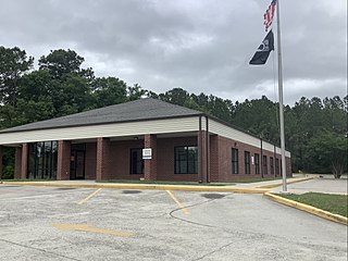
Raeford is a city in Hoke County, North Carolina, United States. Its population was 4,559 at the 2020 census. It is the county seat of Hoke County.

<span class="mw-page-title-main">Barker Ten Mile, North Carolina</span> CDP in North Carolina, United States

Barker Ten Mile is a census-designated place (CDP) in Robeson County, North Carolina, United States. The population was 952 at the 2010 census. According to local author Christopher Musselwhite, the name "Barker Ten Mile" comes from the location of the community, near Barker United Methodist Church and Ten Mile Swamp, a local waterway.

Elrod is a census-designated place (CDP) in Robeson County, North Carolina, United States. The population was 441 at the 2000 census.

<span class="mw-page-title-main">Fairmont, North Carolina</span> Town in North Carolina, United States

Fairmont is a town in Robeson County, North Carolina, United States. The population was 2,663 at the 2010 census.

<span class="mw-page-title-main">Lumber Bridge, North Carolina</span> Town in North Carolina, United States

Lumber Bridge is a town in Robeson County, North Carolina, United States. The population was 94 at the 2010 census.

<span class="mw-page-title-main">Lumberton, North Carolina</span> City in North Carolina, United States

Lumberton is a city in Robeson County, North Carolina, United States. As of 2020, its population was 19,025. It is the seat of Robeson County's government.

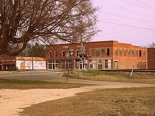
Marietta is a town located in Robeson County, North Carolina, United States. As of the 2010 census, the town had a total population of 175.

<span class="mw-page-title-main">McDonald, North Carolina</span> Town in North Carolina, United States

McDonald is a town in Robeson County, North Carolina, United States. The population was 113 at the 2010 census.

Orrum is a town in Robeson County, North Carolina, United States. The population was 91 at the 2010 census.

<span class="mw-page-title-main">Parkton, North Carolina</span> Town in North Carolina, United States

Parkton is a town in Robeson County, North Carolina, Lumberton metro area, United States. The town was so named because it was a place where farmers tied up their horses while waiting for the train. As of the 2020 census, the town population was 504.

<span class="mw-page-title-main">Pembroke, North Carolina</span> Town in North Carolina, United States

Pembroke is a town in Robeson County, North Carolina, United States. It is about 90 miles inland and northwest from the Atlantic Coast. The population was 2,823 at the 2020 census. The town is the seat of the state-recognized Lumbee tribe of North Carolina, as well as the home of the University of North Carolina at Pembroke.

<span class="mw-page-title-main">Proctorville, North Carolina</span> Town in North Carolina, United States

Proctorville is a town in Robeson County, North Carolina, United States. The population was 117 at the 2010 census.

Prospect is a census-designated place (CDP) in Robeson County, North Carolina, United States. The population was 690 at the 2000 census. Located due northeast of Pembroke, Prospect is a traditionally Methodist community, with its church members largely becoming representatives for the entirety of the American Indian-Methodist community. Prospect is noted for one of its native sons, Adolph Dial, whose contributions to American Indian Studies have led to an heightened awareness of the local Lumbee Tribe and Native Americans throughout the Southeastern United States.

Raemon is a census-designated place (CDP) in Robeson County, North Carolina, United States. The population was 212 as of the 2000 census.

<span class="mw-page-title-main">Raynham, North Carolina</span> Town in North Carolina, United States

Raynham is a town in Robeson County, North Carolina, United States. The population was 72 at the 2010 census.

<span class="mw-page-title-main">Rennert, North Carolina</span> Town in North Carolina, United States

Rennert is a town in Robeson County, North Carolina, United States. The population was 383 at the 2010 census.

<span class="mw-page-title-main">St. Pauls, North Carolina</span> Town in North Carolina, United States

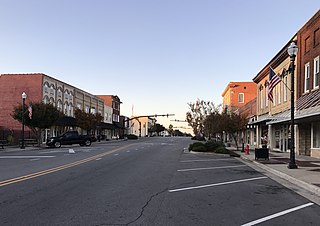
St. Pauls is a town in Robeson County, North Carolina, United States. The population was 2,035 at the 2010 census.

<span class="mw-page-title-main">Elm City, North Carolina</span> Town in North Carolina, United States

Elm City is a town in Wilson County, North Carolina, United States. The population was 1,298 in 2010.

<span class="mw-page-title-main">Red Springs, North Carolina</span> Town in North Carolina, United States

Red Springs is a town in Robeson County in the U.S. state of North Carolina. The population was 3,428 at the 2010 census.

References

  1. "ArcGIS REST Services Directory". United States Census Bureau. Retrieved September 20, 2022.
  2. 1 2 U.S. Geological Survey Geographic Names Information System: Maxton, North Carolina
  3. 1 2 "U.S. Census website". United States Census Bureau . Retrieved January 31, 2008.
  4. 1 2 3 4 5 "History". Town of Maxton. Archived from the original on July 18, 2011. Retrieved July 12, 2011.
  5. Sider 2015, pp. 5–6, 63.
  6. Sider 2015, p. 63.
  7. Sider 2015, p. 62.
  8. "National Register Information System". National Register of Historic Places . National Park Service. July 9, 2010.
  9. "Run". Run.
  10. "Census of Population and Housing". Census.gov. Retrieved June 4, 2015.
  11. "Explore Census Data". data.census.gov. Retrieved December 10, 2021.

Works cited