Meansville, Georgia

Last updated
Meansville, Georgia
Pike County Georgia Incorporated and Unincorporated areas Meansville Highlighted.svg
Location in Pike County and the state of Georgia
Coordinates: 33°3′0″N84°18′35″W / 33.05000°N 84.30972°W / 33.05000; -84.30972 Coordinates: 33°3′0″N84°18′35″W / 33.05000°N 84.30972°W / 33.05000; -84.30972
Country United States
State Georgia
County Pike
Area
[1]
  Total0.52 sq mi (1.36 km2)
  Land0.50 sq mi (1.30 km2)
  Water0.02 sq mi (0.06 km2)
Elevation
794 ft (242 m)
Population
 (2020)
  Total266
  Density530.94/sq mi (204.85/km2)
Time zone UTC-5 (Eastern (EST))
  Summer (DST) UTC-4 (EDT)
ZIP code
30256
Area code 770
FIPS code 13-50596 [2]
GNIS feature ID0332364 [3]

Meansville is a city in Pike County, Georgia, United States. The population was 192 at the 2000 census.

Contents

History

The Georgia General Assembly incorporated Meansville as a town in 1913. [4] According to tradition, the community was named for homesteader John Means. [5]

Geography

Meansville is located at 33°3′0″N84°18′35″W / 33.05000°N 84.30972°W / 33.05000; -84.30972 (33.050024, -84.309706). [6]

According to the United States Census Bureau, the city has a total area of 0.5 square miles (1.3 km2), all land.

Demographics

Historical population
CensusPop.
1900 155
1910 23350.3%
1920 229−1.7%
1930 169−26.2%
1940 19314.2%
1950 22416.1%
1960 33549.6%
1970 313−6.6%
1980 303−3.2%
1990 250−17.5%
2000 192−23.2%
2010 182−5.2%
2020 26646.2%
U.S. Decennial Census [7]

As of the census [2] of 2000, there were 192 people, 73 households, and 58 families residing in the city. The population density was 365.9 inhabitants per square mile (141.3/km2). There were 78 housing units at an average density of 148.7 per square mile (57.4/km2). The racial makeup of the city was 79.17% White, 17.19% African American, 2.08% Native American, 0.52% from other races, and 1.04% from two or more races. Hispanic or Latino of any race were 4.17% of the population.

There were 73 households, out of which 32.9% had children under the age of 18 living with them, 64.4% were married couples living together, 15.1% had a female householder with no husband present, and 19.2% were non-families. 17.8% of all households were made up of individuals, and 15.1% had someone living alone who was 65 years of age or older. The average household size was 2.63 and the average family size was 2.97.

In the city, the population was spread out, with 26.0% under the age of 18, 6.8% from 18 to 24, 29.7% from 25 to 44, 20.3% from 45 to 64, and 17.2% who were 65 years of age or older. The median age was 37 years. For every 100 females, there were 95.9 males. For every 100 females age 18 and over, there were 94.5 males.

The median income for a household in the city was $33,125, and the median income for a family was $38,750. Males had a median income of $26,875 versus $21,406 for females. The per capita income for the city was $16,908. About 4.4% of families and 5.8% of the population were below the poverty line, including 10.6% of those under the age of eighteen and none of those 65 or over.

Education

Meansville Public Schools are part of the Pike County School District. The school district has one Pre-K building (lottery funded), one primary school (K-2), one elementary school (3-5), one middle school (6-8), a ninth grade academy and two high schools.

Michael Duncan, Ed. D. is the Superintendent of Schools. [8]

Related Research Articles

<span class="mw-page-title-main">Spalding County, Georgia</span> County in Georgia, United States

Spalding County is a county located in the west central portion of the U.S. state of Georgia. As of the 2010 census, the population was 64,073. The county seat is Griffin. The county was created December 20, 1851 and named for former United States representative and senator Thomas Spalding.

<span class="mw-page-title-main">Seminole County, Georgia</span> County in Georgia, United States

Seminole County is a county located in the southwestern corner of U.S. state of Georgia. As of the 2010 census, the population was 8,729. The county seat is Donalsonville.

<span class="mw-page-title-main">Pike County, Georgia</span> County in Georgia, United States

Pike County is a county located in the west central portion of the U.S. state of Georgia. As of the 2010 census, the population was 17,869. The county seat is Zebulon.

<span class="mw-page-title-main">Meriwether County, Georgia</span> County in Georgia, United States

Meriwether County is a county located in the west central portion of the U.S. state of Georgia. As of the 2010 census, the population was 21,992. The county seat is Greenville, home of the Meriwether County Courthouse. The county was formed on December 14, 1827, as the 73rd county in Georgia. It was named for David Meriwether, a general in the American Revolutionary War and member of Congress from Georgia.

<span class="mw-page-title-main">DeLand Southwest, Florida</span> CDP in Florida, United States

DeLand Southwest is an unincorporated census-designated place located in Volusia County, Florida, United States. The population was 1,056 at the 2020 census.

<span class="mw-page-title-main">Newton, Georgia</span> City in Georgia, United States

Newton is a city in Baker County, Georgia, United States. As of the 2020 census, the city population was 602. The city is the county seat of Baker County.

<span class="mw-page-title-main">Edison, Georgia</span> City in Georgia, United States

Edison is a city in Calhoun County, Georgia, United States. Per the 2020 census, the population was 1,230. The Edison Commercial Historic District is listed on the National Register of Historic Places.

<span class="mw-page-title-main">Lake City, Georgia</span> City in Georgia, United States

Lake City is a city in Clayton County, Georgia, United States. The population was 2,612 at the 2010 census.

<span class="mw-page-title-main">Panthersville, Georgia</span> CDP in Georgia, United States

Panthersville is a census-designated place (CDP) in DeKalb County, Georgia, United States. The population was 9,749 at the 2010 census.

<span class="mw-page-title-main">Union City, Georgia</span> City in Georgia, United States

Union City is a city in Fulton County, Georgia, United States. The population was 19,456 at the 2010 census.

<span class="mw-page-title-main">Hampton, Georgia</span> City in Georgia, United States

Hampton is a city in southwestern Henry County, Georgia, United States. As of the 2010 census, the city had a population of 6,987, up from 3,857 at the 2000 census. By 2018 the estimated population was 7,922. "Hampton" mailing addresses outside the city limits reach into rural parts of eastern Clayton County and northern Spalding County. It is a southeastern suburb in the Atlanta metropolitan area.

<span class="mw-page-title-main">Greenville, Georgia</span> City in Georgia, United States

Greenville is a city and the county seat of Meriwether County, Georgia, United States. The population was 876 at the 2010 census. The city is located 54.9 miles (88.4 km) southwest of Atlanta and, as such, is part of the Atlanta metropolitan area.

<span class="mw-page-title-main">Pelham, Georgia</span> City in Georgia, United States

Pelham is a city in Mitchell County, Georgia, United States. The population was 3,898 at the 2010 census. Pelham is at the crossroads of US 19 and State Route 93 and is approximately 38 miles (61 km) south of Albany and about 26 miles (42 km) north of Thomasville. Pelham is well-known for its agriculture, with vast farming of cotton and pecans in the area.

<span class="mw-page-title-main">Concord, Georgia</span> Town in Georgia, United States

Concord is a town in Pike County, Georgia, United States. The population was 375 at the 2010 census.

<span class="mw-page-title-main">Hilltop, Georgia</span> CDP in Georgia, United States

Hilltop is a census-designated place (CDP) in Pike County, Georgia, United States. The population was 401 at the 2000 census.

<span class="mw-page-title-main">Molena, Georgia</span> City in Georgia, United States

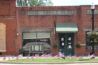
Molena is a city in Pike County, Georgia, United States. The population was 475 at the 2000 census.

<span class="mw-page-title-main">Williamson, Georgia</span> City in Georgia, United States

Williamson is a city in Pike County, Georgia, United States. The population was 352 at the 2010 census.

<span class="mw-page-title-main">Zebulon, Georgia</span> City in Georgia, United States

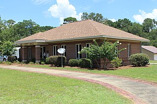
Zebulon is a city in Pike County, Georgia, United States. The population was 1,174 at the 2010 census. The city is the county seat of Pike County. The city and county were named after explorer Zebulon Pike.

<span class="mw-page-title-main">Leacock Township, Lancaster County, Pennsylvania</span> Township in Pennsylvania, United States

Leacock Township is a township in east central Lancaster County, Pennsylvania, United States. As of the 2020 census the population of the township was 5,652, up from 5,220 at the 2010 census. The township has a large Amish and Mennonite population.

<span class="mw-page-title-main">Locust Grove, Georgia</span> City in Georgia, United States

Locust Grove is a city in Henry County, Georgia, United States. The population was 5,402 at the 2010 census, up from 2,322 in 2000. Some unincorporated communities such as Luella and many rural areas surround Locust Grove, and those communities have Locust Grove postal addresses.

References

  1. "2020 U.S. Gazetteer Files". United States Census Bureau. Retrieved December 18, 2021.
  2. 1 2 "U.S. Census website". United States Census Bureau . Retrieved 2008-01-31.
  3. "US Board on Geographic Names". United States Geological Survey. 2007-10-25. Retrieved 2008-01-31.
  4. Acts and Resolutions of the General Assembly of the State of Georgia. Clark & Hines, State Printers. 1913. p. 1055.
  5. Krakow, Kenneth K. (1975). Georgia Place-Names: Their History and Origins (PDF). Macon, GA: Winship Press. p. 145. ISBN   0-915430-00-2.
  6. "US Gazetteer files: 2010, 2000, and 1990". United States Census Bureau. 2011-02-12. Retrieved 2011-04-23.
  7. "Census of Population and Housing". Census.gov. Retrieved June 4, 2015.
  8. "Pike County Schools". Pike County Schools. Retrieved 2012-06-30.