Prescott, Ontario is a small town on the north shore of the Saint Lawrence River in the United Counties of Leeds and Grenville, Canada. In 2021, the town had a population of 4,078. The Ogdensburg–Prescott International Bridge, 5 kilometres (3.1 mi) east of Prescott at Johnstown, connects the town with Ogdensburg, New York. The town is about an hour from both Ottawa and Kingston.
Whitewater Region is a township on the Ottawa River in Renfrew County, located within the scenic Ottawa Valley in eastern Ontario, Canada. Whitewater Region is made up of the former municipalities of Beachburg, Cobden, Ross and Westmeath, which were amalgamated into the current township on January 1, 2001.
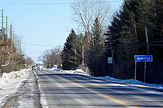
Edwards is a dispersed rural community at the headwaters of Bear Brook in the Osgoode Ward of Ottawa, Ontario, Canada. According to the Canada 2011 Census, the surrounding blocks had a population of 346.

Orléans is a federal electoral district in Ottawa, Ontario, Canada, that has been represented in the House of Commons of Canada since 1988.

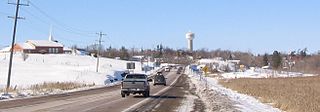
Greely is a suburban-rural community in Ottawa, Ontario, Canada. Located south of the city in Osgoode Ward, it was part of the Township of Osgoode prior to amalgamation in 2001. Greely is currently the largest rural village in terms of land area and the third largest in terms of population in the City of Ottawa. According to the Greely Community Association, it is bounded on the east by Sale Barn Road and Greyscreek Road, on the north by Mitch Owens on the west by Manotick Station Road, and on the south by Snake Island Road. According to the Canada 2011 Census, the population within these boundaries was 9,049.

The Regional Municipality of Ottawa–Carleton was a Regional Municipality and Census Division in Ontario, Canada, that existed between January 1, 1969, and January 1, 2001, and was primarily centred on the City of Ottawa. It was created in 1969 by restructuring Carleton County and annexing Cumberland Township from the United Counties of Prescott and Russell into the newly created Region of Ottawa–Carleton.

Orleans is a suburb of Ottawa, Ontario, Canada. It is located in the east end of the city along the Ottawa River, about 16 km (10 mi) from Downtown Ottawa. The Canada 2021 Census determined that Orléans' population was 125,937. Prior to being amalgamated into Ottawa in 2001, the community of Orléans was spread over two municipal jurisdictions, the eastern portion being in the pre-amalgamation City of Cumberland, the western portion in the City of Gloucester. According to the 2021 census, 75,453 people lived in the Cumberland portion of Orleans, while 50,484 people lived in the Gloucester portion. Today, Orléans spans the municipal wards of Orléans, Innes, and Cumberland. Orléans contains a significant francophone population.

Stittsville is a suburban community, part of the Canadian capital of Ottawa, Ontario. It is within the former Goulbourn Township. A part of the National Capital Region, Stittsville is immediately to the southwest of Kanata, adjacent to Richmond and about 20 km (12 mi) west of Downtown Ottawa. The urban part of the community corresponds to Stittsville Ward on Ottawa City Council, and has been represented by Glen Gower since 2018. As of 2021, Stittsville ward had a population of 46,430.

Osgoode Township High School is an Ottawa-Carleton District School Board high school in Ottawa, Ontario, Canada. It is located in the rural town of Metcalfe. The school was opened in 1920 as part of the Carleton Board of Education. It joined the new OCDSB in 1944 when the Carleton Board of Education merged with the Ottawa Board of Education. The school's motto 'Semper d altiora nitamur' means 'Always, we strive for higher'.

Osgoode Township is a former township that is now a part of the city of Ottawa, Ontario, Canada. The township along the Rideau River was established in 1798 and incorporated in 1850. It was an independent township in Carleton County until its amalgamation with the city in 2001. It remains a largely rural area with only some 23,285 inhabitants as of the 2016 census. As of the Canada 2021 Census, this had increased to 24,199. On Ottawa city council it is represented by George Darouze.

Carleton is a federal electoral district in Ontario, Canada, represented in the House of Commons of Canada from 1867 to 1968 and since 2015. It was represented in the Legislative Assembly of Upper Canada from 1821 to 1840 and in the Legislative Assembly of the Province of Canada from 1841 until 1866.
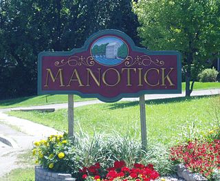
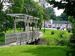
Manotick is a community in Rideau-Jock Ward in the rural south part of the City of Ottawa, Ontario, Canada. It is a suburb of the city, located on the Rideau River, immediately south of the suburbs Barrhaven and Riverside South, about 25 km (16 mi) from downtown Ottawa. It was founded by Moss Kent Dickinson in 1864. He named the village 'Manotick', after the Algonquin word for 'island'. It has been part of the City of Ottawa since amalgamation in 2001. Prior to that, it was located in Rideau Township. According to the Canada 2016 Census, Manotick had a population of 4,486.
Osgoode is a population centre in Osgoode Ward in the rural south end of Ottawa, Ontario, Canada. It is located just 2 km east of the Rideau River. Until amalgamation in 2001, it was located in Osgoode Township. According to the Canada 2016 Census Osgoode had a population of 2,578.

North Gower Township is a former and now geographic township in eastern Ontario, Canada, now located in Ottawa. It contains the communities of Manotick and North Gower.
North Gower is a small village in eastern Ontario, originally part of North Gower Township, now part of the city of Ottawa. Surrounding communities include Richmond, Kemptville, Kars and Manotick. Public high school students in this area go to South Carleton High School in Richmond.

The Township of Russell is a municipal township, located south-east of Canada's capital of Ottawa in eastern Ontario, in the United Counties of Prescott and Russell, on the Castor River.
Kars is a village on the Rideau River within Rideau-Jock Ward in the city of Ottawa, Ontario. Prior to joining the city in 2000 it was part of Rideau Township.
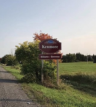
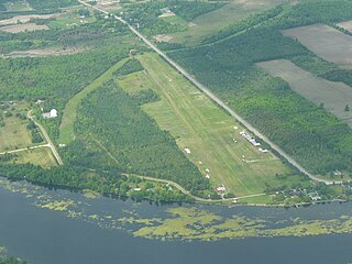
Kenmore is a rural community in Osgoode Ward in the southeastern corner of the City of Ottawa, Ontario, Canada. Prior to amalgamation in 2001, it was located in Osgoode Township. It consists of two small residential neighbourhoods and farmland. Notable features include Kenmore Bicentennial Park, Kenmore Community Centre, and the Castor River, a tributary of the South Nation River. According to the Canada 2011 Census, the population of the surrounding blocks was 501.
Vernon is a compact rural community in Osgoode Ward in the southern part of the city of Ottawa, Ontario, Canada. Prior to amalgamation in 2001, Vernon was located in Osgoode Township.