
Whittier is a neighborhood within the Powderhorn community in the U.S. city of Minneapolis, Minnesota, bounded by Franklin Avenue on the north, Interstate 35W on the east, Lake Street on the south, and Lyndale Avenue on the west. It is known for its many diverse restaurants, coffee shops and Asian markets, especially along Nicollet Avenue. The neighborhood is home to the Minneapolis Institute of Art, the Minneapolis College of Art and Design, and the Children's Theatre Company.

Uptown is a commercial district in southwestern Minneapolis in the U.S. state of Minnesota, that is centered at the Uptown Theater at the intersection of Hennepin and Lagoon avenues. It has traditionally spanned the corners of four neighborhoods, Lowry Hill East, East Calhoun, South Uptown and East Isles neighborhoods, which are all within the Calhoun Isles community. Historically, the boundaries of Uptown are Bde Maka Ska to the west, Dupont Avenue to the east, 31st Street to the south, and 28th Street to the north. Uptown is a popular destination for retail, nightlife, and cultural events, and the district was famously written about by recording artist Prince.
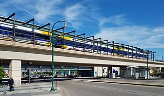
Lake Street/Midtown station, also referred locally as just Midtown station, is a Blue Line light rail station in Minneapolis, Minnesota, United States.

Lake Street is a major east-west thoroughfare between 29th and 31st streets in Minneapolis, Minnesota United States. From its western most end at the city's limits, Lake Street reaches the Chain of Lakes, passing over a small channel linking Bde Maka Ska and Lake of the Isles, and at its eastern most end it reaches the Mississippi River. In May 2020, the Lake Street corridor suffered extensive damage during local unrest over the murder of George Floyd. In August of the same year, city officials designated East Lake Street as one of seven cultural districts to promote racial equity, preserve cultural identity, and promote economic growth.

The Midtown Greenway is a 5.7-mile (9.2 km) rail trail in Minneapolis, Minnesota. It is considered under segregated cycle facilities.

The Midtown Exchange is a large commercial building located in the Midtown Phillips neighborhood, in Minneapolis, Minnesota, United States. It is the second-largest building in Minnesota in terms of leasable space, after the Mall of America. It was built in 1928 as a retail and mail-order catalog facility for Sears, which occupied it until 1994. It lay vacant until 2005, when it was transformed into multipurpose commercial space.

Longfellow is a defined community in Minneapolis, Minnesota which includes five smaller neighborhoods inside of it: Seward, Cooper, Hiawatha, Howe and Longfellow. Grouped with South Minneapolis between the city's eastern border with the Mississippi River and the Metro Blue Line, Longfellow takes its name from Longfellow neighborhood which in turn is named after Henry Wadsworth Longfellow. The renowned American poet incorporated elements into his poem The Song of Hiawatha from Henry Schoolcraft's accounts of native Dakota lore in Minnesota which included Minnehaha Falls in Longfellow's southern tip. The early reference of Highway 55 as Hiawatha Avenue, along the west border, may have influenced the naming decision when community borders were drawn in the 1960s. Hiawatha Avenue is the main thoroughfare leading north into Downtown Minneapolis and south to the Minneapolis-Saint Paul Airport.
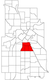
Phillips is a community in Minneapolis, just south of downtown. Phillips is a diverse area in many ways: its population includes people of many nationalities; it has a mix of residential, commercial and industrial uses; and it is home to several large employers such as Abbott Northwestern Hospital, Wells Fargo Mortgage and Allina Health Care Services along with small neighborhood businesses. Traditionally, it was both a community and a neighborhood. On May 9, 2002, Phillips neighborhood was subdivided into four smaller neighborhoods. The official neighborhoods are now known as Ventura Village, Phillips West, East Phillips, and Midtown Phillips. Though not an officially designated neighborhood, Phillips also includes the Little Earth residential area. The boundaries of the Phillips community are Interstate 94 to the north, Hiawatha Avenue to the east, Lake Street to the south, and Interstate 35W to the west.
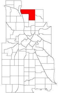
Columbia Park is a neighborhood in the Northeast community in Minneapolis.

Lyn-Lake is a commercial district in south Minneapolis. At the core is the intersection of Lake Street and Lyndale Avenue from which Lyn-Lake takes its name. This is also at the intersection of four Minneapolis neighborhoods: Whittier on the northeast, Lyndale on the southeast, South Uptown on the southwest, and Lowry Hill East on the northwest. Most residents who consider themselves part of the "Lyn-Lake neighborhood" originate from the southeast corner of the Lyndale neighborhood. Lyn-Lake was branded by the Lyn-Lake Business Association in 1999.

Robert Lilligren is an American politician and member of the Minnesota Democratic-Farmer-Labor Party. He was an elected member of the Minneapolis City Council. He was first elected in 2001, to represent the 8th Ward of the Minneapolis City Council. Following the defeat of Green Party member Dean Zimmermann, during the 2005 municipal elections, Lilligren represented the 6th Ward of the City of Minneapolis. When first elected to office, Lilligren was serving as a volunteer on eight different community boards and commissions including: vice-chair of Phillips West Neighborhood organization, the Midtown Greenway Coalition, the Hennepin County-appointed I-35W Project Advisory Committee, and as a board member for several affordable housing groups throughout South Minneapolis. He lost his re-election bid in 2013 to Abdi Warsame. He was appointed to the Metropolitan Council by Governor Tim Walz in March 2019.

King Field is a neighborhood in the Southwest community in Minneapolis, Minnesota. Its boundaries are 36th Street to the north, Interstate 35W to the east, 46th Street to the south, and Lyndale Avenue to the west. King Field, within the King Field neighborhood is a park named after Dr. Martin Luther King Jr.

Sheridan is a neighborhood in the Northeast community in Minneapolis, Minnesota.
The Midtown Farmers Market is a seasonal open-air farmers market in the Midtown area of south Minneapolis. Established in 2003, the market is held Saturdays from May through October, and Tuesdays from June through October in a parking lot in the Corcoran neighborhood. The market is a project of the Corcoran Neighborhood Organization, and is known for a selection of locally produced and organic fare. All of the products sold at the market are grown or produced in Minnesota or Wisconsin by the individual vendors. At the peak of the season, the Saturday market hosts over 70 vendors and draws over 60,000 shoppers each season.

Little Sugar Creek Greenway is a linear park and stream restoration project in Mecklenburg County, North Carolina. When completed it will consist of twenty miles of trails and paved walkways running from Cordelia Park just north of uptown Charlotte, then south through midtown Charlotte, and continuing all the way to the South Carolina state line. The Little Sugar Creek Greenway will be a key part of the Carolina Thread Trail, a regionwide network of trails that will ultimately pass through 15 counties.
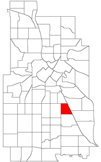
Corcoran is a neighborhood within the Powderhorn community in Minneapolis, Minnesota, United States. The neighborhood is bordered by Longfellow and Howe neighborhoods to the east, Phillips to the north, Powderhorn Park to the west and Standish to the south. Its official boundaries are East Lake Street to the north, Hiawatha Avenue to the east, East 36th Street to the south, and Cedar Avenue to the west.

Hiawatha LRT Trail is a 4.7-mile (7.6 km), multi-use path adjacent to a light-rail transit line in Minneapolis, Minnesota, United States, that is popular with bicycle commuters. Users travel along the Metro Blue Line and Hiawatha Avenue transit corridor, reaching downtown Minneapolis near an indoor sports stadium at the trail’s northern end, and reaching a bridge above Minnehaha Creek at the trail’s southern end. Hiawatha LRT Trail provides a vital link between several Minneapolis neighborhoods and the city’s downtown area.

Little Earth Trail is an approximately 1-mile (1.6 km), multi-use bicycle path in Minneapolis, Minnesota, United States, that links several neighborhoods, parks, businesses, and trails in the Phillips community. The trail begins at its northern end near the intersection of East Franklin Avenue and 16th Avenue South and eventually follows the west side of Hiawatha Avenue to the Midtown Greenway and Martin Olav Sabo Bridge. Named after the nearby Little Earth community, the shared-use pathway provides transportation and recreation opportunities, and is a frequent location of activism on social justice issues in Minneapolis.

Min Hi Line is a proposed linear park and shared-use path that would eventually re-purpose an active rail and agri-industrial corridor in the Longfellow community of Minneapolis, Minnesota, United States. Modeled after successful projects like the Atlanta Beltline and New York High Line, it would feature an approximately 3-mile (4.8 km), shared-use pathway that traverses housing, retail, commercial buildings, gardens, playgrounds, and public art installments. Two pilot projects completed in 2018 and 2019 connect the Min Hi Line corridor to trail systems at its northern and southern ends.

Minneapolis is often considered one of the top biking and walking cities in the United States due to its vast network of trails and dedicated pedestrian areas. In 2020, Walk Score rated Minneapolis as 13th highest among cities over 200,000 people. Some bicycling ratings list Minneapolis at the top of all United States cities, while others list Minneapolis in the top ten. There are over 80 miles (130 km) of paved, protected pathways in Minneapolis for use as transportation and recreation. The city's Grand Rounds National Scenic Byway parkway system accounts for the vast majority of the city's shared-use paths at approximately 50 miles (80 km) of dedicated biking and walking areas. By 2008, other city, county, and park board areas accounted for approximately 30 miles (48 km) of additional trails, for a city-wide total of approximately 80 miles (130 km) of protected pathways. The network of shared biking and walking paths continued to grow into the late 2010s with the additions of the Hiawatha LRT Trail gap remediation, Min Hi Line pilot projects, and Samatar Crossing. The city also features several natural-surface hiking trails, mountain-biking paths, groomed cross-country ski trails in winter, and other pedestrian walkways.