Milesburg, Pennsylvania

Last updated
Milesburg, Pennsylvania
Milesburg Peaks.jpg
Milesburg in December 2011
Centre County Pennsylvania Incorporated and Unincorporated areas Milesburg Highlighted.svg
Location of Milesburg in Centre County, Pennsylvania
Map of Pennsylvania highlighting Centre County.svg
Location of Centre County in Pennsylvania
USA Pennsylvania location map.svg
Red pog.svg
Milesburg
Usa edcp location map.svg
Red pog.svg
Milesburg
Coordinates: 40°56′33″N77°47′21″W / 40.94250°N 77.78917°W / 40.94250; -77.78917
Country United States
State Pennsylvania
County Centre
Settled1793
Incorporated (borough)1843
Government
  MayorClair Martin
Area
[1]
  Total0.44 sq mi (1.13 km2)
  Land0.44 sq mi (1.13 km2)
  Water0.00 sq mi (0.00 km2)
Elevation
692 ft (211 m)
Population
 (2020) [2]
  Total1,093
  Density2,501.14/sq mi (965.97/km2)
Time zone Eastern (EST)
  Summer (DST)EDT
Zip Code
16853
Area code 814
FIPS code 42-49368

Milesburg is a borough in Centre County, Pennsylvania. It is part of the State College, Pennsylvania metropolitan statistical area. The population was 1,093 at the 2020 census.

Contents

History

Milesburg and nearby Miles Township were named after Samuel Miles, [3] who co-owned the Centre Furnace Iron Works, along with Colonel John Patton and John Dunlop.

Milesburg is located near the site of a former Lenape Indian settlement known as Bald Eagle's Nest.

Iddings-Baldridge House in Milesburg was added to the National Register of Historic Places in 1977. [4]

Geography

Milesburg is located at 40°56′33″N77°47′21″W / 40.94250°N 77.78917°W / 40.94250; -77.78917 (40.942533, -77.789207). [5]

According to the U.S. Census Bureau, the borough has a total area of 0.4 square miles (1.0 km2), all land.

Demographics

Historical population
CensusPop.Note
1850 478
1860 59123.6%
1870 6001.5%
1880 6437.2%
1890 71411.0%
1900 594−16.8%
1910 531−10.6%
1920 5452.6%
1930 64418.2%
1940 6815.7%
1950 7337.6%
1960 729−0.5%
1970 1,19664.1%
1980 1,3099.4%
1990 1,144−12.6%
2000 1,1873.8%
2010 1,123−5.4%
2020 1,093−2.7%
Sources: [6] [7] [8] [2]

At the 2010 census there were 1,123 people, 459 households, and 305 families residing in the borough. The population density was 2,503.4 inhabitants per square mile (966.6/km2). There were 489 housing units at an average density of 1,090.1 per square mile (420.9/km2). The racial makeup of the borough was 98.7% White, 0.4% Black or African American, 0.1% Native American, 0.4% Asian, 0.2% other, and 0.2% from other races. Hispanic or Latino of any race were 0.3%. [7]

There were 459 households, 29.8% had children under the age of 18 living with them, 47.3% were married couples living together, 6.2% had a male householder with no wife present, 12.9% had a female householder with no husband present, and 33.6% were non-families. 26.6% of households were made up of individuals, and 8.5% were one person aged 65 or older. The average household size was 2.45 and the average family size was 2.77.

In the borough, the population was spread out, with 19.1% under the age of 18, 8.8% from 18 to 24, 25.3% from 25 to 44, 29.3% from 45 to 64, and 17.5% 65 or older. The median age was 42 years. For every 100 females there were 89.1 males. For every 100 females age 18 and over, there were 87.8 males.

The median household income was $45,588 and the median family income was $51,597. The per capita income for the borough was $19,310. About 5.0% of families and 7.2% of the population were below the poverty line, including 1.7% of those under age 18 and 3.4% of those age 65 or over.

Related Research Articles

<span class="mw-page-title-main">Ben Avon Heights, Pennsylvania</span> Borough in Pennsylvania, United States

Ben Avon Heights is a borough in Allegheny County, Pennsylvania, United States, located on a hill above the Ohio River, 9 miles (14 km) from the city of Pittsburgh. The population was 400 at the 2020 census. Ben Avon Heights is part of the Pittsburgh Metropolitan Area.

<span class="mw-page-title-main">Duncansville, Pennsylvania</span> Borough in Pennsylvania, United States

Duncansville is a borough in Blair County, Pennsylvania, United States. It is part of the Altoona, PA Metropolitan Statistical Area. Duncansville is one of the communities that comprises the Altoona Urban Area. The population was 1,258 at the 2020 census.

<span class="mw-page-title-main">Geistown, Pennsylvania</span> Borough in Pennsylvania, United States

Geistown is a borough in Cambria County, Pennsylvania, United States. It is part of the Johnstown, Pennsylvania Metropolitan Statistical Area. The population was 2,467 at the 2010 census.

<span class="mw-page-title-main">Blanchard, Centre County, Pennsylvania</span> Census-designated place in Pennsylvania, United States

Blanchard is a census-designated place (CDP) in Centre County, Pennsylvania, United States. It is part of the State College, Pennsylvania Metropolitan Statistical Area. The population was 740 at the 2010 census.

<span class="mw-page-title-main">Boggs Township, Centre County, Pennsylvania</span> Township in Pennsylvania, United States

Boggs Township is a township in Centre County, Pennsylvania, United States. It is part of the State College, Pennsylvania Metropolitan Statistical Area. It is located north of Bellefonte at approximately 40°54′48″N77°45′53″W. As of the 2010 census, the township population was 2,985.

<span class="mw-page-title-main">Julian, Pennsylvania</span> Census-designated place in Pennsylvania, United States

Julian is an unincorporated community and census-designated place (CDP) that is located in Centre County, Pennsylvania, United States. It is part of the State College, Pennsylvania Metropolitan Statistical Area. The population was 152 at the 2010 census. Most locals pronounce the name "Joo-lee-ānn".

<span class="mw-page-title-main">Millheim, Pennsylvania</span> Borough in Pennsylvania, United States

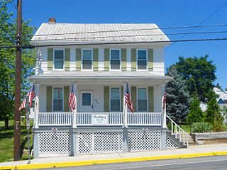
Millheim is a borough in Centre County, Pennsylvania, United States. It is part of the State College, Pennsylvania Metropolitan Statistical Area. The population was 904 at the 2010 census. The Millheim Historic District, which includes 176 contributing buildings, was listed on the National Register of Historic Places in 1986.

<span class="mw-page-title-main">Penn Township, Centre County, Pennsylvania</span> Township in Pennsylvania, United States

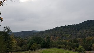
Penn Township is a township in Centre County, Pennsylvania, United States. It is part of the State College, Pennsylvania Metropolitan Statistical Area. The population was 1,214 at the 2020 census. Poe Valley State Park is in Penn Township.

<span class="mw-page-title-main">Beech Creek, Pennsylvania</span> Borough in Pennsylvania, United States

Beech Creek is a borough in Clinton County, Pennsylvania, United States. The population was 701 at the 2010 census. It is the setting for Fun Home, a 2006 graphic memoir by Alison Bechdel, who grew up there. Brittani Kline, winner of America's Next Top Model, Cycle 16, was born there.

<span class="mw-page-title-main">Blooming Valley, Pennsylvania</span> Borough in Pennsylvania, United States

Blooming Valley is a borough in Crawford County, Pennsylvania, United States. The population was 344 at the 2020 census, up from 337 at the 2010 census.

<span class="mw-page-title-main">Newburg, Cumberland County, Pennsylvania</span> Borough in Pennsylvania, United States

Newburg is a borough in Cumberland County, Pennsylvania, United States. The population was 336 at the 2010 census. It is part of the Harrisburg–Carlisle metropolitan statistical area.

<span class="mw-page-title-main">Lykens, Pennsylvania</span> Borough in Pennsylvania, United States

Lykens is a borough in Dauphin County, Pennsylvania, United States. Anthracite coal mining sustained a population of 2,762 in 1900 and 2,943 in 1910. The population was 1,865 at the 2020 census.

<span class="mw-page-title-main">Valley-Hi, Pennsylvania</span> Borough in Pennsylvania, United States

Valley-Hi is a borough in Fulton County, Pennsylvania, United States. The population was 7 at the 2020 census.

<span class="mw-page-title-main">Shade Gap, Pennsylvania</span> Borough in Pennsylvania, United States

Shade Gap is a borough in Huntingdon County, Pennsylvania, United States. The population was 105 at the 2010 census.

<span class="mw-page-title-main">Salladasburg, Pennsylvania</span> Borough in Pennsylvania, United States

Salladasburg is a borough in Lycoming County, Pennsylvania, United States. The population was 252 at the 2020 census, making it the smallest borough in Lycoming County. It is part of the Williamsport, Pennsylvania Metropolitan Statistical Area.

<span class="mw-page-title-main">Burnham, Pennsylvania</span> Borough in Pennsylvania, United States

Burnham is a borough in Mifflin County, Pennsylvania, United States. The population was 1,999 at the 2020 census.

<span class="mw-page-title-main">McVeytown, Pennsylvania</span> Borough in Pennsylvania, United States

McVeytown is a borough in Mifflin County, Pennsylvania, United States, on the west bank of the Juniata River. Formerly known as Waynesburg, it was settled in 1762, laid out in 1795, and incorporated in 1833. The population was 344 at the 2020 census. The "Father of Pennsylvania Forestry", Dr. Joseph Rothrock was born in McVeytown on April 9, 1839. He was largely responsible for the acquisition of the lands that became Pennsylvania state parks and forests, including Rothrock State Forest.

<span class="mw-page-title-main">West Leechburg, Pennsylvania</span> Borough in Pennsylvania, United States

West Leechburg is a borough in Westmoreland County, Pennsylvania, United States, along the Kiskiminetas River. The population was 1,294 at the 2010 census.

<span class="mw-page-title-main">Franklintown, Pennsylvania</span> Borough in Pennsylvania, United States

Franklintown is a borough in York County, Pennsylvania, United States. The population was 511 at the 2020 census.

<span class="mw-page-title-main">Grantley, Pennsylvania</span> CDP in Pennsylvania, United States

Grantley is a census-designated place (CDP) in York County, Pennsylvania, United States. The population was 3,628 at the 2010 census.

References

  1. "ArcGIS REST Services Directory". United States Census Bureau. Retrieved October 12, 2022.
  2. 1 2 "Census Population API". United States Census Bureau. Retrieved Oct 12, 2022.
  3. Gannett, Henry (1905). The Origin of Certain Place Names in the United States. U.S. Government Printing Office. p.  208.
  4. "National Register Information System". National Register of Historic Places . National Park Service. July 9, 2010.
  5. "US Gazetteer files: 2010, 2000, and 1990". United States Census Bureau. 2011-02-12. Retrieved 2011-04-23.
  6. "Census of Population and Housing". U.S. Census Bureau. Retrieved 11 December 2013.
  7. 1 2 "U.S. Census website". United States Census Bureau . Retrieved 2008-01-31.
  8. "Incorporated Places and Minor Civil Divisions Datasets: Subcounty Resident Population Estimates: April 1, 2010 to July 1, 2012". Population Estimates. U.S. Census Bureau. Archived from the original on 11 June 2013. Retrieved 11 December 2013.