Stadium–Armory is an Washington Metro station located in Southeast, Washington, D.C. The station was opened on July 1, 1977, and is operated by the Washington Metropolitan Area Transit Authority (WMATA). Stadium–Armory serves the Blue, Orange and Silver Lines. It is a transfer station, as this is the last station shared by the three lines before the lines diverge going east. In addition, it is the last underground station for Orange Line trains before they rise above ground, continuing its commute outside. Blue and Silver Line trains rise above ground from the station too, but re-emerge back into underground mode.

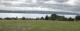
Magnuson Park is a park in the Sand Point neighborhood of Seattle, Washington, United States. At 350 acres (140 ha) it is the second-largest park in Seattle, after Discovery Park in Magnolia. Magnuson Park is located at the site of the former Naval Station Puget Sound, on the Sand Point peninsula with Pontiac and Wolf bays that juts into Lake Washington in northeast Seattle.

The Montrose Park is a public park, owned by the federal government, located in the 3000 block of R Street, Northwest, Washington, D.C., in the Georgetown neighborhood. It is located between Dumbarton Oaks Park and Oak Hill Cemetery. Both Montrose Park and Dumbarton Oaks Park were jointly listed on the National Register of Historic Places on May 28, 1967. Montrose Park obtained an individual listing in 2007. In addition to a large children's play area in the back of the park, there are two sets of tennis courts, as well as open space with footwalks and trails which lead into Rock Creek Park.

Colman Park is a 24.3-acre (98,000 m2) park in the Mount Baker neighborhood of Seattle, Washington, located just south of the Lacey V. Murrow Memorial Bridge along Lake Washington and inland to 31st Avenue S.

Fort Ethan Allen was an earthwork fortification that the Union Army built in 1861 on the property of Gilbert Vanderwerken in Alexandria County, Virginia, as part of the Civil War defenses of Washington. The remains of the fort are now within Arlington County's Fort Ethan Allen Park.

Tenley Circle is a traffic circle in the Northwest Washington, D.C. neighborhood of Tenleytown. Tenley Circle lies at the intersection of Nebraska Avenue, Wisconsin Avenue, and Yuma Street. Unlike many of the circles in Washington, Tenley's traffic pattern has evolved such that the dominant roadway, Wisconsin Avenue, can pass straight through the center instead of going around the outside circumference.
Sherman Circle is an urban park and traffic circle in the Northwest Washington, D.C. neighborhood of Petworth at the intersection of Illinois Avenue, Kansas Avenue, 7th Street, and Crittenden Street NW. The circle is named in honor of Civil War general William Tecumseh Sherman. Administered by the National Park Service's Rock Creek Park unit, Sherman Circle together with four surrounding triangular parks covers 3.44 acres (1.39 ha) and is considered by the National Park Service a "cultural landscape."

Columbia City station is a light rail station located in Seattle, Washington. It is situated between the Othello and Mount Baker stations on Line 1, which runs from Seattle–Tacoma International Airport to Downtown Seattle and the University of Washington as part of the Link light rail system. The station consists of two at-grade side platforms between South Alaska Street and South Edmunds Street in the median of Martin Luther King Jr. Way South in the Columbia City neighborhood, part of Seattle's Rainier Valley.

The Mount Vernon Triangle Historic District is a historic district in the Mount Vernon Triangle neighborhood of Washington, D.C., consisting of 22 contributing residential, commercial, and industrial buildings, and one known archaeological site. The area was once a working class neighborhood for mostly German immigrants and home to semi-industrial enterprises such as a dairy and an automobile repair shop. The Northern Liberty Market that once stood on the corner of 5th Street and K Street NW played a large role in spurring development in the surrounding area as did the streetcars on Massachusetts Avenue and New York Avenue.

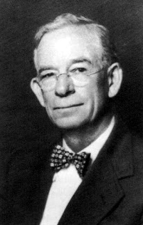
Arthur B. Heaton was an American architect from Washington, D.C. During his 50-year career Heaton designed over 1,000 commissions, including many notable buildings listed on the National Register of Historic Places (NRHP). He was the first supervising architect of the Washington National Cathedral and one of several local architects responsible for designing many of the buildings in the Burleith, Cleveland Park, Kalorama Triangle, and Woodley Park neighborhoods.
Green Valley is a neighborhood in the southern part of Arlington County, Virginia. It is bordered by Four Mile Run and Shirlington to the south, Douglas Park to the west, I-395 to the east, and Columbia Heights and the Army-Navy Country Club to the north. The southeastern corner of the neighborhood borders the City of Alexandria. The neighborhood for a time was also known as "Nauck," after former Confederate Army soldier, John D. Nauck, who purchased and subdivided 46 acres of land in the early 1870s. In 2019, the Nauck Civic Association voted to change its name to the Green Valley Civic Association in recognition of this history and requested a formal neighborhood name change from the county board back to Green Valley which was approved.

Rigo Walled Park is a neighborhood-named urban open space located on National Park Service property south of New York Avenue at L Street, NW in the Mount Vernon Square neighborhood of Washington, D.C. It is administered as part of the National Mall and Memorial Parks.

Seaton Park is a neighborhood-named pocket park located on National Park Service property at south of Massachusetts Avenue and north of I Street NW between 5th and 6th St NW in the Chinatown neighborhood of Washington, D.C.. It is also referred to as Chinatown Park.

Vincent R. Sombrotto Park is on National Park Service property at Louisiana Avenue, 1st and C Streets, NW in the Swampoodle neighborhood of Washington, D.C. across from the National Association of Letter Carriers (NALC). It is named for Vincent Sombrotto President of the NALC from 1979 to 2002.

Barnard Hill Park is an urban park located in the Washington, D.C. neighborhood of Woodridge; it also abuts the Maryland city of Mount Rainier. This 21.82 acre site is administered by the National Park Service as a part of Rock Creek Park, but is not contiguous with that park. Located on the border with Maryland, it is the eastern end of a corridor of contiguous greenspace from Fort Totten Park to Barnard Hill.
Denny Way is an east–west arterial street in downtown Seattle, Washington, United States. It forms the northern end of the Belltown street grid as well as the boundaries of Belltown, Lower Queen Anne, South Lake Union, Denny Triangle, and Cascade. The street continues east through Capitol Hill to Madrona as a minor neighborhood street, ending near Madrona Park on Lake Washington.

McAdams is a neighborhood in Wichita, Kansas, United States. A mixed industrial and residential area northeast of Downtown Wichita, it is a historical center of the city’s African American community.
The Hyde, also known as Kellogg School, is a neighborhood in Wichita, Kansas, United States. It is a mixed commercial and residential area immediately southeast of Downtown Wichita on the west side of Interstate 135.


