Stamford is a city in Fairfield County, Connecticut, United States, 34 miles outside of New York City. It is the sixth-most populous city in New England. Stamford is also the largest city in the Western Connecticut Planning Region, and Connecticut's second-most populous city, behind Bridgeport. With a population of 135,470, Stamford passed Hartford and New Haven in population as of the 2020 census. It is in the Bridgeport-Stamford-Norwalk-Danbury metropolitan statistical area, which is part of the New York City metropolitan area.

The Great Park is a public park located in Irvine, California, with a focus on sports, agriculture, and the arts. It is a non-aviation reuse of the decommissioned Marine Corps Air Station (MCAS) El Toro. The Orange County park comprises 28.8% of the total area that once made up the air base. The project was approved by the voters of Orange County in 2002 at $1.1 billion.

The Sepulveda Dam is a dry dam constructed by the U.S. Army Corps of Engineers to withhold winter flood waters along the Los Angeles River. Completed in 1941, at a cost of $6,650,561, it is located south of center in the San Fernando Valley, approximately eight miles (13 km) east of the river's source in the western end of the Valley, in Los Angeles, California.

Cove Island Park is an 83-acre park, beach and recreation area in the Cove section of Stamford, Connecticut, located on Long Island Sound.

The Greater Grand Forks Greenway is a huge greenway bordering the Red River and Red Lake River in the twin cities of Grand Forks, North Dakota and East Grand Forks, Minnesota. At 2,200 acres (9 km2), the Greenway is more than twice the size of New York City's Central Park. It has an extensive, 20-mile (32 km) system of bike paths, which are used by bikers, walkers, joggers, and rollerbladers. In 2007, the system was designated as a National Recreation Trail by the National Park Service.

Zoombezi Bay is a 22.7-acre (9.2 ha) water park owned by the Columbus Zoo and Aquarium near Powell, Ohio just north of Columbus. The park sits on the site of the former Wyandot Lake Adventure Park, which was purchased by the Columbus Zoo and Aquarium in 2006. Zoombezi Bay opened to the public on May 26, 2008, and currently ranks as one of the Midwest's most popular water parks, attracting more than 400,000 visitors annually.

Bushnell Park in Hartford, Connecticut is the oldest publicly funded park in the United States. It was conceived by the Reverend Horace Bushnell in the mid-1850s at a time when the need for open public spaces was just starting to be recognized. Today the park comprises 50 acres (20 ha) of green space, and is visited by over one million people each year. Paths through the park contribute to the East Coast Greenway.

Riverbank State Park is a 28-acre (11 ha) state park built on top of a sewage treatment facility on the Hudson River, in the New York City borough of Manhattan. It was opened in 1993. On September 5, 2017, it was renamed Denny Farrell Riverbank State Park, after longtime New York State Assembly member Denny Farrell who represented the surrounding area.

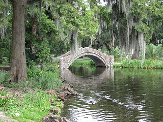
City Park, a 1,300-acre (5.3 km2) public park in New Orleans, Louisiana, is the 87th largest and 20th-most-visited urban public park in the United States. City Park is approximately 50% larger than Central Park in New York City, the municipal park recognized by Americans nationwide as the archetypal urban greenspace. Although it is an urban park whose land is owned by the City of New Orleans, it is administered by the City Park Improvement Association, an arm of state government, not by the New Orleans Parks and Parkways Department. City Park is unusual in that it is a largely self-supporting public park, with most of its annual budget derived from self-generated revenue through user fees and donations. In the wake of the enormous damage inflicted upon the park due to Hurricane Katrina, the Louisiana Department of Culture, Recreation and Tourism began to partially subsidize the park's operations.

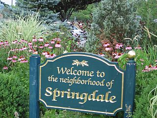
Springdale is a neighborhood in Stamford, Connecticut. Located in the eastern portion of Stamford, close to the border of Darien and New Canaan, Springdale is noted for its "small town feel". Hope Street serves as Springdale's center, and is lined with various shops, restaurants, and apartments. Much of the neighborhood also runs parallel to the New Canaan Branch, and the area is served by Springdale station.

The South End of Stamford, Connecticut is a neighborhood located at the southern end of the city, just south of the Downtown neighborhood. The South End is a peninsula bordered by Downtown Stamford and Interstate 95 to the north and almost totally by water on all other sides, with few streets linking it to other neighborhoods.

The Quinebaug River is a river in south-central Massachusetts and eastern Connecticut, with watershed extending into western Rhode Island. The name "Quinebaug" comes from the southern New England Native American term, spelled variously Qunnubbâgge, Quinibauge, etc., meaning "long pond", from qunni-, "long", and -paug, "pond". The river is one of the namesake rivers in the Quinebaug and Shetucket Rivers Valley National Heritage Corridor.

A linear park is a type of park that is significantly longer than it is wide. These linear parks are strips of public land running along canals, rivers, streams, defensive walls, electrical lines, or highways and shorelines. Examples of linear parks include everything from wildlife corridors to riverways to trails, capturing the broadest sense of the word. Other examples include rail trails, which are disused railroad beds converted for recreational use by removing existing structures. Commonly, these linear parks result from the public and private sectors acting on the dense urban need for open green space. Linear parks stretch through urban areas, coming through as a solution for the lack of space and need for urban greenery. They also effectively connect different neighborhoods in dense urban areas as a result, and create places that are ideal for activities such as jogging or walking. Linear parks may also be categorized as greenways. In Australia, a linear park along the coast is known as a foreshoreway. When being designed, linear parks appear unique as they are planned around the public's opinion of how the space will affect them.

The Pequonnock River is a 16.7-mile-long (26.9 km) waterway in eastern Fairfield County, Connecticut. Its watershed is located in five communities, with the majority of it located within Monroe, Trumbull, and Bridgeport. The river has a penchant for flooding, particularly in spring since the removal of a retention dam in Trumbull in the 1950s. There seems to be a sharp difference of opinion among historians as to just what the Indian word Pequonnock signifies. Some insist it meant cleared field or open ground; others are sure it meant broken ground; while a third group is certain it meant place of slaughter or place of destruction.

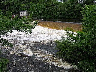
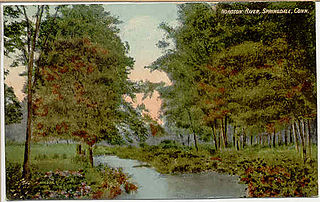
The Noroton River is a 9.4-mile-long (15.1 km) stream which forms most of the border between Stamford and Darien, Connecticut, United States. The river's headwaters are in New Canaan, Connecticut and flow into Holly Pond. It is the largest flowing body of water between the Mill River/Rippowam River to the west and the Fivemile River to the east, although Stony Brook and the Goodwives River in Darien are not much smaller.
The Mill River is a 1.25-mile-long (2.01 km) tributary of the Connecticut River in Springfield, Massachusetts. It flows from Watershops Pond to its confluence with the Connecticut River. It is referred to as "The Miracle Mile" in a 2009 master's thesis that outlines possibilities for reclaiming the river's mouth as a recreational area. As of 2011, the final 350 feet (110 m) of the river, including its mouth, is confined in a pipe underneath Interstate 91, railroad tracks and a car dealership. Many Springfield residents have bemoaned the loss of the Mill River as a recreational area, and hope to gain greater access to both it and the Connecticut River in upcoming years. As it has for over a century, today the Mill River serves as a barrier between Springfield neighborhoods. Surrounding it are some of the most densely urbanized locations in Springfield.

Park Tower Stamford is a 36-story condominium property located at 1 Broad Street in Stamford, Connecticut. Real estate developers Thomas Rich and Louis R. Cappelli began planning the project as Park Tower in February 2006; it was renamed as Trump Parc Stamford later that year, after Donald Trump joined the project, and again renamed Park Tower Stamford.

The River Arts District in Asheville, North Carolina is an area of former industrial buildings located near the French Broad River, along Riverside Drive east of Interstate 240. Numerous artists have moved into the area and produce and display their works. It is the result of RiverLink's design to redevelop the urban riverfront corridor, built and expanded from the 1989 Asheville Riverfront Plan, which won the American Planning Association Award and represents the consolidation of over 20 years of community planning.

The Scioto Mile is a collection of parks and trails along both banks of the Scioto River in Columbus, Ohio, connecting parts of the Scioto Greenway Trail with downtown Columbus and Franklinton. The nine parks cover 145 acres (59 ha).

Coolidge Park is a park located on the North Shore of Chattanooga, Tennessee, along the Tennessee River. It has an interactive water fountain, rock climbing, a pavilion, picnic amenities, a military memorial, and a 100-year old restored antique carousel. There are also docking facilities. It is also near the Walnut Street Bridge. It is also close to the city’s entertainment and art districts. It serves as a venue for concerts, festivals, fundraisers, and special events. The park is also a part of the Tennessee Riverwalk, a 13-mile public waterfront greenway that follows the Tennessee River.


