
A supplemental route is a state secondary road in the U.S. state of Missouri, designated with letters. Supplemental routes were various roads within the state which the Missouri Department of Transportation was given in 1952 to maintain in addition to the regular routes, though lettered routes had been in use from at least 1932. The four types of roads designated as Routes are:

Route 101 is a short highway in southern Missouri. The route starts at Arkansas Highway 101 at the Arkansas–Missouri state line, and travels northeastward. It travels through the city of Bakersfield, intersecting Route 142. The road then continues north to its northern terminus at U.S. Route 160 in Caulfield. The route was designated in 1941, after a supplementary route was renumbered.
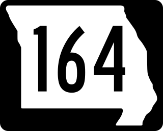
Route 164 is a state highway in the Missouri Bootheel. The route starts at U.S. Route 412 in Cardwell. The route travels eastward across the bootheel, and it goes through the towns of Arbyrd, Hornersville, Rives, and Steele. It becomes concurrent with US 61 briefly in Steele, and intersects Interstate 55 (I-55) east of the city. The route ends east of Cottonwood Point, near the Mississippi River.

Route 16 is a 16.709-mile-long (26.891 km) highway in Lewis County, Missouri. The western terminus is at Route 6 east of Lewistown. The route travels eastward, through Monticello and over a few rivers. Route 16 then intersects U.S. Route 61. The route ends at US 61 Business and Route B in Canton. The road was formerly part of Route 6, but it was rerouted in 1931. The old alignment was renumbered Route 96 that year. Ten years later, the route was renumbered to Route 16.

Route 102 is a highway in southeastern Missouri. The route starts at Route 105 near East Prairie. It travels southeastwards through farmland to Big Oak Tree State Park. The road then turns east past the entrance to the park, and ends at its eastern terminus at Route 77 in Dorena. The route was designated in 1940, as a road from the state park to a supplemental route. Route 102 replaced a large section of the supplemental route in 1961, and then was extended eastwards to a new terminus at Route 77 in 1994.

Route 162 is a state highway in the Missouri Bootheel. Its western terminus is at Route 25 in Clarkton, Dunklin County, and the route travels eastward to nearby towns of Gideon and Portageville, where it intersects U.S. Route 61 and Interstate 55 (I-55). The road then continues through rural New Madrid County and ends at a boat ramp near the Mississippi River.

Route 103 is a short highway in southeastern Missouri. Its southern terminus is at Route Z inside the Ozark National Scenic Riverways. The route travels north and intersects a few county roads as it leaves the national park. The road ends at U.S. Route 60 in a three-way junction. After being proposed in 1930, a road was built from the national park to US 60 in 1933. The gravel road was designated as Route 103, and it was paved five years later.

Route 48 is a state highway in northwestern Missouri. Its western terminus is located at U.S. Route 71 north of Savannah. The route travels eastward across the communities of Rosendale, Rea, and Whitesville. The road ends at US 169 in King City, about 20 miles (32 km) from its western terminus. The road was designated around 1926, and was completely laid down with gravel by 1936 and paved in asphalt by 1942.
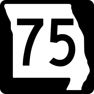
Route 75 is a short highway in Mississippi County in the U.S. state of Missouri. Its southern terminus is at Route 80, and it travels north through farmland to the town of Anniston. It then travels westward to its northern terminus at Route 105 north of East Prairie. The route was designated in 1968, after Route 77 was moved to a new alignment east of Anniston, and the remaining section was renumbered to Route 75.

Route 121 is a short highway in northwestern Missouri. It begins at U.S. Route 69 (US 69) south of Cameron, where it begins travelling eastward. The road intersects a county route and crosses over two streams. The route ends at the Wallace State Park entrance, where the road becomes Route HH after the intersection. The route was opened around 1936, serving as the connector between US 69 and the state park. The road cost $18,000 to build in 1935, and it allowed federal construction to begin at the park.

State Route 119 (SR 119) is a 10.93-mile-long (17.59 km) state highway in the U.S. state of Washington, serving Lake Cushman in Mason County within Olympic National Forest. The highway, known locally as Lake Cushman Road, travels northwest into the Olympic Mountains from U.S. Route 101 (US 101) in Hoodsport to Lake Cushman and ends at a gravel road east of the entrance to Olympic National Park on Forest Highway 24 (FFH-24). A gravel road connecting Lake Cushman to the state highway system has existed since the late 1950s and was codified into the current state highway system in 1991, prior to being completely paved by 1999.

K-26 is a 3.601-mile-long (5.795 km) state highway located entirely within Cherokee County, Kansas. It runs from an intersection with U.S. Route 166 (US-166) and US-400 northwest of the Missouri/Kansas/Oklahoma tripoint north to K-66 in Galena. The highway is maintained by the Kansas Department of Transportation (KDOT).

Highway 143 is a north–south state highway in Carroll County, Arkansas. The highway begins at US Highway 62 (US 62) and Highway 980 near Pleasant Valley and runs northwest to Missouri supplemental route H at the Missouri state line. The route is maintained by the Arkansas Department of Transportation (ArDOT).

Highway 137 is a north–south state highway in Mississippi County, Arkansas. The route runs 8.82 miles (14.19 km) from Highway 312 north to the Missouri state line.
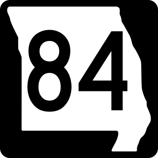
Route 84 is a state highway in the Missouri bootheel. The route starts at Arkansas Highway 90 over the St. Francis River on the Arkansas–Missouri state line. The road travels eastward to Kennett, where it becomes concurrent with U.S. Route 412. East of Kennett, the concurrent routes travel eastward on a divided highway to Hayti Heights, where the concurrency ends. Route 84 travels through Hayti Heights and Hayti, and it crosses Interstate 55 (I-55) and US 61. The route then travels southeastwards to Caruthersville, and bypasses the central area of the city. In the southern part of Caruthersville, Route 84 ends at an interchange with I-155 and US 412.

K-383 is a state highway in Kansas, United states. The highway runs 74.042 miles (119.159 km) from U.S. Route 83 (US-83) and K-23 near Selden north and east to US-183 near Woodruff, just south of the Nebraska state line. K-383 runs southwest–northeast and connects Norton with Colby to the southwest and Alma, Nebraska, to the northeast via the valley of Prairie Dog Creek, a tributary of the Republican River. The highway also serves the cities of Selden in northern Sheridan County; Dresden, Jennings, and Clayton in southeastern Decatur County; Almena in eastern Norton County; and Long Island in northern Phillips County. K-383 was assigned in 1981 over the portions of former US-383 that had not run concurrently with either US-83 or US-183. The highway was originally designated as parts of US-36 and K-22 in the mid-1920s. The entire route became US-83 and was placed on much of its modern alignment in the early 1930s, replacing the original path that followed section lines. The route was redesignated US-383 in the mid-1940s and paved from the late 1930s to the late 1940s. The highway was relocated within Norton in the late 1930s and early 1940s. Other relocations of K-383 have included the segment near Clayton in the mid-1950s, southwest of Norton in the late 1930s and again in the early 1960s, and at both ends of the highway in the early 1990s.

Mississippi Highway 37 is a state highway in central Mississippi. The route starts at U.S. Route 84 near Collins. The road travels northward through the town of Taylorsville, crossing from Covington County to Smith County. MS 37 turns northwestward and ends at MS 35 in Raleigh. The road first existed as part of MS 35, and it became a spur route of MS 35 by 1941. It was renumbered as MS 37 by 1950, and fully paved by 1952.
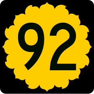
K-92 is an approximately 44-mile-long (71 km) state highway in the U.S. state of Kansas. K-92's western terminus is at K-4 south of the community of Rock Creek, and the eastern terminus is a continuation as Missouri State Route 92 at the Missouri border by the City of Leavenworth. K-92 is co-designated as U.S. Route 59 (US-59) in Oskaloosa, K-16 from Oskaloosa to McLouth, and K-7 and US-73 in Leavenworth. The majority of the route passes through rural farmland and is almost entirely a two-lane roadway, except for the overlap with K-7 and US-73 and a portion of the US-59 overlap, which are four-lane.

Mississippi Highway 47 (MS 47) is a 23.048-mile-long (37.092 km) state highway located in the U.S. state of Mississippi. The route starts at MS 50 west of West Point in Clay County. The road then travels northwest through small communities in Clay and Chickasaw counties, and it intersects MS 8 in Trebloc, Chickasaw County. MS 47 ends at Aberdeen Road near Buena Vista, and the road continues as MS 385. The route was designated around 1934, from MS 10 near West Point to MS 8 in Buena Vista, and MS 8 was rerouted south through Trebloc by 1944. MS 47 was fully paved by 1958.

Mississippi Highway 245 is a state highway located in the U.S. state of Mississippi. It is the designation for two separate sections of the old U.S. Route 45 Alternate that the state continues to maintain. The Crawford section, designated in 2007, runs south to north from US 45 Alt. back to US 45 Alt. in Lowndes County. The other section's southern terminus is at US 45 Alt. south of Okolona in Chickasaw County and the northern terminus is at MS 145 in Shannon in Lee County. Along the way this section intersects MS 41 and the eastern terminus of MS 32 in Okolona. The section from Chickasaw County to Lee County was designated in 1998, after the completion of a four-lane bypass for US 45 Alt..

