Missouri Valley, Iowa

Last updated

Missouri Valley, Iowa
Missouri Valley, IA.jpg
Harrison County Iowa Incorporated and Unincorporated areas Missouri Valley Highlighted.svg
Location of Missouri Valley, Iowa
Coordinates: 41°33′34″N95°54′09″W / 41.55944°N 95.90250°W / 41.55944; -95.90250
Country Flag of the United States (23px).png  United States
State Flag of Iowa.svg  Iowa
County Harrison
Incorporated October 30, 1871 [1]
Government
   Mayor Shawn Kelly [2]
Area
[3]
  Total3.32 sq mi (8.61 km2)
  Land3.32 sq mi (8.61 km2)
  Water0.00 sq mi (0.00 km2)
Elevation
[4]
1,001 ft (305 m)
Population
 (2020)
  Total2,678
  Density806.14/sq mi (311.21/km2)
Time zone UTC-6 (Central (CST))
  Summer (DST) UTC-5 (CDT)
ZIP code
51555
Area code 712
FIPS code 19-52860
GNIS feature ID2395356 [4]
Website http://www.cityofmissourivalley.com
Main Street, 1905 FI0005596 1905 Missouri Valley.jpg
Main Street, 1905

Missouri Valley is a city in Harrison County, Iowa, United States. The population was 2,678 at the time of the 2020 census. [5]

Contents

History

Originally, Missouri Valley was known as St. John's (Findley or Old St. Johns), and established in 1856. [6] This settlement was founded at the intersection of the Chicago & Northwestern, Sioux City & Pacific, and the Fremont, Elkhorn & Missouri Valley lines. Following the collapse of wild cat banks in 1858 and the near completion of the railroad, the town was moved 2 miles from its original location and renamed "New St. Johns". [7] The town was formally renamed a second time soon after, this time being named after the valley of the Missouri River. [8] [9]

Missouri Valley was formally laid out in 1867 when the Chicago and North Western Railway was extended to that point. [10] [8] Missouri Valley was a true railroad town in the late 1800s. The Sioux City and Pacific's headquarters was there and with it came the associated repair and machine shops, blacksmith, round house, etc. By 1896 population was approaching 4,000 and 25 passenger trains were coming in and out of Missouri Valley each day on 3 different lines. In 1900 the city adopted a resolution that the railroads were its chief industry and main sustenance. [11]

Geography

According to the United States Census Bureau, the city has a total area of 3.13 square miles (8.11 km2), all of it land. [12] [13] Missouri Valley is located within Iowa's Loess Hills. [14]

Demographics

Historical populations
YearPop.±%
1880 1,154    
1890 2,797+142.4%
1900 4,010+43.4%
1910 3,187−20.5%
1920 3,985+25.0%
1930 4,230+6.1%
1940 3,994−5.6%
1950 3,546−11.2%
1960 3,567+0.6%
1970 3,519−1.3%
1980 3,107−11.7%
1990 2,888−7.0%
2000 2,992+3.6%
2010 2,838−5.1%
2020 2,678−5.6%
Source: "U.S. Census website". United States Census Bureau . Retrieved March 29, 2020. and Iowa Data Center
Source:
U.S. Decennial Census [15] [5]

2010 census

As of the census [16] of 2010, there were 2,838 people, 1,160 households, and 707 families living in the city. The population density was 906.7 inhabitants per square mile (350.1/km2). There were 1,291 housing units at an average density of 412.5 units per square mile (159.3 units/km2). The racial makeup of the city was 97.6% White, 0.3% African American, 0.3% Native American, 0.1% Asian, 0.5% from other races, and 1.2% from two or more races. Hispanic or Latino of any race were 2.1% of the population.

There were 1,160 households, of which 32.3% had children under the age of 18 living with them, 44.4% were married couples living together, 11.5% had a female householder with no husband present, 5.1% had a male householder with no wife present, and 39.1% were non-families. 34.1% of all households were made up of individuals, and 15.7% had someone living alone who was 65 years of age or older. The average household size was 2.36 and the average family size was 2.99.

The median age in the city was 39.7 years. 24.4% of residents were under the age of 18; 8.1% were between the ages of 18 and 24; 23.8% were from 25 to 44; 24.7% were from 45 to 64; and 19% were 65 years of age or older. The gender makeup of the city was 47.7% male and 52.3% female.

2000 census

As of the census [17] of 2000, there were 2,992 people, 1,222 households, and 779 families living in the city. The population density was 982.9 inhabitants per square mile (379.5/km2). There were 1,300 housing units at an average density of 427.1 units per square mile (164.9 units/km2). The racial makeup of the city was 99.03% White, 0.03% Native American, 0.07% Asian, 0.20% from other races, and 0.67% from two or more races. Hispanic or Latino of any race were 0.70% of the population.

There were 1,222 households, out of which 30.2% had children under the age of 18 living with them, 49.5% were married couples living together, 10.1% had a female householder with no husband present, and 36.2% were non-families. 31.7% of all households were made up of individuals, and 16.9% had someone living alone who was 65 years of age or older. The average household size was 2.35 and the average family size was 2.96.

Age spread: 23.6% under the age of 18, 9.2% from 18 to 24, 28.1% from 25 to 44, 19.6% from 45 to 64, and 19.5% who were 65 years of age or older. The median age was 38 years. For every 100 females, there were 89.1 males. For every 100 females age 18 and over, there were 85.4 males.

The median income for a household in the city was $36,594, and the median income for a family was $47,250. Males had a median income of $28,109 versus $22,396 for females. The per capita income for the city was $18,031. About 3.1% of families and 5.6% of the population were below the poverty line, including 5.5% of those under age 18 and 5.3% of those age 65 or over.

Education

The community of Missouri Valley and the surrounding rural area educational needs are met by the Missouri Valley Community School District.

Saint Albert Catholic Schools in Council Bluffs takes students from Missouri Valley. [18]

Infrastructure

Transportation

Missouri Valley is located on both sides of U.S. Route 30 on the east side of Interstate 29 near exit 75. The city is also serviced by L20 a county road running north and south, and F66 a county road running east from its junction with U.S. 30. [19]

Notable people

Related Research Articles

<span class="mw-page-title-main">Sheldahl, Iowa</span> City in Iowa, United States

Sheldahl is a city in Polk, Boone, and Story counties in the U.S. state of Iowa. The population was 297 at the time of the 2020 census.

<span class="mw-page-title-main">Fairbank, Iowa</span> City in Iowa, United States

Fairbank is a city in Buchanan and Fayette counties in the U.S. state of Iowa. The population was 1,111 at the time of the 2020 census.

<span class="mw-page-title-main">Rinard, Iowa</span> City in Iowa, United States

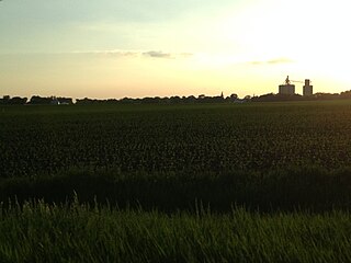
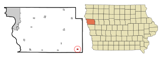
Rinard is a city in Calhoun County, Iowa, United States. The population was 38 at the time of the 2020 census.

<span class="mw-page-title-main">Somers, Iowa</span> City in Iowa, United States

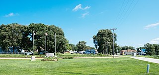
Somers is a city in Calhoun County, Iowa, United States. The population was 128 at the time of the 2020 census.

<span class="mw-page-title-main">Arion, Iowa</span> City in Iowa, United States

Arion is a city in Crawford County, Iowa, United States, along the Boyer River. The population was 97 at the 2020 census.

<span class="mw-page-title-main">Lamoni, Iowa</span> City in Iowa, United States

Lamoni is a city in Decatur County, Iowa, United States. The population was 1,969 at the time of the 2020 Census. Lamoni is the home of Graceland University, affiliated with the Community of Christ, a denomination of the Latter Day Saint movement. The city was the church's headquarters from 1880 to 1920, after which it moved to Independence, Missouri.

<span class="mw-page-title-main">Dunlap, Iowa</span> City in Iowa, United States

Dunlap is a city in Harrison and Crawford counties, Iowa, United States, along the Boyer River. The population was 1,038 at the time of the 2020 census.

<span class="mw-page-title-main">Marengo, Iowa</span> Town in Iowa, United States

Marengo is a town in and the county seat of Iowa County, Iowa, United States. It has served as the county seat since August 1845, even though it was not incorporated until July 1859. The population was 2,435 in the 2020 census, a decline from 2,535 in 2000.

<span class="mw-page-title-main">Blanchard, Iowa</span> City in Iowa, United States

Blanchard is a city in Page County, Iowa, United States. The population was 29 at the 2020 census.

<span class="mw-page-title-main">Braddyville, Iowa</span> City in Iowa, United States

Braddyville is a city in Page County, Iowa, United States. The population was 147 at the 2020 census.

<span class="mw-page-title-main">Rock Valley, Iowa</span> City in Iowa, United States

Rock Valley is a city in Sioux County, Iowa, the North Western corner of Iowa, United States, along the Rock River. The population was 4,059 at the time of the 2020 census.

<span class="mw-page-title-main">Danbury, Iowa</span> City in Iowa, United States

Danbury is a city in Woodbury County, Iowa, United States. It is part of the Sioux City, IA–NE–SD Metropolitan Statistical Area. The population was 320 at the time of the 2020 census. Danbury has two churches, St. Mary's Catholic Church and the United Methodist Church. Danbury holds a fall celebration called Corn Days during harvest.

<span class="mw-page-title-main">Rock Port, Missouri</span> City in Missouri, United States

Rock Port is a city in, and the county seat of, Atchison County, Missouri, United States. The population was 1,278 at the 2020 census.

<span class="mw-page-title-main">Alexandria, Missouri</span> City in Missouri, United States

Alexandria is a city in eastern Clark County, Missouri, United States. As of the 2020 census, its population was 105.

<span class="mw-page-title-main">Corning, Missouri</span> Village in Missouri, United States

Corning is a village in Holt County, Missouri, United States. The population was 3 at the 2020 census.

<span class="mw-page-title-main">Grain Valley, Missouri</span> City in Missouri, United States

Grain Valley is a city in Jackson County, Missouri, United States. Grain Valley is located in the Kansas City Metropolitan Area and is a suburb of Kansas City. The population was 12,854 at the 2010 census and an estimated 15,627 in 2020. It is 23 miles (37 km) east of downtown Kansas City.

<span class="mw-page-title-main">Elmer, Missouri</span> City in Missouri, United States

Elmer is a city in Macon County, Missouri, United States. The population was 51 at the 2020 census, down from 80 in 2010.

<span class="mw-page-title-main">Clearmont, Missouri</span> City in Missouri, United States

Clearmont is a city in northwest Nodaway County, Missouri, United States. The population was 158 at the 2020 census.

<span class="mw-page-title-main">Clarkson Valley, Missouri</span> City in Missouri, United States

Clarkson Valley is a city in St. Louis County, Missouri, United States. The population was 2,609 at the 2020 census.

<span class="mw-page-title-main">North English, Iowa</span> City in Iowa, United States

North English is a city located mainly in Iowa county with a small portion in Keokuk county in the U.S. state of Iowa. The population was 1,065 at the time of the 2020 census. It is named for the English River.

References

  1. "Missouri Valley, Iowa". City-Data. Retrieved May 14, 2011.
  2. "Administration". City of Missouri Valley. Retrieved July 19, 2018.
  3. "2020 U.S. Gazetteer Files". United States Census Bureau. Retrieved March 16, 2022.
  4. 1 2 U.S. Geological Survey Geographic Names Information System: Missouri Valley, Iowa
  5. 1 2 "2020 Census State Redistricting Data". census.gov. United states Census Bureau. Retrieved August 12, 2021.
  6. "GNIS Detail - Township of Saint John". geonames.usgs.gov. Retrieved July 9, 2021.
  7. "St John's Township - Harrison County Iowa History". iagenweb.org. Retrieved July 9, 2021.
  8. 1 2 Chicago and North Western Railway Company (1908). A History of the Origin of the Place Names Connected with the Chicago & North Western and Chicago, St. Paul, Minneapolis & Omaha Railways. p. 103.
  9. "Community". City of Missouri Valley, Iowa. Retrieved July 9, 2021.
  10. History of Western Iowa, Its Settlement and Growth. Western Publishing Company. 1882. pp.  309.
  11. John W. Gard. The development of Missouri Valley, Iowa to 1931.
  12. "US Gazetteer files 2010". United States Census Bureau. Archived from the original on February 20, 2011. Retrieved May 11, 2012.
  13. "US Gazetteer files: 2010, 2000, and 1990". United States Census Bureau. February 12, 2011. Retrieved April 23, 2011.
  14. "Iowa's Loess Hills". Iowa PBS. November 29, 2016. Retrieved July 6, 2021.
  15. "Census of Population and Housing". Census.gov. Retrieved June 4, 2015.
  16. "U.S. Census website". United States Census Bureau . Retrieved May 11, 2012.
  17. "U.S. Census website". United States Census Bureau . Retrieved January 31, 2008.
  18. "Home". Saint Albert Catholic Schools. February 28, 2001. Archived from the original on February 28, 2001. Retrieved April 25, 2021.
  19. "Missouri Valley, Iowa". mapquest. Retrieved May 14, 2011.