Mont Blanc Tunnel

Last updated
Mont Blanc Tunnel
Alps location map.png
Red pog.svg
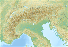
Mont Blanc Tunnel
Location in the western Alps
Overview
Other name(s)Tunnel du Mont-Blanc (French)
Traforo del Monte Bianco (Italian)
Location
  • France
  • Italy
Coordinates 45°51′14″N6°54′50″E / 45.854°N 6.914°E / 45.854; 6.914
StatusOpen
Route Route nationale francaise 205.svg RN205
Traforo T1 Italia.svg T1
Start Chamonix, Haute-Savoie, France
End Courmayeur, Aosta Valley, Italy
Operation
Work begunMay 1959 (1946)
Constructed195965
Opened19 July 1965
OperatorMBT-EEIG, controlled
by both ATMB and SITMB
TrafficAutomotive
CharacterPassenger and freight
Toll 48.- (one-way), 2020
passenger vehicle
over €300 (one-way),
three or more axles
Technical
Length11.611 km (7.215 mi)
No. of lanes 2
Operating speed50–70 km/h (31–43 mph)
Highest elevation1,395 m (4,577 ft)
center
Lowest elevation1,274 m (4,180 ft)
France (NW)
Tunnel clearance 4.35 m (14.3 ft)
Width8.6 m (28 ft)
Mont Blanc Tunnel in Italy Tunnel du mont-blanc cote italien.jpg
Mont Blanc Tunnel in Italy
Mont Blanc Tunnel in France Mont Blanc Tunnel French Side.jpg
Mont Blanc Tunnel in France
Mont Blanc Tunnel in 2008 Mont Blanc Tunnel.jpg
Mont Blanc Tunnel in 2008

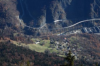
The Mont Blanc Tunnel is a highway tunnel between France and Italy, under Mont Blanc in the Alps. It links Chamonix, Haute-Savoie, France with Courmayeur, Aosta Valley, Italy, via the French Route Nationale 205 and the Italian Traforo T1 (forming the European route E25), in particular the motorways serving Geneva (A40 of France) and Turin (A5 of Italy). The passageway is one of the major trans-Alpine transport routes, particularly for Italy, which relies on this tunnel for transporting as much as one-third of its freight to northern Europe. It reduces the route from France to Turin by 50 kilometres (30 miles) and to Milan by 100 km (60 mi). Northeast of Mont Blanc's summit, the tunnel is about 15 km (10 mi) southwest of the tripoint with Switzerland, near Mont Dolent.

Contents

The agreement between France and Italy on building a tunnel was signed in 1949. Two operating companies were founded, each responsible for one half of the tunnel: the French Autoroutes et tunnel du Mont-Blanc (ATMB), founded on 30 April 1958, and the Italian Società italiana per azioni per il Traforo del Monte Bianco (SITMB), founded on 1 September 1957. [1] Drilling began in 1959 and was completed in 1962; the tunnel was opened to traffic on 19 July 1965.

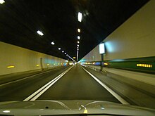
The tunnel is 11.611 km (7.215 mi) in length, 8.6 m (28 ft) in width, and 4.35 m (14.3 ft) in height. The passageway is not horizontal, but in a slightly inverted "V", which assists ventilation. The tunnel consists of a single gallery with a two-lane dual direction road. At the time of its construction, it was twice as long as any existing highway tunnel. [2]

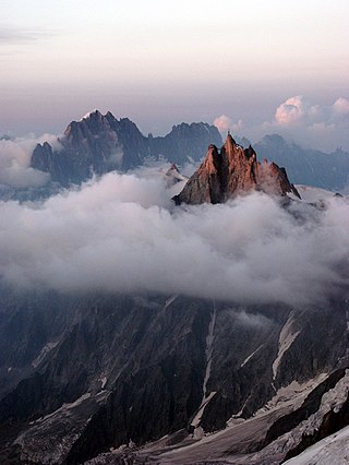
The tunnel passes almost exactly under the summit of the Aiguille du Midi. At this spot, it lies 2,480 metres (8,140 ft) beneath the surface, making it the world's second deepest operational tunnel [3] after the Gotthard Base Tunnel.

The Mont Blanc Tunnel was originally managed by the two building companies. Following a fire in 1999 in which 39 people died, which showed how lack of coordination could hamper the safety of the tunnel, all the operations are managed by a single entity: MBT-EEIG, controlled by both ATMB and SITMB together, through a 50–50 shares distribution. [4]

An alternative route for road traffic between France to Italy is the Fréjus Road Tunnel. Road traffic grew steadily until 1994, even with the opening of the Fréjus tunnel. Since then, the combined traffic volume of the former has remained roughly constant.

Construction statistics

History

Inaugural Plaque, French side Mont Blanc Tunnel Inaugural Plaque.jpg
Inaugural Plaque, French side

The idea of building a tunnel underneath Mont Blanc to avoid the need for long journeys dates back to the nineteenth century during the heyday of the railway. However, the idea did not receive widespread attention until 1907, when Francesco Farinet, a Member of Parliament of the Aosta Valley, advocated constructing of the tunnel. [5] In 1908, a first design was presented by French engineer Arnold Monod, to much interest from Italian and French politicians. [5]

Agreement between France and Italy and start of construction by 1959

Due to political turmoil and World War I and World War II, the project did not start until 1959, when excavations on the tunnel officially began. [5] This was preceded by the signing of a national charter for the tunnel construction, ratified by the parliaments of France (1957) and Italy (1954). That same year, the STMB (Société du tunnel du Mont Blanc) was formed, which became ATMB (Autoroutes et Tunnel du Mont Blanc) in 1996. [5] In 1962, the French and Italian drilling teams met on 4 August. The opening was successful, with an axis variation of less than 13 centimetres (5 inches). [6]

Opening

The tunnel was inaugurated by the French president, Charles de Gaulle, and the Italian President, Giuseppe Saragat on 16 July 1965. The tunnel opened to traffic on 19 July. [6] Surveillance cameras were installed in 1978. [7]

Updates in the 1990s

The tunnel underwent extensive modernisation works in 1990, including the addition of safety features such as new video surveillance cameras, 8 pressurized emergency shelters, a sprinkler system and other safety maintenance. In 1997, a fire detection system was installed along with centralized safety equipment management, and new variable message signs. [8]

1999 fire

On the morning of 24 March 1999, the engine of a Belgian transport truck carrying volatile freight caught fire in the tunnel. [1] The event expanded into a catastrophe which killed 39 people. [9]

2002 reopening

The fire led to a tunnel closure until 9 March 2002. [10] The reopening followed an extensive overhaul of the safety features. [11] The highway trunk from Aosta to the tunnel on the Italian side was completed in 2007. [12]

Traffic

Truck traffic statistics: Mont Blanc and Frejus Road Tunnels Traffico autostradale Frejus-Monte Bianco.png
Truck traffic statistics: Mont Blanc and Fréjus Road Tunnels

In 2010, the average traffic volume was 4,945 vehicles per day, or around 1.80 million vehicles per year. In 2011, there were an average of 5,113 vehicles per day (about 1.87 million vehicles per year).

Although several lines of vehicles can queue up at the toll station, only a limited number of vehicles per unit time is allowed to transit the tunnel to ensure a safety distance between them.

Within the tunnel, a minimum speed of 50 km/h and a maximum speed of 70 km/h applies, while the prescribed distance between vehicles is 150 m; trucks are allowed to enter in groups of five. These security measures were taken as a consequence of the 1999 tunnel fire.

Pedestrians can cross the tunnel by bus; bicycles can also be carried through the tunnel with a reservation.

Toll

Receipt for tunnel crossing of 28 July 1969 TunnelMtBlanc1969.jpg
Receipt for tunnel crossing of 28 July 1969

The tunnel crossing is subject to a toll; the toll differs from Italy to France because of their different VAT rates.

In 2013, the one-way ticket for a car was €40.90 (€41.40 on the Italian side), while the return ticket, valid for 7 days, was €51 (€51.60 on the Italian side). [13] In 2016, the one-way ticket for a car cost €43.50 (€44.20 on the Italian side).

Mont Blanc Tunnel Tolls on the Italian side from 1 January 2022 (22% VAT included) [14]

Vehicle TypeOne WayReturn
Cars€52.30€65.30
Motorbikes€34.60€43.50
Caravans€69.30€87.10

Mont Blanc Tunnel Tolls on the French side from 1 January 2022 (20% VAT included) [14]

Vehicle TypeOne WayReturn
Cars€51.50€64.20
Motorbikes€34.10€42.80
Caravans€68.10€85.60

See also

Related Research Articles

<span class="mw-page-title-main">Mont Blanc</span> Highest mountain in the Alps (4,808 m)

Mont Blanc is the highest mountain in the Alps and Western Europe, and the highest mountain in Europe outside the Caucasus mountains, rising 4,805.59 m (15,766 ft) above sea level, located on the French-Italian border. It is the second-most prominent mountain in Europe, after Mount Elbrus, and the 11th most prominent mountain in the world.

<span class="mw-page-title-main">Chamonix</span> Commune in Auvergne-Rhône-Alpes, France

Chamonix-Mont-Blanc, more commonly known simply as Chamonix (Chamôni), is a commune in the Haute-Savoie department in the Auvergne-Rhône-Alpes region in Southeastern France. It was the site of the first Winter Olympics, held in 1924.

<span class="mw-page-title-main">Aosta</span> Comune in Aosta Valley, Italy

Aosta is the principal city of the Aosta Valley, a bilingual region in the Italian Alps, 110 km (68 mi) north-northwest of Turin. It is situated near the Italian entrance of the Mont Blanc Tunnel, at the confluence of the Buthier and the Dora Baltea, and at the junction of the Great and Little St Bernard Pass routes.

<span class="mw-page-title-main">Aiguille du Midi</span> Mountain in the French Alps

The Aiguille du Midi is a 3,842-metre-tall (12,605 ft) mountain in the Mont Blanc massif within the French Alps. It is a popular tourist destination and can be directly accessed by cable car from Chamonix that takes visitors close to Mont Blanc.

<span class="mw-page-title-main">Courmayeur</span> Comune in Aosta Valley, Italy

Courmayeur is a town and comune in northern Italy, in the autonomous region of Aosta Valley.

<span class="mw-page-title-main">Mont Blanc Tunnel fire</span> Transport truck fire in the Mont Blanc Tunnel

On 24 March 1999, a transport truck caught fire while driving through the Mont Blanc Tunnel between France and Italy. When it stopped halfway through the tunnel, it violently combusted. Other vehicles traveling through the tunnel quickly became trapped and they also caught fire as firefighters were unable to reach the transport truck. 39 people were killed. In the aftermath, major changes were made to the tunnel to improve its safety.

<span class="mw-page-title-main">Ultra-Trail du Mont-Blanc</span> Single-stage mountain ultramarathon held in Chamonix, France

The Ultra-Trail du Mont-Blanc (UTMB) is a mountain ultramarathon race, first held in 2003, that follows the route of the Tour du Mont Blanc. It has been regarded as the most competitive trail ultramarathon in the world.

<span class="mw-page-title-main">Mont Blanc massif</span> Mountain range in the Alps

The Mont Blanc massif is a mountain range in the Alps, located mostly in France and Italy, but also straddling Switzerland at its northeastern end. It contains eleven major independent summits, each over 4,000 metres (13,123 ft) in height. It is named after Mont Blanc, the highest point in western Europe and the European Union. Because of its considerable overall altitude, a large proportion of the massif is covered by glaciers, which include the Mer de Glace and the Miage Glacier – the longest glaciers in France and Italy, respectively.

<span class="mw-page-title-main">Tour du Mont Blanc</span> Long distance walk in Europe

The Tour du Mont Blanc or TMB is one of the most popular long-distance walks in Europe. It circles the Mont Blanc massif, covering a distance of roughly 165 kilometres (103 mi) with 10 kilometres (6.2 mi) of ascent/descent and passing through parts of Switzerland, Italy and France.

<span class="mw-page-title-main">European route E25</span> Road in trans-European E-road network

European route E25 is a north–south European route from Hook of Holland in the Netherlands, to Palermo in Italy which includes ferry crossings from Genoa to Bastia (Corsica), from Bonifacio to Porto Torres (Sardinia) and from Cagliari to Palermo (Sicily).

<span class="mw-page-title-main">A40 autoroute</span> Road in France

The Autoroute A40 is a motorway in France that extends from Mâcon on the west to Passy on the east, terminating not far from Chamonix and the Mont Blanc Tunnel. The road runs 208 kilometres (129 mi) through Bresse, the high southern Jura Mountains, northern Prealps and French Alps. It was fully completed in 1990, and includes 12 viaducts and 3 tunnels. The road is maintained by Autoroutes Paris-Rhin-Rhône, comprising part of European routes E25 and E62.

<span class="mw-page-title-main">Great St Bernard Tunnel</span> Road tunnel complementing the Great St Bernard Pass

The Great St Bernard Tunnel is a road tunnel complementing the Great St Bernard Pass, linking Martigny with Saint-Rhémy-en-Bosses.

<span class="mw-page-title-main">Val Ferret</span> Name shared by two valleys separated by the Col Ferret

Val Ferret is the name shared by two valleys separated by the Col Ferret, a pass on the border between Italy and Switzerland. The valleys lie southeast of Mont Blanc Massif. The Swiss valley drains northeast towards Orsières and on into the Rhône basin; whereas the Italian valley drains southwest towards Courmayeur and on into the Po basin.

<span class="mw-page-title-main">Pointe Helbronner</span> Mountain in the Mont Blanc massif

Pointe Helbronner is a mountain in the Mont Blanc massif in the Graian Alps on the watershed between France and Italy.

<span class="mw-page-title-main">Torino Hut</span> Mountain refuge in the Alps

The Torino Hut is a high mountain refuge in the Alps in northwestern Italy. Located near the border with France, it is about 15 km (10 mi) southwest of Mont Dolent, the tripoint with Switzerland. The refuge is in the Mont Blanc massif above the town of Courmayeur in the Aosta Valley, Italy. It can be most easily accessed from the Italian side by the Skyway Monte Bianco cable car from La Palud in Courmayeur, with a change at the Pavilion du Mont Fréty. It can also be reached from Chamonix via the Aiguille du Midi, either by cable car which crosses the massif, or by a long crossing of the Glacier du Gèant. The refuge lies nearly directly above the 11.6 km (7.2 mi) Mont Blanc Tunnel, which passes deep underground, and connects Courmayeur to Chamonix.

<span class="mw-page-title-main">France–Italy border</span> International border

The France–Italy border is 515 km long. It runs from the Alps in the north, a region in which it passes over Mont Blanc, down to the Mediterranean coast in the south. Three national parks are located along the border: Vanoise National Park and Mercantour National Park on the French side and Gran Paradiso National Park on the Italian side.

<span class="mw-page-title-main">Skyway Monte Bianco</span> Cable car on Mont Blanc in Italy

Skyway Monte Bianco is a cable car in the Italian Alps, linking the town of Courmayeur with Pointe Helbronner on the southern side of the Mont Blanc massif. Taking over three years to construct, it opened in 2015 at a cost of 110 million euros, and is considered to be the world's most expensive cable car installation.

<span class="mw-page-title-main">Égratz Viaduct</span> Bridge in Auvergne-Rhône-Alpes, south-east France

The Égratz Viaduct is a curved concrete box girder bridge in south-east France, in the French Alps, near Switzerland and Italy. The bridge is almost one mile long.

<span class="mw-page-title-main">Col du Géant</span> Main pass of the Mont Blanc massif

The Col du Géant at 3,356 m (11,010 ft) is the main passage of the Mont Blanc massif between Courmayeur in the Aosta Valley and Chamonix-Mont Blanc in the Arve Valley. On the French side, to the north is the Géant Glacier which overlooks the Mer de Glace.

<span class="mw-page-title-main">Route nationale 205</span> Road in France

The Route nationale 205 is a Route nationale of France that is located entirely within the Department of Haute-Savoie. It starts off from the France–Switzerland border in the commune of Gaillard which is adjacent to Geneva; and ends at Chamonix, at the French side of the Mont Blanc Tunnel. It is also nicknamed the Route blanche due to its snowiness, and shares the title with the A40 autoroute, also nicknamed the Autoroute blanche.

References

  1. 1 2 Barry, Keith (15 July 2010). "July 16, 1965: Mont Blanc Tunnel Opens". Wired. Retrieved 16 July 2010.
  2. Soule, Gardner (December 1959). "World's longest auto tunnel to pierce the Alps". Popular Science. pp. 121–123/236–238.
  3. "Today in Science History" . Retrieved 22 November 2014.
  4. "A French-Italian Operator - Autoroutes et Tunnel du Mont Blanc". Archived from the original on 29 July 2012. Retrieved 27 September 2011.
  5. 1 2 3 4 "Mont Blanc Tunnel at age 46". www.tunneltalk.com. Retrieved 21 December 2018.
  6. 1 2 Barry, Keith (16 July 2010). "July 16, 1965: Mont Blanc Tunnel Opens". Wired. ISSN   1059-1028 . Retrieved 21 December 2018.
  7. "Histoire du Tunnel du Mont Blanc". ATMB (Autoroutes et Tunnel du Mont Blanc). Archived from the original on 21 December 2018. Retrieved 29 February 2024.
  8. "History of the Tunnel". Autoroutes et Tunnel du Mont Blanc. Archived from the original on 4 January 2014. Retrieved 20 December 2013.
  9. "The Fire of 1999 - Autoroutes et Tunnel du Mont Blanc". Archived from the original on 29 July 2012. Retrieved 27 September 2011.
  10. "Mont Blanc tunnel reopens". 9 March 2002. Retrieved 21 December 2018.
  11. "The security features of the Mont Blanc Tunnel | DW | 17 July 2015". DW.COM. Retrieved 21 December 2018.
  12. "A5 Mont Blanc-Aosta Motorway - Courmayeur- Morgex Section – Lot No 2 - Salini Impregilo". www.salini-impregilo.com. Retrieved 21 December 2018.
  13. "TMB - Tarifs". archive.wikiwix.com (in French). Archived from the original on 30 December 2013. Retrieved 12 November 2018.
  14. 1 2 "Mont Blanc Tunnel Toll Prices - Get from France to Italy". chamonix.net.
Records
Preceded by
Great St Bernard Tunnel
5.80 km (3.60 mi)
World's longest road tunnel
1965–1978
Succeeded by
Arlberg Road Tunnel
13.98 km (8.69 mi)