Mooresboro, North Carolina

Last updated

Mooresboro, North Carolina
Mooresboro-old-gym-nc.jpg
Old Mooresboro Gym
NCMap-doton-Mooresboro.PNG
Location of Mooresboro, North Carolina
Coordinates: 35°17′57″N81°41′55″W / 35.29917°N 81.69861°W / 35.29917; -81.69861
Country United States
State North Carolina
County Cleveland
Area
[1]
  Total1.77 sq mi (4.58 km2)
  Land1.77 sq mi (4.58 km2)
  Water0.00 sq mi (0.00 km2)
Elevation
[2]
886 ft (270 m)
Population
 (2020)
  Total293
  Density165.82/sq mi (64.01/km2)
Time zone UTC-5 (Eastern (EST))
  Summer (DST) UTC-4 (EDT)
ZIP code
28114
Area code(s) 704, 828, 980
FIPS code 37-44160 [3]
GNIS feature ID2406187 [2]
Website townofmooresboro.og

Mooresboro is a town in Cleveland County, North Carolina, United States. The population was 311 at the 2010 census.

Contents

History

Mooresboro was settled in the 1780s, it was incorporated as a town in 1885, and its charter was repealed in 1943. It was named for Lem Moore, an early settler. [4]

The Henrietta-Caroleen High School was added to the National Register of Historic Places in 2005. [5]

Geography

According to the United States Census Bureau, the town has a total area of 1.8 square miles (4.7 km2), all land.

Demographics

Historical population
CensusPop.Note
1890 197
1900 144−26.9%
1920 228
1930 27018.4%
1980 405
1990 294−27.4%
2000 3146.8%
2010 311−1.0%
2020 293−5.8%
U.S. Decennial Census [6]

As of the census [3] of 2000, there were 314 people, 131 households, and 94 families residing in the town. The population density was 178.3 inhabitants per square mile (68.8/km2). There were 140 housing units at an average density of 79.5 per square mile (30.7/km2). The racial makeup of the town was 88.22% White, 11.46% African American and 0.32% Pacific Islander.

There were 131 households, out of which 33.6% had children under the age of 18 living with them, 51.1% were married couples living together, 16.8% had a female householder with no husband present, and 28.2% were non-families. 27.5% of all households were made up of individuals, and 9.9% had someone living alone who was 65 years of age or older. The average household size was 2.40 and the average family size was 2.88.

In the town, the population was spread out, with 25.2% under the age of 18, 5.7% from 18 to 24, 30.9% from 25 to 44, 25.2% from 45 to 64, and 13.1% who were 65 years of age or older. The median age was 38 years. For every 100 females, there were 95.0 males. For every 100 females age 18 and over, there were 91.1 males.

The median income for a household in the town was $33,125, and the median income for a family was $36,500. Males had a median income of $29,219 versus $27,083 for females. The per capita income for the town was $19,791. About 8.5% of families and 13.7% of the population were below the poverty line, including 29.4% of those under age 18 and 28.9% of those age 65 or over.

Notable people

Related Research Articles

<span class="mw-page-title-main">Jefferson, North Carolina</span> Town in North Carolina, United States

Jefferson is a town in and the county seat of Ashe County, North Carolina, United States. The population was 1,622 at the 2020 U.S. census.

<span class="mw-page-title-main">Elk Park, North Carolina</span> Town in North Carolina, United States

Elk Park is a town in Avery County, North Carolina, United States. The town was so named because of the number of elk killed there. The population was 452 at the 2010 census.

<span class="mw-page-title-main">Clarkton, North Carolina</span> Town in North Carolina, United States

Clarkton is a town in Bladen County, North Carolina, United States. The population was 837 at the 2010 census.

<span class="mw-page-title-main">Biltmore Forest, North Carolina</span> Town in North Carolina, United States

Biltmore Forest is a town in Buncombe County, North Carolina, United States. The population was 1,343 in 2010. It is part of the Asheville Metropolitan Statistical Area. Biltmore Forest is the second-wealthiest town in North Carolina by per capita income at $85,044.

<span class="mw-page-title-main">Trent Woods, North Carolina</span> Town in North Carolina, United States

Trent Woods is a town in Craven County, North Carolina, United States. The population was 4,155 in 2010. It is part of the New Bern, North Carolina Metropolitan Statistical Area.

<span class="mw-page-title-main">Wade, North Carolina</span> Town in North Carolina, United States

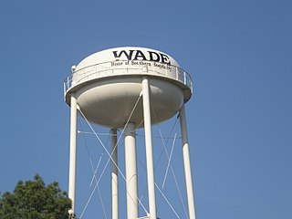
Wade is a town in Cumberland County, North Carolina, United States. The population was 556 at the 2010 census.

<span class="mw-page-title-main">Macclesfield, North Carolina</span> Town in North Carolina, United States

Macclesfield is a town in Edgecombe County, North Carolina, United States. It is part of the Rocky Mount, North Carolina Metropolitan Statistical Area. The population was 471 at the 2010 census.

<span class="mw-page-title-main">Sedalia, North Carolina</span> Town in North Carolina, United States

Sedalia is a town in Guilford County, North Carolina, United States. As of the 2020 census, the population of the town was 676.

<span class="mw-page-title-main">Whitsett, North Carolina</span> Town in North Carolina, United States

Whitsett is a town in Guilford County, North Carolina, United States. The population was 584 at the 2020 census.

<span class="mw-page-title-main">Trenton, North Carolina</span> Town in North Carolina, United States

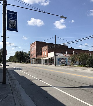
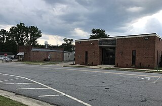
Trenton is a town in Jones County, North Carolina, United States. The population was 238 in 2020 census. It is the county seat of Jones County.

<span class="mw-page-title-main">Bailey, North Carolina</span> Town in North Carolina, United States

Bailey is a town in Nash County, North Carolina, United States. It is part of the Rocky Mount, North Carolina Metropolitan Statistical Area. The population was 566 at the 2020 census.

<span class="mw-page-title-main">Garysburg, North Carolina</span> Town in North Carolina, United States

Garysburg is a town in Northampton County, North Carolina, United States. The population was 1,057 at the 2010 census. It is part of the Roanoke Rapids, North Carolina Micropolitan Statistical Area.

<span class="mw-page-title-main">Winfall, North Carolina</span> Town in North Carolina, United States

Winfall is a town in Perquimans County, North Carolina, United States. The population was 554 at the 2020 census. It is part of the Elizabeth City, North Carolina Micropolitan Statistical Area.

<span class="mw-page-title-main">Franklinville, North Carolina</span> Town in North Carolina, United States

Franklinville is a town in Randolph County, North Carolina, United States. The population was 1,164 at the 2010 census.

<span class="mw-page-title-main">Ramseur, North Carolina</span> Town in North Carolina, United States

Ramseur is a town in Randolph County, North Carolina, United States. The population was 1,692 at the 2010 census.

<span class="mw-page-title-main">Salemburg, North Carolina</span> Town in North Carolina, United States

Salemburg is a town in Sampson County, North Carolina, United States. The population was 457 at the 2020 census.

<span class="mw-page-title-main">Saratoga, North Carolina</span> Town in North Carolina, United States

Saratoga is a town in Wilson County, North Carolina, United States. The population was 408 at the 2010 census.

<span class="mw-page-title-main">Troy, South Carolina</span> Town in South Carolina, United States

Troy is a town in Greenwood County, South Carolina, United States. The population was 93 at the 2010 census.

<span class="mw-page-title-main">Falcon, North Carolina</span> Town in North Carolina, United States

Falcon is a town in Cumberland and Sampson counties in the U.S. state of North Carolina. The population was 258 at the 2010 census.

Harrells is a town in Duplin and Sampson counties, North Carolina, United States. The population was 160 at the 2020 census. At the previous census in 2010, the population was 202.

References

  1. "ArcGIS REST Services Directory". United States Census Bureau. Retrieved September 20, 2022.
  2. 1 2 U.S. Geological Survey Geographic Names Information System: Mooresboro, North Carolina
  3. 1 2 "U.S. Census website". United States Census Bureau . Retrieved January 31, 2008.
  4. Powell, William S. (1968). The North Carolina Gazetteer: A Dictionary of Tar Heel Places. Chapel Hill, N.C.: The University of North Carolina Press. p. 333. ISBN   0-8078-1247-1.
  5. "National Register Information System". National Register of Historic Places . National Park Service. July 9, 2010.
  6. "Census of Population and Housing". Census.gov. Retrieved June 4, 2015.