Morenci, Arizona

Last updated

Morenci, Arizona
PostcardMorenciAZAerialViewCirca1910.jpg
Morenci, about 1910
Greenlee County Incorporated and Unincorporated areas Morenci highlighted.svg
Location in Greenlee County and the state of Arizona
USA Arizona location map.svg
Red pog.svg
Morenci
Location in the United States
Usa edcp location map.svg
Red pog.svg
Morenci
Morenci (the United States)
Coordinates: 33°2′59″N109°19′40″W / 33.04972°N 109.32778°W / 33.04972; -109.32778
Country United States
State Arizona
County Greenlee
Area
[1]
  Total0.93 sq mi (2.40 km2)
  Land0.91 sq mi (2.34 km2)
  Water0.02 sq mi (0.06 km2)
Elevation
4,747 ft (1,447 m)
Population
 (2020)
  Total2,028
  Density2,240.88/sq mi (865.22/km2)
Time zone UTC-7 (MST (no DST))
ZIP code
85540
Area code 928
FIPS code 04-47610
GNIS feature ID0032021

Morenci is a census-designated place (CDP) and company town in Greenlee County, Arizona, United States, and was founded by the Detroit Copper Mining Company of Arizona. The population was 2,000 at the 2000 census and 1,489 at the 2010 census. [2] The biggest employer in Morenci (and in nearby Clifton) and the owner of the town is Freeport-McMoRan, the owner of the Morenci Mine, the largest copper mining operation in North America, and one of the largest copper mines in the world. The town was a site of the Arizona Copper Mine Strike of 1983. The large open-pit mine is north of the town.

Contents

Geography

Morenci is located in central Greenlee County at 33°2′59″N109°19′40″W / 33.04972°N 109.32778°W / 33.04972; -109.32778 (33.049804, -109.327856). [3] It lies on the northeastern border of the town of Clifton, the county seat. U.S. Route 191 (the Coronado Trail) passes through the northern part of the community, leading east and downhill into Clifton and north through the Apache National Forest 117 miles (188 km) to Eagar.

According to the United States Census Bureau, the Morenci CDP has a total area of 0.98 square miles (2.55 km2), of which 0.96 square miles (2.49 km2) is land and 0.02 square miles (0.06 km2), or 2.23%, is water. [2]

Climate

This region experiences hot and dry summers, with average monthly high temperatures above 80 °F for seven months a year. According to the Köppen Climate Classification system, Morenci has a warm-summer Mediterranean climate, abbreviated "Csb" on climate maps. [4]

Demographics

Historical population
CensusPop.Note
2000 2,000
2010 1,489−25.5%
2020 2,02836.2%
U.S. Decennial Census [5]

As of the census [6] of 2000, there were 1,879 people, 672 households, and 454 families residing in the CDP. The population density was 2,317.4 inhabitants per square mile (894.8/km2). There were 754 housing units at an average density of 929.9 per square mile (359.0/km2). The racial makeup of the CDP was 68.0% White, 0.5% Black or African American, 2.1% Native American, 0.5% Asian, 25.0% from other races, and 3.9% from two or more races. 44.5% of the population were Hispanic or Latino of any race.

There were 672 households, out of which 45.7% had children under the age of 18 living with them, 56.7% were married couples living together, 6.1% had a female householder with no husband present, and 32.3% were non-families. 30.8% of all households were made up of individuals, and 0.7% had someone living alone who was 65 years of age or older. The average household size was 2.80 and the average family size was 3.55.

In the CDP, the population was spread out, with 35.6% under the age of 18, 7.2% from 18 to 24, 34.4% from 25 to 44, 22.1% from 45 to 64, and 0.6% who were 65 years of age or older. The median age was 30 years. For every 100 females, there were 119.0 males. For every 100 females age 18 and over, there were 128.7 males.

The median income for a household in the CDP was $46,010, and the median income for a family was $54,583. Males had a median income of $41,875 versus $26,063 for females. The per capita income for the CDP was $18,695. About 2.7% of families and 3.0% of the population were below the poverty line, including 2.9% of those under age 18 and none of those age 65 or over.

Economy

The economy of Morenci as well as that of the surrounding area is almost completely dependent on the Morenci Mine. [7] Between 2003 and 2008, the worldwide rise in copper prices led the mine to double its work force to 4,000 employees and increase production by 55 percent to an average of one million tons of ore per day. [7]

Several hundred new homes were built, leading to a boom in the construction industry. [7] All the homes in Morenci, new and old, remain owned by Freeport-McMoRan. [7]

Education

It is in the Morenci Unified School District. [8]

Notable people

See also

Related Research Articles

<span class="mw-page-title-main">Greenlee County, Arizona</span> County in Arizona, United States

Greenlee County is a county in the southeastern part of the U.S. state of Arizona. As of the 2020 census, the population was 9,563, making it Arizona's least populous county. The county seat is Clifton.

<span class="mw-page-title-main">Bisbee, Arizona</span> City in Cochise County, Arizona, US

Bisbee is a city in and the county seat of Cochise County in southeastern Arizona, United States. It is 92 miles (148 km) southeast of Tucson and 11 miles (18 km) north of the Mexican border. According to the 2020 census, the population of the town was 4,923, down from 5,575 in the 2010 census.

<span class="mw-page-title-main">Claypool, Arizona</span> CDP in Gila County, Arizona

Claypool is a census-designated place (CDP) in Gila County, Arizona, United States. The population was 1,538 at the 2010 census, down from 1,794 at the 2000 census. It was named after W. D. Claypool, a member of both the State House of Representatives and State Senate in the 1910s and 1920s.

<span class="mw-page-title-main">Hayden, Arizona</span> Town in Gila and Pinal Counties, Arizona

Hayden is a town in Gila and Pinal counties in Arizona, United States. According to the 2010 census, the population of the town was 662.

<span class="mw-page-title-main">Miami, Arizona</span> Town in Gila County, Arizona

Miami is a town in Gila County, Arizona, United States. Miami is a classic Western copper boom-town. Miami's old downtown has been partly renovated, and the Bullion Plaza Museum features the cultural, mining and ranching history of the Miami area.

<span class="mw-page-title-main">Safford, Arizona</span> City in Arizona, United States

Safford is a city in Graham County, Arizona, United States. According to the 2020 Census, the population of the city is 10,129. The city is the county seat of Graham County.

<span class="mw-page-title-main">Clifton, Arizona</span> Town in Greenlee County, Arizona

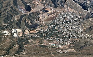
Clifton is a town in and is the county seat of Greenlee County, Arizona, United States, along the San Francisco River. The population of the town was 3,311 at the 2010 census, with a 2018 population estimate of 3,700. It was a place of the Arizona copper mine strike of 1983.

<span class="mw-page-title-main">Duncan, Arizona</span> Town in Greenlee County, Arizona

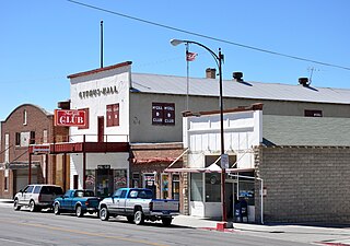
Duncan is a town in Greenlee County, Arizona, United States. As of the 2010 census, the population of the town was 696. In 2018 the estimated population was 789.

<span class="mw-page-title-main">Ajo, Arizona</span> Community in Pima County, Arizona

Ajo is an unincorporated community in Pima County, Arizona, United States. It is the closest community to Organ Pipe Cactus National Monument. The population was 3,039 at the 2020 census. Ajo is located on State Route 85 just 43 miles (69 km) from the Mexican border.

<span class="mw-page-title-main">Green Valley, Arizona</span> CDP in Pima County, Arizona

Green Valley is an unincorporated community and census-designated place (CDP) in Pima County, Arizona, United States. The population was 22,616 at the 2020 census.

<span class="mw-page-title-main">San Manuel, Arizona</span> CDP in Pinal County, Arizona

San Manuel is a census-designated place (CDP) in Pinal County, Arizona, United States. The population was 3,551 at the 2010 census.

<span class="mw-page-title-main">Superior, Arizona</span> Town in Pinal County, Arizona

Superior is a town in Pinal County, Arizona, United States. Superior, which is in northern Pinal County, is the oldest town in that county. According to the 2020 census, the population of the town was 2,407. Superior was founded as a mining town for the Silver King and the later Magma mines; silver was mined at first, and then transitioned to copper. Currently, exploitation of the huge Resolution Copper deposit is being explored.

<span class="mw-page-title-main">Bagdad, Arizona</span> CDP in Yavapai County, Arizona

Bagdad is a copper mining community and census-designated place (CDP) in Yavapai County, Arizona, United States, in the western part of the state. It is one of only two remaining company towns in Arizona. The population was 1,876 at the 2010 census, up from 1,578 in 2000.

<span class="mw-page-title-main">Congress, Arizona</span> CDP in Yavapai County, Arizona

Congress is a census-designated place (CDP) in Yavapai County, Arizona, United States. Once a gold-mining center for the Congress Mine and then a ghost town, Congress now serves as a retirement and bedroom community for nearby Wickenburg. The population was 1,811 at the 2020 census.

<span class="mw-page-title-main">Allouez Township, Michigan</span> Civil township in Michigan, United States

Allouez Township is a civil township of Keweenaw County in the U.S. state of Michigan. The population was 1,428 at the 2020 census.

<span class="mw-page-title-main">McGill, Nevada</span> CDP in Nevada, United States

McGill is a census-designated place (CDP) in White Pine County, Nevada, United States. The population was 1,148 at the 2010 census.

<span class="mw-page-title-main">Ravensdale, Washington</span> Census-designated place in Washington, United States

Ravensdale is a census-designated place (CDP) in King County, Washington, United States. The population was 555 at the 2020 census.

<span class="mw-page-title-main">Morenci mine</span> Copper mine in Greenlee County, Arizona, United States

The Morenci Mine is a large copper mine located near Morenci, Arizona, United States. Morenci represents one of the largest copper reserves in the United States and in the world, having estimated reserves of 3.2 billion tonnes (3.5×10⁹ short tons) of ore grading 0.16% copper. It is located in Greenlee County, just outside the company town of Morenci and the town of Clifton. Freeport-McMoRan is the principal owner and, since 2016, Sumitomo Group has owned a 13% interest in the mine.

<span class="mw-page-title-main">York, Arizona</span> CDP in Greenlee County, Arizona

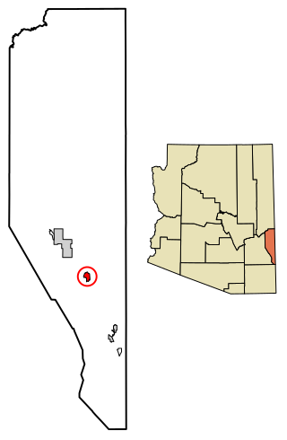
York, also known as York Valley, is a census-designated place in Greenlee County, Arizona, United States. As of the 2010 census, the population was 557.

<span class="mw-page-title-main">Franklin, Arizona</span> CDP in Greenlee County, Arizona

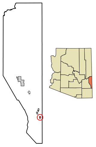
Franklin is an unincorporated community and census-designated place in Greenlee County, Arizona, United States. As of the 2010 census it had a population of 92. It is located in southern Greenlee County along U.S. Route 70, 3 miles (4.8 km) west of the border with New Mexico, 3 miles (4.8 km) south of Duncan, and 32 miles (51 km) south of Clifton. Residents of Franklin are zoned to Duncan public schools, such ase the nearby community of York as well as Virden, New Mexico. Many residents work for the Morenci Mine, owned by Freeport-McMoRan in Morenci.

References

  1. "2020 U.S. Gazetteer Files". United States Census Bureau. Retrieved October 29, 2021.
  2. 1 2 "Profile of General Population and Housing Characteristics: 2010 (Morenci CDP, Arizona)". American Fact Finder. United States Census Bureau. Archived from the original on February 13, 2020. Retrieved November 8, 2016.
  3. "US Gazetteer files: 2010, 2000, and 1990". United States Census Bureau. February 12, 2011. Retrieved April 23, 2011.
  4. Climate Summary for Morenci, Arizona
  5. "Census of Population and Housing". Census.gov. Retrieved June 4, 2016.
  6. "U.S. Census website". United States Census Bureau . Retrieved January 31, 2008.
  7. 1 2 3 4 Rudolf, John Collin. "Copper's Every Dip Is Felt in Arizona." New York Times. November 27, 2008.
  8. "2020 CENSUS - SCHOOL DISTRICT REFERENCE MAP: Greenlee County, AZ" (PDF). U.S. Census Bureau . Retrieved July 17, 2022.

Further reading