Zaire is one of the 18 provinces of Angola. It occupies 40,130 square kilometres (15,490 sq mi) in the north west of the country and had a population of 594,428 inhabitants in 2014. It is bordered on the west by the Atlantic Ocean, on the north by the Democratic Republic of Congo, on the east by the Uíge Province, and on the south by the Bengo Province.
Luanda is a province of Angola. It covers an area of 18,835 km2, and had a population of 6,945,386 at the Census of 16 May 2014. The latest official estimate is 9,079,811.

Malanje is the capital city of Malanje Province in Angola, with a population of 455,000, and a municipality, with a population of 506,847. Projected to be the thirteenth fastest growing city on the African continent between 2020 and 2025, with a 5.17% growth. It is located 380 kilometres (240 mi) east of Angola's capital Luanda. Near it are the spectacular Calandula waterfalls, the rock formations of Pungo Andongo, and the Capanda Dam. The climate is mainly humid, with average temperatures between 20 and 24 °C and rainfall 900 to 130 millimetres in the rainy season.

Moçâmedes is a city in southwestern Angola, capital of Namibe Province. The city's current population is 255,000. Founded in 1840 by the Portuguese colonial administration, the city was named Namibe between 1985 and 2016. Moçâmedes has a cool dry climate and desert vegetation, because it is near the Namib Desert.

Lubango, formerly known as Sá da Bandeira, is a municipality in Angola, capital of the Huíla Province, with a population of 914,456 in 2022. The city center had a population of 600,751 in 2014 making it the second-most populous city in Angola after the capital city Luanda.

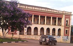
Uíge, formerly Carmona, is a provincial capital city in northwestern Angola, with a population of 322,531, and a municipality, with a population of 519,196, located in the province of the same name. It grew from a small market centre in 1945 to become a city in 1956. It is serviced by the Uíge Airport with daily flights to Luanda.
Caála is a town and a municipality located 23 km west of the city of Huambo, in the namesake province in Angola. It was known as Vila Robert Williams while Angola was a Portuguese colony, after the famous railroad developer and mining magnate, Sir Robert Williams. The town has a population of 130,000 and the municipality a population of 279,792 according to the 2014 census.
Ondjiva, formerly Vila Pereira d'Eça, is a town, with a population of 121,537 (2014), and a commune in the municipality of Cuanhama, province of Cunene, Angola. It is also the administrative capital of Cunene Province and is located at the extreme south of the country, about 42 kilometres (26 mi) from the border with Namibia. It was traditionally the seat of the Ovambo king of the Oukwanyama tribe. Ondjiva was greatly affected by the Angolan Civil War (1975-2002).

Viana is a city and one of the nine municipalities that make up the province of Luanda in Angola. Viana lies 15 to 30 kilometers east as a suburb of the capital Luanda and has a population of 2,092,439 (2022), including about 6,000 long-term refugees primarily from Katanga Province in the Democratic Republic of the Congo.
Cacuaco is a city and one of the nine municipalities that make up the province of Luanda. A suburb of the capital, Luanda, it has a population of 1,279,488 (2019).
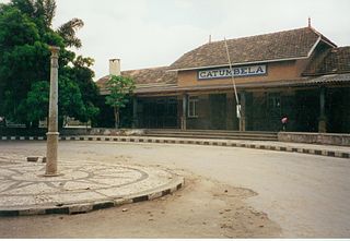
Catumbela is a city and municipality of the Benguela province in Angola. The municipality had a population of 175,805 in 2014.
Bocoio is a town and municipality in Benguela Province in Angola. Its administrative capital is Tchissandji. The municipality had a population of 164,685 in 2014.
Cazenga is a city and the most densely populated of the nine municipalities that make up the province of Luanda, Angola. It has a population of 892,401, with an estimated 1,045,722 in 2019, covering an area of 37 km2.

Bibala is a town, with a population of 10,500 (2014), and a municipality in southern Angola. It lies in Namibe Province. The municipality of Bibala covers 7,700 square kilometres (3,000 sq mi) with a population of 64,504 (2014).
Funda is a commune, with a population of 209,387 (2014), and a town in the Municipality of Cacuaco of Luanda Province, Angola.

Dondo is a town, with a population of 64,643 (2014), and a commune in the municipality of Cambambe, province of Cuanza Norte, Angola.

Ícolo e Bengo is a city council in the province of Luanda in Angola. It had a population of 81,144 in 2014.

Barra do Dande is a town, with a population of 75,000 (2014), and a commune in the municipality of Dande, province of Bengo, Angola.
Cabiri is a town and commune in the municipality of Ícolo e Bengo, Luanda Province, Angola.
Cangandala is a town and municipality in the province of Malanje (Malange) in Angola. It covers an area of 5,770 square kilometres (2,230 sq mi) and its population is 45,120.