
Transport in Ghana is accomplished by road, rail, air and water. Ghana's transportation and communications networks are centered in the southern regions, especially the areas in which gold, cocoa, and timber are produced. The northern and central areas are connected through a major road system.

The N1 is a national route in South Africa that runs from Cape Town through Bloemfontein, Johannesburg, Pretoria and Polokwane to Beit Bridge on the border with Zimbabwe. It forms the first section of the famed Cape to Cairo Road.

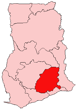
The Ashanti Region is located in the southern part of Ghana and it is the third largest of 16 administrative regions, occupying a total land surface of 24,389 km2 (9,417 sq mi) or 10.2 percent of the total land area of Ghana. In terms of population, however, it is the most populated region with a population of 4,780,380 according to the 2011 census, accounting for 19.4% of Ghana's total population. The Ashanti Region is known for its major gold bar and cocoa production. The largest city and regional capital is Kumasi.

Nsawam is a town in south Ghana and is the capital of the Nsawam-Adoagyire Municipal District, a district in the Eastern Region of south Ghana. The main ethnic group is Akan, followed by Ga and then Ewe. Nsawam is controlled by Nsawam-Adoagyire Municipal District (ASMD). As of 2013, Nsawam has a settlement population of 44,522 people. Nsawam is situated on the main railway between Accra and Kumasi and highway to Kumasi. It has Densu river acting as a border between itself and Adoagyiri. Densu River, is the main source of water for both domestic and industrial purposes for people in and around Nsawam.

The Eastern Region is located in the Eastern part of Ghana and is one of the sixteen administrative regions of Ghana. Eastern region is bordered to the east by the Lake Volta, to the north by Bono East Region and Ashanti region, to the west by Ashanti region, to the south by Central region and Greater Accra Region. Akans are the dominant inhabitants and natives of Eastern region and Akan, Ewe, Krobo, Hausa and English are the main spoken languages. The capital town of Eastern Region is Koforidua.The Eastern region is the location of the Akosombo dam and the economy of the Eastern region is dominated by its high-capacity electricity generation. Eastern region covers an area of 19,323 square kilometres, which is about 8.1% of Ghana's total landform.

The Greater Accra Region has the smallest area of Ghana's 16 administrative regions, occupying a total land surface of 3,245 square kilometres. This is 1.4 per cent of the total land area of Ghana. It is the most populated region, with a population of 5,455,692 in 2021, accounting for 17.7 per cent of Ghana's total population.
Kwahu refers to an area and group of people that live in Ghana and are part of the Twi-speaking Akan group. The area has been dubbed Asaase Aban, or the Natural Fortress, in view of its position as the highest habitable elevation in the country. Kwahu lies in the Eastern Region of Ghana, on the west shore of Lake Volta. The Kwahus share the Eastern Region with their fellow Akans: the Akyem and Akuapem, as well as the Adangbe-Krobos. Among Kwahu lands, a significant migrant population work as traders, farm-hands, fisherfolk, and caretakers in the fertile waterfront 'melting pot' of Afram plains. These migrants are mostly from the Northern and Volta Regions, as well as, some indigenous Guans from the bordering Oti and Brong East Regions live in the Afram Plains area. Kwahus are traditionally known to be very entrepreneurial, owning a significant number of businesses and industries in Ghana.

Nkawkaw is a town in southern Ghana and is the capital of Kwahu West Municipal, an area in the Eastern Region of south Ghana. Nkawkaw has a 2013 settlement population of 61,785 people. Nkawkaw is also described as a city in a valley as it the gateway to ascend the Kwahu mountains. Hon. Joseph Frempong is the current member of parliament for the Kwahu West who was elected in the 2020 elections.
The Roman Catholic Diocese of Konongo–Mampong is a diocese located in the city of Konongo–Mampong in the Ecclesiastical province of Kumasi in Ghana.

The railway stations in Ghana serve a rail network concentrated in the south of the country.

Roads in Ghana form a network of varied quality and capacity. Responsibility for the road network differs between trunk and non-trunk routes. Trunk roads, which are the most important roads, are administered by the Ghana Highway Authority, which was established in 1974 to develop the trunk road network. Ghana's 13,367 km of trunk roads accounts for 33% of the total road network of 40,186 km. The Department of Feeder Roads is responsible for the construction and maintenance of feeder roads in Ghana, while responsibility for urban roads lies with the Department of Urban Roads. In the 18th and 19th centuries, the Ashanti Empire constructed a complex network of roads to link Kumasi with their territories in modern Ghana. For John Thornton, these roads improved transportation across the region by the 19th century.
Adeiso is capital of the Upper West Akim district of the Eastern Region of Ghana.
The N1 or National Highway 1 is a national highway in Ghana that begins at the border with Ivory Coast at Elubo and runs through Sekondi-Takoradi, Cape Coast, Winneba, Accra and Tema to the border with Togo at Aflao. It is the main highway along the coast of the country, with a total distance of 540 kilometers. The route runs through the Western, Central, Greater Accra and Volta regions of Ghana.

Asuboi is a town in the Suhum/Kraboa/Coaltar district in the Eastern Region of Ghana. It is along the Accra–Kumasi N6 highway close to the Techimanti community.
The N2 or National Highway 2 is a national highway in Ghana that begins at the Tema Motorway interchange at Tema and runs through Hohoe, Nkwanta, Yendi, and Bawku to the border with Burkina Faso at Kulungugu. It is the main north-south highway in the eastern corridor of the country, with a total distance of 640 kilometres (400 mi). The route runs through the Greater Accra, Eastern, Volta, Oti, Northern, North East Region and Upper East regions of Ghana.
The N3 or National Highway 3 is a national highway in Ghana that begins at Kpong and runs west through Oterkpalu to Koforidua. It is a link between the N2 and N4 in the Eastern region of the country, with a total distance of 40 kilometers.
The IR1 or Inter-Regional Highway 1 is a highway in Ghana that begins at Mankessim in the Central Region and runs through Agona Swedru and Nsawam to Aburi. It runs parallel to the N1 between the Central and Eastern regions, and has a total distance of 142 kilometers. The route runs through the Central, Greater Accra and Eastern regions of Ghana.
The N4 or National Highway 4 is a national highway in Ghana that begins at the Tetteh Quarshie Interchange in Accra and runs through Adenta, Koforidua, and Asokore to join the N6, which continues to Kumasi. It serves as an alternate route from Accra to Kumasi, with a total distance of 110 kilometers. The route runs through the Greater Accra and Eastern regions of Ghana.
