National Register of Historic Places listings in Montgomery County, Tennessee

Last updated

Location of Montgomery County in Tennessee Map of Tennessee highlighting Montgomery County.svg
Location of Montgomery County in Tennessee

This is a list of the National Register of Historic Places listings in Montgomery County, Tennessee.

Contents

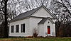
This is intended to be a complete list of the properties and districts on the National Register of Historic Places in Montgomery County, Tennessee, United States. Latitude and longitude coordinates are provided for many National Register properties and districts; these locations may be seen together in a map. [1]

There are 53 properties and districts listed on the National Register in the county. Another 4 properties were once listed but have been removed.

Current listings

[2] Name on the Register [3] ImageDate listed [4] Location City or townDescription
1 Allen House October 3, 1978
(#78002619)
North of Clarksville on Allen-Griffey Rd.; also 2401 and 2409 Allen Griffey Rd.
36°36′12″N87°22′16″W / 36.603333°N 87.371111°W / 36.603333; -87.371111 (Allen House)
Clarksville Second set of addresses represents a boundary increase of March 27, 2013
2 Bethlehem Methodist Church and Cemetery
Bethlehem Methodist Church and Cemetery Bethlehem Methodist Church & Graveyard , Clarksville, TN (17).jpg
Bethlehem Methodist Church and Cemetery
June 10, 1994
(#94000576)
Western side of Gholson Rd. about 0.5 miles (0.80 km) south of its junction with Grafton Rd.
36°27′52″N87°16′33″W / 36.464454°N 87.275714°W / 36.464454; -87.275714 (Bethlehem Methodist Church and Cemetery)
Clarksville
3 Catholic Church and Rectory
Catholic Church and Rectory Chapel-side.JPG
Catholic Church and Rectory
August 2, 1982
(#82004032)
716 Franklin St.
36°31′44″N87°21′03″W / 36.528889°N 87.350833°W / 36.528889; -87.350833 (Catholic Church and Rectory)
Clarksville
4 Clarksville Architectural District
Clarksville Architectural District Clarksville Architectural District.JPG
Clarksville Architectural District
May 13, 1976
(#76001791)
Public Sq., Legion, 3rd, Franklin, and Commerce Sts.
36°31′38″N87°21′36″W / 36.527222°N 87.36°W / 36.527222; -87.36 (Clarksville Architectural District)
Clarksville
5 Clarksville Federal Building
Clarksville Federal Building Custom's House Museum 3.JPG
Clarksville Federal Building
June 13, 1972
(#72001246)
200 S. 2nd St. [5]
36°31′34″N87°21′30″W / 36.5262°N 87.3584°W / 36.5262; -87.3584 (Clarksville Federal Building)
Clarksville Now used as the Customs House Museum & Cultural Center
6 Clarksville Foundry and Machine Works Office
Clarksville Foundry and Machine Works Office Clarksville Machine Works and Foundry.JPG
Clarksville Foundry and Machine Works Office
November 25, 1987
(#87002007)
96 Commerce St.
36°31′32″N87°21′40″W / 36.525556°N 87.361111°W / 36.525556; -87.361111 (Clarksville Foundry and Machine Works Office)
Clarksville
7 Clarksville High School
Clarksville High School Clarksville High School 2.JPG
Clarksville High School
December 8, 1983
(#83004281)
Greenwood Ave.
36°31′31″N87°20′56″W / 36.525278°N 87.348889°W / 36.525278; -87.348889 (Clarksville High School)
Clarksville
8 Clarksville Industrial District
Clarksville Industrial District Sullivan below Washington in Clarksville.jpg
Clarksville Industrial District
April 30, 1976
(#76002295)
Bounded by Washington St., Crossland Ave., the Illinois Central railroad line, and the Cumberland River
36°31′24″N87°21′44″W / 36.523333°N 87.362222°W / 36.523333; -87.362222 (Clarksville Industrial District)
Clarksville
9 Clarksville Methodist Church
Clarksville Methodist Church Clarksville Methodist Church former building.jpg
Clarksville Methodist Church
April 6, 1982
(#82004033)
334 Main St.
36°31′46″N87°21′24″W / 36.529306°N 87.356667°W / 36.529306; -87.356667 (Clarksville Methodist Church)
Clarksville
10 Cloverlands
Cloverlands Cloverlands, Clarksville, TN (13).jpg
Cloverlands
January 8, 1979
(#79002451)
North of St. Bethlehem on Clarksville-Trenton Rd.
36°38′20″N87°19′35″W / 36.638889°N 87.326389°W / 36.638889; -87.326389 (Cloverlands)
St. Bethlehem
11 Country Woman's Club
Country Woman's Club Country Womens Club - Clarksville TN (17).jpg
Country Woman's Club
July 5, 2006
(#06000549)
2216 Old Russellville Pike
36°34′00″N87°18′07″W / 36.566667°N 87.302000°W / 36.566667; -87.302000 (Country Woman's Club)
Clarksville
12 Dog Hill Architectural District
Dog Hill Architectural District W.A. Quarles Home 2.JPG
Dog Hill Architectural District
May 9, 1980
(#80003849)
Munford Ave., 1st, Union, Madison, and 2nd Sts.
36°31′26″N87°21′34″W / 36.523889°N 87.359444°W / 36.523889; -87.359444 (Dog Hill Architectural District)
Clarksville
13 Dunlop Milling Company February 12, 1999
(#99000213)
1138 Franklin St.
36°31′54″N87°20′31″W / 36.531667°N 87.341944°W / 36.531667; -87.341944 (Dunlop Milling Company)
Clarksville
14 Emerald Hill
Emerald Hill Emerald Hill in Clarksville.jpg
Emerald Hill
July 14, 1971
(#71000826)
N. 2nd St.
36°32′22″N87°21′41″W / 36.539444°N 87.361389°W / 36.539444; -87.361389 (Emerald Hill)
Clarksville
15 First Presbyterian Church
First Presbyterian Church Side picture.JPG
First Presbyterian Church
April 30, 1976
(#76001793)
213 Main St.
36°31′45″N87°21′31″W / 36.529167°N 87.358611°W / 36.529167; -87.358611 (First Presbyterian Church)
Clarksville
16 First Presbyterian Church Manse
First Presbyterian Church Manse First Presbyterian Manse.JPG
First Presbyterian Church Manse
August 31, 2001
(#01000929)
305 Main St.
36°31′45″N87°21′28″W / 36.529167°N 87.357778°W / 36.529167; -87.357778 (First Presbyterian Church Manse)
Clarksville
17 Forbes-Mabry House
Forbes-Mabry House Forbes-Mabry House.JPG
Forbes-Mabry House
January 12, 1995
(#94001544)
607 N. 2nd St.
36°32′07″N87°21′38″W / 36.535278°N 87.360556°W / 36.535278; -87.360556 (Forbes-Mabry House)
Clarksville
18 Fort Defiance CSA/Fort Bruce USA
Fort Defiance CSA/Fort Bruce USA Fort Defiance, Clarkville, TN (69).jpg
Fort Defiance CSA/Fort Bruce USA
February 4, 1982
(#82004036)
120 Duncan St. [6]
36°32′28″N87°22′25″W / 36.541111°N 87.373611°W / 36.541111; -87.373611 (Fort Defiance CSA/Fort Bruce USA)
New Providence
19 Glenwood Historic District
Glenwood Historic District Glenwood Historic District 3.JPG
Glenwood Historic District
November 29, 1996
(#96001405)
101-109 Glenwood Dr., 110-182 E. Glenwood Dr., and 111-179 W. Glenwood Dr.
36°31′33″N87°20′21″W / 36.525833°N 87.339167°W / 36.525833; -87.339167 (Glenwood Historic District)
Clarksville
20 Golden Hill Cemetery November 21, 2001
(#01001261)
Seven Mile Ferry Rd.
36°30′11″N87°20′30″W / 36.5031°N 87.3417°W / 36.5031; -87.3417 (Golden Hill Cemetery)
Clarksville
21 Gracey-Woodward Furnace (40MT378) November 25, 1987
(#87002003)
Address Restricted
Clarksville
22 Guildfield Missionary Baptist Church March 24, 2003
(#03000151)
Guildfield Church Rd.
36°38′25″N87°10′19″W / 36.6403°N 87.1719°W / 36.6403; -87.1719 (Guildfield Missionary Baptist Church)
South Guthrie
23 Johnson-Hach House
Johnson-Hach House Johnson Hatch House.JPG
Johnson-Hach House
December 10, 1998
(#98001507)
403 Greenwood Ave.
36°31′28″N87°20′49″W / 36.5244°N 87.3469°W / 36.5244; -87.3469 (Johnson-Hach House)
Clarksville
24 Lafayette Furnace (40MT372) November 25, 1987
(#87002000)
Address Restricted
Southside
25 Louisa Furnace (40MT379) January 12, 1988
(#87002004)
Address Restricted
Slayden
26 Madison Street Historic District
Madison Street Historic District Madison east of Eleventh in Clarksville.jpg
Madison Street Historic District
November 22, 1999
(#99001393)
Along Madison St. [7]
36°31′29″N87°20′32″W / 36.5247°N 87.3422°W / 36.5247; -87.3422 (Madison Street Historic District)
Clarksville
27 Madison Street Methodist Church
Madison Street Methodist Church Madison Street UMC.JPG
Madison Street Methodist Church
May 13, 1976
(#76001794)
319 Madison St.
36°31′33″N87°21′22″W / 36.5258°N 87.3561°W / 36.5258; -87.3561 (Madison Street Methodist Church)
Clarksville
28 McCauley Hill Farm March 30, 1995
(#95000268)
1535 Harville Rd.
36°27′21″N87°16′29″W / 36.4558°N 87.2747°W / 36.4558; -87.2747 (McCauley Hill Farm)
Clarksville
29 Mt. Olive Cemetery
Mt. Olive Cemetery Mount Olive Cemetery Sign.jpg
Mt. Olive Cemetery
November 16, 2020
(#100005789)
951 Cumberland Dr.
36°30′39″N87°21′18″W / 36.5108°N 87.3549°W / 36.5108; -87.3549 (Mt. Olive Cemetery)
Clarksville
30 Northington-Beach House
Northington-Beach House Northington-Beach House.JPG
Northington-Beach House
July 19, 2001
(#01000758)
512 Madison St.
36°31′33″N87°21′13″W / 36.5258°N 87.3536°W / 36.5258; -87.3536 (Northington-Beach House)
Clarksville
31 Oak Top
Oak Top Oak Top-front.JPG
Oak Top
July 8, 1980
(#80003850)
107 Madison Terrace
36°31′21″N87°20′15″W / 36.5225°N 87.3375°W / 36.5225; -87.3375 (Oak Top)
Clarksville
32 Old Post House
Old Post House Old Post House.jpg
Old Post House
March 8, 1978
(#78002621)
North of Clarksville on U.S. Route 41A
36°38′06″N87°26′09″W / 36.6350°N 87.4358°W / 36.6350; -87.4358 (Old Post House)
Clarksville
33 Poplar Spring Furnace (40MT376) January 12, 1988
(#87002002)
Address Restricted
Needmore
34 Port Royal Road
Port Royal Road PORT ROYAL ROAD.jpg
Port Royal Road
December 12, 2006
(#06001131)
North of the Red River junction west of State Route 238, adjacent to the modern Port Royal Rd.
36°33′25″N87°08′33″W / 36.5569°N 87.1425°W / 36.5569; -87.1425 (Port Royal Road)
Port Royal
35 Poston Block
Poston Block Poston Block, 126-130 Public Square, Clarksville (Montgomery, Tennessee).jpg
Poston Block
June 13, 1972
(#72001247)
Main St. and Public Square
36°31′41″N87°21′43″W / 36.5281°N 87.3619°W / 36.5281; -87.3619 (Poston Block)
Clarksville
36 Samuel Rexinger House
Samuel Rexinger House Archwood.JPG
Samuel Rexinger House
April 13, 1977
(#77001284)
703 E. College St.
36°31′57″N87°21′06″W / 36.5324°N 87.3517°W / 36.5324; -87.3517 (Samuel Rexinger House)
Clarksville
37 Riverview March 26, 1979
(#79002450)
West of Clarksville on Cumberland Heights Rd.
36°30′13″N87°22′51″W / 36.5036°N 87.3808°W / 36.5036; -87.3808 (Riverview)
Clarksville
38 RiverView Mounds Archeological Site March 4, 2009
(#09000116)
1715 Boyd Rinehart Rd.
36°27′11″N87°17′50″W / 36.4531°N 87.2972°W / 36.4531; -87.2972 (RiverView Mounds Archeological Site)
Clarksville The site is a multi-mound complex with two platform mounds and associated cemetery and village areas. Although not a large site, it is important for its informational value because of its preservation. The site is currently part of the "RiverView Mounds Family Fun Farm" and is available for public viewing and tours. [8]
39 Alfred A. Robb House
Alfred A. Robb House Alfred Robb House 03.JPG
Alfred A. Robb House
September 22, 2000
(#00001162)
529 York St.
36°32′10″N87°21′35″W / 36.5361°N 87.3597°W / 36.5361; -87.3597 (Alfred A. Robb House)
Clarksville
40 Sailor's Rest Furnace (40MT375) November 25, 1987
(#87002001)
Address Restricted
Shiloh
41 St. Peter African Methodist Church
St. Peter African Methodist Church St. Peter's AME Church 01.JPG
St. Peter African Methodist Church
April 6, 1982
(#82004034)
518 Franklin St.
36°31′42″N87°21′14″W / 36.5283°N 87.3539°W / 36.5283; -87.3539 (St. Peter African Methodist Church)
Clarksville
42 Sevier Station
Sevier Station Sevier Station Clarksville.jpg
Sevier Station
May 6, 1971
(#71000827)
Walker St., south of B St.
36°32′38″N87°22′29″W / 36.5439°N 87.3747°W / 36.5439; -87.3747 (Sevier Station)
Clarksville
43 Christopher H. Smith House March 8, 1988
(#88000173)
Spring and McClure Sts.
36°32′04″N87°21′50″W / 36.5344°N 87.3639°W / 36.5344; -87.3639 (Christopher H. Smith House)
Clarksville
44 Smith-Hoffman House August 22, 1977
(#77001285)
Beech and A Sts.
36°32′33″N87°22′42″W / 36.5425°N 87.3783°W / 36.5425; -87.3783 (Smith-Hoffman House)
Clarksville
45 Sulphur Fork Bridge
Sulphur Fork Bridge Port royal bridge.jpg
Sulphur Fork Bridge
July 20, 2020
(#100005366)
3300 Old Clarksville Hwy. over the Sulphur Fork of the Red River (Port Royal State Park)
36°33′15″N87°08′25″W / 36.5542°N 87.1404°W / 36.5542; -87.1404 (Sulphur Fork Bridge)
Adams
46 Tennessee Furnace (40MT383) November 25, 1987
(#87002006)
Address Restricted
McAllisters Crossroad
47 Tip Top
Tip Top Tip Top Mansion 2.JPG
Tip Top
July 15, 1998
(#97001566)
15 Trahern Terrace
36°31′29″N87°20′13″W / 36.5247°N 87.3369°W / 36.5247; -87.3369 (Tip Top)
Clarksville
48 Trinity Church and Rectory
Trinity Church and Rectory Trinity Episcopal Church 03.JPG
Trinity Church and Rectory
April 6, 1982
(#82004035)
317 Franklin St.
36°31′41″N87°21′26″W / 36.5281°N 87.3572°W / 36.5281; -87.3572 (Trinity Church and Rectory)
Clarksville
49 Washington Furnace and Forge (40MT382) January 12, 1988
(#87002005)
Address Restricted
Excell
50 White Chapel
White Chapel White Chapel (Rossview, Tennessee).JPG
White Chapel
June 26, 1986
(#86001395)
Rossview Rd.
36°33′43″N87°13′40″W / 36.5619°N 87.2278°W / 36.5619; -87.2278 (White Chapel)
Rossview
51 Whitehall January 31, 1978
(#78002622)
Northwest of Clarksville off State Route 12 on Mill Rd.
36°35′49″N87°24′58″W / 36.5969°N 87.4161°W / 36.5969; -87.4161 (Whitehall)
Clarksville
52 Sanford Wilson House
Sanford Wilson House Sanford Wilson House , Clarksville, TN (19).jpg
Sanford Wilson House
September 13, 1978
(#78002623)
Old Ashland City Highway
36°26′22″N87°13′08″W / 36.4394°N 87.2189°W / 36.4394; -87.2189 (Sanford Wilson House)
Fredonia
53 Yellow Creek Furnace and Forge (40MT371) January 12, 1988
(#87001999)
Address Restricted
Needmore

Former listings

[2] Name on the RegisterImageDate listedDate removedLocation City or townDescription
1 Drane-Foust House July 7, 1988
(#88001023)
January 29, 2013319 Home Ave.
Clarksville
2 Home Infirmary August 24, 1978
(#78002620)
July 24, 2008Riverside Dr. and Current St.
Clarksville Destroyed by arsonist on January 13, 1992. [9]
3 Minglewood Farm October 15, 1987
(#87001856)
March 10, 20091650 Hopkinsville Highway
36°34′41″N87°24′43″W / 36.5781°N 87.4119°W / 36.5781; -87.4119 (Minglewood Farm)
Clarksville
4 Ringgold Mill Complex July 8, 1980
(#80003851)
December 18, 2013Northwest of Clarksville on Mill Rd.
36°35′59″N87°25′13″W / 36.599722°N 87.420278°W / 36.599722; -87.420278 (Ringgold Mill Complex)
Clarksville Demolished in September, 2012. [10]

See also

Related Research Articles

<span class="mw-page-title-main">National Register of Historic Places listings in Montgomery County, Alabama</span>

This is a list of the National Register of Historic Places listings in Montgomery County, Alabama.

<span class="mw-page-title-main">National Register of Historic Places listings in Montgomery County, New York</span>

List of the National Register of Historic Places listings in Montgomery County, New York

<span class="mw-page-title-main">National Register of Historic Places listings in Delaware County, Pennsylvania</span>

This is a list of the National Register of Historic Places listings in Delaware County, Pennsylvania.

<span class="mw-page-title-main">National Register of Historic Places listings in Volusia County, Florida</span>

This is a list of the National Register of Historic Places listings in Volusia County, Florida.

<span class="mw-page-title-main">National Register of Historic Places listings in Butler County, Ohio</span>

This is a list of the National Register of Historic Places listings in Butler County, Ohio.

<span class="mw-page-title-main">National Register of Historic Places listings in Knox County, Ohio</span>

This is a list of the National Register of Historic Places listings in Knox County, Ohio.

<span class="mw-page-title-main">National Register of Historic Places listings in Clark County, Ohio</span>

This is a list of the National Register of Historic Places listings in Clark County, Ohio.

<span class="mw-page-title-main">National Register of Historic Places listings in Montgomery County, Maryland</span>

This is a list of the National Register of Historic Places listings in Montgomery County, Maryland.

<span class="mw-page-title-main">National Register of Historic Places listings in Montgomery County, Kentucky</span>

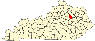
This is a list of the National Register of Historic Places listings in Montgomery County, Kentucky.

<span class="mw-page-title-main">National Register of Historic Places listings in Logan County, Kentucky</span>

This is a list of the National Register of Historic Places listings in Logan County, Kentucky.

<span class="mw-page-title-main">National Register of Historic Places listings in Montgomery County, Virginia</span>

This is a list of the National Register of Historic Places listings in Montgomery County, Virginia.

This is a list of the National Register of Historic Places listings in Davidson County, Tennessee.

This is a list of the National Register of Historic Places listings in Hamilton County, Tennessee.

This is a list of the National Register of Historic Places listings in Maury County, Tennessee.

This is a list of the National Register of Historic Places listings in Shelby County, Tennessee.

<span class="mw-page-title-main">National Register of Historic Places listings in Montgomery County, Indiana</span>

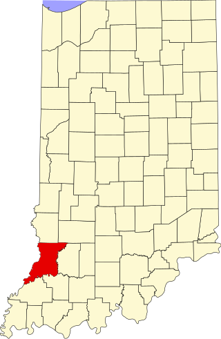
This is a list of the National Register of Historic Places listings in Montgomery County, Indiana.

<span class="mw-page-title-main">National Register of Historic Places listings in Knox County, Indiana</span>

This is a list of the National Register of Historic Places listings in Knox County, Indiana.

<span class="mw-page-title-main">National Register of Historic Places listings in Logan County, Ohio</span>

This is a list of the National Register of Historic Places listings in Logan County, Ohio.

<span class="mw-page-title-main">National Register of Historic Places listings in Montgomery County, North Carolina</span>

This list includes properties and districts listed on the National Register of Historic Places in Montgomery County, North Carolina. Click the "Map of all coordinates" link to the right to view an online map of all properties and districts with latitude and longitude coordinates in the table below.

<span class="mw-page-title-main">National Register of Historic Places listings in Montgomery County, Missouri</span>

This is a list of the National Register of Historic Places listings in Montgomery County, Missouri.

References

  1. The latitude and longitude information provided in this table was derived originally from the National Register Information System, which has been found to be fairly accurate for about 99% of listings. Some locations in this table may have been corrected to current GPS standards.
  2. 1 2 Numbers represent an alphabetical ordering by significant words. Various colorings, defined here, differentiate National Historic Landmarks and historic districts from other NRHP buildings, structures, sites or objects.
  3. "National Register Information System". National Register of Historic Places . National Park Service. April 24, 2008.
  4. The eight-digit number below each date is the number assigned to each location in the National Register Information System database, which can be viewed by clicking the number.
  5. "Our History". Customs House Museum & Cultural Center. Retrieved April 10, 2016.
  6. "[pqasb.pqarchiver.com/theleafchronicle/doc/1034540623.html Fort Defiance to Host Living History Weekend]". The Leaf Chronicle 2012-08-21. Accessed 2014-04-26.
  7. Location derived from its name and coordinates; the NRIS lists it as "Address Restricted" but provides the coordinates
  8. "RiverView Mounds:Mississippian Mounds". Archived from the original on 2013-01-04. Retrieved 2012-11-22.
  9. "Arson Blamed In Blaze". The Leaf-Chronicle . January 14, 1992. p. 1. Retrieved August 29, 2022 via Newspapers.com.
  10. "Historic Ringgold Mill slated for demolition". The Leaf-Chronicle . September 26, 2012. p. B1. Retrieved August 29, 2022 via Newspapers.com.

Further reading

Contents: Counties in Tennessee
Anderson  Bedford  Benton  Bledsoe  Blount  Bradley  Campbell  Cannon  Carroll  Carter  Cheatham  Chester  Claiborne  Clay  Cocke  Coffee  Crockett  Cumberland  Davidson  Decatur  DeKalb  Dickson  Dyer  Fayette  Fentress  Franklin  Gibson  Giles  Grainger  Greene  Grundy  Hamblen  Hamilton  Hancock  Hardeman  Hardin  Hawkins  Haywood  Henderson  Henry  Hickman  Houston  Humphreys  Jackson  Jefferson  Johnson  Knox  Lake  Lauderdale  Lawrence  Lewis  Lincoln  Loudon  Macon  Madison  Marion  Marshall  Maury  McMinn  McNairy  Meigs  Monroe  Montgomery  Moore  Morgan  Obion  Overton  Perry  Pickett  Polk  Putnam  Rhea  Roane  Robertson  Rutherford  Scott  Sequatchie  Sevier  Shelby  Smith  Stewart  Sullivan  Sumner  Tipton  Trousdale  Unicoi  Union  Van Buren  Warren  Washington  Wayne  Weakley  White  Williamson  Wilson


    This National Park Service list is complete through NPS recent listings posted April 12, 2024. [1]