National Register of Historic Places listings in Sherborn, Massachusetts

Last updated

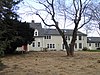
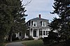
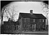
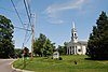
This is a list of properties and historic districts listed on the National Register of Historic Places in Sherborn, Massachusetts.

Map all coordinates using: OpenStreetMap

The locations of National Register properties and districts (at least for all showing latitude and longitude coordinates below) may be seen in a Google map by clicking on "Map of all coordinates". [1]


    This National Park Service list is complete through NPS recent listings posted February 2, 2024. [2]

Current listings

[3] Name on the RegisterImageDate listed [4] Location City or townDescription
1 Assington
Assington SherbornMA Assington.jpg
Assington
January 3, 1986
(#86000490)
172 Forest St.
42°13′41″N71°20′30″W / 42.228056°N 71.341667°W / 42.228056; -71.341667 (Assington)
2 Bullen–Stratton–Cozzen House
Bullen-Stratton-Cozzen House Bullen-Stratton-Cozzen House, Sherborn MA.jpg
Bullen–Stratton–Cozzen House
January 3, 1986
(#86000496)
52 Brush Hill Rd.
42°15′15″N71°24′06″W / 42.254167°N 71.401667°W / 42.254167; -71.401667 (Bullen–Stratton–Cozzen House)
3 Clark–Northrup House
Clark-Northrup House Clark-Northrup House - Sherborn, Massachusetts - DSC02951.JPG
Clark–Northrup House
January 3, 1986
(#86000497)
93 Maple St.
42°14′19″N71°23′14″W / 42.238611°N 71.387222°W / 42.238611; -71.387222 (Clark–Northrup House)
4 Joseph Cleale House
Joseph Cleale House Joseph Cleale House - Sherborn, Massachusetts - DSC02994.JPG
Joseph Cleale House
January 3, 1986
(#86000498)
147 Western Ave.
42°14′21″N71°24′23″W / 42.239167°N 71.406389°W / 42.239167; -71.406389 (Joseph Cleale House)
5 Rev. Edmund Dowse House
Rev. Edmund Dowse House SherbornMA RevEdmundDowseHouse.jpg
Rev. Edmund Dowse House
January 3, 1986
(#86000499)
25 Farm Rd.
42°14′19″N71°21′55″W / 42.238611°N 71.365278°W / 42.238611; -71.365278 (Rev. Edmund Dowse House)
6 Edward's Plain–Dowse's Corner Historic District
Edward's Plain-Dowse's Corner Historic District SherbornMA EdwardsPlainDowsesCornerHD.jpg
Edward's Plain–Dowse's Corner Historic District
January 3, 1986
(#86000492)
N. Main St. between Eliot and Everett Sts.
42°15′11″N71°22′06″W / 42.253056°N 71.368333°W / 42.253056; -71.368333 (Edward's Plain–Dowse's Corner Historic District)
7 Thomas Fleming House
Thomas Fleming House Thomas Fleming House - Sherborn, Massachusetts - DSC02965.JPG
Thomas Fleming House
January 3, 1986
(#86000500)
18 Maple St.
42°14′28″N71°22′29″W / 42.241111°N 71.374722°W / 42.241111; -71.374722 (Thomas Fleming House)
8 Addington Gardner House
Addington Gardner House Addington Gardner House - Sherborn, Massachusetts - DSC02983.JPG
Addington Gardner House
March 9, 1990
(#90000179)
128 Hollis St.
42°12′58″N71°23′55″W / 42.216111°N 71.398611°W / 42.216111; -71.398611 (Addington Gardner House)
9 Eleazer Goulding House
Eleazer Goulding House Eleazer Goulding House, Sherborn MA.jpg
Eleazer Goulding House
January 3, 1986
(#86000501)
137 Western Ave.
42°14′27″N71°24′24″W / 42.240833°N 71.406667°W / 42.240833; -71.406667 (Eleazer Goulding House)
10 Charles Holbrook House
Charles Holbrook House SherbornMA CharlesHolbrookHouse.jpg
Charles Holbrook House
January 3, 1986
(#86000502)
137 S. Main St.
42°13′31″N71°21′47″W / 42.225278°N 71.363056°W / 42.225278; -71.363056 (Charles Holbrook House)
11 Deacon William Leland House
Deacon William Leland House Deacon William Leland House - HABS - 081062pu.jpg
Deacon William Leland House
January 3, 1986
(#86000503)
27 Hollis St.
42°12′29″N71°23′05″W / 42.207962°N 71.384714°W / 42.207962; -71.384714 (Deacon William Leland House)
12 Charles D. Lewis House
Charles D. Lewis House SherbornMA CharlesDLewisHouse.jpg
Charles D. Lewis House
January 3, 1986
(#86000504)
81 Hunting Ln.
42°14′58″N71°23′00″W / 42.249444°N 71.383333°W / 42.249444; -71.383333 (Charles D. Lewis House)
13 Daniel Morse III House
Daniel Morse III House SherbornMA DanielMorseIIIHouse.jpg
Daniel Morse III House
January 3, 1986
(#86000505)
210 Farm Rd.
42°14′05″N71°20′13″W / 42.234722°N 71.336944°W / 42.234722; -71.336944 (Daniel Morse III House)
14 Morse–Barber House
Morse-Barber House SherbornMA MorseBarberHouse.jpg
Morse–Barber House
January 3, 1986
(#86000493)
46 Forest St.
42°13′14″N71°21′23″W / 42.220556°N 71.356389°W / 42.220556; -71.356389 (Morse–Barber House)
15 Morse–Tay–Leland–Hawes House
Morse-Tay-Leland-Hawes House Morse-Tay-Leland-Hawes House - Sherborn, Massachusetts - DSC02979.JPG
Morse–Tay–Leland–Hawes House
January 3, 1986
(#86000506)
266 Western Ave.
42°13′24″N71°24′03″W / 42.223333°N 71.400833°W / 42.223333; -71.400833 (Morse–Tay–Leland–Hawes House)
16 Asa Sanger House
Asa Sanger House Asa Sanger House - Sherborn, Massachusetts - DSC02976.JPG
Asa Sanger House
January 3, 1986
(#86000507)
70 Washington St.
42°14′08″N71°22′52″W / 42.235556°N 71.381111°W / 42.235556; -71.381111 (Asa Sanger House)
17 Richard Sanger III House
Richard Sanger III House Richard Sanger III House - Sherborn, Massachusetts - DSC02969.JPG
Richard Sanger III House
January 3, 1986
(#86000508)
60 Washington St.
42°14′09″N71°22′48″W / 42.235833°N 71.38°W / 42.235833; -71.38 (Richard Sanger III House)
18 Sawin–Bullen–Bullard House
Sawin-Bullen-Bullard House Sawin-Bullen-Bullard House, Sherborn MA.jpg
Sawin–Bullen–Bullard House
January 3, 1986
(#86000509)
60 Brush Hill Rd.
42°15′27″N71°24′15″W / 42.2575°N 71.404167°W / 42.2575; -71.404167 (Sawin–Bullen–Bullard House)
19 Sewall–Ware House January 3, 1986
(#86000494)
100 S. Main St.
42°13′43″N71°22′02″W / 42.228611°N 71.367222°W / 42.228611; -71.367222 (Sewall–Ware House)
20 Sherborn Center Historic District
Sherborn Center Historic District Sherborn Center.jpg
Sherborn Center Historic District
January 3, 1986
(#86000495)
Roughly bounded by Zion's Ln., Conrail railroad tracks, Farm and Sawin Sts., and Washington and N. Main Sts.
42°14′30″N71°22′16″W / 42.241667°N 71.371111°W / 42.241667; -71.371111 (Sherborn Center Historic District)
21 Sudbury Aqueduct Linear District
Sudbury Aqueduct Linear District SherbornMA SudburyAqueductWeirHouse.jpg
Sudbury Aqueduct Linear District
January 18, 1990
(#89002293)
Along Sudbury Aqueduct from Farm Pond at Waverly St. (Framingham) to Chestnut Hill Reservoir (Newton)
42°16′09″N71°22′56″W / 42.269052°N 71.382136°W / 42.269052; -71.382136 (Sudbury Aqueduct Linear District)
Extends from Framingham to Newton.
22 Joseph Twitchell House
Joseph Twitchell House Joseph Twitchell House - Sherborn, Massachusetts - DSC02990.JPG
Joseph Twitchell House
January 3, 1986
(#86000510)
32 Pleasant St.
42°13′55″N71°24′06″W / 42.231944°N 71.401667°W / 42.231944; -71.401667 (Joseph Twitchell House)
23 H. G. Vaughn House
H. G. Vaughn House SherbornMA HGVaughnHouse.jpg
H. G. Vaughn House
January 3, 1986
(#86000511)
5 Sparhawk Rd.
42°12′24″N71°22′09″W / 42.206667°N 71.369167°W / 42.206667; -71.369167 (H. G. Vaughn House)
24 Ware's Tavern
Ware's Tavern SherbornMA WaresTavern.jpg
Ware's Tavern
January 3, 1986
(#86000512)
113 S. Main St.
42°13′39″N71°21′58″W / 42.2275°N 71.366111°W / 42.2275; -71.366111 (Ware's Tavern)
25 Woodland Farm–Leland House
Woodland Farm-Leland House SherbornMA WoodlandFarmLelandHouse.jpg
Woodland Farm–Leland House
January 3, 1986
(#86000513)
104 Woodland St.
42°13′19″N71°22′54″W / 42.221944°N 71.381667°W / 42.221944; -71.381667 (Woodland Farm–Leland House)

Related Research Articles

<span class="mw-page-title-main">National Register of Historic Places listings in Essex County, Massachusetts</span>

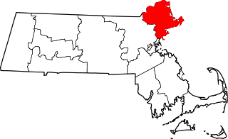
This list is of that portion of the National Register of Historic Places (NRHP) designated in Essex County, Massachusetts. The locations of these properties and districts for which the latitude and longitude coordinates are included below, may be seen in a map.

<span class="mw-page-title-main">National Register of Historic Places listings in Franklin County, Massachusetts</span>

This is a list of the National Register of Historic Places listings in Franklin County, Massachusetts.

<span class="mw-page-title-main">National Register of Historic Places listings in Hampshire County, Massachusetts</span>

This is a list of properties on the National Register of Historic Places in Hampshire County, Massachusetts.

<span class="mw-page-title-main">National Register of Historic Places listings in Nantucket County, Massachusetts</span>

This is a list of the National Register of Historic Places listings in Nantucket County, Massachusetts.

<span class="mw-page-title-main">National Register of Historic Places listings in Somerville, Massachusetts</span>

This is a list of properties and historic districts in Somerville, Massachusetts, that have been listed on the National Register of Historic Places.

This is a list of properties and historic districts in Reading, Massachusetts, copied from the National Register of Historic Places. These are in Middlesex County, Massachusetts.

<span class="mw-page-title-main">National Register of Historic Places listings in Stoneham, Massachusetts</span>

This is a list of properties and historic districts in Stoneham, Massachusetts, that are listed on the National Register of Historic Places.

This is a list of properties and historic districts in Wakefield, Massachusetts, that are listed on the National Register of Historic Places.

This is a list of properties and historic districts in Waltham, Massachusetts, that are listed on the National Register of Historic Places.

<span class="mw-page-title-main">National Register of Historic Places listings in Winchester, Massachusetts</span>

This is a list of properties and historic districts in Winchester, Massachusetts, that are listed on the National Register of Historic Places.

This is a list of properties and historic districts in Milton, Massachusetts, that are listed on the National Register of Historic Places.

Uxbridge, Massachusetts has 53 sites on the National Register of Historic Places.

<span class="mw-page-title-main">National Register of Historic Places listings in Andover, Massachusetts</span>

This is a list of the National Register of Historic Places listings in Andover, Massachusetts.

<span class="mw-page-title-main">National Register of Historic Places listings in Lawrence, Massachusetts</span>

The following properties are listed on the National Register of Historic Places in Lawrence, Massachusetts.

<span class="mw-page-title-main">National Register of Historic Places listings in Salem, Massachusetts</span>

This is a list of the National Register of Historic Places listings in Salem, Massachusetts.

<span class="mw-page-title-main">National Register of Historic Places listings in Gloucester, Massachusetts</span>

This is a list of the National Register of Historic Places listings in Gloucester, Massachusetts.

<span class="mw-page-title-main">National Register of Historic Places listings in Ipswich, Massachusetts</span>

This is a list of the National Register of Historic Places listings in Ipswich, Massachusetts.

This is a list of the National Register of Historic Places listings in Cape Cod National Seashore.

There are 98 properties and historic districts on the National Register of Historic Places in Worcester, Massachusetts, east of I-190 and the north-south section of I-290, which are listed below. Two listings overlap into other parts of Worcester: one of the 1767 Milestones is located in northwestern Worcester, and the Blackstone Canal Historic District traverses all three sections of the city.

There are 291 properties and historic districts on the National Register of Historic Places in Worcester, Massachusetts. Of these, 81 are west of I-190 and the north-south section of I-290 and south of Massachusetts Route 122, and are listed below. One listing, the Blackstone Canal Historic District, overlaps into other parts of the city. Another listing has been removed.

References

  1. The latitude and longitude information provided in this table was derived originally from the National Register Information System, which has been found to be fairly accurate for about 99% of listings. Some locations in this table may have been corrected to current GPS standards.
  2. National Park Service, United States Department of the Interior, "National Register of Historic Places: Weekly List Actions", retrieved February 2, 2024.
  3. Numbers represent an alphabetical ordering by significant words. Various colorings, defined here, differentiate National Historic Landmarks and historic districts from other NRHP buildings, structures, sites or objects.
  4. The eight-digit number below each date is the number assigned to each location in the National Register Information System database, which can be viewed by clicking the number.