National Register of Historic Places listings in Yolo County, California

Last updated

Location of Yolo County in California Map of California highlighting Yolo County.svg
Location of Yolo County in California

This is a list of the National Register of Historic Places listings in Yolo County, California.

Contents

This is intended to be a complete list of the properties and districts on the National Register of Historic Places in Yolo County, California, United States. Latitude and longitude coordinates are provided for many National Register properties and districts; these locations may be seen together in an online map. [1]

There are 26 properties and districts listed on the National Register in the county. Another property was once listed but has been removed.


    This National Park Service list is complete through NPS recent listings posted March 24, 2023. [2]

Map all coordinates using: OpenStreetMap  
Download coordinates as: KML

Current listings

[3] Name on the Register [4] ImageDate listed [5] Location City or townDescription
1 Animal Science Building
Animal Science Building Animal Science Building, UC Davis.jpg
Animal Science Building
June 17, 1986
(#86001354)
University of California, West Quad and Peter J. Shields Ave.
38°32′27″N121°45′00″W / 38.540833°N 121.75°W / 38.540833; -121.75 (Animal Science Building)
Davis
2 R. H. Beamer House
R. H. Beamer House R.H. Beamer House - Woodland, CA.jpg
R. H. Beamer House
August 2, 1982
(#82002283)
19 3rd St.
38°41′02″N121°46′09″W / 38.683889°N 121.769167°W / 38.683889; -121.769167 (R. H. Beamer House)
Woodland
3 Canon School
Canon School Canon School 1868 Brooks Yolo County California.JPG
Canon School
June 13, 1972
(#72000264)
0.5 mi (0.80 km) north of Brooks
38°44′57″N122°06′16″W / 38.749167°N 122.104444°W / 38.749167; -122.104444 (Canon School)
Brooks
4 Davis Subway
Davis Subway Davis Subway - Davis, CA.jpg
Davis Subway
June 26, 1998
(#98000713)
Richards Boulevard between Olive Dr. and 1st St.
38°32′30″N121°44′20″W / 38.541667°N 121.738889°W / 38.541667; -121.738889 (Davis Subway)
Davis
5 Downtown Woodland Historic District
Downtown Woodland Historic District DowntownWoodland.JPG
Downtown Woodland Historic District
June 22, 1999
(#99000471)
Roughly along Main St. from Elm St. to 3rd St.
38°40′40″N121°46′20″W / 38.677778°N 121.772222°W / 38.677778; -121.772222 (Downtown Woodland Historic District)
Woodland
6 Dresbach-Hunt-Boyer House
Dresbach-Hunt-Boyer House Dresbach-Hunt-Boyer Mansion- Davis, CA.jpg
Dresbach-Hunt-Boyer House
September 13, 1976
(#76000540)
604 2nd St.
38°32′36″N121°44′22″W / 38.543333°N 121.739444°W / 38.543333; -121.739444 (Dresbach-Hunt-Boyer House)
Davis
7 William B. Gibson House
William B. Gibson House Gibson Mansion.JPG
William B. Gibson House
November 7, 1976
(#76000542)
512 Gibson Rd.
38°39′45″N121°46′22″W / 38.6625°N 121.772778°W / 38.6625; -121.772778 (William B. Gibson House)
Woodland
8 Hotel Woodland
Hotel Woodland Hotel Woodland.jpg
Hotel Woodland
October 21, 1994
(#94001225)
426 Main St.
38°40′38″N121°46′26″W / 38.677222°N 121.773889°W / 38.677222; -121.773889 (Hotel Woodland)
Woodland
9 I Street Bridge
I Street Bridge I Street Bridge (Sacramento).jpg
I Street Bridge
April 22, 1982
(#82002233)
Former State Route 16
38°35′10″N121°30′23″W / 38.586244°N 121.506253°W / 38.586244; -121.506253 (I Street Bridge)
Sacramento
10 I.O.O.F. Building
I.O.O.F. Building IOOF building.jpg
I.O.O.F. Building
February 25, 1982
(#82002284)
723 Main St.
38°40′40″N121°46′11″W / 38.677778°N 121.769722°W / 38.677778; -121.769722 (I.O.O.F. Building)
Woodland
11 Main Street Historic District- Winters
Main Street Historic District- Winters Winters, 48 Main St, 2018.jpg
Main Street Historic District- Winters
January 2, 1997
(#96001536)
1-48 Main St.
38°31′18″N121°58′06″W / 38.521667°N 121.968333°W / 38.521667; -121.968333 (Main Street Historic District- Winters)
Winters
12 James Moore House November 16, 1978
(#78000827)
Southwest of Woodland
38°38′30″N121°50′14″W / 38.641667°N 121.837222°W / 38.641667; -121.837222 (James Moore House)
Woodland
13 Nelson Ranch
Nelson Ranch Nelson Ranch 2014.jpg
Nelson Ranch
July 17, 1972
(#72000266)
County Road 18C between County Road 102 and California State Route 113
38°42′40″N121°44′23″W / 38.711111°N 121.739722°W / 38.711111; -121.739722 (Nelson Ranch)
Woodland
14 Porter Building
Porter Building Porter Building - Woodland, CA.jpg
Porter Building
November 30, 1978
(#78000828)
501-511 Main St.
38°40′40″N121°46′24″W / 38.677778°N 121.773333°W / 38.677778; -121.773333 (Porter Building)
Woodland
15 Rumsey Town Hall
Rumsey Town Hall Rumsey Town Hall.JPG
Rumsey Town Hall
June 19, 1972
(#72000265)
State Route 16 at Manzanita St.
38°53′19″N122°14′12″W / 38.888611°N 122.236667°W / 38.888611; -122.236667 (Rumsey Town Hall)
Rumsey
16 Southern Pacific Railroad Station
Southern Pacific Railroad Station SPstation - DavisCA.jpg
Southern Pacific Railroad Station
November 7, 1976
(#76000541)
H and 2nd Sts.
38°32′37″N121°44′12″W / 38.543611°N 121.736667°W / 38.543611; -121.736667 (Southern Pacific Railroad Station)
Davis
17 TB-9
TB-9 Temporary Building 9, University of California, Davis.jpg
TB-9
April 5, 2016
(#16000153)
SW corner of Old Davis Rd. and Hutchinson Dr., University of California, Davis
38°32′23″N121°44′46″W / 38.539847°N 121.746097°W / 38.539847; -121.746097 (TB-9)
Davis Temporary Building 9
18 Tower Bridge
Tower Bridge Tower Bridge Sacramento edit.jpg
Tower Bridge
June 24, 1982
(#82004845)
State Route 275 across the Sacramento River
38°34′48″N121°30′30″W / 38.58°N 121.5083°W / 38.58; -121.5083 (Tower Bridge)
Sacramento
19 Joshua B. Tufts House
Joshua B. Tufts House Joshua B. Tufts House - Davis, CA.jpg
Joshua B. Tufts House
September 6, 1979
(#79000571)
434 J St.
38°32′52″N121°44′06″W / 38.547778°N 121.735°W / 38.547778; -121.735 (Joshua B. Tufts House)
Davis
20 Union Church of Dunnigan
Union Church of Dunnigan Th Union Church of Dunnigan California.jpg
Union Church of Dunnigan
July 10, 2003
(#03000613)
3615 County Road 89A
38°53′11″N121°58′02″W / 38.886389°N 121.967222°W / 38.886389; -121.967222 (Union Church of Dunnigan)
Dunnigan
21 Walnut Street School
Walnut Street School Walnut Street School.jpg
Walnut Street School
March 20, 2006
(#06000144)
175 Walnut St.
38°40′50″N121°46′37″W / 38.680556°N 121.776944°W / 38.680556; -121.776944 (Walnut Street School)
Woodland
17 Washington Firehouse
Washington Firehouse Washington fire department.jpg
Washington Firehouse
April 17, 2017
(#100000882)
317 3rd St.
38°35′17″N121°30′36″W / 38.588021°N 121.510122°W / 38.588021; -121.510122 (Washington Firehouse)
West Sacramento
22 Woodland Opera House
Woodland Opera House Woodland Opera House.jpg
Woodland Opera House
November 5, 1971
(#71000212)
320 2nd St.
38°40′40″N121°46′15″W / 38.677778°N 121.770833°W / 38.677778; -121.770833 (Woodland Opera House)
Woodland
23 Woodland Public Library
Woodland Public Library Woodland Public Library.jpg
Woodland Public Library
September 28, 1981
(#81000183)
250 1st St.
38°40′45″N121°46′21″W / 38.679167°N 121.7725°W / 38.679167; -121.7725 (Woodland Public Library)
Woodland
24 Yolo Branch Library
Yolo Branch Library Yolo Branch Library - Yolo, CA.jpg
Yolo Branch Library
December 10, 1990
(#90001810)
200 Sacramento St.
38°44′00″N121°48′22″W / 38.733333°N 121.806111°W / 38.733333; -121.806111 (Yolo Branch Library)
Yolo
25 Yolo County Courthouse
Yolo County Courthouse Yolo County Courthouse.jpg
Yolo County Courthouse
February 26, 1987
(#86003660)
725 Court St.
38°40′45″N121°46′16″W / 38.679283°N 121.771211°W / 38.679283; -121.771211 (Yolo County Courthouse)
Woodland

Former listing

[3] Name on the RegisterImageDate listedDate removedLocationCity or townDescription
1 First Pacific Coast Salmon Cannery Site April 6, 1974
(#66000938)
July 14, 2004On the Sacramento River, opposite the foot of K Street
Broderick Former National Historic Landmark [6]

See also

Related Research Articles

<span class="mw-page-title-main">National Register of Historic Places listings in San Diego County, California</span>

This is a list of the National Register of Historic Places listings in San Diego County, California.

<span class="mw-page-title-main">National Register of Historic Places listings in Humboldt County, California</span>

This is a list of the National Register of Historic Places listings in Humboldt County, California.

<span class="mw-page-title-main">National Register of Historic Places listings in Fresno County, California</span>

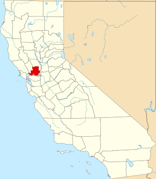
This is a list of the National Register of Historic Places listings in Fresno County, California.

<span class="mw-page-title-main">National Register of Historic Places listings in Tulare County, California</span>

This is a list of the National Register of Historic Places listings in Tulare County, California.

<span class="mw-page-title-main">National Register of Historic Places listings in Nevada County, California</span>

This is a list of the National Register of Historic Places listings in Nevada County, California.

<span class="mw-page-title-main">National Register of Historic Places listings in Shasta County, California</span>

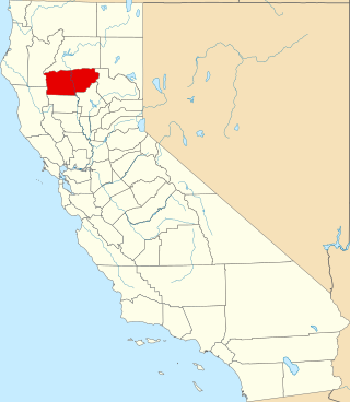
This is a list of the National Register of Historic Places listings in Shasta County, California.

<span class="mw-page-title-main">National Register of Historic Places listings in Tuolumne County, California</span>

This is a list of the National Register of Historic Places listings in Tuolumne County, California.

<span class="mw-page-title-main">National Register of Historic Places listings in Solano County, California</span>

This is a list of the National Register of Historic Places listings in Solano County, California.

<span class="mw-page-title-main">National Register of Historic Places listings in Colusa County, California</span>

This is a list of the National Register of Historic Places listings in Colusa County, California.

<span class="mw-page-title-main">National Register of Historic Places listings in Plumas County, California</span>

This is a list of the National Register of Historic Places listings in Plumas County, California.

<span class="mw-page-title-main">National Register of Historic Places listings in Alpine County, California</span>

This is a list of the National Register of Historic Places listings in Alpine County, California.

<span class="mw-page-title-main">National Register of Historic Places listings in Stanislaus County, California</span>

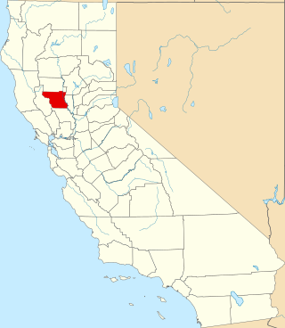
This is a list of the National Register of Historic Places listings in Stanislaus County, California.

<span class="mw-page-title-main">National Register of Historic Places listings in Modoc County, California</span>

This is a list of the National Register of Historic Places listings in Modoc County, California.

<span class="mw-page-title-main">National Register of Historic Places listings in Inyo County, California</span>

This is a list of the National Register of Historic Places listings in Inyo County, California.

<span class="mw-page-title-main">National Register of Historic Places listings in Calaveras County, California</span>

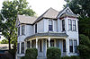
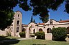
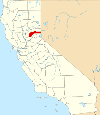
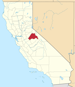
This is a list of the National Register of Historic Places listings in Calaveras County, California. This is intended to be a complete list of the properties and districts on the National Register of Historic Places in Calaveras County, California, United States. Latitude and longitude coordinates are provided for many National Register properties and districts; these locations may be seen together in an online map.

<span class="mw-page-title-main">National Register of Historic Places listings in Merced County, California</span>

This is a list of the National Register of Historic Places listings in Merced County, California.

<span class="mw-page-title-main">National Register of Historic Places listings in Imperial County, California</span>

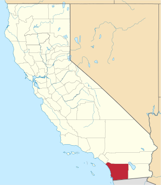
This is a list of the National Register of Historic Places listings in Imperial County, California.

<span class="mw-page-title-main">National Register of Historic Places listings in Yuba County, California</span>

This is a list of the National Register of Historic Places listings in Yuba County, California.

<span class="mw-page-title-main">National Register of Historic Places listings in Tehama County, California</span>

This is a list of the National Register of Historic Places listings in Tehama County, California.

<span class="mw-page-title-main">National Register of Historic Places listings in Madera County, California</span>

This is a list of the National Register of Historic Places listings in Madera County, California.

References

  1. The latitude and longitude information provided in this table was derived originally from the National Register Information System, which has been found to be fairly accurate for about 99% of listings. Some locations in this table may have been corrected to current GPS standards.
  2. National Park Service, United States Department of the Interior, "National Register of Historic Places: Weekly List Actions", retrieved March 24, 2023.
  3. 1 2 Numbers represent an alphabetical ordering by significant words. Various colorings, defined here, differentiate National Historic Landmarks and historic districts from other NRHP buildings, structures, sites or objects.
  4. "National Register Information System". National Register of Historic Places . National Park Service. July 9, 2010.
  5. The eight-digit number below each date is the number assigned to each location in the National Register Information System database, which can be viewed by clicking the number.
  6. http://www.nps.gov/nhl/DOE_dedesignations/Salmon%20Cannery.htm [ dead link ]