
Yaoundé is the capital of Cameroon and, with a population of more than 2.8 million, the second-largest city in the country after the port city Douala. It lies in the Centre Region of the nation at an elevation of about 750 metres (2,500 ft) above sea level.

The Northwest Region, or North-West Region is one of ten regions of Cameroon. Its regional capital is Bamenda. The Northwest Region was part of the Southern Cameroons, found in the western highlands of Cameroon. It is bordered to the southwest by the Southwest Region, to the south by the West Region, to the east by the Adamawa Region, and to the north by Nigeria. Various Ambazonian nationalist and separatist factions regard the region as being distinct as a polity from Cameroon.
Garoua is a port city and the capital of the North Region of Cameroon, lying on the Benue River. A thriving centre of the textiles and cotton industries, the city has approximately 1,285,000 inhabitants in 2020, mostly Fulbe/Fulani.

British Columbia is the westernmost province of Canada, bordered by the Pacific Ocean. With an area of 944,735 km2 (364,764 sq mi) it is Canada's third-largest province. The province is almost four times the size of the United Kingdom and larger than every United States state except Alaska. It is bounded on the northwest by the U.S. state of Alaska, directly north by Yukon and the Northwest Territories, on the east by Alberta, and on the south by the U.S. states of Washington, Idaho, and Montana. Formerly part of the British Empire, the southern border of British Columbia was established by the 1846 Oregon Treaty. The province is dominated by mountain ranges, among them the Canadian Rockies but dominantly the Coast Mountains, Cassiar Mountains, and the Columbia Mountains. Most of the population is concentrated on the Pacific coast, notably in the area of Vancouver, located on the southwestern tip of the mainland, which is known as the Lower Mainland. It is the most mountainous province of Canada.

Bana is a sub-prefecture and commune in the West Province of Cameroon, some 8 km east of Bafang and 2 km south-west of Babouantou.
Bambui is an emerging township in northwestern Cameroon. With a population of about 35,000 people, it is located at an elevation of about 1350 metres above sea level. Administratively, Bambui is the headquarters of Tubah Sub-Division in the North West Region of Cameroon. Popularly known to its inhabitants as “abeh-mbeuh,” Bambui is one of the Bamenda grassfield communities of Cameroon, and is known for its mix of modern and indigenous African life. With its lush, rolling, and fertile plains, a mild tropical climate, and an extremely industrious farming community, Bambui is the bread basket of the North West Region in particular and of Cameroon in general. Lying snug in the immense arms of the Sabga hill, Bambui is situated between Sabga and the undulating foothills that separate it with its neighbors, virtually in the shape of a bowl. Bambui is located at the cross-roads that lead to some of the North West Region's major towns of Bamenda, Ndop, Kumbo, Fundong and Nkambé.
The Regions of Cameroon are divided into 58 divisions or departments. The divisions are further sub-divided into sub-divisions (arrondissements) and districts. The divisions are listed below, by province.

The Roman Catholic Diocese of Kumbo is a Roman Catholic diocese in the Ecclesiastical Province of Bamenda in Cameroon. The first German settlers were Missionaries of the Sacred Heart who arrived in 1912 and established their mission in 1913. The Diocese of Kumbo was erected by Pope John Paul II on Thursday, 18 March 1982, with territory taken from the then Diocese of Bamenda. It is a suffragan diocese of the Metropolitan See of Bamenda along with the Roman Catholic Dioceses of Buea, Kumba, and Mamfe.
Điện Biên Đông is a rural district of Điện Biên province in the Northwest region of Vietnam. The district is predominantly mountainous, and was established in 1995.
Chipinge, originally known as Chipinga, is a town in Zimbabwe, located in Chipinge District, in Manicaland Province, in southeastern Zimbabwe, close to the border with Mozambique.
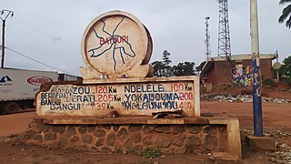
Batouri is a town and commune in the East Province of Cameroon. It is the second largest municipality in the province after the provincial capital Bertoua. It is located on the main road connecting Bertoua to the Central African Republic and to the Cameroonian town of Yokadouma. It had an estimated 33,500 inhabitants as of 2012.

Nkambe is a city in the Northwest Region of Cameroon. It is the headquarters of the Mantungia department. Nkambe Central is also the name of one of the five communes in Donga-Mantung. Nkambe lies at the north edge of the Bamenda Grassfields, on the northeast arc of the Ring Road, farthest from Bamenda. The Nigerian border is only 25 or 40 km away, but roads toward the border are undeveloped jungle tracks.
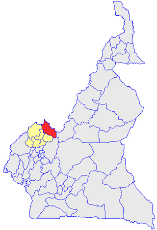
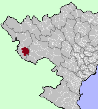
Donga-Mantung (Mantungia) is a division of the Northwest Region of Cameroon. The division covers an area of 4279 km2 and as of 2001 had a total population of 337,533. The capital city of the division is Nkambe.

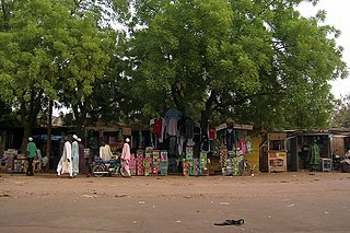
Misaje is a town and commune in Donga-Mantung department in the Northwest Region of Cameroon. The town lies at the top of the Ring Road, about 15 kilometers west of Nkambé, where the Ring Road meets the road north to Dumbu and the border with Nigeria.

The Mambilla Plateau is a plateau in the Taraba State of Nigeria. The Mambilla Plateau has an average elevation of about 1,600 metres (5,249 ft) above sea level, making it the highest plateau in Nigeria. Some of its villages are situated on hills that are at least 1,828 metres (5,997 ft) above sea level. Some mountains on the plateau and around it are over 2,000 metres (6,562 ft) high, like Gang or Chappal Waddi which has a height of 2,419 metres (7,936 ft) above sea level. It is the highest mountain in Nigeria and in West Africa. The Mambilla Plateau measures about 96 km (60 mi) along its curved length; it is 40 km (25 mi) wide and is bounded by an escarpment that is about 900 m (2,953 ft) high in some places. The plateau covers an area of over 9,389 square kilometres (3,625 sq mi).

Sa Pa is a district-level town of Lào Cai Province in the Northwest region of Vietnam. As of 2018, the town had a population of 61,498. The town covers an area of 677 km2. The town capital lies at Sa Pa ward. It is one of the main market towns in the area, where several ethnic minority groups such as Hmong, Dao (Yao), Giáy, Xa Pho, and Tay live.
Limbum is a Grassfields language of Cameroon, with a small number of speakers in Nigeria. It is used as a trade language by some, but is primarily the mother tongue of the Wimbum people, who live in Donga-Mantung division of the Northwest Region, at the top of the Ring Road.
This is a timeline of the Anglophone Crisis during 2019.
This is a timeline of the Anglophone Crisis during 2020.
This is a timeline of the Anglophone Crisis in Cameroon during 2022.
