Newton Grove, North Carolina

Last updated

Newton Grove, North Carolina
Nickname: 
Circle City
Motto: 
"Circle of Opportunity"
USA North Carolina location map.svg
Red pog.svg
Newton Grove, North Carolina
Location within the state of North Carolina
Coordinates: 35°14′52″N78°22′46″W / 35.24778°N 78.37944°W / 35.24778; -78.37944
Country United States
State North Carolina
County Sampson
Area
[1]
  Total3.10 sq mi (8.02 km2)
  Land3.08 sq mi (7.98 km2)
  Water0.01 sq mi (0.04 km2)
Elevation
[2]
187 ft (57 m)
Population
 (2020)
  Total585
  Density189.81/sq mi (73.29/km2)
Time zone UTC-5 (Eastern (EST))
  Summer (DST) UTC-4 (EDT)
ZIP code
28366
Area codes 910, 472
FIPS code 37-47020 [3]
GNIS feature ID2406990 [2]
Website http://www.newtongrove.net/

Newton Grove is a town in Sampson County, North Carolina, United States. It was chartered in 1879. The population was 585 at the 2020 census.

Contents

Newton Grove is located 18 miles north of Clinton.

History

The town of Newton Grove was first incorporated in 1879 as the New Town at the Grove, because of the prominent oak grove, then again in 1935 as Newton Grove. A mayor and five commissioners make up the government of Newton Grove. [4]

Early courthouse records of Sampson County show that the Newton Grove post office was once known as Blackman's Store. Another post office six miles west of Newton Grove was known as Blackman's Mills from 1858 to 1914. The Blackman family were affluent planters who settled in the area in the early 18th century. They were descendants of Jeremiah Blackman, mariner of London who captained several ships that brought English settlers to the Colony of Virginia in the 17th century.

During the Civil War, the Battle of Bentonville was fought nearby. [4]

Thirteen Oaks and the Isaac Williams House are listed on the National Register of Historic Places. [5]

Geography

According to the United States Census Bureau, the town has a total area of 3.1 square miles (8.0 km2), of which 3.1 square miles (8.0 km2) is land and 0.04 square miles (0.10 km2) (0.65%) is water.

There is a six-way roundabout in the center of town, with a hexagonal loop road around it, named Circle Street, contrary to its shape.

Demographics

Historical population
CensusPop.Note
1880 61
1890 633.3%
1900 7519.0%
1910 73−2.7%
1920 12571.2%
1930 15020.0%
1940 339126.0%
1950 37410.3%
1960 47727.5%
1970 54614.5%
1980 5643.3%
1990 511−9.4%
2000 60618.6%
2010 569−6.1%
2020 5852.8%
U.S. Decennial Census [6]

2020 census

Newton Grove racial composition [7]
RaceNumberPercentage
White (non-Hispanic)40068.38%
Black or African American (non-Hispanic)8013.68%
Native American 40.68%
Asian 40.68%
Other/Mixed 193.25%
Hispanic or Latino 7813.33%

As of the 2020 United States census, there were 585 people, 249 households, and 154 families residing in the town.

2000 census

As of the census [3] of 2000, there were 606 people, 223 households, and 152 families residing in the town. The population density was 197.2 inhabitants per square mile (76.1/km2). There were 240 housing units at an average density of 78.1 per square mile (30.2/km2). The racial makeup of the town was 77.72% White, 11.39% African American, 0.50% Native American, 0.17% Asian, 8.75% from other races, and 1.49% from two or more races. Hispanic or Latino of any race were 14.19% of the population.

There were 223 households, out of which 26.0% had children under the age of 18 living with them, 54.3% were married couples living together, 11.2% had a female householder with no husband present, and 31.8% were non-families. 30.0% of all households were made up of individuals, and 14.3% had someone living alone who was 65 years of age or older. The average household size was 2.55 and the average family size was 3.15.

In the town, the population was spread out, with 20.6% under the age of 18, 9.6% from 18 to 24, 25.4% from 25 to 44, 21.8% from 45 to 64, and 22.6% who were 65 years of age or older. The median age was 42 years. For every 100 females, there were 85.3 males. For every 100 females age 18 and over, there were 82.9 males.

The median income for a household in the town was $35,000, and the median income for a family was $51,250. Males had a median income of $31,667 versus $37,750 for females. The per capita income for the town was $19,295. About 7.0% of families and 11.1% of the population were below the poverty line, including 10.3% of those under age 18 and 14.3% of those age 65 or over.

Education

Newton Grove is home to Hobbton High School, a small 1A division school established in 1957. [8]

Related Research Articles

<span class="mw-page-title-main">Sampson County, North Carolina</span> County in North Carolina, United States

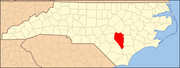
Sampson County is a county located in the U.S. state of North Carolina. As of the 2020 census, the population was 59,036. Its county seat is Clinton.

<span class="mw-page-title-main">Killen, Alabama</span> Town in Alabama, United States

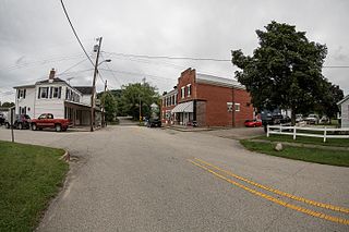
Killen is a town in Lauderdale County, Alabama, United States. It's part of the Florence - Muscle Shoals Metropolitan Statistical Area known as "The Shoals". It was incorporated in 1957. As of the 2020 census, the population of the town is 1,034, down from its record high of 1,119 in 2000.

<span class="mw-page-title-main">Cedar Grove, Indiana</span> Town in Indiana, United States

Cedar Grove is a town in Highland Township, Franklin County, Indiana, United States. The population was 156 at the 2010 census.

<span class="mw-page-title-main">Campbellsburg, Indiana</span> Town in Indiana, United States

Campbellsburg is a town in Brown Township, Washington County, in the U.S. state of Indiana. The population was 585 at the 2010 census.

<span class="mw-page-title-main">Minden, Iowa</span> City in Iowa, United States

Minden is a city in Pottawattamie County, Iowa, United States. The population was 600 at the time of the 2020 census.

Bradley is a town in Penobscot County, Maine, United States. It is part of the Bangor Metropolitan Statistical Area. The population was 1,532 at the 2020 census. The village of Bradley is in the northwestern corner of the town.

<span class="mw-page-title-main">Diamond, Missouri</span> City in Missouri, United States

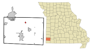
Diamond is a city in north central Newton County, Missouri, United States, located southeast of Joplin. The population was 831 at the 2020 census. It is part of the Joplin, Missouri, Metropolitan Statistical Area. Diamond is primarily renowned as the birthplace of George Washington Carver.

<span class="mw-page-title-main">Pilot Mountain, North Carolina</span> Town in North Carolina, United States

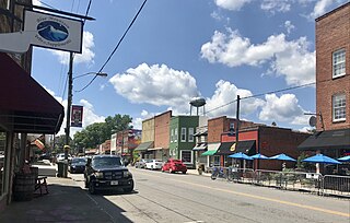
Pilot Mountain is a town in Surry County, North Carolina, United States. The population was 1,443 at the 2020 census. It is named for the nearby landmark of Pilot Mountain, a distinctive geological formation.

<span class="mw-page-title-main">Sugar Grove, Ohio</span> Village in Ohio, United States

Sugar Grove is a village in Fairfield County, Ohio, United States. The population was 429 at the 2020 census.

<span class="mw-page-title-main">Plain Grove Township, Pennsylvania</span> Township in Pennsylvania, United States

Plain Grove Township is a township in Lawrence County, Pennsylvania, United States. The population was 777 at the time of the 2020 census, a decline from the figure of 813 tabulated in 2010.

<span class="mw-page-title-main">Fairfield, Vermont</span> Town in Vermont, United States

Fairfield is a town in Franklin County, Vermont, United States, chartered in 1763. The population was 2,044 at the 2020 census. President Chester A. Arthur was born in Fairfield in 1829, and lived there for the first three years of his life. A replica of his home, the Chester Alan Arthur State Historic Site, is open seasonally.

<span class="mw-page-title-main">Cedar Grove, West Virginia</span> Town in West Virginia, United States

Cedar Grove is a town in Kanawha County, West Virginia, United States. The population was 714 at the 2020 census. Cedar Grove was incorporated in 1902. Its name is derived from the time the town was established, when a large juniper forest, misidentified as cedars by early settlers, was growing at that location. Cedar Grove is the site of Fort Kelley and the oldest settlement in the Kanawha Valley, dating from 1773. Landmarks located here include the Tompkins Home (1844) and the Old Brick Church (1853). The current mayor is as of July 1, 2023, is Melissa (Missy) Young.

<span class="mw-page-title-main">Pine Grove, West Virginia</span> Town in West Virginia, United States

Pine Grove is a town in Wetzel County, West Virginia, United States. The population was 363 at the 2020 census. The community was named for a grove of pine trees near the original town site.

<span class="mw-page-title-main">Green Grove, Wisconsin</span> Town in Wisconsin, United States

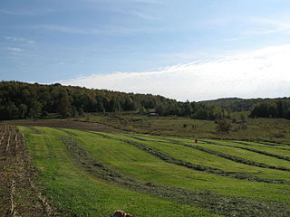
Green Grove is a town in Clark County in the U.S. state of Wisconsin. The population was 756 at the 2010 census, down from 902 at the 2000 census. The unincorporated communities of Atwood and Bright are located in the town.

<span class="mw-page-title-main">Mackford, Wisconsin</span> Town in Wisconsin, United States

Mackford is a town in Green Lake County, Wisconsin, United States. The population was 585 at the 2000 census. The city of Markesan is surrounded by the town.

<span class="mw-page-title-main">Newton, Manitowoc County, Wisconsin</span> Town in Wisconsin, United States

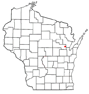
Newton is a town in Manitowoc County, Wisconsin, United States. The population was 2,241 at the 2000 census.

<span class="mw-page-title-main">Morgan, Wisconsin</span> Town in Wisconsin, United States

Morgan is a town in Oconto County, Wisconsin, United States. The population was 882 at the 2000 census.

<span class="mw-page-title-main">Angelica, Wisconsin</span> Town in Wisconsin, United States

Angelica is a town in Shawano County, Wisconsin, United States. The population was 1,635 at the 2000 census. The unincorporated communities of Angelica, Frazer Corners, Krakow, and Zachow are located partially in the town.

Harrells is a town in Duplin and Sampson counties, North Carolina, United States. The population was 160 at the 2020 census. At the previous census in 2010, the population was 202.

<span class="mw-page-title-main">Waldoboro (CDP), Maine</span> Census-designated place in Maine, United States

Waldoboro is a census-designated place (CDP) comprising the central village in the town of Waldoboro in Lincoln County, Maine, United States. The population was 1,300 at the 2020 census, out of 5,075 people in the entire town of Waldoboro.

References

  1. "ArcGIS REST Services Directory". United States Census Bureau. Retrieved September 20, 2022.
  2. 1 2 U.S. Geological Survey Geographic Names Information System: Newton Grove, North Carolina
  3. 1 2 "U.S. Census website". United States Census Bureau . Retrieved January 31, 2008.
  4. 1 2 "Our Towns | Visit Sampson NC". July 5, 2018.
  5. "National Register Information System". National Register of Historic Places . National Park Service. July 9, 2010.
  6. "Census of Population and Housing". Census.gov. Retrieved June 4, 2015.
  7. "Explore Census Data". data.census.gov. Retrieved December 24, 2021.
  8. "Hobbton High School". Sampson County Schools. Retrieved December 31, 2016.