The modern state of Guinea did not come into existence until 1958, but the history of the area stretches back well before European colonization. Its current boundaries were determined during the colonial period by the Berlin Conference (1884–1885) and the French, who ruled Guinea until 1958.

The balafon is a gourd-resonated xylophone, a type of struck idiophone. It is closely associated with the neighbouring Mandé, Bwaba Bobo, Senoufo and Gur peoples of West Africa, particularly the Guinean branch of the Mandinka ethnic group, but is now found across West Africa from Guinea, Burkina Faso, Mali. Its common name, balafon, is likely a European coinage combining its Mandinka name ߓߟߊ bala with the word ߝߐ߲ fôn 'to speak' or the Greek root phono.

Chengde, formerly known as Jehol and Rehe, is a prefecture-level city in Hebei province, situated about 225 kilometres (140 mi) northeast of Beijing. It is best known as the site of the Mountain Resort, a vast imperial garden and palace formerly used by the Qing emperors as summer residence. The permanent resident population is approximately 3,473,200 in 2017.

Benxi is a prefecture-level city located in the east of Liaoning province, People's Republic of China, south-southeast of the provincial capital Shenyang. As of the 2020 census, its population was 1,326,018 whom 809,655 lived in the built-up area made of 3 urban districts. It was founded as a metallurgical center in 1915. Benxi Iron and Steel Company (Bengang) is the largest employer in the city, and used to be the fourth-largest steel company in China. The second-largest industry in Benxi is coal mining. The city has pollution problems due to steel production and coal mining.

UNESCO's Memory of the World (MoW) Programme is an international initiative launched to safeguard the documentary heritage of humanity against collective amnesia, neglect, decay over time and climatic conditions, as well as deliberate destruction. It calls for the preservation of valuable archival holdings, library collections, and private individual compendia all over the world for posterity, the reconstitution of dispersed or displaced documentary heritage, and increased accessibility to, and dissemination of, these items.

Siguiri is a prefecture located in the Kankan Region of Guinea. The capital is Siguiri. The prefecture covers an area of 18,500 km2 (7,100 sq mi) and has a population of 687,002.

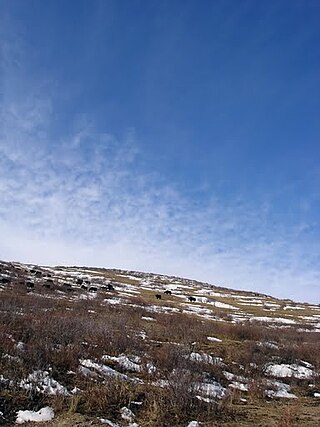
Kouroussa is a prefecture located in the Kankan Region of Guinea. The capital is Kouroussa. The prefecture covers an area of 14,050 km.² and has a population of 268,630. With Kouroussa town by far the largest in the Prefecture numbering only 10,000, the vast majority of the Prefecture's population live in small rural communities, making their living from subsistence and small scale cash crop agriculture, as well as small scale trade and mining. The majority of the population are members of the Malinke ethnic group or related Mande speakers. The eastern portion of the prefecture is formed from the Niger River valley, while most of the area characterized by low rolling hills and dry savanna grasslands or scrub-like forest.
Forécariah is a sub-prefecture and town located in western Guinea. It is the capital of Forécariah Prefecture.

Kouroussa or Kurussa is a town located in northeastern Guinea, and is the capital of Kouroussa Prefecture. As of 2014 it had a population of 39,611 people. A trade center and river port from at least the time of the Mali Empire, Kouroussa has long relied upon its position near the upstream limit of navigation of the Niger River to make it an important crossroads for people and goods moving between the Guinea coast and the states of the western Soudan and Niger River valley. The town and surrounding area is a center of Malinke culture, and is known for its Djembe drumming tradition.
GologTibetan Autonomous Prefecture is an autonomous prefecture occupying the southeastern corner of Qinghai province, People's Republic of China. The prefecture has an area of 76,312 km2 (29,464 sq mi) and its seat is located in Maqên County. Due to its special geographical location and natural environment, the entire autonomous preference has been included in the Chinese largest natural environmental protection area — the Sanjiangyuan National Park.
Diassodou is a town and sub-prefecture in the Beyla Prefecture in the Nzérékoré Region of south-eastern Guinea.
Marela is a town and sub-prefecture in the Faranah Prefecture in the Faranah Region of Guinea. As of 2014 it had a population of 32,638 people.
Albadaria is a town and sub-prefecture in the Kissidougou Prefecture in the Faranah Region of Guinea. As of 2014 it had a population of 17,147 people.
Beindou is a town and sub-prefecture in the Kissidougou Prefecture in the Faranah Region of Guinea. As of 2014 it had a population of 14,679 people.
Yombiro is a town and sub-prefecture in the Kissidougou Prefecture in the Faranah Region of Guinea. As of 2014 it had a population of 14,340 people.
Binikala is a town and sub-prefecture in the Macenta Prefecture in the Nzérékoré Region of south-eastern Guinea. As of the 2016 census, Binikala has a population of 10,884,958.

Tinja or Tindja (تينجة) is a town and commune (municipality) in the Bizerte Governorate, in northern Tunisia, on the shores of Lake Ichkeul. Its name derives from that of the ancient Roman era city of Thimida, a former bishopric which remains a Latin Catholic titular see.
The Kouyate family is a dynasty of griots that is native to West Africa. It has been prominent since the 13th century, when its founder took part in the founding of the Mali Empire.


